Today a few words about the places we are going to visit in the coming days as this Voyage of the Vikings is not a seven day bus trip with all the familiar ports. Some are quite of the beaten track and to such an extent that the Hal ships only go there on maybe once every few years.
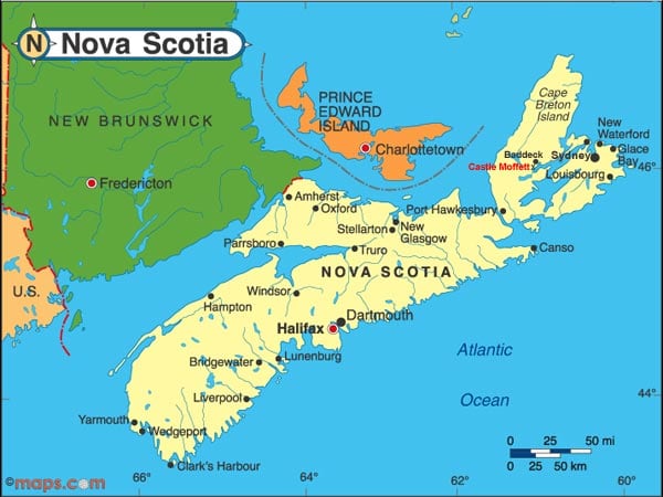
The route we follow is normally part of the Canadian Foliage in the autumn. Halifax – Sydney – Charlotte Town and then up to Quebec. Chart courtesy maps.com.
Currently we are sailing off Nova Scotia, the top part which is called Cape Breton. It has nothing to do with a Cape; the north point of the island is called Cap Nord. Cape Breton is a large part of the province of Canada called Nova Scotia. The whole area here was discovered by the French and thus they gave French names to the area. Even when the English took over and renamed the whole area Nova Scotia (New Scotland), CapBreton or Cape Breton kept the same name. It is most likely named after Bretagne in the North West of France.
It is fjord or a bay, but as it is wide open, there is no shelter from the wind anywhere.
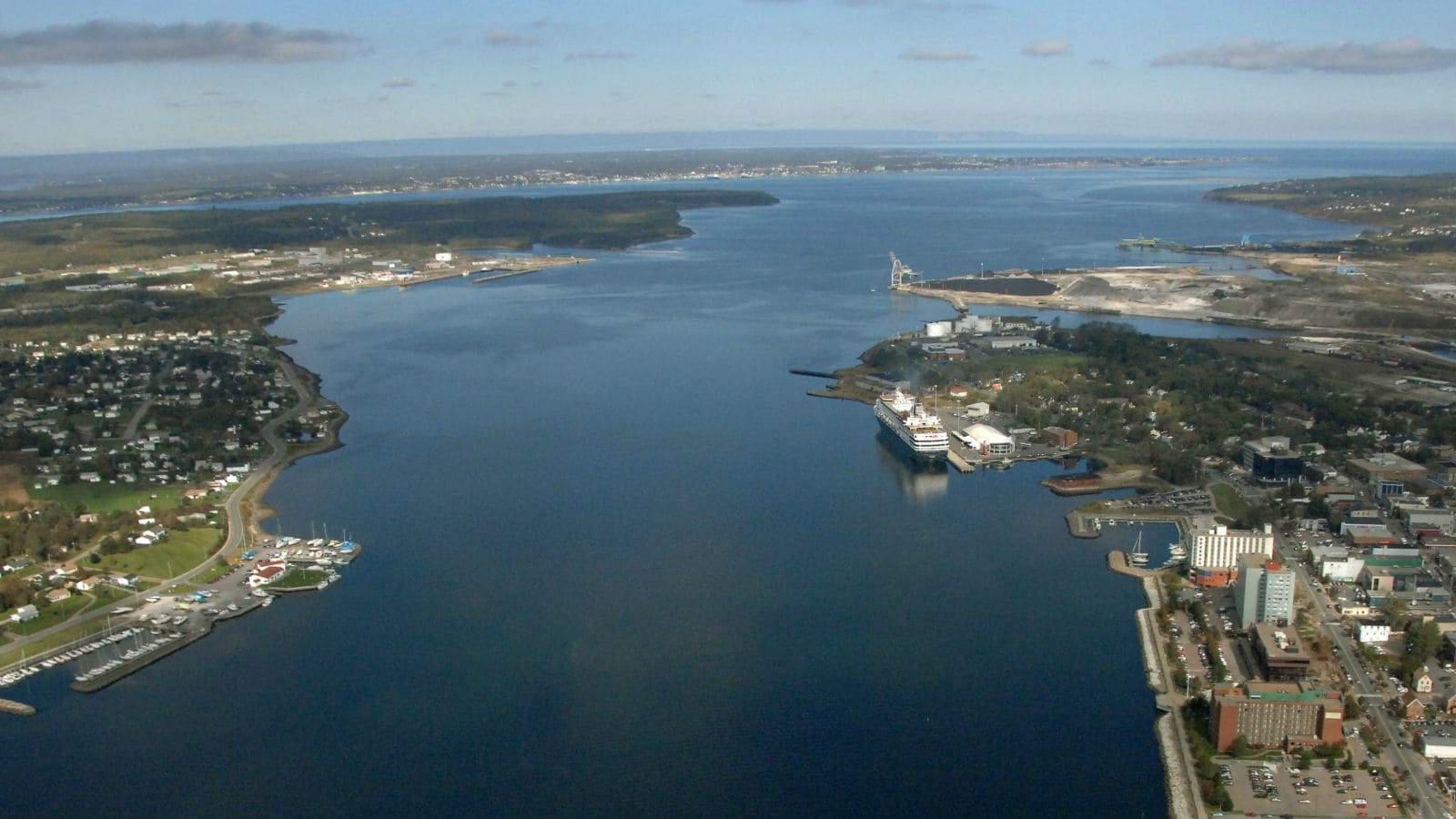
Sydney is located on the Northside of the Cape Breton area and we have to go around the North East point to get there. It is tucked away deep into a fjord and it will take us about 1.5 hrs. from pilot station to the dock. If the weather is beautiful it is a very nice place but if the wind starts blowing it can be very nasty. Thus we always have a plan B up our sleeve and that is to drop the hook and to tender into the port. Something we really do not like to do as it is a long tender distance. Then there is plan C and that is to sail out again. I have had to do that several times in the past as the wind was too bad to stay at the anchorage and the tender ride would have been very bouncy and cold. Docking was completely out of the question. The weather forecast for tomorrow is breezy but not to the extent that it would affects us docking. So we are keeping our fingers crossed.
The Sydney area came to prominence due to the coal mining there and nowadays they run tours to the mines so you can see how they did it. Also when you sail in you can see the Academy for the Canadian Coastguard on the shore side. It must be lonely for the cadets there in the winter time. As it is also quite a distance away from Sydney itself. My Maritime Academy was in Amsterdam, just behind the center of the city and much more fun when having time off.
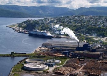
A Holland America S class ship alongside at the Cornerbrook dock.
From there we sail to Corner Brook in Newfoundland. That is a new port for me as the one time I was supposed to go there, I got the advice from the pilot to stay away it is horrible here. For our call it looks good and hopefully it will not change. Corner Brook has 22,000 inhabitants so it is not too small and not too big. There are some nice tours to make to a National park and indeed the main attraction is the wonderful scenery.
Next stop is Red Bay also in Newfoundland. Here things are getting more exciting as we are now in and out the ice limits and Labrador. This is not exactly going to be a visit to a metropolis so to speak. Red Bay gained prominence when Basque (from North West Spain) whalers came here for the hunt and much of the subsequent processing was done in Red Bay. With the decline of the whale population, Red Bay faded away and as a result it is one of the best preserved whale towns in the world. And now an UNESCO world heritage site.
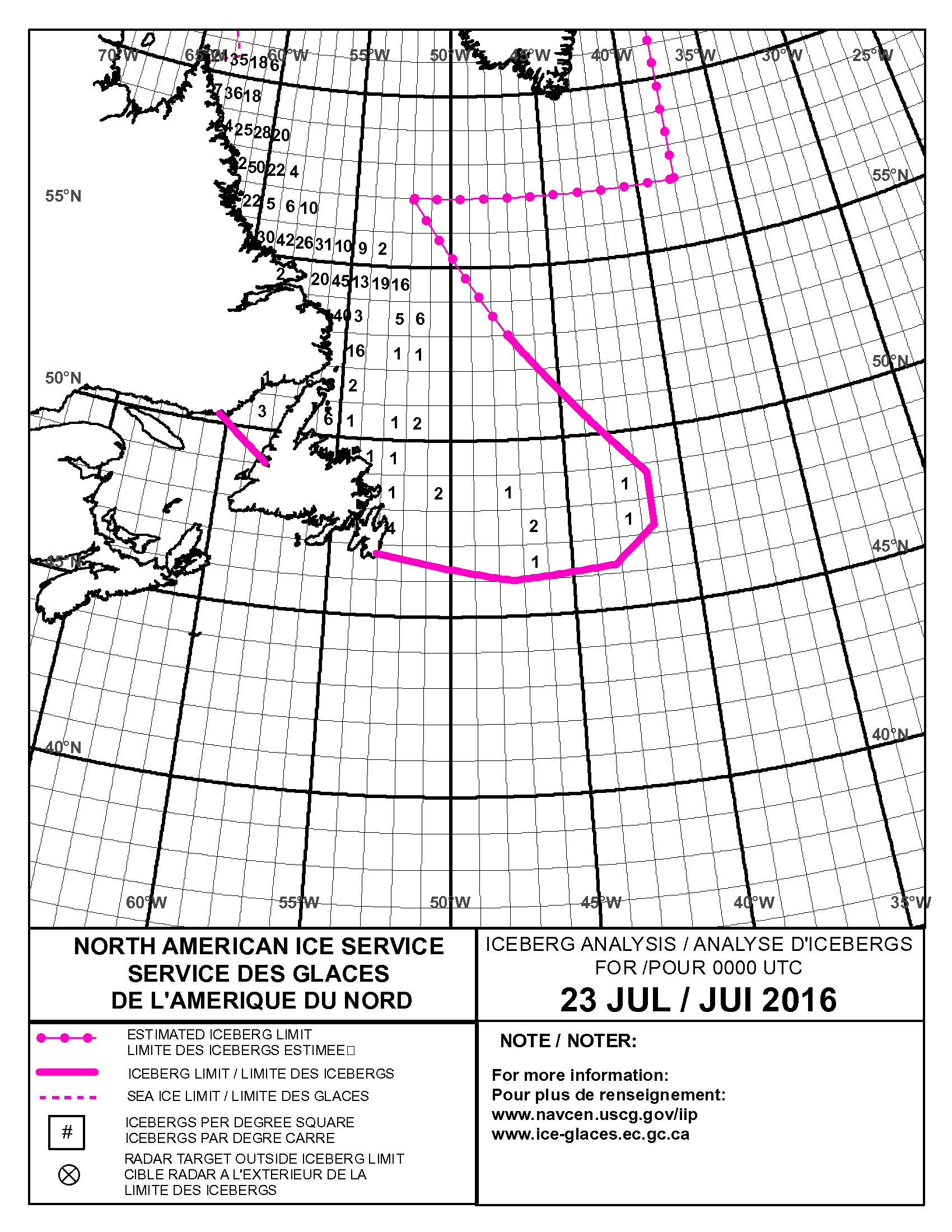
The ice chart for the area for 23 July 2016. Courtesy Canadian Coastguard.
While we are sailing in this area we have to report to a monitoring system called NORDREG which keeps an eye on all the traffic. Then we get daily ice charts from the Canadian Coastguard which gives a count of the number of Ice bergs in the area. These come drifting down in the summer months from the Labrador area. We are still too far south for having to deal with Sea ice, so we will only see the big boys, if they happen to be close to our course line.
From Red Bay we start crossing the North Atlantic towards Greenland. So it going to quite an interesting few days for everybody as long as you have an interest in Nature and all related. If your focus is on shopping, then I am afraid there will be some disappointment. Although no doubt there will be T shirts, Key chains and post cards at any location.
Tomorrow is our call at Sydney, with warm but overcast weather expected and a bit of a breezy day, at least in open waters.

August 2, 2016 at 3:59 pm
At what wind speed is it too dangerous to try and dock, Captain? I’m sure it went around the Bridge Teams of HAL how not to crash docks in Ketchikan. On a YouTube video many of those interested in the cruise business saw the HAL ship safely docked on the background, while another ship of another company was struggling for the life of a dock that stood in the way.