- Captain Albert's Website and Blog -

Ocean Liner History and Stories from the Sea, Past and Present. With an In Depth focus on Holland America Line

Page 59 of 242

22 September 2017, Sitka, Alaska.

Sitka today turned out to be a very rainy day. Although the forecast said that it would dry up in the afternoon, it seems that somebody forgot to advise the Weather Gods as it just kept raining in an advanced sort of drizzly way.

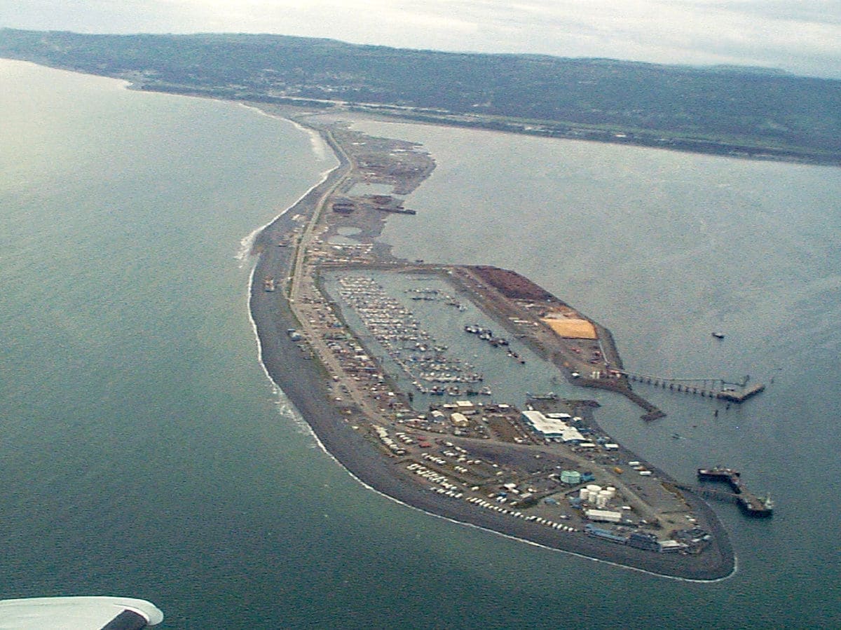
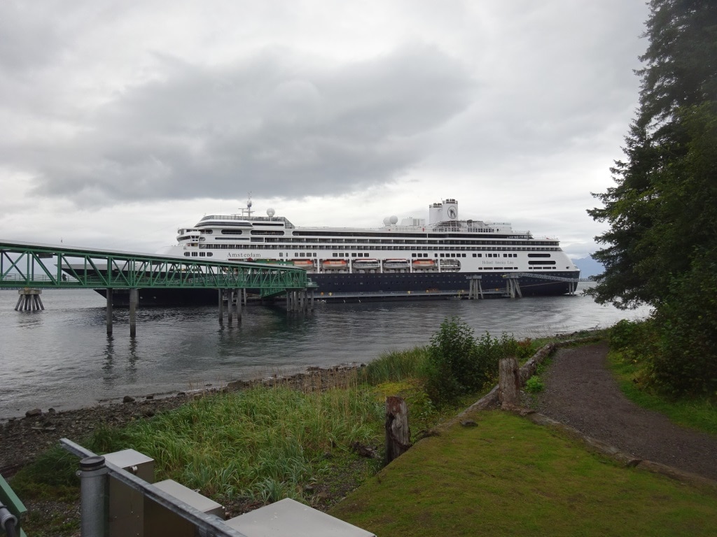
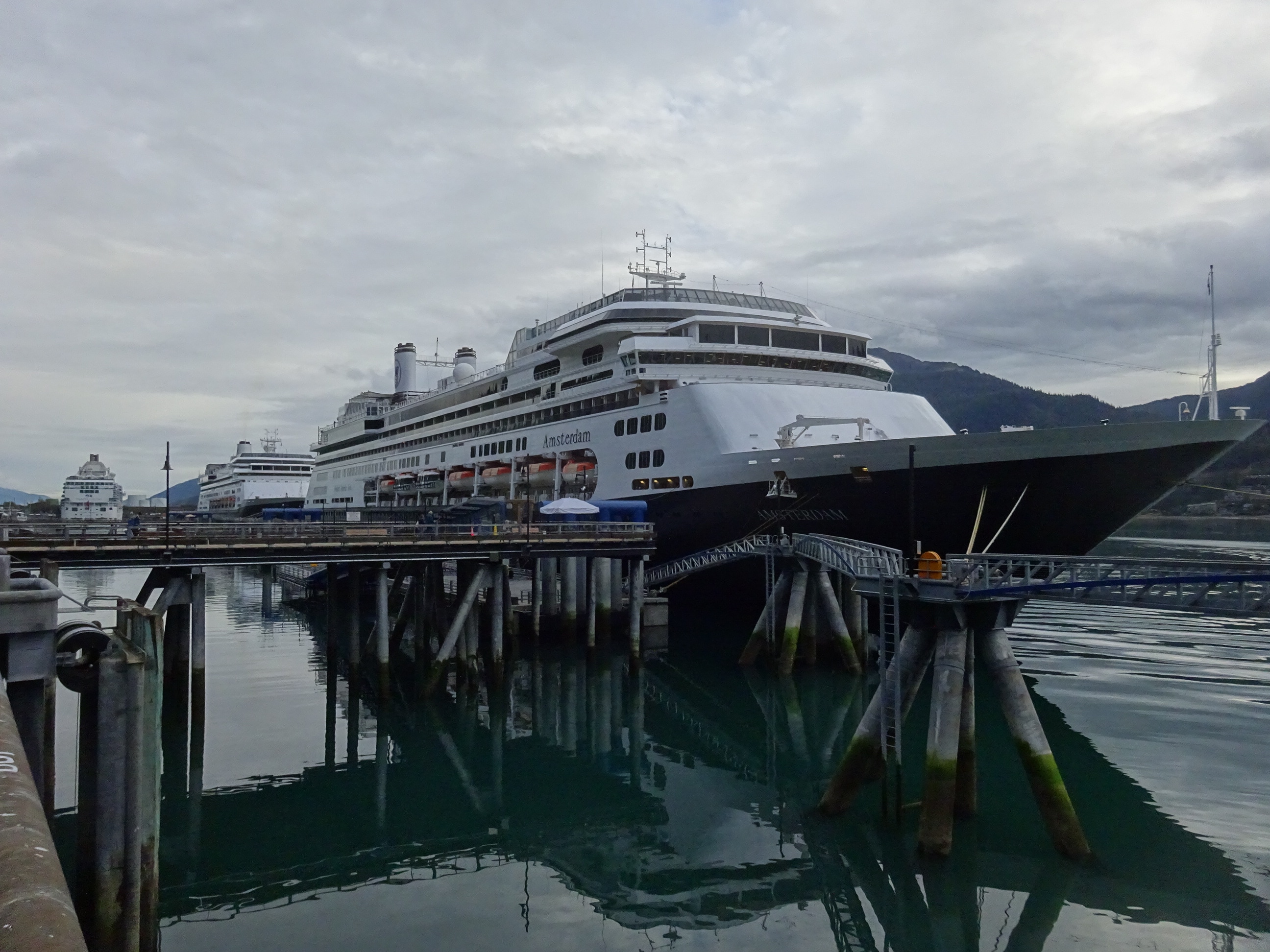
The good ship Amsterdam docked at Sitka this time, as a dock was built a few years ago at the cargo area of the town. Basically the area where the tug and tows come in with all the containers with supplies from the lower 48.

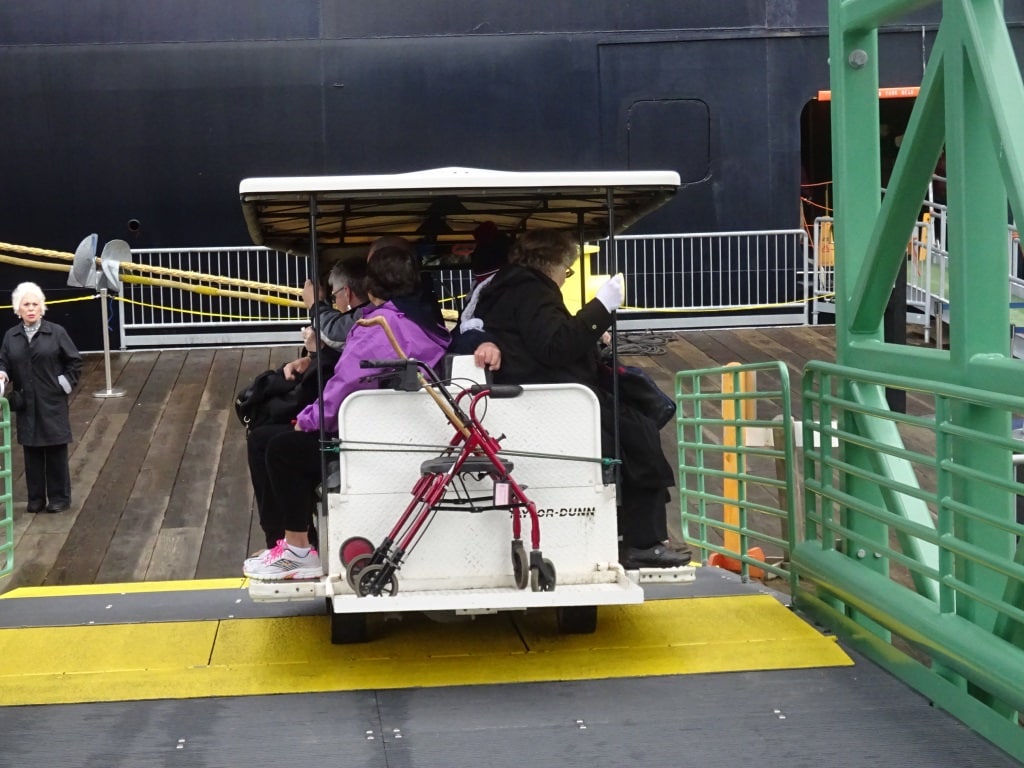
Until 2013 every cruise ship, unless it was very small, had to anchor on the south side of Sitka where there are four designated anchorages and at times these were all occupied. The advantage, as long as you were on the inner anchorage or at the 7 Fathom anchorage, was that it was a short tender distance and you landed straight in down town.  The other two anchorages were further out and caused a long tender ride.  The inner anchorage and the 7 Fathom were not suitable for the larger cruise ships and thus they had to go further out. Their length made it impossible to swing around on the tide and then, either they had to keep their engines on and work against the current which tried to swing the ship around or go to one of the two anchorages further out.

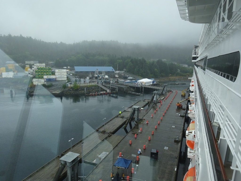
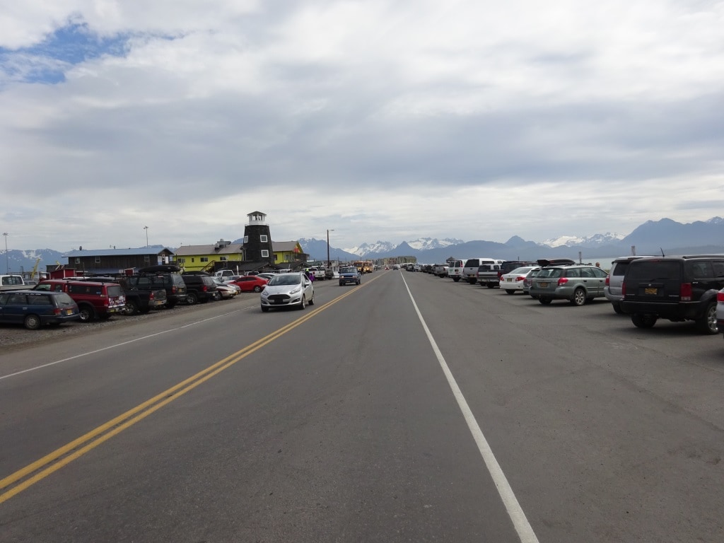
The dock as seen from the bridge of the ms Amsterdam. The white tent is a sort of Visitors Meet and Greet. Note the containers on the dock which are brought in by tug and tow.

Thus the decision was made to create one big dock in the cargo port which could handle one big cruise ship. Who was going there? We have the regular Alaskan pecking order again. Those who have been here the longest go first, if the ships are the same size. If that does not apply then the biggest ship will dock that makes the largest number of calls during the season.  If there is only one ship then of course it is easy although that ship could opt to go to anchor.

With tendering the tenders sailed straight into town. First exclusively into the Marina, which is on the East side but that upset the shopkeepers whose shops were on the west side of the town. So a second tender landing was created and the tenders would call one week at the East –Marina –Side and the next week and the West – down town- Side. If there were more ships in on the same day, those ships were equally divided over the two landing areas. We had to do a lot of work in those days to keep the shopkeepers happy in Sitka.

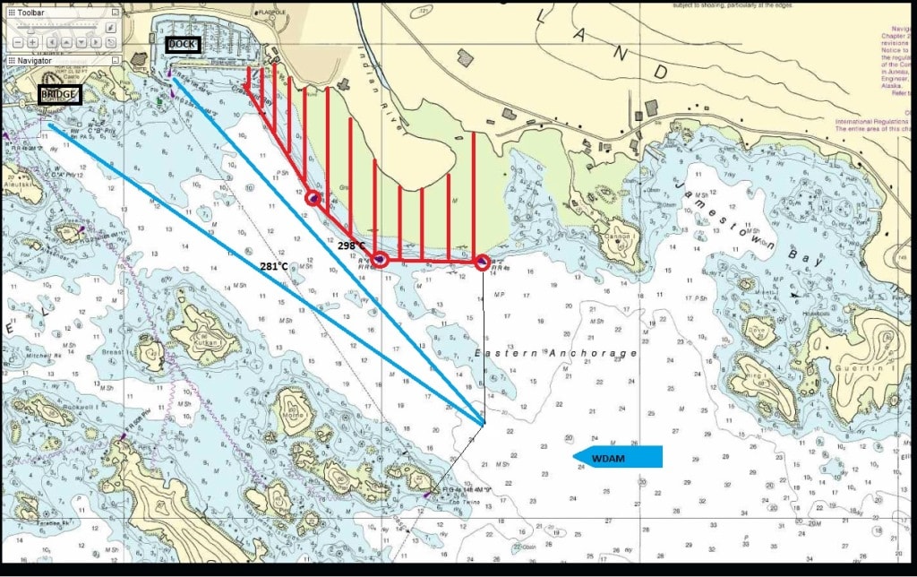
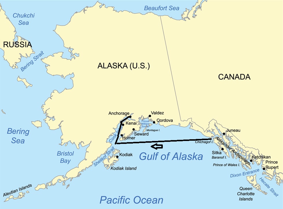
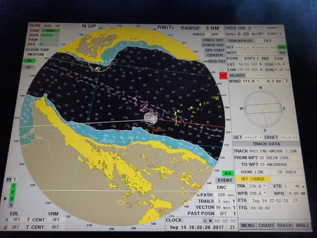
Shop keeper navigation. One week we steered 298o to the Marina and the next week 281o to the bridge dock. The blue patch of shallows is called the 7 fathom bank where we preferred to anchor.

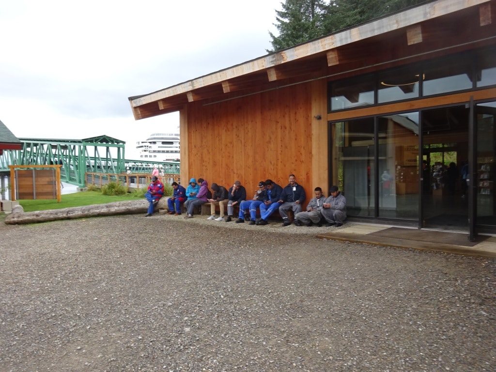
For the guests who go to town from the cruise dock, there is a free shuttle bus system which takes them in 8 – 10 minutes to Sitka itself. For myself I still have to figure out what the best option is for the guests. Dock at the North Dock and need to use the 8 minute shuttle into town or be at the inner anchorage and have a 5 minute tender service to the shore. For us who have to run the tender service it is much better to dock. It takes a lot less labor and we do not get wet and cold while standing there conducting the tender service. If we would have had to tender today, it would have been quite miserable and very chilly.

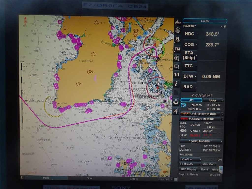
The route to the dock. When going to the anchorage you sail straight on instead of changing course to the North.

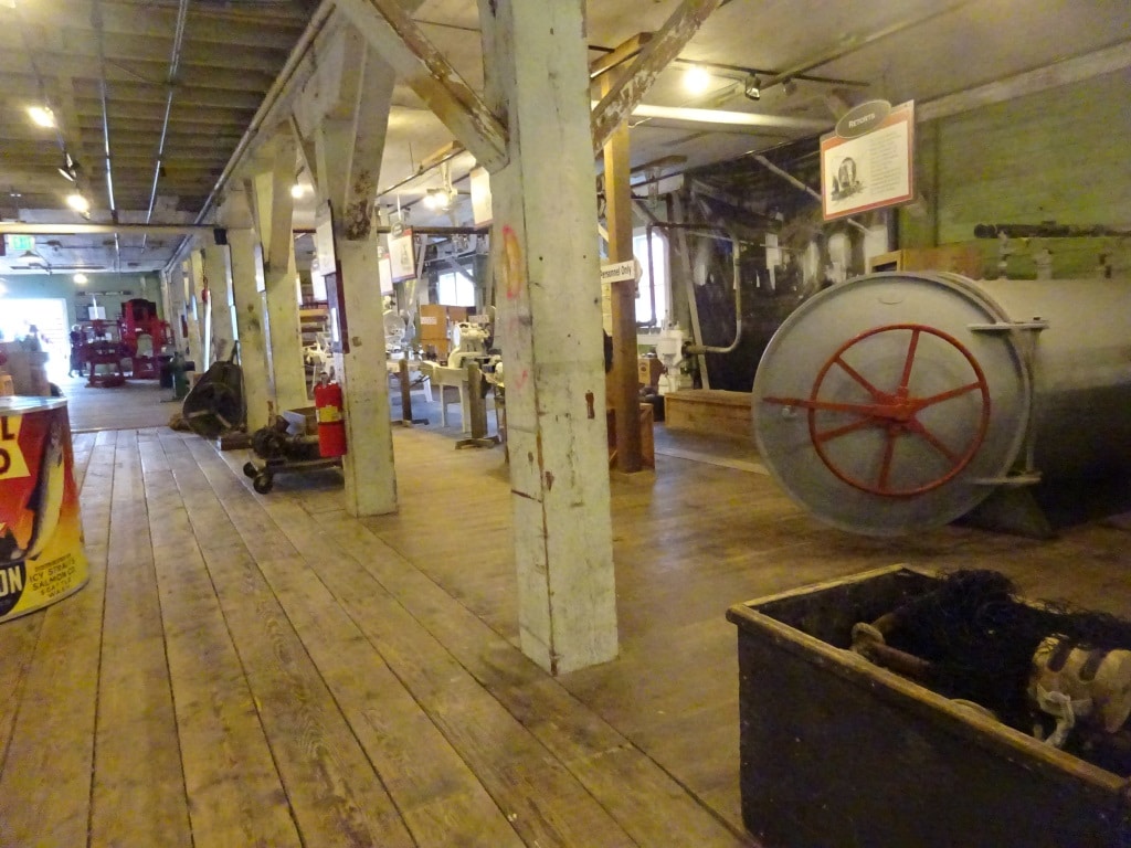
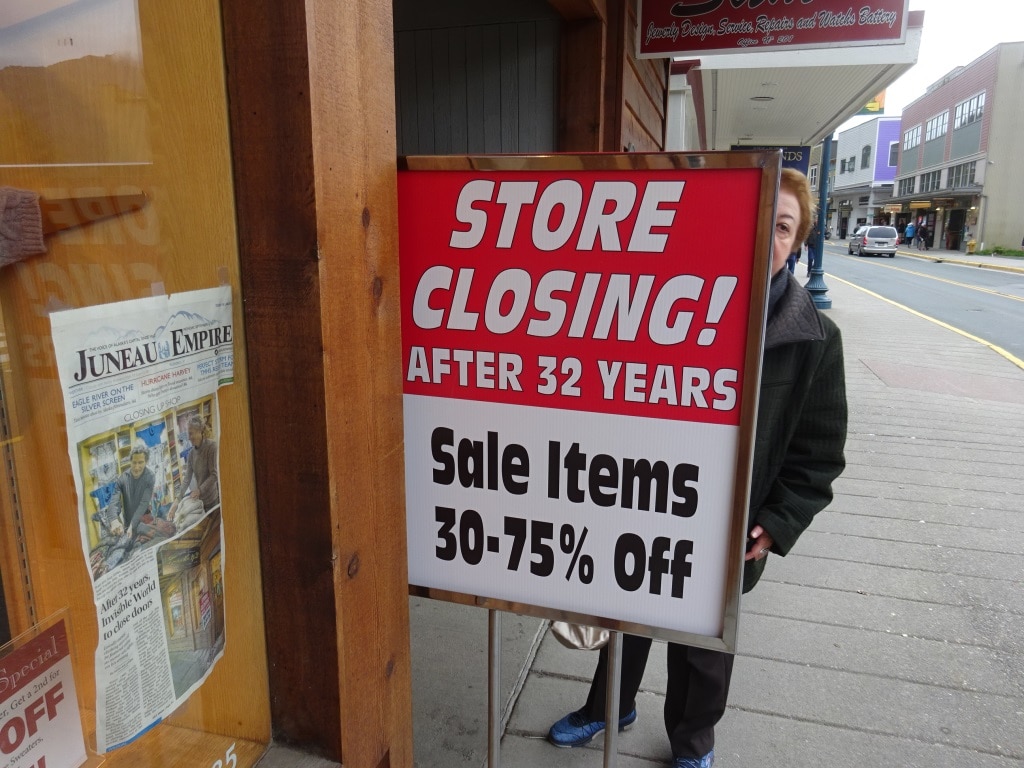
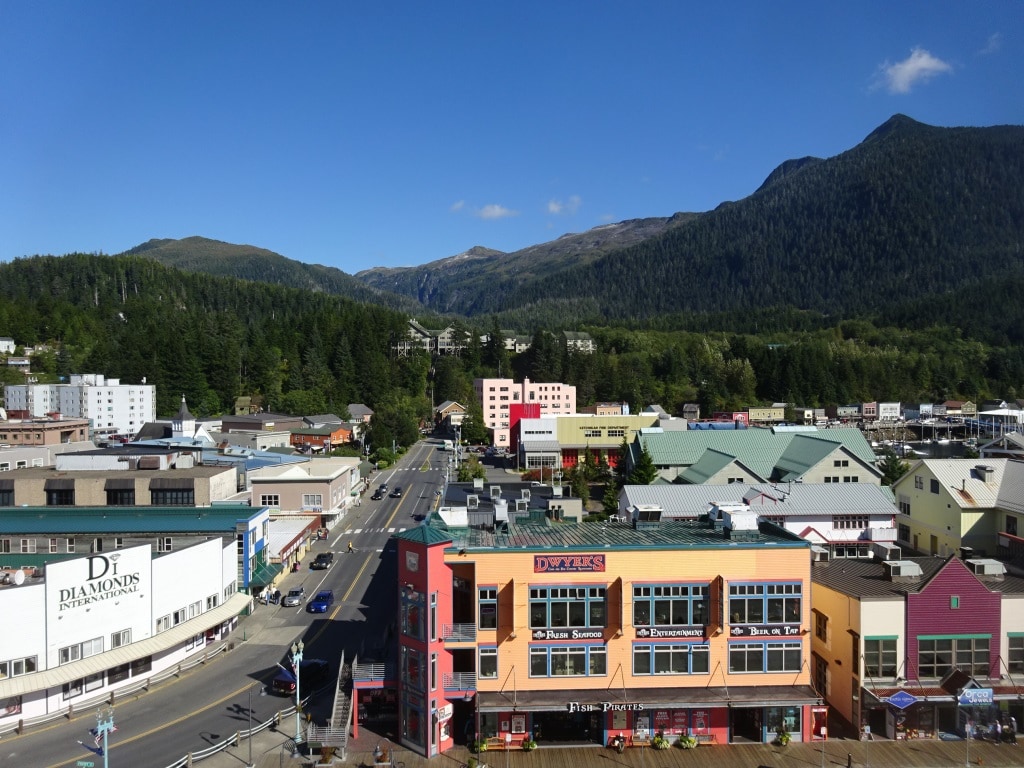
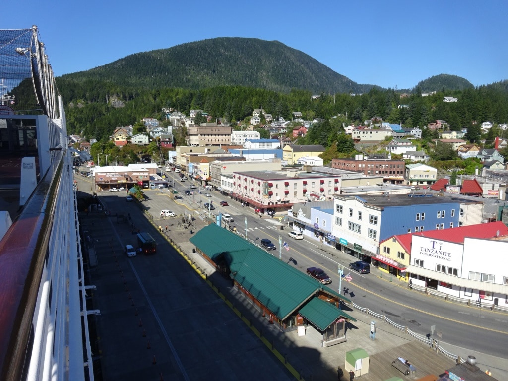
We stayed in Sitka from 08.00 – 16.00 hrs. and about half the guests ventured ashore. Those who stayed behind had either been there before or decided to wait to a next trip when it would be dry and sunny. Sitka does have it attractions though. It used to be the capital of Alaska when it was still Russian owned and remnants of the Russian culture are still very much visible. The heritage center keeps the old traditions alive and several buildings from the old days are still there. I like the place as it feels that it is the least commercialized of all the other ports, compared to Juneau, Skagway and Ketchikan.  Russian souvenirs are very much in vogue although I must admit that I saw a shop in Juneau which had much better quality.  So there is a challenge for Sitka not to lose its edge.

We sailed at 16.00 hrs. and went from the drizzle into the Fog. A large area of “very low hanging clouds” is lying along the South side of Vancouver Island and we have to sail straight through it. So the captain will be busy with honking the horn every two minutes to let the whole world know that the ms Amsterdam is in the vicinity and on its merry way to Victoria, Canada.


21 September 2017; Hubbard Glacier.

The Gulf of Alaska must have thought it was summer time as the sea was as smooth as could be. Just a low swell was still running from the South West but it was a really low swell and did not affect us at all. Main focus of the day was the visit at Hubbard Glacier. We normally call there between 2 and 8 in the afternoon but with days getting shorter, the captain decided to arrive at noon time at the entrance so would still have day light for the whole period. That meant cranking up the speed a lot not good for the fuel consumption but some of it will be regained again when sailing down to Sitka at a lower speed.

NOAA chart US 16761 showing the whole of Yakutat and disenchantment Bay. Latouche is the bump where the Bay bends to the North East.

Hubbard Glacier is located at the top of Disenchantment Bay, which is a 2nd bay behind the Yakutat Bay. The border is roughly at point Latouche about ¾ up.  The name disenchantment was given to the bay by the Spanish Explorer Malespina who thought that he had found the entrance to the North West Passage. He had not as he was stopped by an ice barrier called a Glacier and thus was very “disenchanted”. Looking from Disenchant Bay down to the Yakutat, the bays are separated by a promontory on the Eastern side called Point Latouche or Latouche. It is surmised that George Vancouver named it after the French Naval Commander Latouche.

We enter the bay sailing through a gap in the shallows and then make a lee for the pilot boat. (See the black course line deviating from the red/planned route)

Yakutat is a native name or at least the English version of the Tlingit name: Yaakwdáat. And the bay is accordingly named after this town located at the entrance. When we enter the Yakutat, we are coming back into US territorial waters and that means we need to get a pilot on board. He/she boards from a boat coming out of Yakutat after having flown in from the South. The town itself is very small but it has an airport which services the whole area. Long time ago I sailed in there once with the old ss Rotterdam to facilitate a Medivac. It was quite funny as they had never had a ship that size come into the bay which forms the inner harbor and the man in charge, the local harbor master, had decided to take an extended lunch on that day and at that time. So he missed the event of the century. He gave the pilots considerable stick over it but it shows that long lunches are detrimental to work. (Although very good fun)

Once the pilot is on board, the pattern is normally to race as fast as possible up Yakutat Bay to save and create extra time for when the ship comes to the ice. You never know how much ice there will be as Hubbard normally caves a lot but can be quite erratic. I have sailed in the past all the way up to the face of the glacier but have also been stuck at an ice barrier just North of Latouche.

We try to sail mid channel courses but it all depends on the ice. Icebergs do not always give way to a cruise coming in and thus today the ms Amsterdam was hugging the Eastern side of the bay close to Point Latouche.

Today we had the best of both worlds, there was a lot of caving but there was also a lot of space between the ice bergs. Thus the ship could get to a nice spot south of the Glaciers face. Close enough to see the caving going on and far enough out to keep perspective of the whole area. Hubbard Glacier is immense with a face extending close to 3 miles and then there is an inlet to the East which extends the face even further. A number of years ago, Hubbard advanced suddenly and that inlet was closed off for most of the year. That caused the waters to rise inside and keep everything trapped until the water pressure became too strong and the ice burst. (Or the Glacier retreated again. I cannot remember, it was nearly 20 years ago) The environmental world was quite concerned about the dolphins trapped inside and about the danger of a deluge coming down the bay.

A number of years ago this side arm, called Russell Fjord, was completely closed off by the Glacier. Water inside rose 45 feet from Glacier melt water and rain until the opening burst open again.

We had a rainy day in the Yakutat but it proved my point once again: with overcast skies, the natural blue colors of the ice are much better visible than with a lot of sun light.

The true blue colors of a Tide Water Glacier.

Tonight we will sail down to Sitka where we will be docked by 08.00 hrs. in the morning. Sitka has had a dock now for some years but it will be a first for me, as I always was assigned an anchorage in the past.

Weather: Overcast with a chance of showers, no wind predicted and temperatures around 55oF. or 12oC.


20 September 2017, Kodiak Alaska.

It was a dark and chilly arrival this morning when the ms Amsterdam slipped into her berth at Kodiak. We docked right behind a Matson Container ship and that solved the question of where all those Matson containers were coming from, the company has a regular service to some of the Alaskan ports.  It is not meant in a negative way but you can smell Kodiak when you come closer. Right behind the dock which is used for the cruise ships is a Fish Collecting warehouse and the smell of fresh fish was all over the place. I did not sniff any fried or cooked fish, so either there was no fish processing plant or they were not in action during the period we were alongside. Hurrah for that as the smell of cooked and fried fish is very hard to get out of a ship; as the smell tends to cling to anything that is part of the A.C system.

We did not need much A.C today, at least not the cold version, some warm air was much appreciated as it was quite chilly again but we had sunshine and we had a very nice sunrise in bright red behind the ship. I am quite used to beautiful sun rises and sunsets but this was a real good one. My camera did not do justice to it.

It does not look much on camera but it was quite spectacular.

Kodiak is located on Kodiak Island just south of the Kenai Peninsula and just east of that stretch of land which ends up in all those islands called the Aleutians. What is there to do on the island? Plenty of things. A lot centers on wildlife of which there is a plenty, lots of bears, and there are tours by Plane, helicopter or by coach.  There is quite a bit of history from the Russian days including two Museums which are housed in Old Russian buildings. There is even a Maritime Museum which is focused on documenting the history of the fishing industry here.  And last but not least the island has its own Fort; Fort Abercrombie which is located in the local State National Park. It is now in ruins and was constructed in the 2nd world war to stop the Japanese from visiting. There is another Fort of the same name but that one is located in North Dakota as google just advised me. The fort is located in the State National Park and that is the main reason for its significance nowadays.

Kodiak Island located at the most western side of the Gulf of Alaska. Further south it is called the Pacific Ocean again.

I did not see any of this as I was at work deep in the bowels of the ship. The challenge today was to figure out how the builders in Italy had managed to muddle up either the drawing or the way they had built protection around a space in the ship. I blogged about this before during my last contract; but as a recapitulation, when a cruise ship is built, its interior receives special protection, fire insulation around a space depending for what the space is being used. Solas (Safety of Lives at Sea) Legislation recognizes 14 different Categories and each has its own special requirements. If you want to store paint it has to be a category 14, if you want to store just paper then a category 7 is enough. Hallways and staircases which can act as funnels during a fire are a category 2 or 3 and an electric locker with fuse boxes is a category 10. As cruise ships are forever upgraded, these areas are sometimes rebuilt and the right category needs to be adhered to. That normally works out but sometimes the border is a bit blurred. And when not, the crew can also be quite creative in putting things in lockers where it really does not belong.

So Holland America has a program during which the staff Captain or his designee will visit all the spaces on board to see if it is still in compliance. I was today trying to figure out what should be on the checklist so that this inspection can be carried out correctly. The drawing did not help so an extensive inspection was carried out. Turned out that when the space was upgraded a few years ago not all the information had come over and the new drawing did not reflect that.  So all was well in the world and the drawing will be corrected in due course.

As mentioned yesterday, departure time was 14.00 hrs. and the weather decided to follow the forecast today. We are sailing over a very smooth Gulf of Alaska at the moment and it is supposed to stay that way. Winds will increase a little bit to 20 knots but will be blowing with us and will bring some rain. But no bumps are expected in the road thus far. Tomorrow afternoon we will be visiting Hubbard Glacier and we are keeping our fingers crossed for not too much ice so we can get close to the Glacier.

19 September 2017; Homer Alaska.

The port of Homer is a bit of a peculiar thing. It is sitting right on the beach. A beach which is called the Spit and that is one of the reasons we are calling there. The Spit is a long and narrow peninsula sticking out from the main land and there is a sort of settlement located at the end; which is frequented by large numbers of fishermen and a whole tourist industry has sprung up around it. Restaurants, Pubs, Souvenir shops, Fishermen shops and anything else that might attract the tourist and fisherman alike. Because of its remoteness everybody comes by car and the whole approach road all way to the end of the Spit where everything is concentrated is filled with pickup trucks and RV’s. If you are planning to buy one of those and do not know what model to buy, just walk along the street here and you can compare all the brands free of charge and in one location.

The Spit with Homer in the far background. The ship is docked at the finger pier just to the right of the Orange Canopy.  Photo courtesy: unknown source on the internet.

The Spit is also the area for a very large Marina and that is also were we dock, making the Amsterdam the most luxurious yacht in the port. Getting from the ship to the Spit is by means of a complementary shuttle service for which they use school buses. Not a bad idea, as those buses are normally standing idle when they have delivered their early morning load of young America. Homer itself is on the main land, all the way at the end of the Peninsula. To get to Homer there is also a shuttle system available but you have to buy tickets for that trip, or take the shore excursions which mostly include a visit to Homer itself as well.

And this is the “tourist version” from the same Spit. Quite a few things to do while wandering around the place. Thank you to Mr. H.B Hughes who drew this picture.

We were blessed with a sunny day and that was very much needed as it was very chilly. Although the weather forecast had promised a windless day, there was still a gentle breeze blowing but it was a very cold breeze and did not feel very gentle on the skin. I poked my nose outside to touch Homer soil and then hopped straight back inside. I have sunglasses with me but not a fur coat and I needed both today. I wonder what it is like to live here in the winter as the area is not sheltered at all. The Spit is very flat and I would not be amazed if it would partially or completely flood if they get a Storm combined with a Spring Tide. The guests were lucky as it did not rain and the bracing day did not keep them from going ashore.  And they should go ashore as the Spit is quite a nice place to mill around for a few hours. The largest pub has quite a few Craft Beers on draft for those who also wanted to immerse themselves in the local culture by means of a beer glass.

The long road on the Spit. Photo taken during a previous visit.

We arrived here at 10 am. in the morning a bit of an unusual time but that has to do to a large extent with the strong currents in the Captain Cook Inlet. If you set the schedule too tight and you get a strong adverse current, maybe even “enhanced” by an adverse wind you can be an hour late very easily. That has then a knock on effect for shore excursions and everything else, so a 10 am. arrival guarantees that the ship will also be there at that time. By leaving at 18.00 hrs. the guests still get more than enough time to see all the sights.

Tomorrow we are going to do it the other way around. We will be docked before 07.00 hrs. in the morning but leave early in the afternoon at 14.00 hrs. Kodiak is just a short hop south of Homer and thus we can keep that schedule at all times. But after Kodiak we have to cross the Gulf of Alaska again and then we might have adverse weather while doing so. So an early departure from Kodiak will gives us some leeway to ensure that we reach Sitka on time.

The weather forecast does not look too bad at all for the moment but it can change very rapidly here and a forecast six hours later can look quite different from what we looking at now. Below is what we should get tomorrow when we are in the middle of the Gulf, if it does not change. Looking at six foot seas predicted, and then I say “its not bad at all for this time of the year.”

NOAA:

Synopsis: A surface ridge will shift east across the gulf through Thursday and displace a trough of low pressure over the southern panhandle toward the south and east.

Today

W wind 20 kt. Seas 6 ft. W swell early in the morning.

Tonight

W wind 20 kt. Seas 6 ft.

Thu

W wind 15 kt becoming S 25 kt in the afternoon. Seas 6 ft or less. Rain in the afternoon.

Thu Night

SW wind 20 kt. Seas 7 ft. Rain in the evening.

Fri

SW wind 15 kt. Seas 7 ft.


18 September 2017; Anchorage, Alaska.

After embarking the pilot at the Homer pilot station the ms Amsterdam sailed up Captain Cook Inlet to arrive at the Anchorage dock around 07.30 hrs. Anchorage does not have a real passenger terminal but more of a modified cargo shed which is understandable as the dock is extensively used by cargo ships during the off season.  As Anchorage is the largest city in Alaska and a gateway to the central part of the State thus there is a large amount of commercial traffic going on.  It benefits from a big train station (where the trains we use from Seward are terminating) and container ships call on a regular basis. Going by the names on the containers, Matson, which is better known for their shuttle service to Hawaii, has quite an important presence there.

When getting to Hawaii by ship was the only way to go. White ships and Hula girls.

Matson used to be a big Ocean Liner company as well, again predominantly servicing the Hawaiian Islands, before the air planes took over. It built some beautiful ships and many an American dreamed before the 1960’s about a Honeymoon to Hawaii; and sailing on a beautiful white Ocean Liner was a major part of the experience.  White beaches are not exclusive to Hawaii but the white ships of Matson were. But as with many passenger liner companies, Matson could not make the change to cruising when the airplane arrived but they still have the cargo side of the operation, which seems to be doing well as I see their containers in many American ports on the west coast.

The main challenge while being docked in Anchorage is the tide. I mentioned that we already have challenges in ports as Juneau and Ketchikan but Anchorage is one step up from that. If there was a port which could do with a cruise ship pontoon dock, then it would be Anchorage. Due to the narrowing of the Captain Cook Inlet, the water is pushed up and that can give cause to some extreme tides. Also today we had a good one, being 1.4 feet under normal at 13.00 hrs. and then rising to almost 32 feet by 19.00 hrs. That is a variation of 33 Feet between low and high tide.  And that means fussing around with the gangway again during the day to make sure that our guests could get ashore and back without having to climb to steep a ramp. Even more important today as it rained until mid afternoon making everything rather wet and damp. Luckily there was no wind, so even with temperatures barely coming above 50oF / 9o Celsius it was not that cold.

Anchorage, Cook Inlet, Alaska Tides.
Mon 09/18/17 12:34PM 2.5 feet  Low Tide
Mon 09/18/17 1:02PM -1.39 feet  Low Tide
Mon 09/18/17 6:56PM 31.51 feet  High Tide
Mon 09/18/17 8:07PM   Moonset
Mon 09/18/17 8:10PM   Sunset
Tue 09/19/17 1:25AM 1.1 feet  Low Tide


As the port is mainly a cargo port, it is not allowed to walk on the dock but there is a continuous shuttle service to the downtown mall. I have now been a few times to Anchorage and it is basically laid out as any other American town with the difference that it is a fairly young town so there are very few monuments and old buildings to be found. But it has a nice out of town shopping mall, Dimond Center (pronounced Diamond) and I was able to obtain a Television Flat screen for the Bo ‘sun store.  So by tomorrow the Bo ‘sun store will be enriched with a 65 inch screen for all the training’s the sailors have to go through nowadays.

Anchorage as seen from a HAL ship on a sunny day in 2015. The town is about 10 minutes away by shuttle.

The ms Amsterdam sailed from Anchorage at 22.00 hrs. catching the last of the ebbing tide while going down the Inlet again. By 10.00 hrs. tomorrow morning we should be docked in Homer which is a totally different place from Anchorage. Also the weather should be different. Same temperatures as today, also no wind, but more important, it should be sunny.

17 September 2017; Gulf of Alaska.

The ship kept behaving quite lively during the night and then during the day. But by mid afternoon the seas settled down somewhat as the winds, which had abated last night, did not provide the energy anymore. We had a nearly windless morning but the still high seas; I saw a few going up 17 feet, and it made it feel like as if we had bad weather.  Most of our guests kept a low profile and that gave rise to my cabin steward complaining that he could not get in any of his cabins.  Still somehow he managed as he reported that by 14.00 hrs. he had serviced them all.  Bad weather makes it hard for the Cabin Stewards as they have to service all their cabins, and work around the different times that the guests are going out. Their break time is at 14.00 hrs. and they start again around 17.30 so if the guests are not leaving, they try to wait past 14.00 hrs. and then it will eat into their break time. Most guests are quite understanding if their – stay in the cabin- results in their cabin not being made up in the morning but not all of them.

This was our route from leaving Icy Strait Point and sailing towards Anchorage. We had most of the high waves and wind in the area where the map reads “of Alaska” Once coming closer to Kodiak things settled down again.  We will visit both Homer and Kodiak on the way down.

We had most of the ships movement while in the curve of the Gulf of Alaska before passing Cape St. Elias. This makes sense as most of the long waves come all the way from Japan and roll in a North Westerly direction towards Alaska. Hitting land in the area of Glacier Bay. If the bad weather has only been near Japan, then the waves are quite sedate by the time they arrive at the Alaskan shores and the ship does not move at all or only has a gentle motion. Very good for taking an afternoon nap. If the wind is also blowing  over the Northern part of the Gulf then that wind keeps energizing the waves, and can build them up even higher, then we get the wobbly weather which we had today.  The more you sail to the west, the more you get out of that North West wave direction and the quieter it gets. The Kodiak Islands offer quite a nice protection as well.

This does not mean that there is no bad weather near the Kenai peninsula, far from that, it is just that often the waves in the area close to the east side of the Kenai peninsula are a little bit less pronounced as there is some shelter from the land. That is with the waves, read swell, coming from lower parts of the North Pacific Ocean. If you have a full westerly storm thundering over then it is mayhem everywhere. But today we were in the position that the swell slowly started to abate once we came closer and closer to the Kenai Peninsula. And once we rounded the southern point of the Peninsula the swell was completely gone. That was good planning as it gave those who had “been under the weather” to come out and have a good dinner. And dress up at the same time as it was formal night.

The amount of wildlife in the area, as far as whales are concerned, has been less than what we normally see. The bridge officers are reporting that the migration of the whales, either to Hawaii or to Cabo had started a few weeks ago and now most of them are gone. Why, I do not know, they do not always leave at the same time; meaning the same week each year.   I have seen large amount of activity until well in October in the past, when my ship was the last one leaving the coast.  But I did not see any whales at all today. First of all, they do not seem to like high waves as I have never seen them swimming on the surface when there is a swell running of 15 or more feet and secondly, by yesterday afternoon we were more or less away from their track down to Hawaii.

Anchorage is located all the way up the Captain Cook Inlet and that means that we will stop off at Homer to collect the South West Alaska Pilot who will guide the ship all the way up the fjord to the dock. Because Cook Inlet is a sort of estuary and gets smaller and smaller when coming closer to Anchorage, the water has to go somewhere when the flood comes in and if it cannot go sideways it has to go up and that results in large currents and high tidal differences. Just after midnight tonight it will be low tide and thus the ship has to go upstream against the outgoing flow during the evening. Luckily then we get the flood in the back and that will help with arriving nicely on time.

Weather for tomorrow: Overcast with rain, 11oC / 51o Fahrenheit.  No a great day but there is no wind forecast so there should be no wind chill factor to make it worse.


16 September 2017, Icy Strait Point, Alaska.

Icy Strait Point is a fairly new cruise port in Alaska. New compared to Ketchikan and Juneau where the ships have been calling continuously since the 1970’s. Holland America started to call at Icy Strait Point about seven years ago and anchored on the North side of Icy Strait and then used tenders to bring the guests to the other side. The anchorage was just east of the entrance to Glacier Bay. Main points of attraction were the small Indian village of Hoonah and the old cannery which was preserved by the local tribe and turned into a museum, visitor center and general tourist attraction. The feedback from our guests was positive and thus we kept calling. And what one company does, the other does as well and so more cruise companies send ships here.

The ms Amsterdam at the new cruise dock. Note the long covered walkway from the ship to the shore (and beyond)

That made it possible to build a dock for one cruise ship and leaving the option for another one to go at anchor. Today we were the only ship around and thus we went alongside. This is the first time I have seen the dock and it is very nice. Good bollards to make the deck officers happy for the ropes and a long wide and covered catwalk for the guests to walk from the ship to the Visitors center and the cannery museum behind it. The town of Hoonah is 1.5. miles from the dock area but if you do not want to make that journey, the area around the dock is more than enough to spend some quality time.

Part of the Cannery Museum. To the right the open door of the pasteurization process for the filled cans.

Apart from the cannery museum, which is somewhat morphed in the shops system in the big factory shed, there is a visitor center, various eateries and the largest Zip Rider with a 1330 ft. drop. It was in full operation and quite busy. It is not a Zip Line system, but a Zip Ride system the difference is that you do not hang on a pole and Zip down but you sit on a chair while coming down to the Drop Zone which is the end of the ride.

The whole complex of Icy Strait Point.

Hoonah has been an Indian Settlement for a long long time, as far as recollection goes there always has been some sort of settlement just outside Glacier Bay and when the Glaciers started to retreat the territory was simply expanded into the Bay. Now Glacier Bay is a National Park and as a Reserve restricted in its access, but the Indian Tribe still has fishing right there and not too long ago I came across a fishing boat fishing in the lower bay.

The visitors center has free WIFI so the crew were out in force during their break times.

The ship stayed here from 07.00 hrs. to 14.00 hrs. The early afternoon departure has to do with the fact that it is a high speed run of 18 knots to Anchorage. The ship will have to sail a little faster than 18 knots as we are expecting not so nice weather while en route. The summer season is ending and thus the period of the autumn storms are approaching. We are just on the edge of that period and thus it is not un-expected that the “wobbly-ness” of the Pacific is increasing.

So late this afternoon, when we left the Inside Passage near Cape Spencer we were greeted by a lot of wind, force 7 on occasion 8  and the always present North Pacific Ocean swell. The wind will abate during the coming night but it will have whipped up the waves enough by that time that we will have a lively ride until we are in the shelter of the land again.  That means for most of the next 36 hours the ship will feel like a real ship and not like a floating hotel.  Unfortunately a lot of our guests were not ready for this part of their cruise adventure and many cabins had the privacy sign in the key hole this afternoon, no doubt waiting for better times to come.

We will sail in the North Pacific Ocean until late tomorrow evening. We first have to pass Resurrection Bay, the entrance to Seward, then go around the Kenai Peninsula before we can sail into the Fjord at which end Anchorage is located. Weather for tomorrow, overcast, diminishing winds but still with waves present which can reach 15 feet and that will make the ship move around at bit.

For those who find the distance too long too walk, there is a little trolley system which runs to and from the ship.


15 September 2017; Juneau, Alaska.

We raised anchor at 05.45 when daylight was slowly approaching from the East. Winter is coming and the summer days where the ship was in 20 hrs. of daylight while in this area are gone, gone until next summer. The ship had dropped anchor on a bank made up of shingle, pebbles, mud and rock and when the anchor came up, the chain was nice and clean but we had about 1000 pounds of thick grey clay wrapped around the anchor. An indication that this was an excellent anchor spot to hold the ship in position even if there would have been a lot more wind than we had during the night.

One spot of grey, the bank surrounded by black, deeper water at the south side of Stephens Passage. Juneau is about 10 miles to the North.

By 07.00 we started the approach to the dock in Juneau and as we were the first ship in, we could just slide into the new dock at the Alaska Steam. This one was completed last year and now goes up and down with the tide. The locals have kept the old names for the docks although those cannot be reached anymore as the new floating docks lay in front of it.  Until the 1980’s the Juneau waterfront had three docks for specific use. 1.  The USCG dock to the west; 2. The Alaska Steamship dock on the town’s water front, where until 1964 the passenger ships of Alaska Steam used to dock and 3. next to it the ferry terminal which had the great advantage of having a car ramp for the cars and campers.  The USCG dock is still there and in full use, Alaska Steam became the main dock for cruise ships but was joined by the Ferry dock, when the Alaska State ferry terminal moved to Auke Bay. Auke Bay is located on the west side of Juneau on the other side of the mountain ridge. Here it had room to expand and it reduced congestion in downtown. This dock was renamed to Cruise Terminal and all the ships tried to get that spot as it meant that you did not have to shift the gangway for tidal changes.  We could just put the ships gangway on the car ramp and it followed the tide.

Ocean Liner Row in Juneau with the ms Volendam behind the ms Amsterdam and a Princess ship at Franklin Dock in the background.

With the expansion of the cruise industry and the size of the ships, then Franklin dock (on Franklin Street) and the A.J dock were added. Those two docks went up and down with the tide leaving the Alaska Steam a bit of a poor relation. Finally, last year Alaska steam and the cruise terminal were also upgraded with a large new dock but the west end is still called the Alaska Steam and the East end is still called the Cruise Terminal. Franklin dock is normally assigned to Princess and later in the day one of the Princess biggies came in and docked there; no doubt making the shop keepers at that end very happy.  We did not stay alone at our dock, later on in the morning the ms Volendam joined us and thus we had two of the four ships of the R class together.

The R class is not identical but they are near sisters with the Volendam and Zaandam nearly identical and the Rotterdam and Amsterdam quite similar. When you walk around inside there is not much difference in the lay out but outside it is quite visible. Rotterdam and Amsterdam have double funnels, a tribute to the old Rotterdam of 1958, and the ZADM and VODM both have a single funnel. The Rotterdam has heavier engines and can make 25 knots and the Amsterdam was the first Azi-pod ship in the company.

How about a this for a closing down sale !!! We will have to see what will be here next year.

As we are in the last days of the season, the closing down sales have started and all the shops are tempting guests in with discounts of up to 50%. I always question that as I was in a leather shop where I recognized some jackets which clearly came from Turkey and although reduced from $ 800,— to $ 400, there was still a markup of about $ 100. (Believe me I know, I have been dragged by my wife around all the leather shops of Kusadasi and introduced to the system of saving money by spending it because it is a bargain) However I did manage a bargain as well, the windbreakers were 75% off, and that I could not let go. The ms Amsterdam is going into wet dock in Seattle in 10 days and gambling on sunny, dry and warm weather in Seattle is too much to ask. It was a pity that the real good stuff was not reduced but will go in hibernation for a next season of eager shoppers.

The ms Amsterdam left at 21.30 heading for its next call, Icy Point in Icy Strait. They just built a dock there so we can now dock as we are the only ship in port. We will be docked by 7 am. and the forecast is a bit gloomy. Glacier Bay is just around the corner and the proximity of the ice will make it a chilly day if there is no sun to warm things up.

14 September 2017 Tracy Arm, Alaska, sort of.

As mentioned yesterday we had Tracy Arm Fjord on our schedule today and I also mentioned that is was uncertain if we would get there due to the ice. This has been the case for most of the season and today was not different. When we go to Tracy Arm, we want to get to the face of South Sawyer Glacier and see the calving. Lately the Glacier has not been cooperating very much. It has been calving too much and as a result it has been retreating very fast as well. It produces so much ice that the ship has a hard time getting near the glacier and if the ice was not there then we still would have a challenge to get close to the face because the Glacier has been retreating. It has gone back by about half a mile in recent times and we do not know what is under water at this new half a mile stretch. But there was too much ice again to even contemplate going in.

As you can see there is not much difference, apart from Tracy Arm fjord being a bit more narrow. Both Glaciers come from the same ice field but for some reason South Sawyer is retreating fast.

But no worries: Holland America always has a plan B. And that is to go into Endicott Arm. So we went left instead of right into the fjord. The scenery is the same, it is just that Dawes Glacier calves a bit less. But that is exactly what we need. We like to see some action but we still have to get to the Glacier to see it. Too many ice cubes and we have a problem here as well.

This is how it looks on the radar screen. The yellow spots are the reflections of the mountains on either side.

Today we were in luck. The sun was brightly shining, the ice buildup only started about a mile away from the Glacier face and we could get just around the corner and see the Glacier at half a mile distance. It was a good day; it was a spectacular day, probably the best visit of the year. We entered the fjord around 10 am. and then it took with a speed of about 14 knots and slowing down all the time, until 12.30 before we were parked at the rim of the ice field in front of the Glacier. Our ships EXC host narrated the whole progress so everybody understood what there was to be seen and why it was there.

Approaching the face of the Glacier. The ms Amsterdam sailed passed all the large pieces and then stopped in the rubble where it was still safe to do so, approximately 0.5 miles from the Glacier.

By 1700 hrs. we were back outside again and our next stop is Juneau tomorrow. Juneau is only a good two hours distance from Endicott Arm and if we would have gone directly we would have been fully docked by 20.00 hrs. But then what? By the time the ship would have been cleared the town would have closed down for the night.  Juneau’s night life is not that sparkling that our Guests would run ashore to make a grand night of it. Some of the Bars still specialize in “low flying” locals when evicted late at night and that would be too much for most of our Guests. Plus when you dock the Shops, Casino and everything else which has the focus of the taxman has to close down. That takes away a lot of activities and thus not a good idea. So what we and most other company’s do, who are faced with this dilemma, we drop the hook for the night, just outside Gastineau Channel, the entrance fjord to Juneau.

The evening was wind still, there is a nice muddy bank on the West shore of Stephens Passage and by 18.00 hrs. a 3rd officer was dispatched forward. He lowered 5 lengths of chain plus the anchor into the water and onto the ground. 5 lengths of chain is 800 feet, not counting the anchor. The anchor weighs about 13000 pounds, 800 feet of chain weights about 5000 pounds and so 18000 pounds of hardware was sunk into the mud to hold the ship safely into position for the night. If there is a lot of wind, then we can go up to 11 lengths of chain, but the weather forecast was good, so why bother to get more chain dirty.

We will raise the anchor tomorrow morning at 06.00 hrs. and then be docked in Juneau by 08.00 hrs. The weather calls for overcast skies and a temperature of 8oC or 47oF. and no rain. So not a bad day for shopping as long as you wear two pairs of socks. I know I will, as I will be on the mooring decks verifying the procedures that the officers and sailors have to follow to ensure a safe docking.


13 September 2017; Ketchikan, Alaska.

Today we had a glorious day in Ketchikan. One of the best, sunny, days I have seen in a long time. It was quite windy but who cares if the wind keeps the rain away. The wind blew straight through Tongass Narrows an indication of things to come for the town when winter descends upon the South East Alaskan panhandle. Ketchikan is nicely sheltered from the East and to some extend from the West but a North Westerly gale can blow freely through the whole of the Tongass Narrows. Creating on occasion a local phenomenon called Horizontal Rain.  Your face gets wet and your shoes stay dry.

A nice sunny day in Ketchikan. In the distance the biggest hotel in Ketchikan, the Cape Fox.

Another nice thing was that today we were the only ship in port. Some cruise ships have already left Alaska but the fact that we start our cruise on a Monday, helps a little bit. Most ships depart from Vancouver or Seattle on a Saturday or Sunday and that means a full house two days later. And that full house then moves along the coast from port to port.  The ms Amsterdam is sailing a day behind this cycle and thus we have less competition to deal with. And it will be a few days before we come across the ships which are southbound on the return leg of their 7 day voyage. We will miss most of them altogether anyway as we are on route to Anchorage. All in all it makes the shopping experience in downtown less hectic, if you feel the need to go shopping. The sales attendants have even time to talk instead of being sales processing robots. For those who shop, the season is coming to an end and thus there are bargains galore and huge discounts. Most shops sell off their stock before the season ends and the shop goes into hibernation until May of next year.  During the last week of the season you often find items on sale which go for cost without any mark ups at all.

Although Holland America has squatter rights in Ketchikan, we are the most senior company calling, and thus normallyentitled to the best berths but being the only ship in port makes it even easier. The captain can basically park where he wants to go and where he prefers to stop. That is of course as close to downtown as possible but if you want to set your mooring lines in a perfect position, then 20 feet more forward or aft can make all the difference and having the whole berth to yourself makes that possible.

The shadow of the ms Amsterdam looming over downtown Ketchikan. Please note how quiet it is with only one ship in port. The gangway is dealing with high tide and has a shore side platform under it. When the tide goes down, that platform will be removed, stopping gangway traffic for about 10 minutes. In the foreground the Ketchikan Visitors Center.

While Juneau now has all berths tide independent, which means that the part of the dock upon which the ships gangway rests goes up and down with the tide. Ketchikan still has docks which are fixed and the gangway to the ship has to be adjusted to the every changing tide. If the ship is by itself it could select to go to one of the new docks and would not have to face the hassle but it would mean a longer walk for the guests to town and back. So the convenience of docking in town always wins out over the inconvenience of stopping gangway traffic for about 10 minutes to have the gangway adjusted to the tidal condition by keeping the steepness reasonable.

Another advantage of this 14 day cruise is that we have more time in Ketchikan. The 7 day ships have a standard departure of 15.00 hrs. in order to make Juneau on time but we will be in Tracy Arm all day tomorrow and then time is less of an essence. Thus we stayed to 17.00 hrs. and then sailed with a sedate speed of 16 knots to Tracy Arm. We expect to enter around 10 am. and what happens then is anybody’s guess. I have been to Tracy Arm when we could get all the way to the face of the Glacier but this season there were a number of times where the ships could make it barely inside due to the large amounts of ice coming out. So we will see tomorrow morning what Mother Nature has in store for us.

Weather should be good again and I am hoping for overcast skies as it makes the viewing of the Glaciers much more pleasant. Less glare and more natural photos.

« Older posts Newer posts »