- Captain Albert's Website and Blog -

Ocean Liner History and Stories from the Sea, Past and Present. With an In Depth focus on Holland America Line

Page 60 of 242

12 September 2017; The North Pacific Ocean.

We had a bit of a bumpy ride today but the ship was still nicely riding the North Pacific Swell and luckily the strong winds were following the ship. That helped to make it feel not too uncomfortable here on board. Still several people complained about not being warned about the “severe storm” blowing and remained sequestered in their cabins.

From Seattle there are several ways to get to Alaska and the route taken is a decision made by the captain. It involves a large number of considerations, such as speed to maintain, weather outside, weather inside (very low clouds) time lost at pilot change locations and the most important factor: the time of slack tide at Seymour Narrows if the decision is going into the direction of taking the inside route.

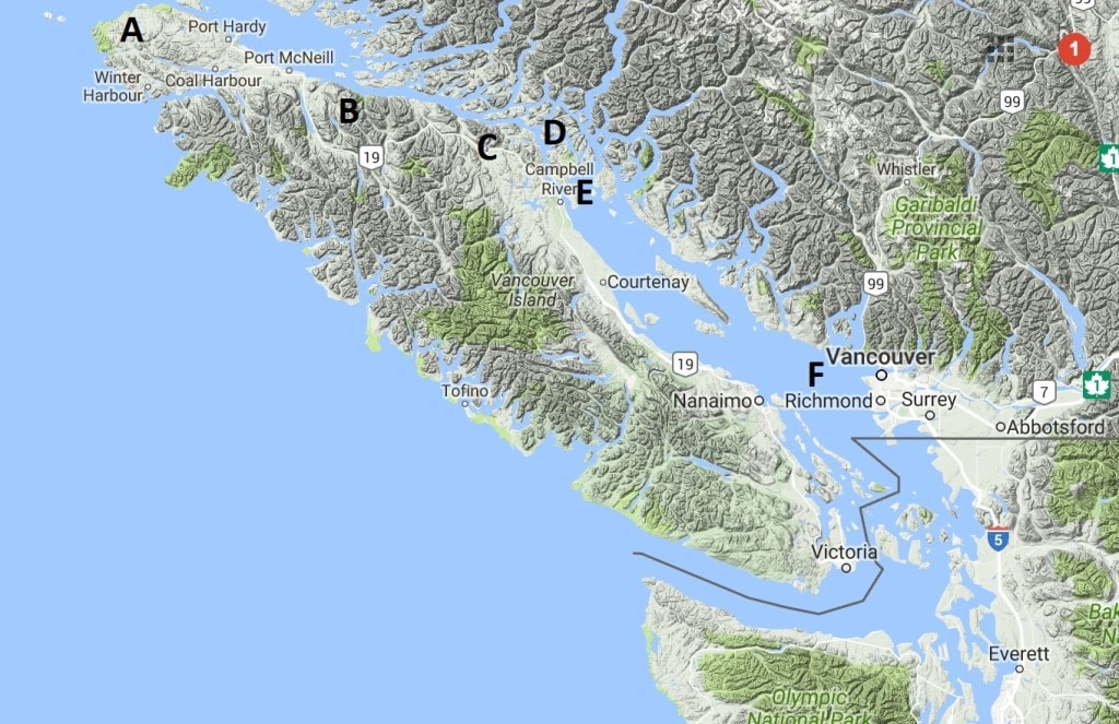
Because of the extra distances in the Inside Passage the average speed to maintain from Seattle to Ketchikan can be up to 19 knots, especially if slack tide at Seymour is not in sync with the average passage time of the ship. From Vancouver is it easy, whether the tide is early or late you can easily adjust. From Seattle you have a lot of extra distance to cover before you even get to where the Vancouver ships start their journey. Plus you lose time at Port Angeles to disembark the Puget Sound pilot, then you lose time as you have to cross the traffic lanes near Victoria with slow speed and then hopefully the B.C pilots are waiting at Victoria and the pilot boat does not have to service another ship first. Also the point of seeing more of the Inside Passage is rather moot as with the Narrows tide and the average speed needed, the ship sails through the whole interesting part of the voyage in the dark.

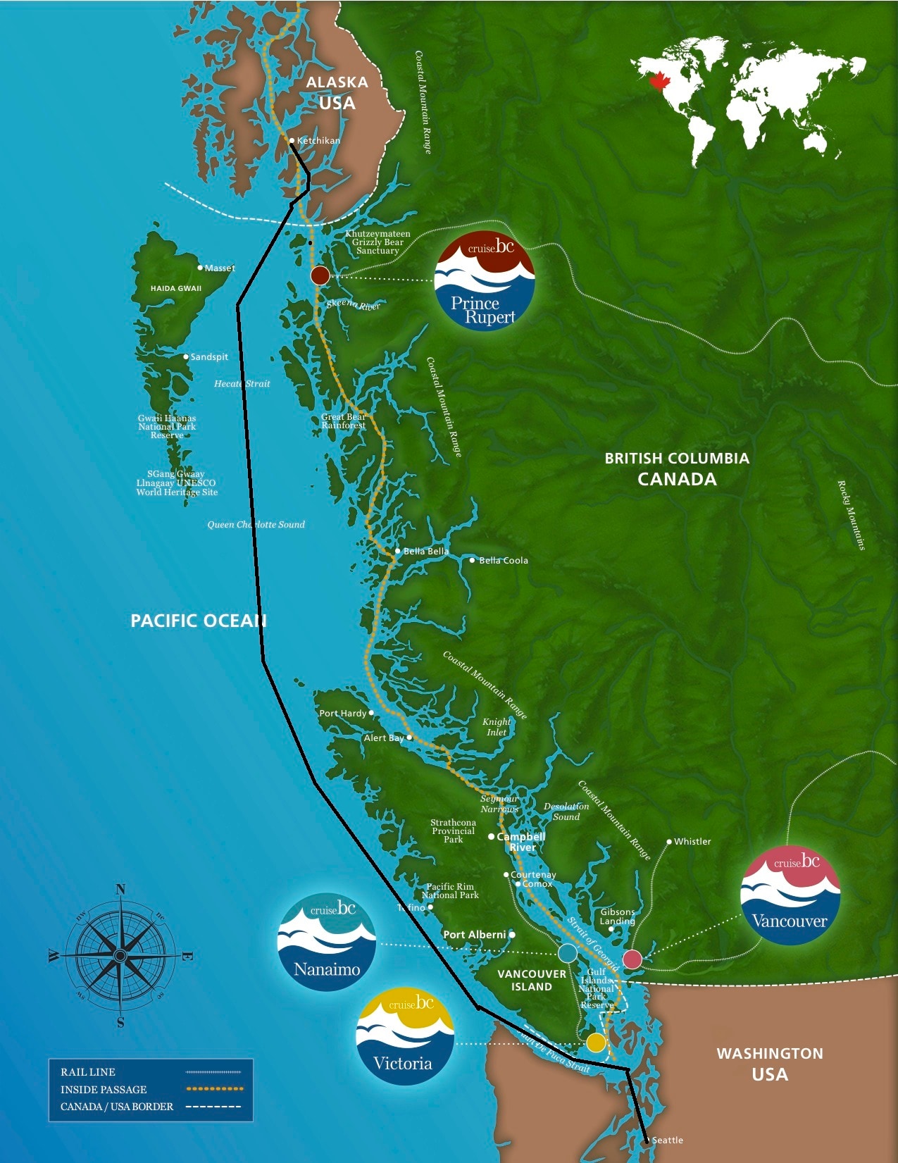
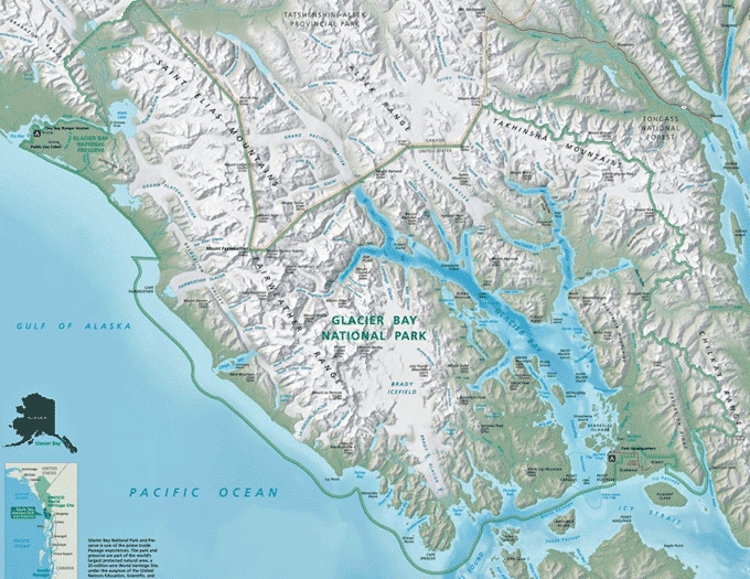
Our route. Chart is courtesy of BC ferries, thank you, as it was the only one I could find which covered the whole area.

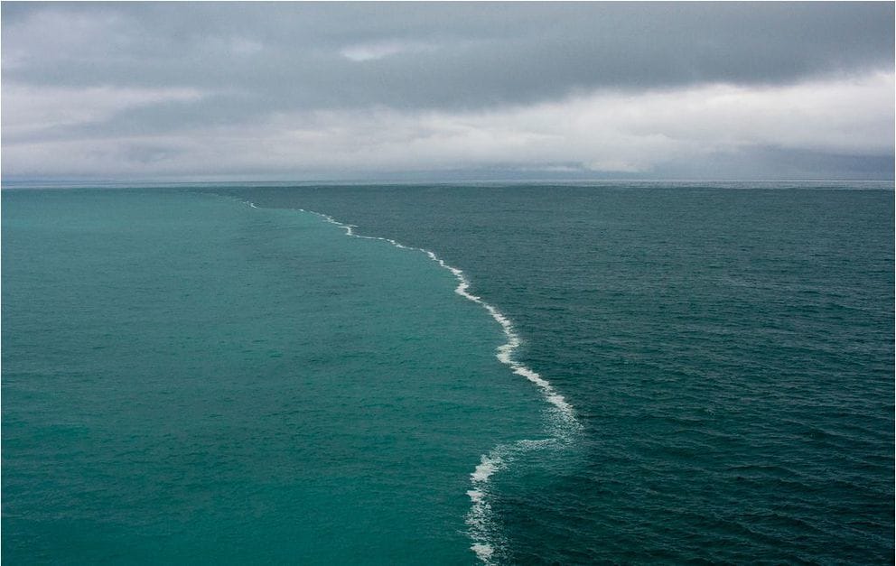
Thus for this cruise the captain decided to go outside around Vancouver Island as the weather was good and it gave a less hectic transit from Seattle to Ketchikan. So we left at 16.00 hrs.  Around 20.00 hrs. we disembarked the Pudget Sound pilot and around midnight we were in the open ocean. As the sun was shining yesterday, the guests had some nice scenery to look at (and some nice real estate on the shores of the Pudget Sound) which is not always the case as it can rain quite a bit here. During the night the Officers on the bridge had to pay for the nice weather as near the exit of Strait Juan de Fuca a thick wide blanket descended upon the ship.

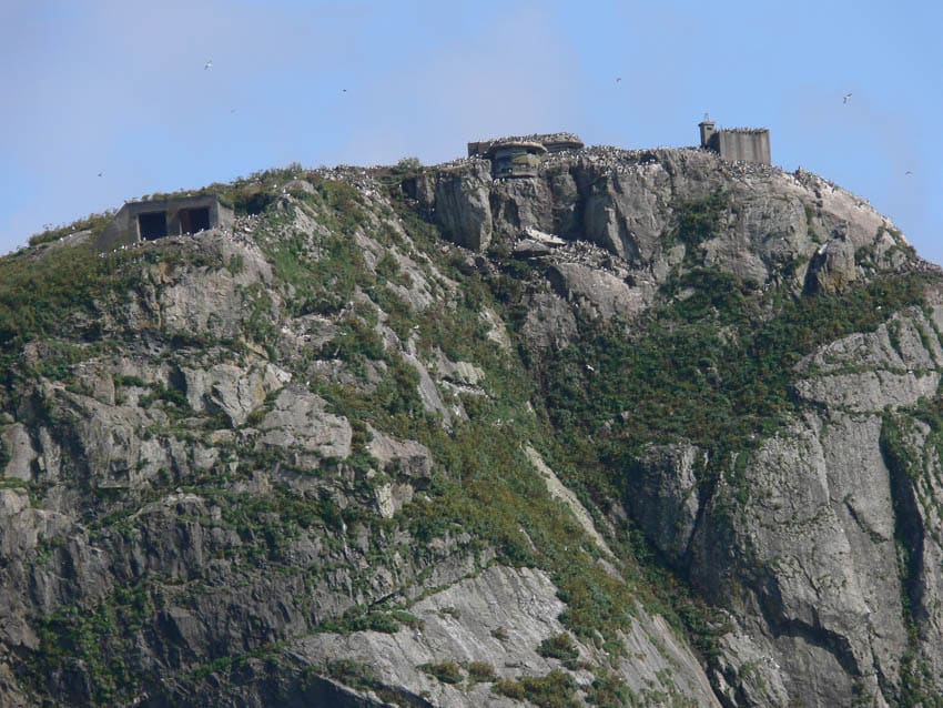
Then we sailed northwest, keeping the coast of Vancouver Island on our Starboard side and then bent inwards into Queen Charlotte Sound once north of Cape Scott the North West point of Vancouver Island. Technically Queen Charlotte Sound is considered Inside Waters but due to the width of the Sound, pilotage is not compulsory in the middle part. And thus the ship could continue its voyage without stopping for a B.C pilot and will enter Alaskan waters tomorrow morning around 04.00 hrs.

Although we are allowed to sail the whole distance without local pilots as the ship stays in open waters according to the definition, we are still monitored by the local authorities. The whole of the Pudget Sound is under observation by “Seattle Traffic” and we are required to call in at certain points. Then when we cross over to the Canadian Side we switch to Victoria Traffic, who then monitors our progress (and good behavior) while sailing to the open ocean via Strait Juan de Fuca. Once almost there, we are handed over to Tofino traffic which monitors all the ships that approach or leave Strait Juan de Fuca.

These monitoring stations were introduced in the 1960’s when traffic became denser and denser and when there was also an increase in ships who were “very creative” in the way they sailed all over the place. Traffic Separation Schemes were introduced and in the area around Victoria there are several real “round-about” areas where the ships have to sometimes make a ¾ turn to go from East to North etc.

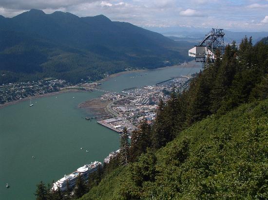
We will be at the Ketchikan pilot station tomorrow morning at 06.00 hrs. and then expect to dock at 08.00 hrs. in Ketchikan. I hope the guests will take advantage of the nice, if chilly, weather as it is supposed to be sunny all day. We did not have much of a nice summer this year, so every good day near the end of the season can help to make up for it.


11 September 2017; Seattle USA.

Today real life came back with a vengeance as I joined the good ship ms Amsterdam in Seattle. It was for a change it was not raining in Seattle, a very nice Indian summer day, and even the taxi drivers were in a good mood. I will be on this ship for the next three weeks and after that is still a bit of a question mark as there is a school class in the planning and then I have to go to whichever ship has cabin space. The ms Amsterdam today started her last Alaska cruise of the season going up to Anchorage and coming down again on a 14 day round trip. Then we go into a wet dock for a few days before the ship starts the autumn South Pacific Cruise.  I will be staying on during this wet dock as it gives me the chance to get a lot of required training out of the way with the new crew joining and before the long Pacific cruise starts.  Normally I do not get much of a chance to share what is going on in a wet dock (which is a dry dock without going out of the water) but there is always a lot of interesting things going on and now I can.

The ms Amsterdam is making a 14 day cruise from Seattle up to Alaska. The schedule calls for visiting: Ketchikan followed by scenic cruising Tracy Arm (ice depending), Juneau, Icy Point (just outside Glacier Bay), Anchorage, Homer, Kodiak, Hubbard Glacier, Sitka, Victoria and then back to Seattle.  As you can see there is no Glacier Bay on this cruise but we go to Hubbard Glacier on the way back.  I am still debating with myself what the better call is, and we will see what that is when we get there.

In command of the ship is Captain Jonathan Mercer who transferred to the ms Amsterdam a number of years ago and is since the Captain who makes the annual world cruise. Which means that with the three on/ three off schedules, it means a number of a number of Alaska cruises as well. His alternating colleague is Captain Fred Everson who will join during the wet dock period and will stay on until the World cruise.

For me this is a scheduled visit to the ship on my regular schedule of what is called the OBTSO. On-board Team Support Officer Visit. If you have read my exploits in the past you will have noticed that it is never the same and this time I will work around the needs of the ship to prepare for wet dock and more importantly to get the ship ready after wet dock. I always compare a wet or dry dock with heart surgery. It is needed, the benefits are great but it takes two months after the surgery to get back to normal again. With a ship we do not have that luxury; we have to perform 110% again the day the wet dock ends and the guests step on board again. So planning and execution is of the utmost importance, taking into consideration that Murphy is a “valued” employee of any dry/wet dock sequence.

Holland America operates three ships from Seattle, The Eurodam on Saturday, the Oosterdam on Sunday and the Amsterdam on Monday departures. Eurodam and Oosterdam are on the 7 day round trip and the Amsterdam does a 14 day round trip. Making it up to Anchorage is hard to do on a 7 day schedule, you need at least 10 days for it, and if doing so you might as well make it 14 days and throw in a few more unusual ports such as Homer and Kodiak. Those ports are totally different again as the ports in S.E Alaska and a large number of guests on board choose this cruise after they have done the 7 day run, either from Seattle or from Vancouver.


So by 16.00 hrs. we sailed away from Smith Cove under sunny skies with temperatures just low enough to not create any bad visibility. The run through Pudget Sound and then to open sea via Strait Juan de Fuca is quite scenic and we might as well enjoy the beauty of it. Tomorrow we will be in the open ocean going around Vancouver Island and the weather looks good. A bit windy and there will be some motion of the North Pacific Ocean but then it is almost the end of the summer season here.

22 July 2017; Inside Passage, British Columbia, Canada.

Tonight the slack tide at Seymour Narrows will be around midnight and thus the whole schedule between Ketchikan and Vancouver has been set up accordingly. For that schedule midnight is not a bad time. It means that you are back in the open waters by 00.45 hrs. Open waters is in this case a relative word as The Strait of Georgia is just a wider space between Vancouver Island and the Canadian Mainland. But relatively spoken it is an open space compared to the really confined waters of Discovery Passage where the Seymour Narrows are located.

The passage time also makes the Chief Engineer happy as it is about as perfect as you can have for an average speed voyage. We can do the whole voyage from Ketchikan to Vancouver with an average speed of about 16 knots.  Steady speeds are good for fuel consumption and speed of 15 knots is easily maintained with two engines and when going through the narrows bit with three engines. You do not need that 3rd engine for power but it goes on line in case one of the other engines would suddenly get the hiccups. Transiting Seymour Narrows does not leave any margin for error and a failing engine while in the Passage would result in a new Holland America Line Hotel being established right on the shore side. No doubt offering a great view but not in line with company policy.

A: Pine Island Pilot Station. B: Blackney Passage. C: Race Passage. D: Seymour Narrows. E-F Strait of Georgia. F Lions Gate Bridge.

So we sailed down with an average speed of 16 knots to Pine Island where we embarked the Canadian Pilots and then had to maintain an average speed of 15 knots to get to the Narrows. The ship was still sailing with a speed of 16 knots but it normally slows down to 12 knots when making the turn at Blackney Passage (90o) and at Chatham Point (another 90o). In between there might be all sorts of traffic in the way and therefore we sail a bit faster than the average speed that is to be maintained. The big question always is, can we go through the Narrows at our preferred time? as everybody wants to go through at the same time.  In that situation we are sometimes lucky and sometimes not. It can easily make a difference of 30 to 45 minutes. A bit earlier nobody minds very much but 30 minutes the other way also means that the captain will be in bed so much later.

If this was followed by a sea day then that would be not be so bad but at 05.30 the phone rings again for standby for arrival as the ship goes under the Lions Gate Bridge between 06.15 and 06.30 for a 07.00 hrs. docking. Then there is a full day in Vancouver and the same evening it goes the other way again. One lucky thing is that Vancouver is a Sunday visit and that at least reduces the number of visitors coming to the ship. Some of them consider themselves “very important” and have little understanding for the fact that the captain might prefer to be in bed, than be entertaining or involved in meetings. I will find out tomorrow morning how the Captain fared this time with keeping to the time table.

This is my last blog for a while. I will be going home tomorrow for a 2 month vacation and will be back on the fleet by the end of September. Which ship is still a little bit up in the air, as two months is a long time in the dynamic life I am currently leading. But I will put my new schedule up as soon as I can.

To all my readers, thank you for keeping up with my daily ramblings, I hope you found it diverting at times. I also hope to work on the history side of the blog but I am still waiting for the company to trace some lost files which went missing earlier in the year with the server change. So I will be back again, most likely to Alaska to help with closing off the season. Keeping my fingers crossed for a nice Indian Summer.

21 July 2017; Ketchikan, Alaska.

All in all, it was not a bad day in Ketchikan. Mist and drizzle hung around the town but it looked like that most of it congregated at the Airport across the Tongass Narrows from downtown. Still I have not needed my sunglasses this season while being here in Alaska for the last six weeks. While on the subject of the Juneau outhouse of yesterday’s blog there is another anecdote about Juneau which has more truth to it. By the way the official name of the outhouse is the Treadwell Mine Salt Water Pump House, so obviously it was not all just about ventilation. This also happened in the 1980’s and it clearly indicates that Alaska is/was still a frontier state sometimes with highly independent thinking people. This is the story about the village of Lucky Me.

The Community of Lucky Me as it is called nowadays. (Photo courtesy: thoresons3ocean)

Somewhere in the 80’s a gentleman living in the town of Douglas fell out with the local council. Douglas is the town connected to Juneau via the bridge at the end of the cruise ship docking area. As the dispute could not be resolved, he was told he would start his own town and council and so he packed up his bags and moved down to the end of the island close to the entrance of Gastineau Channel. He built a log cabin (or something similar) and settled down and thus basically starting up his own town. In front of the house a big illuminated sign was erected with the name: LUCKY ME. Through the years more houses and buildings popped up and a sort of small community grew in an area hard to reach but still close enough to civilization if needed. Last year the sign was still there but due to growing trees it was very hard to see. This year I have not had the chance yet to look for it. What is the morale of this story: in Alaska it was, and maybe still, possible to setup your own town if you do not like what is going on. Try that in the rest of the world. For those more interested, if you do a google with” Lucky Me Juneau” then all sorts of interesting things will show up.

We had a full house again today with all docks filled and the Oosterdam leaving at 13.00 hrs. hot bunking with the Celebrity Infinity arriving at 14.00 hrs. If you think about something this simple for a little bit and take the logistics into account, then it becomes clear it is not that simple at all. Two different – competing – companies have to come up with a schedule that they can occupy the dock at different times to give its guests the best possible service. The Alaska agent who makes the docking schedules has to deal with these companies about 2 years in advance to get it all worked out so that the cruise companies can put it in their cruise brochures. This means that all the berthing arrangements are made about two years in advance. If now a company suddenly has a marketing brainwave and decides to send a bigger ship, then there is a fair chance that troubles arise. There are more and more large cruise ships coming into operation and some of those biggies could also see employ in Alaska.

Downtown Ketchikan, with cruise ships in port. somewhere from the internet.

Nothing wrong with that, if there are guests who are happy to sail Alaska that way then kudos to them; but that ship has to dock. As an example Ketchikan has 4 docks. Dock 3 and 4 can take ships up to about 120.000 tons and dock 1A/B – 2 which is the combined dock, also known as the Tongass dock, normally takes two ships alongside. Now move in a ship over the 120,000 tons and it has to go to dock 1 -2 taking up the space of two ships. But because it is not as long as two ships together, there will be some dock space left empty. Literally a waste of space. Finding then a little cruise ship which can still park behind this behemoth might not be so easy to find. Small cruise ships normally come in a few calls during the summer but not every week and also not always at the same time and same day of the week.  Ketchikan might need a few more docks if bigger ships are coming and so does Juneau………………. But where to go???

After Ketchikan the ms Zaandam heads south back to Vancouver, where we will at 07.00 on Sunday morning. A very important arrival as Yours Truly will be signing off to go home to England for a vacation. Luckily it seems to rain there at the moment so I will not have much of a culture shock. That is if I make it there. My airline has just informed me that they have cancelled my flight from Vancouver to Amsterdam and are in the process to find me another flight which goes the same way.

20 July 2017; Juneau, Alaska.

Either the weather gods were in a good mood or the forecast guru’s had excelled themselves but the weather was in accordance with the forecast. Even the wind did exactly as was announced. Gentle in the morning, breezing up between 1 and 3 pm. and then dying down again. Everybody happy and no worries for the shore excursion department. Even the whale tours were in bonus, as they offer this thing of money back if no whale is seen.  Mother Nature helped today as a whale swam conveniently into Gastineau Channel and then into Juneau Harbor. The exercising Lifeboats of the Princess ship docked ahead of us had quite a hard time staying clear of the whale, as it was quite interested in the boats. I do not know if whales can see color but if so, then I would have been curious as well as you do not see everyday orange things pottering around in your private bathtub.  I was in the water as well with my sailor class and I kept my orange thing far away from our inquisitive whale as it always results in paper work if you do otherwise. The sailors were mostly interested in the fact if you could eat whale. When I explained that it is supposed to taste like cod oil they lost their interest and continued to focus on how to dock with one engine if the other one was broken.

Although Juneau is the Capital of Alaska and thus home to a lot of civil servants and politicians it was always more or less the same size until the cruise ship boom started. And although a lot of people say that the cruise ships do not add much to the local economy I beg to disagree because since 1982 I have seen the city expanding with lots of large nice houses going up. That money has to come from somewhere and politics has not expanded, fishing has gone down and the Gold mine closed again after a brief reopening. Thus tourism must help and today we continued to do so with another full house with 4 ships sending over 10000 guests ashore, who were no doubt spending money all over the place. The cruise industry side estimates that each guest spends at least 125 dollars while ashore and that times 10000 is an amount that should make some people very happy.

And I think that some of those people have built new houses along Gastineau Channel, the entrance fjord which leads up to Juneau harbor. It is the only way in and out as just past the cruise ship docks they have built a bridge to connect the town of Douglas with Juneau and not far past it, the fjord becomes by shallow.

The port of Juneau with the connecting bridge to Douglas on the other side. (sourced from unknown location on the internet)

Getting and out is not that difficult as it is a straight channel, with only one bend and that bend is before we enter the port itself. It is not a natural bend; it is caused by all the rubble from the gold mine they dumped into the channel. In principle a good idea as it provides a natural breakwater for the port and on it they built docks and related. Everything that does not come to Juneau by airplane comes by barge and this is where the containers are loaded and off loaded. Just that the ships are much larger than when they built the rock dump as it is called.

The “outhouse” of Juneau Castle. Ventilation shaft remaining from the Goldmine days in Juneau. (sourced from unknown location on the internet)

That Gold mine gave rise to a nice story. Although the entrance is high above Juneau itself and now almost overgrown, the labyrinth of mine corridors goes all the way under the Gastineau Channel to the other side. When you come in you suddenly see a strange concrete little house sticking out. It looks a bit like an out house with the real house missing. In the 80’s we used to tell everybody that it was the last remainder of Lord Juneau’s Castle which was swept away during a heavy winter storm and indeed his outhouse was the last part left standing. 99% took it for gospel and were happy after taking a photo. The real purpose was that it was and is the top of a ventilation shaft from the mine all the way below. I only came once across one person who said: I did not know that they built castles from re-enforced concrete in the middle ages? That person was partly right and also completely wrong as Juneau only sprang to life in 1880 when gold was found.  Joe Juneau was only the first prospector here and was not much of a real Lord, being a French Canadian laborer who had come west to get rich.

Tomorrow we are in Ketchikan for a late morning arrival. The weather is supposed to change to what the town is famous for: rain and showers. But also the temperature is supposed to hit 16o C. or 61oF. and that is positively balmy for the locals.

19 July 2017 Haines, Alaska.

ms Zaandam docked at Haines during a sunny summers day. (Courtesy, unknown Zaandam deck officer)

Today we were back in Haines, named quaint by a lot of the guests on board. I reserve judgement but if it helps to attract tourists and the locals are happy with it, then quaint it is. But as explained 14 days ago, it looks different compared to other Alaskan towns as the houses we see here were constructed by the army. The army builds standard stuff and obviously they do not have an “Alaska standard” in their house design options.

Haines has been upgrading their dock through the years and can now accommodate a Vista Class ship and still has some space left so the ship can set regular mooring lines. If a ship of any longer length would dock, all the lines would be spring lines and there would be no head or stern lines as the ship would be overhanging the dock. Some companies have therefore tried/pushed for a second dock. But a longer dock would mean a longer walk to the town and it seems that Haines is not in a hurry. According to the security man on the pier, one ship is enough. He said, he was already making more dollars than he could spend. I wonder how much money he is making then. On the other hand I suppose in Alaska you might spend less as there is less to spend on, unless you shop via the internet.

Docking at Haines. If you put the brakes on on time, all will be well.

Docking in Haines consists of going around the corner when coming south from Icy Strait via the Lynn Canal and then putting the brakes on on time so you do not end up with the nose in the mud. Slowing down the ship in such a way that it stops exactly at the planned point is the hardest part of the whole operation.  Therefore it is one of the great ports for the Junior Officers to learn to maneuver the ship. The captain can always correct the speed of the ship, either slowing down or by speeding up, without anything drastic happening.

Normally the pilot initiates the turn, which is almost a 90o from a northerly to a westerly course and while doing so, the ship slows down. For the last 3/10th of a mile we want to be down to 6 knots or less so you can continue to keep reducing gradually.  The pilot has to make the turn as it is still considered navigation. Once there is nothing anymore to navigate it comes all down to pure maneuvering, then the pilot is allowed to hand over to the Captain.   It works the same in Glacier Bay. The pilot brings the ship to the Glacier and once the ship is in position and stopped, the captain can then do his sightseeing bit. That mostly consists  of the Balcony maneuver. A full swing ensuring that each side gets the same amount of time facing the glacier.

In Haines the pilot does the same, when the ship is nearly there, there is nothing to navigate anymore so he/she can step back. We do not have to do the balcony maneuver here as we always dock portside alongside, with the nose to the west. Or better said with the nose towards the shallow area near the shore. You can dock with the propellers to the west, by going starboard side alongside but it brings those propellers very close to the shallows. Nobody likes that, so portside it is. Starboard side would be handier operationally. The R class has an extra gangway door on A deck on the starboard side. Not on the portside. One of those arguments between the practical people and the bean keepers. An extra exit versus the extra revenue of one more cabin; so a compromise was made. So in ports with a large tidal range we try to dock sb. As you have then the option for a gangway on B deck, A Deck, Main Deck and the Lower promenade deck. Here we have large tides as well and we constantly have to move gangways between the various decks to ensure that the gangways are not too steep for the guests.

Today we had nearly perfect Alaska weather, at least as far as we cruise people are concerned. The security man on the dock thought it was much too warm. It was overcast with a tinge of sun coming through, a moderate breeze from the East but the mountains shielded the town from much of this wind. Temperatures wer just around 60oF or 15oC.

Tomorrow we are expected to have a similar day but with less wind and thus the temperatures are expected to rise to a balmy 19oC / 67oF. I have seen it warmer in Juneau, but I am happily signing off on it as long as there is no rain.


18 July 2017; Glacier Bay. Alaska.

It was a regular Glacier Bay day. Due to the climate / weather differences in the lower and upper bay, we had almost all variations of weather, except snow and sun shine. Not so good for the –picture perfect cruise image- but very good for the actual experience. Glacier Bay is not the Caribbean and today the guests saw the area as it was meant to be and what it looks like after all the cruise ships have gone when the season has ended.

To help us tell the story of Glacier Bay we embark the Rangers at Bartlett Cove where the Ranger Station is located. Once it was just the organizational office needed for administering Glacier Bay National Park, and when a cruise ship showed up a Ranger would hop on board and tell something about the area. It gave them an extra chance of travelling up the bay and to get a decent dinner. Bartlett Cove has an airport but the National Park budget in those days was not as such that a life of luxury could be lived there and all that was needed easily flown in.

This was still the case in the early 80’s when I came for the first time to Glacier Bay on the good old Statendam. The Rangers, mainly Ladies, came on board and apart from doing their Cultural thing did not mind at all to combine it with a visit to the Hair dressers. Back packs came on board full of books for sale, backpacks left the ship full of other things “collected” at the Lido Buffet or given to them by a friendly crewmember.  One Ranger told me, that Holland America was always much appreciated as it meant a Cheese and Wine party after they all arrived back at the Ranger Station. She was less complimentary about P & O; she probably did not like the British Food or something like it.

Then the cruise ship boom started and more and bigger ships came to Glacier Bay. To service all the ships, more Rangers were needed and led by Holland America financial support came to the National Park. That support varied from direct – fee- payments to donating and maintaining a complete oil spill barge and related, just for the case of. The Ranger station put their educational approach on a more professional footing (all Rangers now use the same script while on board) and the program was extended by bringing an Indian Representative with the team. This person tells about the history of the Indian tribe in the area who for centuries lived (and still lives) right outside Glacier Bay. They really never lived inside the Bay because before 1780 you could not even get into the Bay as the ice reached all the way down to Icy Strait.

Glacier Bay National Park. It extends over a very large area. Well into the Pacific Ocean and encircles the complete Brady Ice field.

With the Glaciers retreating you could sail the full lower bay after 1860 and since 1907 you could get all the way up to the Glaciers we visit today. Lamplugh, John Hopkins (in September only), Marjorie and Grand Pacific Glacier. People did live inside the Bay, well into the 1950’s there were a few homesteads scattered throughout the area. I remember there was one close to Reid Glacier at the entrance to the upper bay.

Glacier Bay Park Ranger Station. Guests with the bigger cruise ships will never see this. I have only been here once in my 37 years at sea. And that was because I had to arrange for a Medical Evacuation from one of the ships. A Medivac airplane flew in, the patient was transferred and a life was saved.

The Ranger experience which is now offered on the ships was drawn up in close cooperation with the Cruise ship company’s. From their side the whole cruise program for the day centers around the Glacier Bay experience and from the Ranger side the program is setup in such a way that it fits in seamlessly with the route the ships follow and what the company likes to get out of it as well. One example is that I saw from nearby was to develop the Youth part of the program. We have on board, Club HAL for toddlers and teens, and during the day they participate in a small Ranger / Glacier Bay program.  One crew member normally the Travel Guide, is the program coordinator who acts as a liaison between the ship and the Rangers.  Altogether it makes for a very successful day and brings a lot of people much closer to nature. Sometimes people who did not even realize that such a beautiful National Park exists.

The Zaandam said goodbye to the Rangers around 19.00 hrs. and the continued its voyage to Skagway where we are to arrive at 06.00 hrs. in the morning. Early but then the first tour leaves at 06.30. Who said that being a tourist in Alaska is an easy job ??

17 January 2017; Gulf of Alaska.

The route we take today is exactly the opposite from the day before yesterday as we came from Glacier Bay, now after Seward we are going back to Glacier Bay. We are running at the sedate speed of 12 knots which will brings us to the Ranger Station at Bartlett Cove at the entrance of Glacier Bay at 07.30 hrs. tomorrow morning.

Guests sometimes complain that they do not see anything during this sea day in the Gulf but that is not correct. Yes we do not always see land; you need a very clear day to see the Fairweather Mountain Range which lies along the East Side of the Gulf. And we did indeed not see it, it was too gloomy with showers in the distance and fog patches close to land. But the wildlife can easily make up for that. You just have to be out there, be a little bit patient, and watch the sea and the sky.

And there was a lot to be seen. Apart from the regular whale sightings, we had a low flying Albatross (at least it looked like one), porpoises (maybe small dolphins) and at least 10 different species of birds. We sail no more than 12 miles from the shore line and many birds who are not deep sea birds still venture out that distance. It must be regular practice for them as we seldom have hitch-hikers on board. This is what we call birds that were blown off course or ventured too far out to sea and then land on the deck. They stay for a few hours to rest and then attempt to go back where they came from.

Middleton Island, right on our steamer track. It has a light stand to warn ships it is there and to avoid them running aground during nasty weather. Which did happen in the past.

The route, although close to the coast, is mainly in deep water 5000 to 6000 feet is the norm, except at two locations. When we pass St. Elias on the south point of Kayak Island, then we can catch the underwater out run from that island. And before we approach Resurrection Bay, in the middle of the sea, as a sort of Traffic cone, we have Middleton Island. Why do I call it a traffic one, because ships use it as a natural separation point of the routes. It is sort off the beaten track but there is still a considerable amount of traffic around. Barges to and from Seward, barges and oil tankers to and from Valdez, small boat traffic from Prince William Sound area , fishing boats all over the place and then of course us the cruise ships. For some reason we always seem to get all that traffic when we are near Middleton Island and then “the cone” helps… The Cruise ships normally stay to the south but the Fishing boats normally stay to the North.

In the old days, these landmarks along the route where very important. If there was no land you had to rely on seeing the stars and the sun (a nice challenge in Alaska) and if you saw land you needed something to help you avoid running onto that land (read rocks). So there were and still are lights houses. Nowadays automated but still in use. There is a light on Caines Head, there is a light on Middleton Island, and there is a big light house on Cape. St Elias and there is a big light house at Cape Spencer, there where we re-enter the Inside Passage. Most importantly they are also equipped with a horn or other sound signal so it can be heard when not seen, during the frequent hazy days in this area.

Cape Spencer Lighthouse. Its horn is really famous for the amount of noise it makes. (Photo Courtesy: www.Lighthousefriends.com)

And that sound is considerable. It can be easily heard 4 to 5 miles away and that means that it must make quite a racket when you are close to it. The sound is directional = projected forward into the direction of the ships that need to hear it. In principle if you stand behind the horn, it is not so loud. Good thing as well as it would have been even harder otherwise to keep lighthouse keepers in employment. Those men (and often family’s as well) lived quite a lonely life and there are many stories about suicide or completely disappearing. If they would have had to cope with 24 hrs. of Fog horn, the numbers would have been even greater no doubt.

We will round Cape Spencer in the early morning and then enter Glacier Bay at 08.00 hrs. Weather forecast is very un-settled with many a patch of fog in the lower bay. The upper bay should be nice and clear but there will be no sun, so it is going to be very chilly.

16 July 2017; Seward Alaska.

Seward is a sheltered port. Completely sheltered from three sides. So whatever blows out side, will not blow with the same ferocity inside. It has two openings to the south. The one we now use to enter at Caines Head, the South West entrance to Resurrection Bay and Hive Passage which one enters and leaves on an East / West heading. Those passages can let in some unbroken wind and waves but it is not that much and it does not affect the whole bay in such a way that it becomes dangerous to be there. As a result the Alaska Railroad Company from the old days felt very secure in building a terminal here which connected to the ferries, cargo ships and barges coming in from the lower 48.

Noaa Chart 16826. In red the alternative route when sailing to Hubbard glacier and College Fjord.

We now always use the main entrance/exit from Resurrection Bay in the South West corner. Our arrival time is stipulated by the time the shore side starts working and a little time before the Guests are going off. Contrary to disembarkation ports all over the world we are not hampered here by off-loading luggage first as the guests have to collect their luggage in the terminal before seeing immigration. There is no immigration; that is being done in Vancouver, where inside the Canada Place Terminal there is a little piece of the USA hidden behind Canadian Customs.  This routine is possible because for the rest of the time we will only be calling at USA ports.  The CBP protection is also quite happy with the luggage coming on board as it either comes directly from the USA or was cleared by Canadian Customs sometime before.

So we sail completely approved by the American Authorities all the way up to Alaska. Once we get there, there is no CPB to be seen (officially…..) and we can just off load. Because the Guests do not have to go through Customs and because they travel on our trains, voyage with our coaches and stay in our Hotels, we can deliver their luggage to its final destination. Whether that is to the airport or whether that is at their first Hotel stay for the night. And that makes it possible to see the Guest disappearing in the train and the suitcase an hour later into a truck.

For those coming from the Anchorage Airport or from the interior the same thing happens. They arrive by Holland America coaches and their luggage arrives sometime before them and sometimes after them but it ends up in the cabins without the guest having to bother about it. Then after we sail, we do not see any Customs either, as we stay in American Waters until we make it back to Vancouver and Canadian Customs is waiting.

Barwell Island. The soldiers here were mainly busy with information gathering and look-out duties. (Photo Courtesy: unknown source on the internet)

When we sail, we nowadays go out the same way as we come in via the Caines Head entrance. In the good old days of the 1990’s when I was there with the ss Rotterdam V it was more or less standard that we took the Hive passage. Called so because the island marking the entrance resembles a sort of (bee) hive. (Especially after a few beers). It was narrower but straight and it was interesting because the next island, Barwell Island, had gun emplacements on the South side / Ocean side from the 2nd world war. The USA had a sort of own “Atlantic Wall” erected over here against an invasion from Japan. The Japanese did invade Alaska but not here. But the whole area was strongly fortified as Seward was such a sheltered port of entry. Every time I sailed by it, I had to think about the poor soldiers sitting there in the Alaskan winter with the howling storms of the Gulf of Alaska around them and just waiting and waiting and waiting.  In the summer time the whales must have created some distraction but in the winter it must have been quite horrible. From the outside it did not look as if Uncle Sam had spent a lot of money on making the setup really comfortable.

We could go through here as our next stop was College Fjord and we had our South West Pilots on board. Now we do not do that anymore, see blog from yesterday, and thus the pilot gets off well inside, also because we do not have a real pilot boat in Seward. We use the local tugboat, which also acts as a lines boat, for the cruise ships coming in.

Tomorrow we are retracing our route back on the same course track through the Gulf of Alaska. There should be a little bit more swell than yesterday as we had a good 15 knots of southerly winds blowing all afternoon. Still is should be a comfortable ride.

15 July 2017; Crossing the Gulf of Alaska.

As humans do something seldom in the simple way, they decided to give the northern top of the North Pacific Ocean a separate name. Called it the Gulf of Alaska. But really we are sailing in the Pacific Ocean and the weather generated here comes mainly from far away from the West or South Pacific.  Because of the high stretch of open water any bad weather can come over without any hindrance and often increases in “nastiness” while doing so due to relatively warm waters here.  There is a lot of cold water flowing out but it does not stand the competition with the warmer waters which come up the coast from the south. At some places where this glacier water comes out into the ocean, it almost looks like that the waters do not mix. I have seen that myself a few times and as the photo below shows, it looks quite impressive. The salty sea water has a hard time mixing with the sediment laden fresh water coming from the glaciers.

Meeting of the Waters, somewhere near the Prince William Sound. (Photo courtesy: Ken Butland, professor of ocean sciences at University of California-Santa Cruz)

Other places where I have seen this occurring is in Germany where the Rhine and Mosel rivers merge and on the Amazon River, just outside Manaus. Here the Solimoes River (the main tributary of the Amazon) meets the Rio Negro coming from Manaus. The Solimoes River is sweet and has a lot of sand sediment in it and the Rio Negro is an acid river which carries very little in sediment. When these come together the water has a hard time mixing but eventually does of course. If we come across it somewhere and it is in deep water we try to sail through it right on the boundary so guests can see a different water color on each side of the ship. The mixing effect of the propellers then blurs the border line for a while. But it is amazing how fast this borderline is re-established. In Alaska I have not seen it for a long time, not since Hal pulled out of Prince William Sound.

Meeting of the Waters. Just outside Manaus where the Solimoes River and the Rio Negro meet to go downstream as the Amazon. (Courtesy: unknown photographer, somewhere on the Internet)

We used to call there for a long number of years, stopping at Valdez and then sailing up College Fjord. We could only do that when we did not go to Glacier Bay but to Hubbard Glacier. I like Hubbard Glacier but it is very unpredictable. Sometimes it produced so much ice that we could not even get in the Bay and then had to disappoint our guests. Glacier Bay is a bit of a calmer experience and Marjorie Glacier normally obliges with a bit of calving and you get a full day and the Ranger Experience thrown in as well. Thus with us calling at Glacier Bay has the knock on effect that we have to spend our last day at sea. To me that makes sense as well; if you are on a cruise then part of the experience is to enjoy the ship itself.

The Gulf is normally a quiet sea from May to the end of September when the first winter storms start to come through. Then it becomes very un-pleasant here. For those of you who have watched The Deadliest Catch will get the idea. The fishing boats are of course a lot smaller than we are and sometimes they are out in the open when a normal person would have sought shelter. But still the Gulf can cause the ship to get in a roller coaster experience if the storm happens to be in synch with the cruise schedule. The last time it happened to one of our ships was in 2012 when the Statendam under the command of Captain Consen had to cancel Glacier Bay and race to Seward to be inside before the approaching storm would hit the coast. Not very nice to cancel the high light of the cruise but he had to keep the schedule as a full ship of guests were coming down from the interior with nowhere else to go. Frans went home in Seward and was relieved by Yours Truly and the first thing I did was to cancel departure. The swell outside Resurrection Bay was over 25 feet high and not really safe to meet head on. Luckily I could make up the lost time the next day and we could call at Glacier Bay as planned. The ones that relly enjoyed themselves were the crew who had two over nights in Seward. And although Seward is not known for its night life, the crew always finds a way to turn things to their advantage. Even if it only using the free Wi-Fi in the terminal.

Tomorrow we are in Seward and the ship should be docked just after 05.00 hrs. The first guests will be leaving just after 05.30 and then the first new guests will arrive early in the afternoon. The weather looks good and I need that because the sailors need to train with the Tenders. It looks that I will need my sun glasses.

« Older posts Newer posts »