This town is located on the north side of Iceland at the end of a 28 mile deep fjord. The latter can be a blessing or a curse. Fjords can the shelter the docks from the wind or they can enhance the wind or funnel wind, if the wind direction is in line with the fjord. We arrived in foggy weather and also found that the entrance was shrouded in this hazy stuff. I had planned for this situation to occur, so we had built up a bit of spare time in the schedule and that meant that we did not have to race into the fjord. At sea you can always make a round turn or another major course change, in a fjord that is a little bit difficult. Reducing speed is the only option and that means it helps if you are already going slow. By the time we were halfway into the fjord the shore lines came in sight, which meant we had visibility of about a mile. Three quarters down in the fjord, the fog lifted and we could see the hamlets lining the shore. This is the place where a lot of Reykjavikians come for their summer holiday and we saw several clusters of cottages dotting the hill sides. Today it did not look much like a vacation destination but normally the weather is quite pleasant here. Continue reading
Author: Captain Albert (page 187 of 238)
Today was our second day at sea while sailing from Spitsbergen to Iceland. After a foggy night we approached Jan Mayen Island around 06.30 and we just saw the Beerenberg coming out of the fog for a few seconds. That gave hope that we would be able to see something and I slowed the ship down to have maximum exposure time while sailing by. The island is about 20 miles long, at least that is the distance that we had to make to get around it. I mentioned yesterday that Jan Mayen is exactly on the line, and thus on the course line, between the exit of Isefjord in Spitsbergen and the approach to Akureyri. So we had to change course a little bit to the West to avoid running straight onto the beach. Continue reading
Leaving the top of the world behind; we set sail on a South Westerly course for Iceland where we will visit three ports and by doing so sail around half of the island. First on the list is Akureyri which is tucked away at the end of a fjord on the North side of the island and more or less in the middle of it. From Spitsbergen to this place is one straight course line except for the fact that the island of Jan Mayen is in the way. So when we approach that one, by tomorrow morning, we will have to change course temporarily in order not to hit it. This area is notorious for fog, caused by the proximity of various currents, all with a different average temperature and one moist weather system after the other coming over it. I had been warned and the warnings were true. Continue reading
After seeing what North Pole ice looked like yesterday we sailed south towards Spitsbergen again. The top of the mountains of the island were never out of view. The air was so cold and clear that we could see the mountain tops over 40 miles away. About half of the mountain ranges were still visible, their basis lying under the horizon of course due to the curvature of the Earth. As explained in my yesterday’s blog, the ice was closer this year than on average as the summer near Spitsbergen had thus far been very cold. Last year when the Prinsendam did the same cruise they had to travel, full speed, another four hours to reach the ice. Followed by an extra four hours to get back again on track. So an extra journey of 160 miles in the same time span available to me. So I decided to deviate into the Gronefjord which is a side arm of Isfjord at which end Lonyearbeyen is located. Continue reading
Today was the highlight of our cruise. Most places we visit on this cruise you can get to by airplane somehow or the other but for what we did today you need a ship. First on the agenda was scenic cruising in Magdalena Fjord. It is an inlet at the North West side of Spitsbergen. Because it is fairly narrow, the ship comes quite close to the glaciers. It is somewhat comparable to College fjord in Alaska, with the same number of glaciers but compressed into a fifth of the space. The fjord twists and turns around two shallow patches and that makes for tricky navigation. But that is the fun part. There are no pilots here to spoil the good fun; this was the sort of cruising I went to sea for. Continue reading
Today we travelled up North; to the Top of the World, as our cruise is called. This meant going full speed as it is a long way to Spitsbergen (or Svalbard as the Norwegians call it) as we also had some sightseeing to do while on the way. The day did not start very promising with high winds from the East and very low skies with fog banks all over the place. The first scenic stop, or better sail by, was Bear Island which is about half way up between the Nordkapp and the south point of Spitsbergen. The island roughly looks as an inverted triangle with some hills and mountains to the south and it flattens off towards the North. Flat: seen in relation to the average height of everything. Compared to the Spitsbergen you would call it flat, compared to Holland you would call it mountainous. With full sea speed it takes about an hour to sail by the island and we did so. Keeping the island on the West side, we could sail in its lee and thus keep the guests on deck fairly well out of the wind chill. Today it was not a cruise, it was an expedition. Continue reading
Apologies for the delay but at the top of the world there is no Internet connection. Capt
Albert, 28 July 2009.
The town of Honningsvag is located just at the east side of the Nordkapp in a sheltered bay. Basically we sail east, then south, then north into the harbour and then dock on an easterly heading. Full circle to get there. It is really located at the top of Norway. We started sailing along the top of Norway in the early morning and passed the Nordkapp at a distance around 07.30. After departure we had a good look at her from nearby. During the night the wind had started to freshen up from the East and that was less good news, as it blew the clouds away and that could mean a greater chance of fog. So I said a little prayer for overcast weather during the day. Continue reading
Hello readers,
Lesley here, Albert’s wife at home in England .
Just in case you were wondering what had happened to Alberts daily entry here is why you are not seeing it.
At the moment they are way above the arctic circle as you will all know and so they will have run out of satellite signal for a few days, the same thing happened to me on a small cruise ship I was working on a couple of years ago when we went so far north.
I expect them to be back in coverage in a day or two.
Norway as part of the Scandinavian Peninsula is a long and vertical country. You have to travel quite a ways to get from the lower point of the country, North of Denmark all the way to the top, South of Spitsbergen. From 58oN to 71oN that is roughly 780 nautical miles as the crow flies. As we are going all the way to the top and beyond there has to be some sea time in between ports to make it possible. We travel of course more than the 780 nautical miles to get to the top as the Norwegian coast is not straight and we have sail around rocks and islands and other protrusions. Today was thus a day at sea while we travelled from Kristiansund to Honningsvag which lies just around the corner (past it) from the North Cape. With a ship you try to sail as much as possible in a straight line and with Norway that works quite well, if you stay about 4 miles off the coast to start with. The coast, laying in a North Easterly direction, then recedes away from your course line and you only have to make the occasional course change to follow the general direction of the coast. Continue reading
As the bumpy seas were caused by a disappearing weather system near the top of Greenland, the waves became less and less during the night and by the time we arrived at the pilot station the ship was only going up and down with a very gentle movement. By coming midnight it should all be gone. It was a regular traffic jam at the pilot station, two supply vessels going in with inbetween another cruise ship, the Deutschland of Deilmann Cruises. This is a cruise ship that operates in the same market segment as the Prinsendam but as it is almost completely devoted to the German market it is not really competition as such. The ship is a little bit smaller than our Prinsendam with 23000 tons but comparable in what it does for cruises. What it was doing today however confused all of us including the pilot. It sailed inside, picked up the pilot and swung around and went outside to open waters again. As per our own pilot, the ship was destined for Molde but for that you can sail inside through the fjords and there no need to be in the open waters. Anyway the Deutschland raced out and we raced in. Continue reading
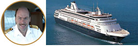
Captain Albert
© 2026 – Captain Albert's Website and Blog –
Theme by Anders Noren — Up ↑