- Captain Albert's Website and Blog -

Ocean Liner History and Stories from the Sea, Past and Present. With an In Depth focus on Holland America Line

Author: Captain Albert (page 47 of 236)

09 Feb. 2018; At Sea.

Today we had the first of one and half sea days to cover the distance between Half Moon Cay and Oranjestad in Aruba. Early this morning we sailed into the Windward Passage, the gap between the East point of Cuba and the West point of Hispaniola, or in the same way, between Cabo Maisi and Haiti. Then by noon time we cleared the Haitian coast and entered the Caribbean Sea.  There was a lot of cloudiness obscuring the sun this morning and that spoiled the sail by near Haiti a little bit. If the sun can casts its rays un-obstructed into the sea then in this area you can see the sea bottom very clearly.
The view of Haiti from the ship. this is near the south west point which is called Cape Tiburon.

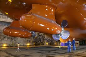
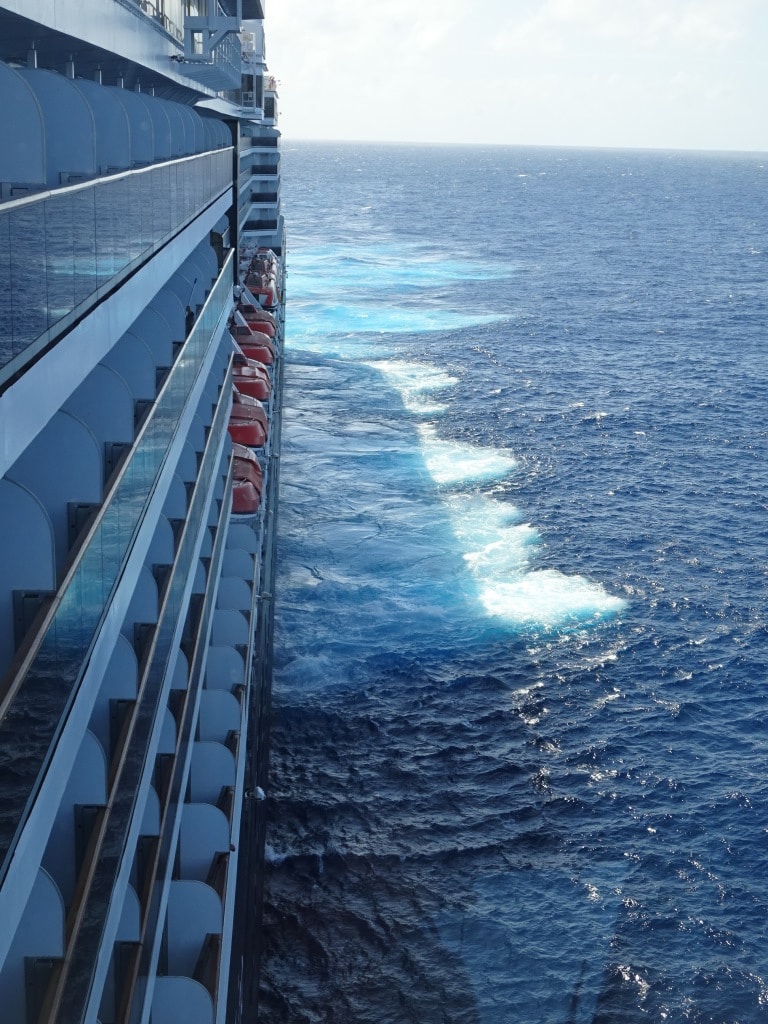
Sometimes to such an extent that it worries the guests who think that we are in very shallow waters. But we stay about 4 miles off the coast and the water is at least 60 to 100 feet deep under the keel on the route that we follow. But as the water is so clear and the bottom consists out of fine white sand, you can see the sandy sea bottom well over 60 feet down.  I always tell guests who are asking about stabilizers on a day like this, to look over the side near lifeboat 7 and 8 when we are in this area, and then they can see them in operation. Not very exciting as it just looks like a stubby air plane wing painted in a red color. By they do their job and that is what it is all about.

I mentioned that the weather in Carib has been very boisterous in the last few days and although it has quieted considerably, the seas are still a bit confused. For a while a North Westerly wind had been blowing around here and now the regular trade wind is returning and is blowing the other way. Which causes the waves to come from two directions and result in a short wave / choppy sea.

Our route into the Caribbean. The density of the arrows give the strength of the current. Problem is that it is never the same so you cannot rely on a diagram like this to get it completely right.

For this run, the captain really has to calculate the miles and the most advantageous courses to steer as we come across some opposite winds and currents. While sailing down from Half Moon Cay we have a small current against us, then before we enter the Windward Passage we get it on the beam and then when entering the Passage we can get up to 2 knots with us and sometimes a push from the wind as well.

Then while sailing off the Haitian coast there is nothing, but once we are clear we get the N.E current in the open Caribbean Sea generated by the Trade Winds. That current is in the beginning sort of with us and then later sort of against us as we are sailing on a South Easterly course. The art of navigating is to figure out roughly (Navigation is an art, not a pure science as we are dealing with the ever changing behavior of Mother Nature) what to expect in current velocity with us and against us and see if we can offset the one against each other. It is always satisfying to arrive at Aruba and to see that the ship had been able to maintain the average speed needed without having to change the engine configuration to catch up and to avoid being late.

So going from HMC until this evening we went faster than we needed on the average, but tonight we might go a little bit too slow, then late tomorrow morning we will pick up some current again and that altogether should bring us exactly on time at the Oranjestad Pilot station, by noon time. Sometimes Mother Nature is not predictable and then we have to adjust. Sometimes we go too fast (That is a bonus, as we save fuel) sometimes we go too slow and we have to give the ship an extra kick on the engines to compensate.

But with average weather and average sea conditions it quite often works out the way it is planned.

Tomorrow we have half a day at sea, and if the weather does what it is supposed to do (follow the weather forecast) then we should have a regular Caribbean Sea day. With the Trade wind blowing over the port bow and a regular low swell coming from the East. But whatever the weather, it will be warm. Even the rain if it falls.

08 Feb 2018; Half Moon Cay, Bahamas.

Half Moon Cay or Little San Salvador Island lays sheltered between other Bahamian Islands.

Today the ship and thus all of us, spent the day at Half Moon Cay. We had a glorious day with partly cloudy skies and a gentle breeze. Perfect weather for a day at the beach…….. as long as you remember sun block 35. By late afternoon it became apparent that not all our guests had remembered that, most likely due to the cool breeze which made if feel a lot less “hot” than it was.  They might remember Half Moon Cay for a few days to come.

It is tight run to get to Half Moon Cay on time from Fort Lauderdale, requiring a 19 knot average speed. It was even more tight than normal as we left later than scheduled as by departure time yesterday, we still had 26 unknown guests outstanding. Unknown means in this case, we did not know where they were as they were coming with their own transport so we could not keep track of them. We always wait if we can and we have the golden rule that if there are more than 10 outstanding, then we take the risk of maybe being a little bit late in the next port. So we sailed 40 minutes later and most of the “unknowns” had shown up by that time. And we just arrived on time at Half Moon Cay.

Holland America purchased a never ending lease for the larger part of Little San Salvador in 1996 and renamed it Half Moon Cay after the sailing ship of Henry Hudson (The Haelve Maen = Half Moon) which until recently was part of the company logo.  Through the years the company has developed the area along the curved beach on the west side, keeping the rest of the island as a nature reserve. That is why there are no activities at the inner lake; we leave that to the local birdies.

The port of Half Moon Cay, with the various boats that support the operations here.

So we arrived right just on time and dropped the hook in 10 meter deep water which left about 3 meters of clearance under the keel. More than enough water to float on. The water is so crystal clear here that we could see the anchor chain running all the way over the sea bottom. We had today about 1000 feet of chain in the water with the anchor itself hooked into the white sand bank in front of the port. Nice and safe and ship stayed where we parked it.

The main square is the first place you see when coming off the ship. It is surrounded by shops, The First Aid post and the Rum Runner Bar. The First Aid post seen here right across the square is manned by the ships medical officers.

We were the only ship in today and that meant we had the sole use of the shore tenders and that made transportation very easy. A few runs with the big tenders and the whole ship was empty. As all the facilities are running on the island, regardless of how many people there are on the island, the 1850 we brought ashore this time, had ample space and there were no lines. The island can easily handle 5000+ guests, which was put to the test some time ago when 2 Carnival Mega Liners called here on the same day. Carnival can use our island but only if there are no HAL ships. You will never see a HAL ship and a Carnival ship together. We do have sometimes two HAL ships at the anchorage together but as all our ships are medium size it is still not very crowded. (Except maybe at the Captain Morgan’s Bar, as drinking room there is somewhat limited as the bar is located inside the hull of an old sailing ship)

Returning to the ship by shore tender after a great day ashore.

All food and drink is supplied by the ship itself; it goes ashore in the morning with a specialized boat called the Half Moon Clipper and on departure the left overs (very little) come back to the ship. Apart from some of the shops and the local sports activities, everything, including all the food and drink outlets are run by our own crew. Thus at the barbeque house you will see the same smiling faces as you see in the Lido every day. Still guests get confused sometimes and the remark of the day was: As I had free lunch here on the island can I still go back and have a free lunch on board????

On days like this you wish that you could stay overnight here with the ship. A night under the stars must be wonderful on the beach.  But more ports are calling and so we had to leave at 15.00 hrs. to maintain the schedule and to arrive in Oranjestad, Aruba on time. And there we stay late in the evening so the guests can stay ashore longer.

We will sail this evening south through the Bahama Islands and then tomorrow morning dive into the Caribbean Sea by sailing through the Windward Passage. Weather at the moment looks good with little chance of turbulence.

I found this Panorama view on the Wikipedia post of HMC. My thanks to the unknown maker. You can see Captain Morgans ship and bar prominently over looking the beach,

07 Feb. 2018; Fort Lauderdale, USA.

Today real life re-surfaced as I rejoined to fleet. I will travel around again for the next three months, and if nothing changes, then I will be on the Zuiderdam, Veendam, Eurodam and Rotterdam. The first ship in the row is the Zuiderdam and here we are now. Although I went on vacation in the last week of November it looks as I have not been away at all, especially as most of my vacation was taken up by doing work for the apartment building I live in. An apartment building is not much different than a ship apart from the fact that it does not move. My years as Chief Officer / Staff Captain on the ships gave me some maintenance and management skills which are still handy for this sort of work.

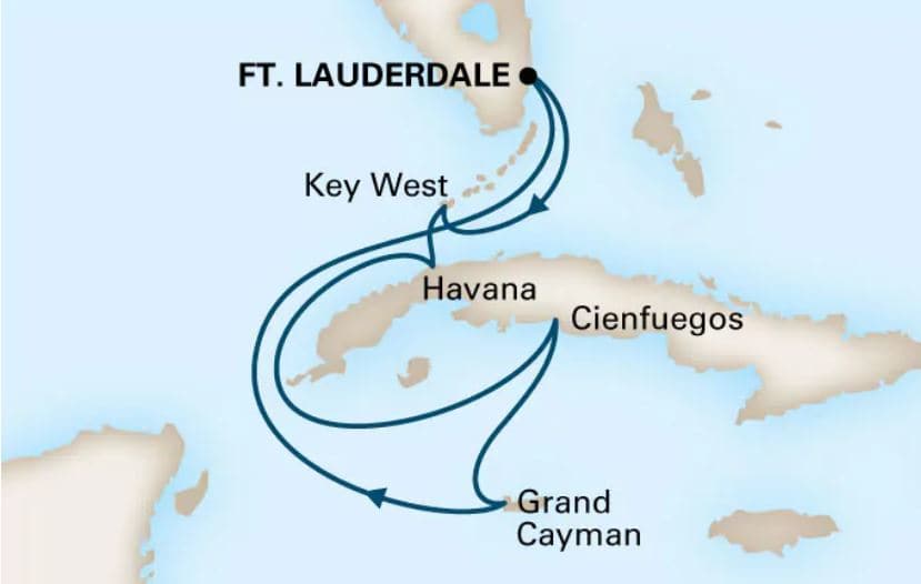
A circle Western Caribbean Cruise which the HAL calls a Sunfarer Cruise

The good ship Zuiderdam is currently engaged in 10 and 11 day Caribbean cruises and this afternoon we started an 11 day cruise which will take us from Fort Lauderdale via Half Moon Cay, to Willemstad, Cartagena, in & out the Panama Canal, Puerto Limon, and back to Fort Lauderdale. This is a nice mixture of ports and sea days and as there are a lot of guests who have figured out that 6 ports in 7 days is not really a vacation and sea days are a lot of fun as well: the ship is fully booked.

The Zuiderdam is under the able command of Captain Bart Vaartjes and his bio is on the blog under the Tab, current captains and their schedules.  For those who are interested I have also just added the Bio of Captain Colm Ryan, currently Master of the ms Veendam. He was one of the captains who was on loan to P&O Australia when we handed over the Statendam and the Ryndam.

This time I am on board the ship to help prepare for one of the audits that all our ships have to go through and hopefully the younger officers will have some benefit of the experience that I will bring with me. The Zuiderdam recently went  through the upgrade which brought the Music Walk on board and also moved the Shore Excursion office to the Crows nest. These upgrades are taking place all over the fleet but they are not all the same for all the ships in each class.  On the Westerdam they have taken out the Atrium staircase and installed the Rijksmuseum experience with paintings and books but here on the Zuiderdam the staircase has remained and a sitting area with internet has been created where the Shore Office once was.  Time will tell what the guests prefer when they start comparing the various Vista Class ships.

While on vacation I have not neglected my historical work and I have been a little bit involved with a big exhibition which is coming in the town of Veendam about the four Veendam’s and the businessman who paid for the first Veendam, Mr. W.A. Scholten. The company named the 3rd new build in 1874 after him and when it was decided that all our ships should have a DAM name, the company named a ship after his hometown Veendam. I will explain some more about that in the coming weeks.  Also there was the yearly lecture (my own State of the Union) for the ships hosts on board the ss Rotterdam.  As you might know the ss Rotterdam V is now a hotel in Rotterdam and there are over 200 volunteers (Many of them have themselves sailed on the ship) who guide guests and visitors around and answer questions. As I researched the ships history quite deeply in the years that I sailed on her, there is always something new to tell, something that the hosts can then use again in their conversations with the visitors on the ship and those who stay as hotel guests.

The first newbuild of Holland America after it became a public company in 1873

Now we are on our way to our first port of call, Half Moon Cay, and if my ships schedule is correct, we will be the only ship there tomorrow. Thus far the weather in the Carib has been quite horrible with lots of wind and rain but from today on-wards it is supposed to improve and the crew is looking quite forward to some nice weather. I have fully taken credited for that, as the weather improved the moment I landed on American soil……………..

Weather for tomorrow in Half Moon Cay: very light winds, partly cloudy and temperatures at noon of 81oF or 27oC.

16 Dec. 2017. Merry Christmas and a Happy New Year.

As usual all the Holland America Ships will be celebrating Christmas guests and crew alike. Where ever they are in the world, all of them at their local time. So the Noordam will be well ahead of the Caribbean ships.

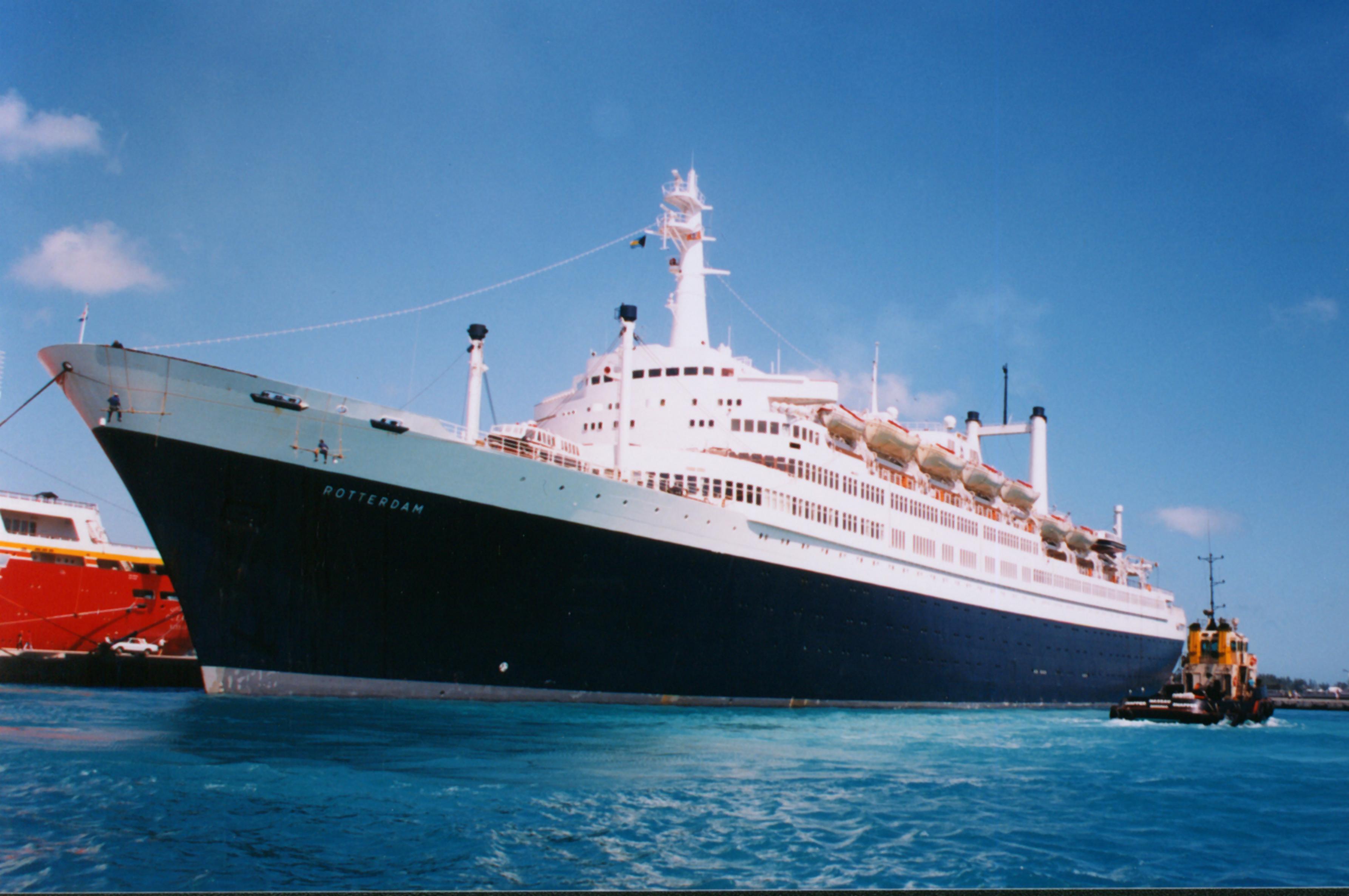
In this case I would to share with you a bit of nostalgia from the good old days.  The old ss Rotterdam, Grand Dame of the Seas, is now a Hotel ship in Rotterdam. And for the first time she has been decked out (and even better) in the way we would have painted best wishes on her decks and raised the Christmas star.  The hotel company which now owns her, has a keen understanding of the importance of maintaining maritime tradition and has now agreed to resurrect the routines we as crew on board followed in the days before 1997.  Ex crew of the ship now, volunteering as hosts on board, showed the old photos and it worked

Happy holidays and a prosperous and blessed 2018, from me and Lesley.

I hope you will enjoy the photos.

Christmas flood lights on the bow.  The pole in front of the name, is the top of the Radarmast, which was taken down in 1980 so she could sail under Seymour Narrows power lines. I brought the mast back to Rotterdam in 2007 with the ms Veendam.

The colored flood lights are an addition by the volunteers as the ship would be in the dark when sailing, so the navigators could keep a good look out.

The Christstar has now returned. This frame would each year be repaired by the engineers and the electricians and then hoisted on the day the Christmas cruise started. (And checked every morning to see if it was still there and not blown away during the night.

20 November 2017; At Sea.

A quiet and sunny day at sea today; that is what everybody needed after hopping 4 ports in a row. The weather was true to form and we had a perfect cruise day to enjoy. Also the bridge team were happy as the expected current along the coast came through and pushed us along with 0.5 knots every hour free of charge. On 32 hours sailing that is at least 16 miles free of charge or a one hour sailing free. If the ship burn 90 tons of fuel every 24 hours then we are looking at, at least 3 to 4 tons of fuel saved. That makes the chief engineer happy and every little bit helps as well to keep costs under control. And lower costs will have a positive effect on the ticket price for a cruise.

With very little wind, there were hardly any waves, just a bit of a long low running swell coming from the Pacific Ocean. With a smooth sea surface it makes it a lot easier to spot wild life and we were not disappointed as we saw dolphins and loads of lazy turtles slowly peddling to a destination obviously important to a turtle. They always seem to go a in North Westerly direction as we always see them swimming in line with our course line. Never coming from port to starboard. Maybe they use the current to help them move along or there is somehow nothing of “turtle interest” along the Mexican coast so they simply pass it by.

My day was filled today with clearing up loose ends and to conduct some training’s and drills. Most important of that was a Damage Control drill for the engineers that make up the Damage Control Teams on board as plugging holes and pipes is a technical expertise. In the same way as the deck officers are responsible for lowering lifeboats in an emergency. My challenge is always to make a damage control drill realistic and meaningful. I cannot cut a hole in the hull of the ship and say “plug it” and I cannot put a compartment on board under water either.  So it needs creativity. Sometimes I have the option to build a wall on the outside deck with fire hoses spouting water through holes in the wooden paneling but then I have to block off a deck. And you do not want to do that on a nice day as we had to day. Guests wanted to be out there and so they should.

Smoke / white haze coming out of various openings which will need to be plugged.

This time I built a smoke box and the smoke simulated the ingress of water. The idea remained the same; plug the holes, if no smoke escapes any more than the hull is watertight again. Luckily a cruise ship always has plenty material available to create a mock up and with 3 luggage bins, damage control support wood, tarpaulins and a smoke machine we were in business. How you patch holes is something that you cannot learn from a book. You have the tools, you have the equipment and for the rest it is engineering ingenuity. Today they used a mattress shored up with wood for the big holes and wooden kegs for the small holes and in 30 minutes time it was all patched up and considered safe by the chief engineer.

Installing a Mattress to block the large holes.

Tomorrow we will be in Puerto Vallarta and that will be my last day on the ship. The ship will dock at 08.00 hrs.  and we will be at berth 2.  There is supposed to be a Princess ship coming as well and going to berth 3. Normally berth 1 is the cruise terminal but that is (still) under re-development and thus we are going to berth 2. Much to the satisfaction of the crew as berth 2 is a bit closer to the shopping center across the road while berth 1 is a bit closer to the city side. Berth 3 is the furthest out but benefits from having the buses for shore excursions being parked the closest to the ship. Thus every berth has something to offer and I do not know which is the best one.  We are looking at another good day in Puerto Vallarta. Sunny, warm and not too humid. I think the guests can consider themselves very lucky with this cruise.

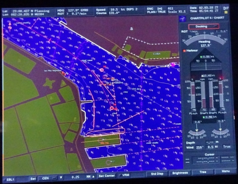
The radar chart picture of Puerta Vallarta. Here the ship is docked at berth 3. Today we were at berth 2, close to the shopping center.

From Puerta Vallarta I will fly home via Mexico City and Amsterdam. I have been away from home for nearly 3 months so it is time to go and see “senior management” again.  Also next week I have to attend a training course at our simulator at C-Smart in Almere the Netherlands.  If I get the chance to take some photos then I will post them in due course on the blog.  And then my vacation will start until the first week of February.

If nothing changes, ………….. although it normally does,………………… but if nothing changes , then I will return to the Westerdam for another School Class with new Navigators. But that is all depending on cabin availability, so I might also end up on another ship. Never a dull moment if you work for Holland America.

Time to say thank you to all my readers from the past period. I hope you found my daily blog of interest and maybe even diverting at times. I should be back with the blog after the first week of February. I hope to add some more material to the historical past of the blog but that will depend among other things upon the “honey do” list of my wife and needs of the apartment building I live in. But the first job at home will be to get all the Christmas tree’s out of the loft and install them in the apartment. So from my side: Happy holidays and a prosperous and blessed 2018.

19 November 2017; Huatalco de Santa Cruz, Mexico

19 November 2017; Huatalco de Santa Cruz.

To sail from Puerto Chiapas to Huatalco means crossing the Golfo de Tehuantepec. And there you can have this very nasty funnel wind. It seems as if it starts out of nowhere, it does not go anywhere, and it stops as abruptly as it starts but it can reach winds speeds of up to 50 knots or even more. Predicting it is not easy either as it depends on the weather in the Gulf of Mexico. But this time they did predict it and both the pilots in Chiapas and Huatalco were confirming the expected bad weather. So for us the first question was when?

This is what is causing this local wind. Wind being pushed through a small gap in the mountains. (Diagram courtesy: website: The Vane)

A Tehuantepeccer wind is caused by a weather front that drops down from the Gulf of Mexico instead of going up inland. If this happens, then it pushes a high pressure system into the curve of Mexico which on the Caribbean side ends up near the Yucatan Peninsula. The mountain range running down the middle of Mexico keeps that pressure system in the Carib or the Gulf. But there is a tiny gap where the mountains are less high. That tiny gap gives access to the Gulf of Tehuantepec. So the pressure can get through and is pressed into a small gap and thus increases in velocity. On the Pacific side you have the town of Salina Cruz right in the gap and Huatalco and Chiapas on either side. When the wind comes through, it keeps intensifying as it feeds off the warm water until the sheer size of open water lets it disperse.

This is what we do not like. the wind field is fanning out to the West and Huatalco could just be affected by it.

The important part for the sailor is the angle of the vortex of the wind. If it is perpendicular on the coast, then yes we will get a lot of wind while at sea but the ports will not be affected. If the wind blows under an angle into the open sea, then either Huatalco or Chiapas can be affected. Luckily for the guests, it is a land wind so it does not bring much swell that can make the ship rock. So while in Chiapas the bridge kept a close eye on the weather charts that are received every day and it did not look that the wind would start to blow until we were well past the middle of the Gulf. So we could get to Huatalco without too much wind. Once at the pilot station we could then see what would be the wise thing to do.  Go in or stay out, depending if the wind would hit the port or not. And thus the ms Westerdam set sail with high hopes for not having any challenges.

And then the pressure system in the Gulf did not want to drop down so the Tehuantepeccer never started to blow at all. We arrived with flat calm seas and a sunny sky at Huatalco and slipped into the port without any issues and the wind, any wind at all, never materialized. The skies remained sunny, the wind stayed away and luckily it was not that humid either, so we had a very good day here. Our guests did not come back all that hot and bothered from their sightseeing as sometimes can be the case in Mexico. Huatalco is a tourist resort created by the Mexican Government and as part of creating work for the locals also the cruise pier was built, which now is servicing cruise ships nearly every day. Most of the tourists that I see, if they are not coming from the ships, are locals from the nearby larger towns. Huatalco is just the beach front area with the bars and hotels. The inland part is called La Crucecita, close by but on the other side of a small mountain ridge and not visible from the ship and or the resort.

The resort of Huatalco. Two big ships of the Westerdam size fit at the pier and there is room for one ship at the anchorage. Then the ships tenders dock all the way inside the little marina.

We stayed until 18.00 hrs. and then backed out of the bay to head North West to Puerta Vallarta. Tomorrow we are at sea and as we now go from the far south of Mexico to the border of Mexican California, it is a high speed run with an average of 19 knots to maintain. The weather is supposed to hold, with clear skies and smooth seas. So we should be able to see dolphins and turtles.

18 November 2017; Puerto Chiapas, Mexico.

It is always nice when King Neptune cooperates with our wishes and desires. And he did today by directing the ocean swell to run along the shore and not into the breakwater and entrance to the port. Not too long ago this area had a heavy earthquake and although Chiapas on the coast itself was not hit that much it caused some underwater land sides in the estuary which reduces the depth. The dredgers had been out in force again to make sure that there was enough water again to get in and out………….. under normal circumstances….. but the depth was still a meter short of the standard. Which meant that if a swell had been running, we would have had at least one meter less to play with and that would have been a 10% reduction of the normal depth. Very nasty.

However we were in luck and we did not have to worry. The very minimum depth observed under the keel was 1.6 meters, or 5 feet, which is not much but if there is no swell, we can happily live with that. I have docked with less under the keel and as long as you move over the shallows at a slow speed then you can work with small margins without any difficulty. And thus without much delay we docked at the passenger terminal for a nice and sunny day in Mexico. Swinging around on arrival so we would have a clear shot out in the evening; just in case the wind would pick up in the afternoon.

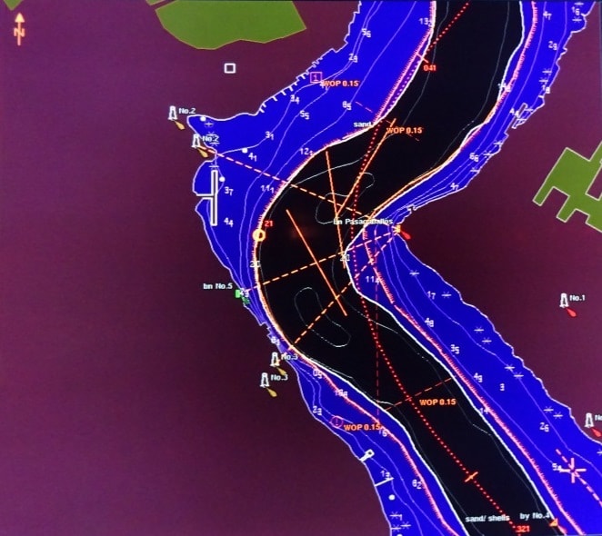
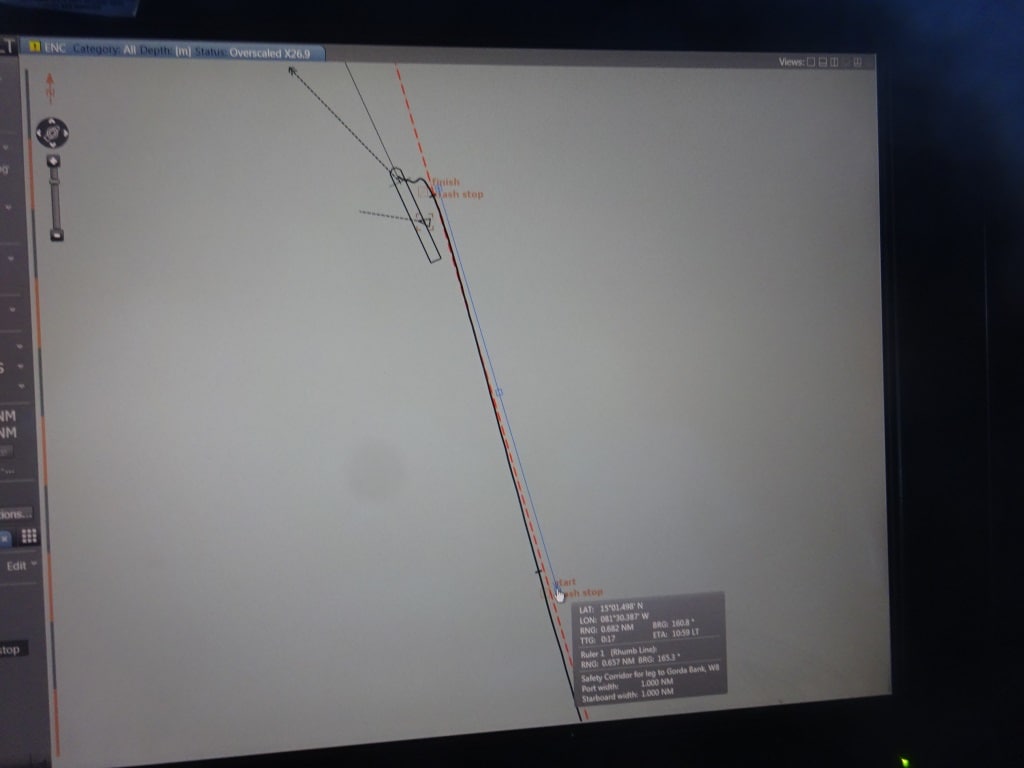
Still docked alongside. First part of the maneuver is to go sideways and get onto the dotted line, and what ever you do remain in between the red lines as they indicate the safety boundary’s.

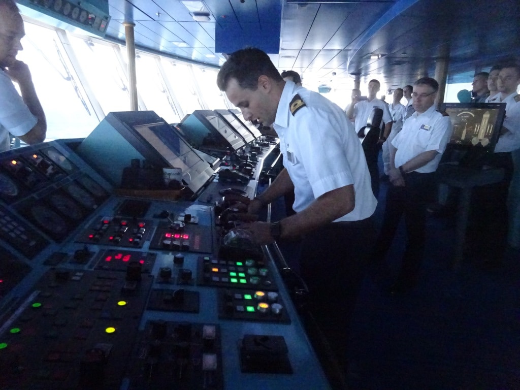
Puerto Chiapas is also a port which is ideal to train new officers in conning the ship as sailing out only entails 3 small course changes and slowly increasing in speed while doing so. Ideal to get a feeling for the ship, especially when you are just starting with practical ship handling. Thus today the 2nd officer of the 4 to 8 watch was going to have “the conn” supervised by the Captain, the Staff Captain and the local pilot. In the good old days junior officers seldom got the chance to play with the ship and then were sort of stuck when they became close to being captain. In those days pilots did most of the maneuvering as it always involved tugboats so the captains themselves were not that experienced either. Then came the bow and stern thrusters and the whole ball game changed. In the beginning power was marginal so you needed a quiet day for training but now we have so much power that the captain can always carry out corrective action if something happens.

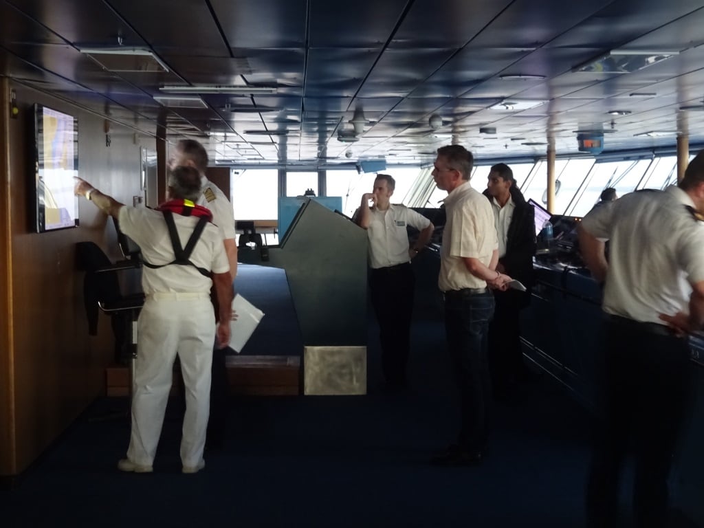
2nd Officer Brian Pas as Navigator, Captain Mark Rowden as supervisor, Staff Captain Wiebe Sypperda communication with the officers forward and aft. Captain Acurro, local pilot, communication with the shore side,

To give everybody a chance the bridge teams are nowadays built up in such a way that you can easily rotate without taking the overall responsibility away from the Master. Team members can just assume different functions.  So today we had:

Captain – Operations Director – oversight, Staff Captain – Communication with the mooring station, 2nd officer – navigator and conning, 3rd officer – Assistant of the watch / Administration and alarms,  Pilot – on the phone talking to the linesmen,  Quartermaster 1 – steering, Quartermaster 2 – Lookout and alarms.

Once the ship is in the middle of the fairway, the whole team moves to the center of the bridge to sail the ship out.

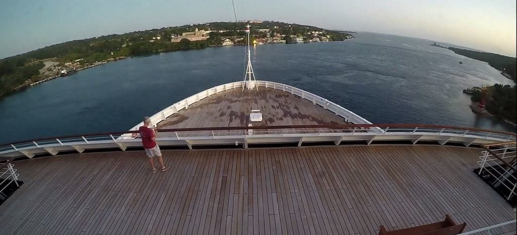
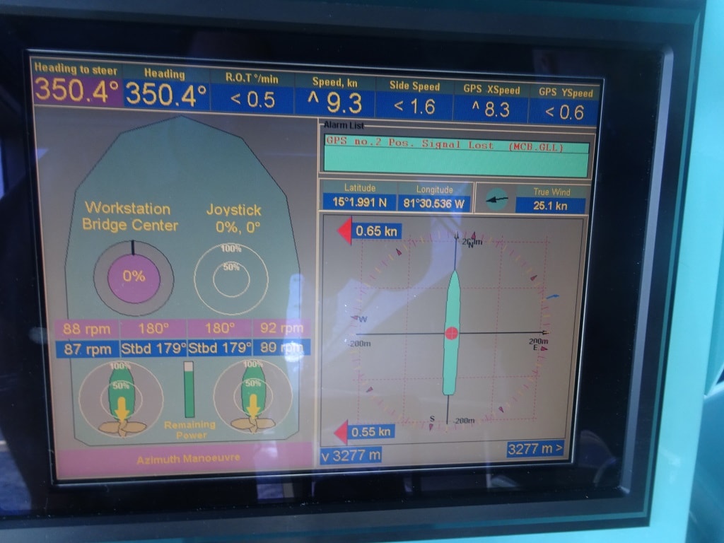
The maneuver consists of going sideways off the dock until the ship is in the middle of the fairway and then after turning the pods forward slowly build up speed and stay in the middle of the fairway. Once passed the shallow “earthquake” patch, speed can be increased again until we come outside and settle on a speed between 6 and 10 knots to disembark the pilot.

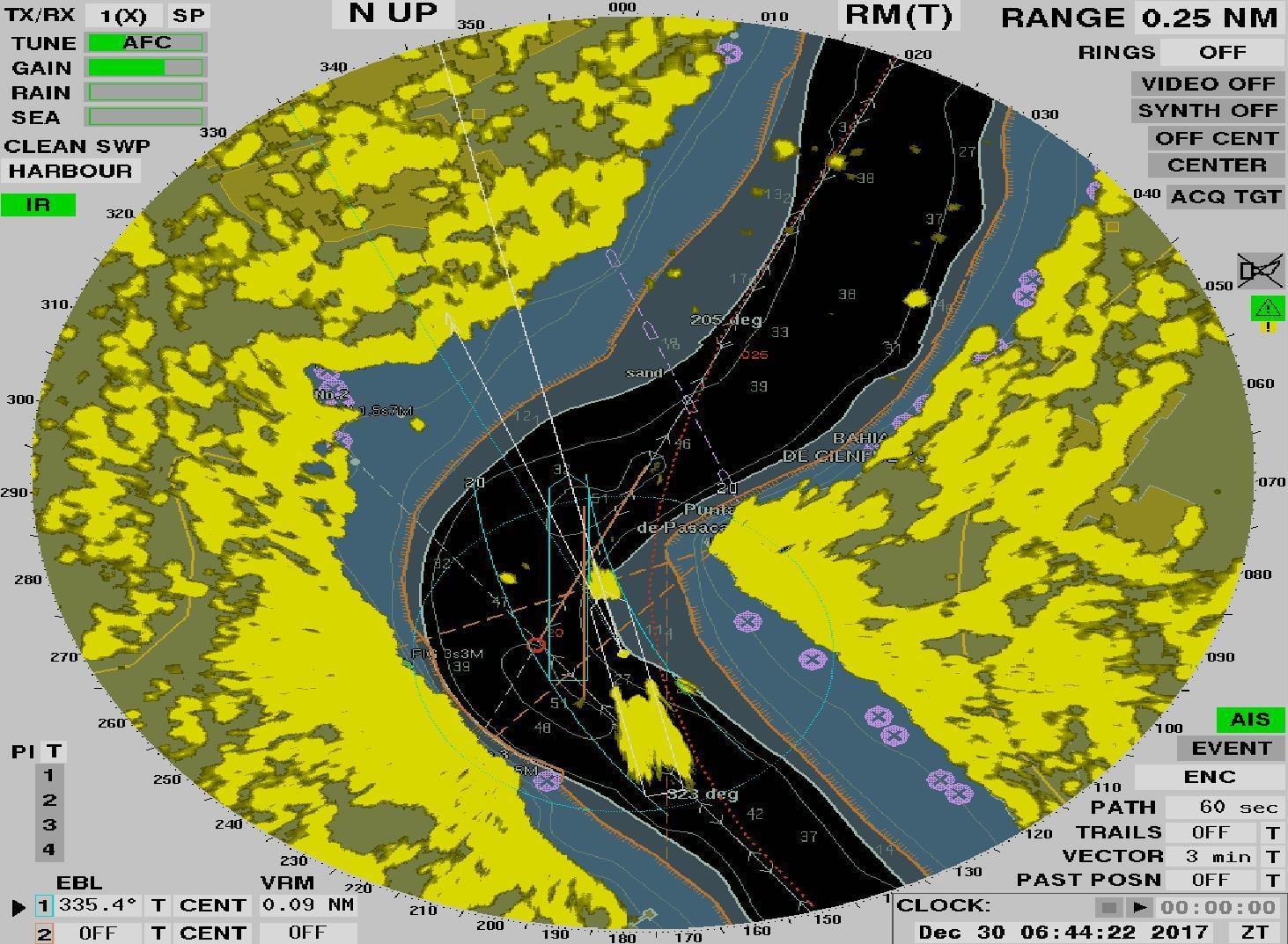
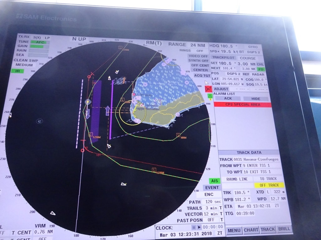
The Radar predicts the movement of the ship 3 minutes ahead based on course and current. As long as we stay in the black we are in good shape. As you can see there is not much room for error as the ship barely fits in the dredged channel.

We sailed outside exactly on the dotted line as planned and once the pilot was off, turned to the North West and headed for our next port of call Huatalco de Santa Cruz. There is a chance of a Tehuantepec wind starting to blow but to me it looks it that that will happen after we are well past the area. So we should have a nearly windless sailing and a great day tomorrow.

17 November 2017; Puerto Quetzal, Guatemala.

Remember our visit with the Nieuw Amsterdam about a month ago? We were supposed to dock at the passenger terminal but a day before a Tanker had taken the turn too wide and had damaged one of the dolphins. The Port Authority said that repairs were needed and would be accomplished in about 14 days’ time. So now coming back again with the Westerdam I was expecting that indeed the repairs would have been completed and the terminal dock would be available. Alas no. The floating dock was still not available and we were re-directed to the cargo pier. No doubt to the chagrin of a cargo ship captain whose ship was bumped back to the anchorage.  I am a little bit disappointed in the port people here, as normally they are very much on the ball and things tend to happen more the European way than the Middle American way in terms of time management.  The ship will come back here in the near future so we have high hopes.


Instead of going left (yellow) we had to curve to the right (red) and dock in the cargo terminal.

In the meantime it is an inconvenience for the guests who are not on tour as they have to be (shuttle) bused from the ship to the cruise terminal and either nose around there or go inland from there. Most of our guests are on tour and the majority of them are on a half day or full day visit to Antigua. This is an old Spanish town further inland and its main claim to fame is the old Colonial buildings which have been preserved here very well. Good enough to be assigned as a UNESCO World heritage site. Then maybe more unusual are the hot springs nearby; although the area is very volcanic so really it should not come as much of a surprise.  All this is about 60 minutes to 90 minutes away from the ship. For the rest there are coffee plantations and chocolate factories that can be visited, hence most guests are on a tour.

The cruise pier, the whole center section floats and thus the gangway height never changes. (Volendam or Zaandam alongside)

We do not like docking at the cargo terminal very much. First of all the pier is fixed so we have to adjust the gangway all the time for the height changes caused by ebb and flood. The cruise ship pier is a pontoon dock which goes up and down with the tides, so the gangway is always under a perfect angle. Secondly there is the ever present chance to get spilled over the decks, whatever the cargo ships on either side are discharging.  If it something like Tapioca or other dried and grounded fish products than it is not fun at all, as apart from the commodity blowing over to our ship, it also does not smell very nice.  Same for fertilizer, the ammonia “perfume” will penetrate to the whole ship if we are not lucky. As far as the other ships were concerned we were quite lucky. No smelly ships today as neighbors and it was wind still so all that was discharged went into the waiting trucks and not over our ship.  Today we had a bulk carrier docked in front of us, with the Belgian registration of Antwerp and they were discharging animal food for the farmers. I could not get out of the local at the gangway what it was, but it was “good for cow and chicken” so I assume that Guatemalan cows and chickens are on the same diet.  Wasn’t there somebody who said that butter, cheese and eggs all came from cows? Maybe we have special local animals here.

Docking at the commercial pier means the captains have to go through a decision making process. Docking with the nose in, or docking with the nose out. Nose out means swinging on arrival and that takes about 30 minutes as there is not much space spare once the ship is perpendicular in the port so it goes slow; but it saves time on departure. Or you can do it vice – versa. Today it was decided to go straight in creating more time to fudge around with the gangway, to get it in a perfect position and height before the first guests were going ashore. So we swung on departure and thus the guests could see the port; first from the starboard side and then from the Port side. Our next port of call is Puerto Chiapas just across the border with Mexico which is a short distance away.

The weather is looking good, same as today, the only concern is the swell, if that is running straight into port, then it reduces the depth of the fairway and that might bring complications.


16 November 2017; Corinto, Nicaragua.

It is a high speed run from Punta Arenas (or Puntarenas) to Corinto and even with the pedal to the metal we can only just make the 09.00 pilot station time required for a 10 am docking. This is another port where a ship’s captain really sits down and has a deep think about. And again it has to do with current and swell.  The port itself is nicely protected behind a peninsula created by the outflow of several rivers which merge here. So once inside, it is wonderful.

The challenge arises first from the swell. Most of the time there is a long running ocean swell and that swell comes in under a 60 to 70 degree angle with the entrance course to the port. So the ship could roll, could roll considerably. Thus the best option is to keep the stabilizers out. But stabilizers need speed, at least 10 knots, and when we move into the approach course the ship has to start slowing down for the first turn.  There is a maximum speed limit of 8 knots imposed by the authorities.  Thus the ship has to plan to sail with 12 knots into the fairway / buoyed channel and then gradually reduce speed so it can make the turn (where we get the swell on a 90o for a moment) with 10 knots. Then down to 8 knots when it comes behind the first island which acts as a breakwater. From then on speed can be reduced to six knots for the next turn and then to three knots to initiate the turn to the dock.

The old -paper – charts in use for Corinto in the good old days.

The 2nd challenge is the current, or better said the currents. The port is subject to an out flowing current caused by the river and a in and out current caused by ebb and flood. The flood is stronger than the river current (unless there has been very heavy rainfall) and that pushes the river current back when the tide comes in. But these two opposing powers continuously battle for supremacy and it is impossible to predict where the influence of the one or the other prevails.  In some ways it makes sense for the ship to come in at full flood tide as then we only have one over ruling current to deal with. But the tides do not follow our cruise brochure so we go in when the schedule dictates.

The current problem really comes into play just around the first corner when leaving the open sea fairway. Now we have just solved the rolling problem by keeping the speed up and the stabilizers out and then focus has to shift to the current. Best way to deal with current is to keep the speed up. The more speed the less drift there is as it diminishes the influence of the current. But we are now in the process of reducing speed from 8 knots to six and then to three knots. So while we are reducing speed we have to keep a close eye on the way the current affects the ship while we are making our 2nd and 3 turn towards the dock.

Approximate boundary’s of the deep water in black but it is not as straight as my drawing. Current arrows everywhere.

Normally we solve the problem by hugging either the high side or the low side of the channel based on the best prediction of where the current will be. Once we see the pattern evolving then we can adjust back more towards the center of the channel or stay where we are. Here the pilot boat comes into play, which is darting ahead of the ship and checking the current at each turn just before the ship gets there. The pilot gets the information and then passes it on to the captain with the words “a little bit more to the middle, a little bit more towards the red buoy or a little bit more to the green buoy”. On cruise ships the captain normally sails the ship in and uses the pilot as an adviser with the local information. For cargo ships (who nearly always need tugboats) it is a different matter, they go in and out of port much less often than we do and there is the local language barrier for the orders to the tugboats.

We stayed in Corinto until 1800 hrs. and had a bit of a hazy day with a layer of thin clouds above which was great as it just kept the heat bearable. The rain did not show so the guests could walk around town without being drenched.

Sailing out is a lot easier as you can make speed as soon as you clear the final turn and have the stabilizers do their work. From Corinto it is only a short hop across the border into Guatemala for a visit to Puerto Quetzal. Here we will arrive at 08.00 hrs. and as it is only 120 miles or so to get there, it will be slow sailing tonight. As it is so close the weather should be the same, Sunny, Dry, hot and humid.


15 November 2017; Punta Arenas, Costa Rica.

As you can see Puntarenas or Punta Arenas is half way up the Golfo the Nicoya. The current comes in and most of it will follow the east shore. But when it comes to the islands in the middle, the flow is distorted and calculations are of little use. So we look at the buoys and watch the drift.

Slack tide for docking in Punta Arenas was calculated for around 05.30 hrs. and thus the Westerdam was there at the precise moment making sure that as soon as the current fell away, she could go alongside. And then the current did not fall away, it diminished somewhat and thus a safe docking could be made but it needed all the power of the thrusters and the Azipods and the help of a tugboat to accomplish this. One hour later and the flood current was still running.  And that is what fills captains with dread every time they have to go here; you cannot rely on the predictions, not even the ones made by the most experienced pilot.  Get the timing or the estimation of the flow wrong and you have a dent or even worse. Due to the flow of water passing by and going further up the inlet and the option for the water to circle around further up the inlet, the currents are not straight forward in and out as with regular tides.

The water is shallow here so a long pier had to be built. It causes the water / current to flow freely under the pier and that is not nice for docking.

Luckily today we had very little swell and that saved the day. On occasion we could hear a bump under the stern when a low wave got caught under the transom but apart from a gentle sway along the dock, it was a nice and quiet day. It being the time of the season, we were blessed with the occasional rain shower but the positive side of this was that it brought down the temperatures. As with a sunny day it can be very HOT here as there is then normally no wind while the humidity remains high.

Punta Arenas is a small town so for the guests who do not go on an excursion, there is something to look at and maybe pick up a small souvenir. But most of our guests go on shore excursions here and quite a few of them on tours up to the capital of Costa Rica, San Jose, two hours’ drive up the mountain. I was there long time ago and visited the National Museum. I found it most interesting as it was a museum with bits of everything.  Including a six feet KNSM (Dutch company called Royal Boat in English) model of a small passenger ship called the Cottica in an original show case. To my horror they had it standing on a covered Verandah but not in a temperature controlled environment. I wonder if it is still there and survived the tropics. The maritime museum in Amsterdam would have drooled over it.

Another thing going on bellows decks. Medical were doing flu shots today. The company strongly encourages all crew to get their yearly shot, so the medical officers are holding several clinics during the cruise to get all 800 crew through.

While the guests were exploring Costa Rica, on board life continued. For those who remained behind were treated to the occasional announcement for testing the P.A system. An unpleasant intrusion but for safety we have to test all the speakers on the outside deck once a year in case we need them during an emergency. We use as many people as possible, by parking each one of them under a speaker so we can keep the number of announcements down but we had to “ding dong” a few times during the day as there are a lot of them. We always find one that has stopped working due to water ingress and then we repair and then have to test again.

Another activity I see every morning when I go for breakfast, yearly morning yoga. Now the question is, why are there only two guys participating and so many Ladies ??

Then there were more announcements at 10.15 hrs. as Yours Truly was running a Fire drill. This time only the captain was aware of it, as once a month we have to stage an un-expected one as the law makers have recognized that too much routine for the crew is not good. We are human and if we can prepare for a drill, mentally (thinking about a fire scenario in advance) and physically (already on standby for the time scheduled) then you lose your edge. Thus once a month there is an un-expected one and if I am on board then it is really un-expected as nobody knows what I might come up with.

Leaving Punta Arenas was easy to day, the tide was again off schedule but very weak and thus we could just push the ship off the dock and sail out of the bay. Tomorrow we are in Corinto Nicaragua, where we are scheduled to arrive at 10.00 hrs.

Weather for Corinto sunny in the morning rain in the late afternoon. No wind and temperatures around

83oF or 28oC with high humidity.

Older posts Newer posts