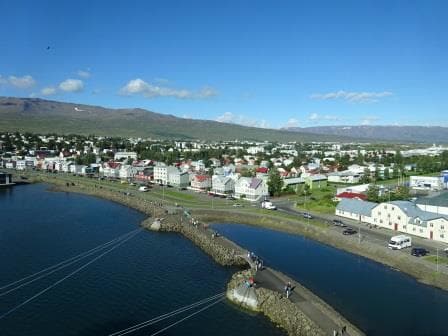
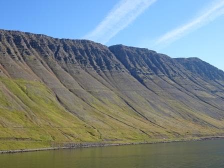
The small heatwave caused by the balance of high and low pressure areas is creating beautiful weather today. There are only some clouds in the sky, there is a gentle breeze which makes it pleasant on deck and the temperatures reached a balmy 20oC / 68oF at noon time and that is not bad at all for this time of the year. We have no hurricane to worry about yet and thus we can happily sail towards Charleston South Carolina where we will arrive tomorrow morning.
As I mentioned an upset Chief engineer yesterday, it is now time to explain what we do to keep him as happy as possible. When we go up the coast from anywhere north of Cabo San Antonio on the West side of Cuba, we try to find the center of the Gulf Stream and then let it push us forward. If we can find the exact center or Axis then we can get up to four knots of current. Especially in the section between Key West and Fort Lauderdale. Before and after that area the Gulf Stream is not so concentrated. If a ship has 16 knots to maintain and it gets 4 knots of bonus speed from the current, then the engines only have to produce 12 knots, which saves a lot of fuel and that makes a Chief engineer very happy.
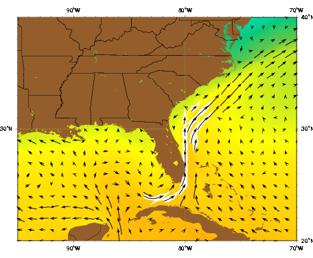
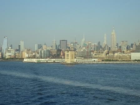
This is the average direction of the Gulf Stream. Coming down from New York you have to sail through at least part of it.
When going south towards Fort Lauderdale or into the Straits of Florida we try to avoid this center of the Gulf Stream by either sailing on the Grand Bahama Banks side when going to the East Caribbean when coming north of Cuba, or staying close to the Florida coast when going to Florida ports or down to the Gulf of Mexico or the West Caribbean.
That is what we are doing today; creeping closer and closer towards the East Coast of the Carolinas and later of Florida. In that way we hope to reduce the opposing current to less than 2 knots and if we are lucky we might even get a counter current. I use the word “lucky” as it is not all science here. We get chartlets made by NOAA which indicate the average location of the current and we have chartlets with the general pattern of the current. But one good hurricane coming through and the Gulf Stream can be completely different or even gone. Hurricanes can push water in a different direction or “suck” water away from a location somewhere else and then the current will go that way to restore the balance.
I sailed once from Norfolk to Half Moon Cay, right after a Hurricane had come through, and there was no Gulf Stream at all; instead I had two knots of current with me all the way down until I sailed between the Bahamian islands. It took two full days before the Gulf Stream came back to its regular flow. As you can understand I had a very happy Chief Engineer at that moment.
Even when the Gulf Stream is flowing normally, we still do not always know the correct location as the Axis of the Gulf Stream can vary quite quickly from being close to Florida to moving all the way over to the East and being close to the Grand Bahama Bank. To get it exactly right is sometimes as much as throwing a dart at the chart, as conducting a deep study of all the information available. What still works the best is to make a plan and then when there, to let the ship “feel” where the current is by going a bit off track to starboard or to port and observe what happens.
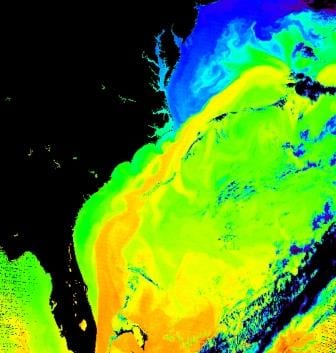
This is the Gulf Stream as indicated by its temperature. The more we can stay in the green part or on the edge of the orange part, the less adverse current we have.
When we are coming closer to Charlestown it is not so much of an issue as the Gulf Stream is still very wide and thus close to the coast we will feel not much more than 0.5 of a knot. But at lunch time we were in the middle of it with two knots and that gave the navigators a good idea of where the Axis should be when we sail back into open waters tomorrow evening. Then the trick will be to stay out of the thick of it.
Weather for tomorrow: Nice and warm but not too warm. Clear skies with noon temperatures of 24oC / 75oF and a gentle breeze.