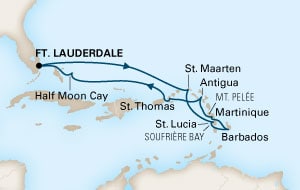
The 2nd day at sea takes us right into the open North Atlantic while we travel that corner marked by Hispaniola and Puerto Rico to the south and the Bahamian Islands to the west. This area is on the edge of the Trade wind system and the regular North Atlantic weather. Those two areas with their own significant weather patterns can sometimes enhance each other to create more wind or the opposite and calm the seas down. Today they worked together and the average wind was between 25 and 35 knots. With the ship going against it with nearly 20 knots it caused relative gale force to storm force winds on the outside decks. Luckily most of the open deck areas for the guests are screened off by glass walls or protected by the bow of the ship. You do not feel 50 knots on the decks, just occasionally a strong tug at your sleeve if the wind plays around the corner of a windscreen.
The ship has to push against the wind and has to use more energy/fuel to keep the same average speed going. With a full wind on the bow, it slows the ship down by about 0.75 knots or so and with having the stabilizers going in the choppy seas as well another 0.75 knots comes off. Thus the ship has to go 1.5 knots faster just to maintain the average speed to get on time to St. Maarten. Because of this we are barreling away through the ocean with a speed of 19.5 knots but in reality we are only eating up the distance with only 18 knots or so. The fact that we lost an hour yesterday at Half Moon Cay does not help of course to keep the average speed down.
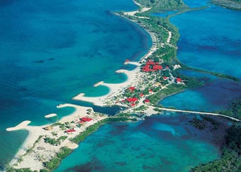
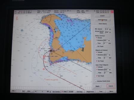
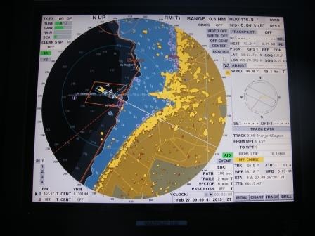
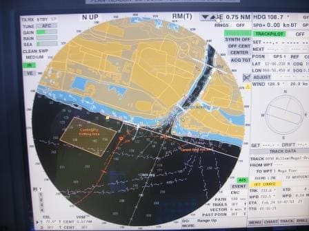
The route takes us far North of Hispaniola and Puerto Rico and it is only in early morning of tomorrow that we will make a landfall near the West side of St. Martin / St Maarten and then approach Philipsburg on the south side, sailing east. The Northside of the island is French and the Southside Dutch but there is not really a border as such. If you travel from south to north you suddenly come across more people speaking French and the restaurants being more French style. Legend has it that this border line was decided by having a French drunk and a Dutch drunk start at opposite sides of the island and meet in the middle. The result is a bit of a wobbly border line with the French side being bigger but the Dutch side being better as it has a deep harbor. That port is called Philipsburg while the French side has Marigot, but there it is very shallow necessitating a long tender ride in and it is exposed to the North Atlantic swell. Hence cruise ships hardly call there.
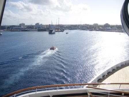
Philipsburg is in the lee of the island and its waters normally have no swell at all, unless the ocean manages to curve around the east side of the island. Nowadays there are two large docks, which can handle 8 large ships and during some days there are 8 mega liners in port with one or two more ships at anchor. Very good for the tourist industry and the French side is really losing out here.
The ship will enter the Caribbean Sea through the passage located between the British Virgin Islands to the West and Anguilla / St. Maarten to the East. Then by 07.00 hrs. we will be at the pilot station and then shortly after docked. A little bit always depends on if the other ships arrive on time because if two ships dock at the same pier on the same side, the ship which is leaving later has to dock first as it is not so easy to get out by sailing around the other ship.
Tomorrow we are expecting: Regal Princess, Freedom of the Seas, Celebrity Eclipse, the Celebrity summit and us. All ships with 2000 or more guests on board. We are looking at a minimum of 14000 guests ashore and most of them will be marching up and down Main Street.
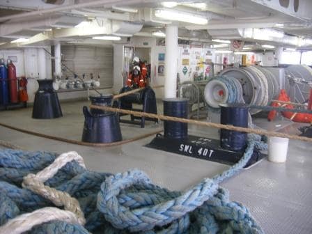
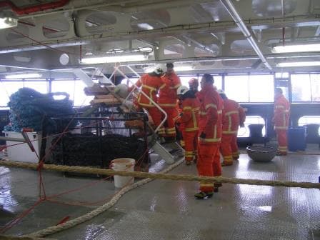
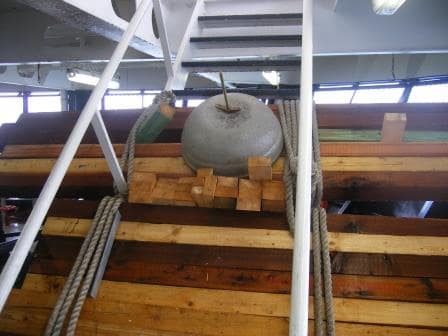
I will not be among them. My class is gearing up for the more serious stuff now and they are about to be initiated in the mysteries of lifeboat lowering.
Weather for tomorrow: Partly cloudy / Mostly sunny 81oF; with winds coming down to about 15 knots.