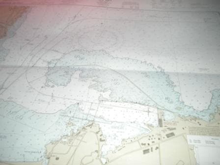
At 05.00 in the morning Fanning Island appeared on the radar, something we had not expected as the island is very low. However we then deducted that it had to do with the density of the trees on the island ring. The chart indicated “dense forest”, but what is dense? A few palm trees with shrubbery or dense jungle; no idea, the sailing directions and the chart were not very clear. After sunrise we realized that dense in this case meant dense as in Jungle-dense. The trees on the island are very closely grouped together and that produced a clear reflection on the radar. We approached from the north, sailed by via the west side staying about 2 miles clear and in 2,000 feet of water. North of the island it was blowing 30 knots and thus we already knew we would be at the mercy of the wind and swell and the angle under which it would hit the island on the south side. All preparation started as normal. Tenders were prepared, the tender platforms taken out of their deep sea- safe locking position and the sb anchor walked out as a failsafe in case something would happen to the ships propulsion while I was slowly moving near the shore. Continue reading
Page 129 of 241
So we made the hop over December 3 and landed safely on December 4th. The lights did not go out, the bridge computers did not stop, the sun still rose in the East and the GPS told us that we were still going in the right direction. Tonight the guests will get the date line certificate in their cabin, giving them proof that they really did it. Later on there will be a certificate for the crossing of the equator. That crossing we will do both ways as well and eventually we will sail East and then North East back towards San Diego. The dateline crossing also did not make any difference to the weather, this morning it breezed up to wind force 6, as was indicated on the weather chart of December 3rd. The weather sites that I use on the internet are mainly from the USA and Europe and thus I have to keep an eye on the correct date. Normally with planning a cruise, I am always days ahead of everybody; now during the coming few days, I will be a day behind everybody, at least as far as the weather is concerned. Continue reading
We are sailing with a speed of 16.5 knots on our way to Fanning Island. Going faster has no use as it would mean that we arrive around midnight. As Fanning Island is not known for its exuberant night life, there is no reason to go faster. Also the slower we go, the steadier the ride is as we have some long ocean swell rolling in from the East. The weather is now identical to that of the Caribbean Sea, moderate to fresh trade winds from the East and a low long rolling swell from roughly the same direction. The only worrying thing is that tomorrow we will have more wind and if that stays until Fanning Island, then we might have a very wobbly day as far as the tender ride is concerned. Still that is another day away. We first have to safely get over the date line tonight. Continue reading
Hilo can be a very difficult port. On the chart it looks very simple, one 90 degree course change and you are approaching the dock and one other 90o degree course change brings you alongside. The whole happening does not take much longer than 40 minutes. The challenge however is the wind. When the regular trade wind is blowing, it is normally under a nearly 90 degree angle with the 2nd course heading for the dock. At the same time you have to slow down because you are approaching the dock and that increases the drift angle. You cannot have too much of a drift angle because just before you enter the docking basin the channel is fairly small due to a reef on the south side. Three items to consider and to make Hilo a lot more complicated than it seems. Luckily today there was no wind and thus the approach was a simple happening. The pilot hopped on board at exactly 06.00 and by 07.00 we were completely and safely docked. Continue reading
During the night we sailed around the island of Lana, as I preferred an approach from the south West, setting the ship up directly in the leading lights of the port. Going north around Lana is a shorter distance but you sail for a prolonged time through a whale sanctuary and I try to avoid that as much as possible. I do not know if there are more whales inside the sanctuary than outside but the areas are indicated in the chart with the request not to go there if you do not have to. We did not and so we stayed out as much as possible. Thus far we have not seen that many whales, either they are somewhere else at the moment or they are still on the way over from Alaska. Scientists are reporting that Hawaii has resident whales and transient whales but as far as I remember the count on resident whales is not that accurate, so it is difficult to say whether there should be a lot of whales around or not. Continue reading
After a windless night we started our 2nd day in Honolulu. During sunrise we were greeted by a brown band lying over the city against the hills. Smog in Honolulu, unexpected; it really does not go together with an image of pineapples and hula hula girls. But there was no wind during the night and thus it happened. During the morning a slight breeze picked up and the brown layer dissipated. I had a funny experience the night before, as I had gone ashore for a few hours to dinner in a restaurant right outside the dock. Friends were drinking wine but I told the waiter that I was staying on water as I was driving. When the bill was being settled, he asked for my parking ticket so he could validate it for me. When I said that my ticket would be a “little bit” too big for him, the answer was, no problem, we deal with large cars & limousines as well. When I then pointed to 800 feet of “car” parked behind me, realization set in that my ticket might be a bit much too handle for the restaurant. It was funny to see the expression on the waiters face as he had never come across that one before. Neither had I never been given the opportunity to validate the parking fee for my ship. Continue reading
In the morning the wind finally veered all the way to the East and became a following wind. The velocity reduced to 10 knots but only for a short while. Shortly after we entered Kaiwa channel between Molokai and Oahu and the funnel wind effect caused the wind to breeze up again to nearly 20 knots. The swell slowly diminished and by the time we came in the lee of Koko head it had mostly disappeared. Koko Head is a protruding cliff that comes out from the land in the same way as Diamond Head does, which is the next cliff/mountain top to the west. During the night the two are not dissimilar and the accumulated sailor’s wisdom in the pilot guide warns to be careful here. Many a ship took a turn to starboard too early, thinking it was sailing past Diamond Head and seeing the lights of Waikiki beach on the sb side. Not every captain realized the mistake on time and some ships ran aground in this area. We did not make that mistake, as we had read the pilot guide of course and we turned to starboard once we were past Diamond Head and saw the port of Honolulu on our starboard side. Continue reading
The wind did not veer as fast to the East as the weather forecast indicated and thus we had the wind blowing on our sb side instead of from behind. That also meant that the swells kept being sustained by this wind and did not abate as fast as I hoped for. That meant that I continued to lose .4 of a knot each hour and that is going to set my arrival time back by about 45 minutes. Nothing to really worry about as we have an overnight stay in Honolulu, so there will be ample time to see the sights and to eat pineapple. Up North it still does not look very look and the people on Vancouver Island have a few windy days coming at them. In the centre of the gale the waves are about 25 to 30 feet high giving room for another series of the “deadliest catch” if needed. We are in a way still lucky as we are only skirting the southern edge of the wave field with 10 to 12 feet high waves. Together with the waves created by the current wind, the total height is about 15 feet and that is just enough for the ship to move about a bit. Still I did not get any reports about guests being sea sick, so all must be well in the world. Continue reading
The bad weather up north intensified and created winds of up to 75 knots under the Aleutians and that meant that the “ripple effect” came further down than was hoped for. So we caught the tail of that whole weather system. It started in the morning with 25 knots of wind from the South West and thus blowing against us. We are still on our straight course of 254o heading directly for the big Oahu and that meant we had the wind fine on our port bow. Then by lunch we had the tail of the frontal passage coming over which brought some strong showers. It made my Staff Captain very happy, as it washed all the salt away, but he was about the only one who could smile about it. During the passage it breezed up to gale force winds of 35 knots, but it did not last long. By 2 pm. we had left the rain behind us and the wind started to veer to starboard.
Continue reading
We are now entering our 2nd full day at sea and thus far the weather has been very cooperative. It remains overcast courtesy of the bad weather up in Alaska, but the cloud cover also indicates that there is little wind; otherwise it would break the cloud cover open. And little wind is exactly what I like as it keeps the waves down. Late on the 27th I expect the wave height to go up from 1.5 meters to about 2.7 meters and that will reduce the speed a little bit, so along there is no wind, those waves will not be sustained and I can build up some plus, to ensure a constant average speed to Honolulu. The guests who are hoping for a sunny day were disappointed but on the other hand a nice a smooth run is also something to be appreciative about. Normally there is a long Pacific Ocean swell running here, which makes the bow rise and fall with the waves but the 3 day bad weather cycle up north is upsetting that pattern a little bit and that results in confused seas, which dampen out the regular wave pattern, much to our advantage. Continue reading
Captain Albert

© 2026 – Captain Albert's Website and Blog –
Theme by Anders Noren — Up ↑