- Captain Albert's Website and Blog -

Ocean Liner History and Stories from the Sea, Past and Present. With an In Depth focus on Holland America Line

Page 63 of 242

22 June 207; Juneau, Alaska.

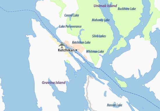
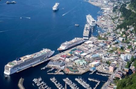
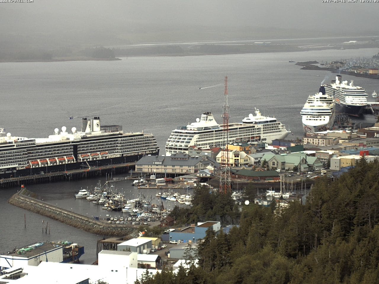
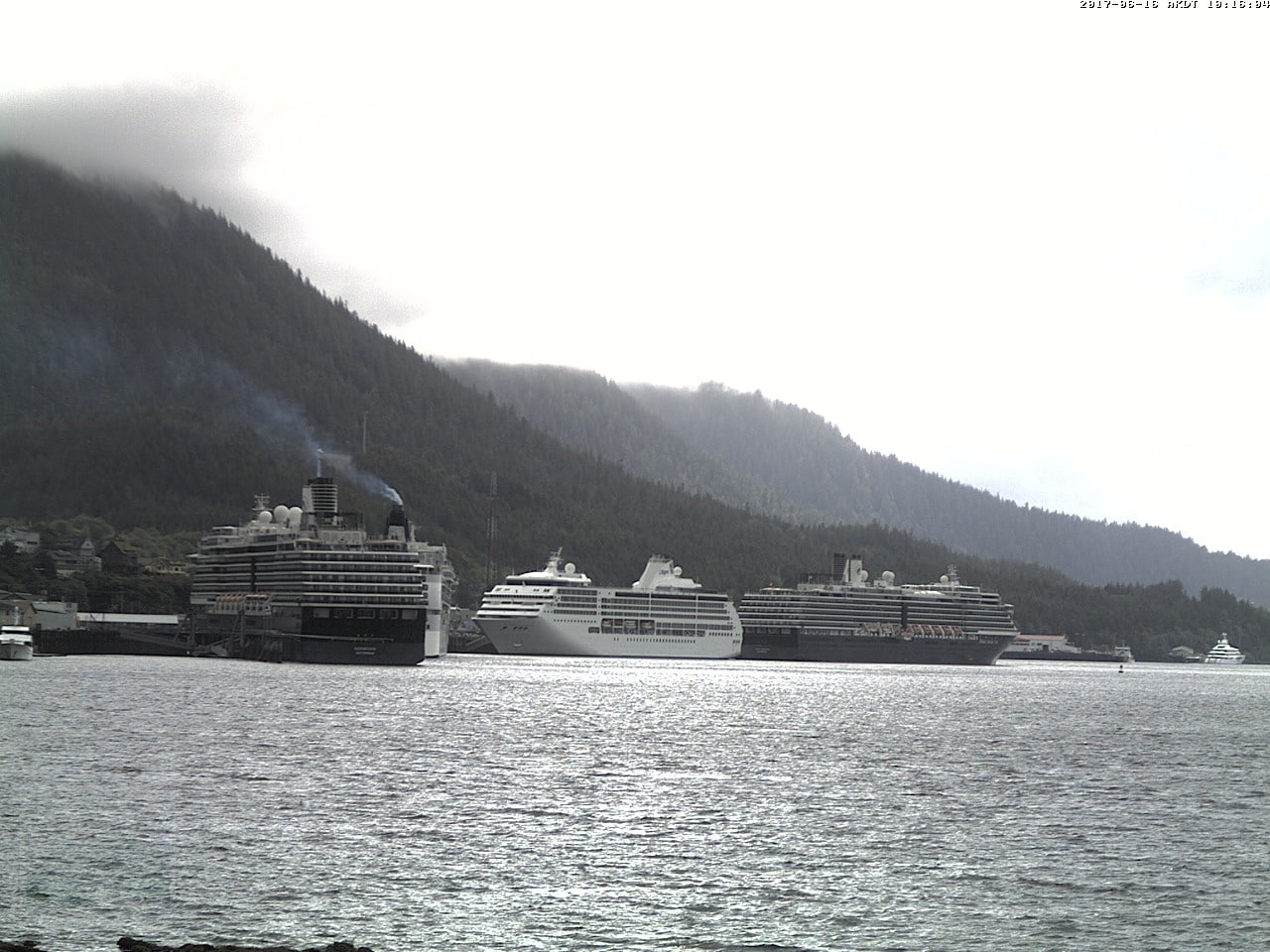
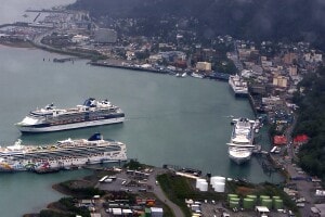
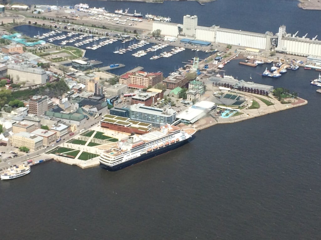
Today we had “Princess Day” in Juneau. Your good old Noordam was sandwiched in between three Princess ships. The Grand Princess, Coral Princess who were there when we arrived and who were later on followed by the Emerald Princess. Which meant that the whole port was taken up by one company. Sort of. Holland America is part of Carnival Corporation which consists of a large number of companies such as Cunard, Costa, Carnival Cruise Lines, Aida, P&O,P&O Australia etc. etc. But we are also part of a sub-division inside this umbrella group called HAG or Holland America Group. This group consists of Holland America, Princess and Seabourn.  It does not mean that we are all the same. Far from that. The products, the Brands, are totally different with each having a distinct clientele and target group.

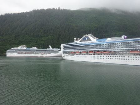
Two of the three Princess Ship in port today. To the right the Grand Princess to the left the Coral Princess.

Where we are coming together is on the operational side. Here we share the same “Marine Services” under the same Exe. Vice President and report to the same company structure which operates the ships. Everything in relation to Nautical, Technical, Ports, and other operational activities which support the product delivered to the guests falls under this Marine Services division.

And that is why I can say we are sort of the same company. When we go for our nautical training in the Netherlands, we do that at C-Smart which was originally developed within Princess. Classes are made up of officers from all the brands of the Carnival Corporate as the correct logic is that safe watch keeping principles and operation should not vary from company to company.  Operational maters are resolved in the same way at HAL and Seabourn as at Princess. We even have officers rotating through the three brands if needed. The other day we had a conference call to discuss certain procedures and it showed that everybody was on the same page and following the same routine.

The product we deliver to our guests makes the difference and both groups of officers are fiercely loyal to their own company in order to deliver that particular cruise experience to the guests. Also for the overland tours here in Alaska, the two company’s work closely together with good results as it is now much easier to share capacity in coaches, hotels and trains which in the past were kept completely separate. If the Holland America branch needs an extra coach then they can get it from Princess and vice versa. We are now in this process of close cooperation a few years now and my impression is, while only seeing small parts of the whole puzzle that it works quite swimmingly.

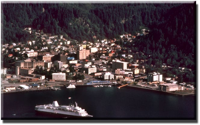
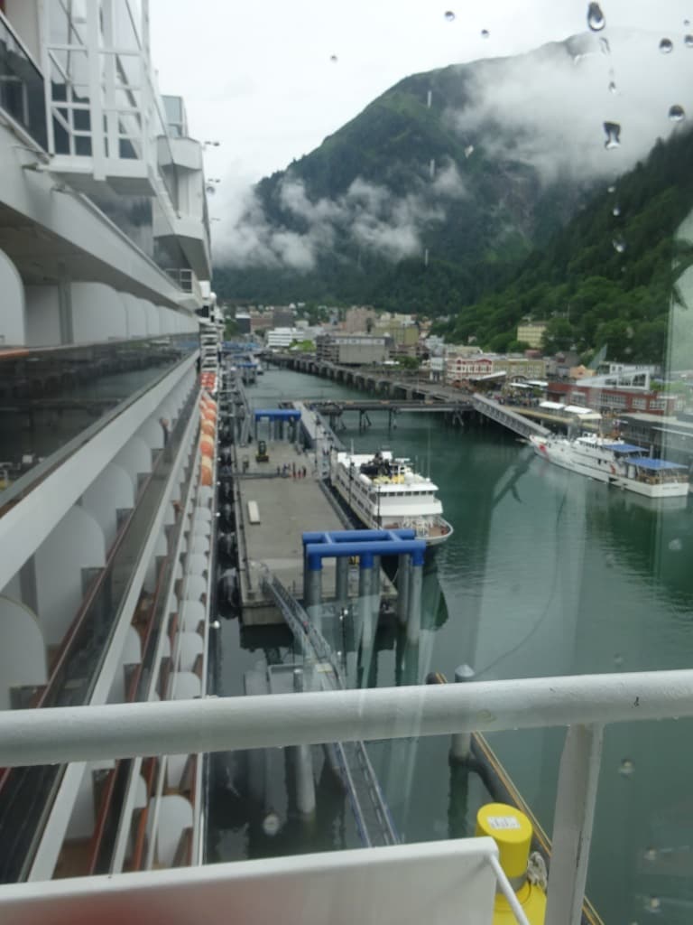
What has not changed is that we try to get the best spot for our ships and the best arrival times and that made that the Captain decide to arrive nice and early this morning to ensure that both gangways were out on time and everybody could stream ashore without any delays. Where possible we operate two gangways on arrival as in general all guests want to leave at the same time and then later we go down to one gangway as the return of the guests is normally a steady trickle.

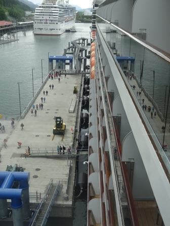
The pontoon and the ship go up and down with the tide. So the guests always have a almost flat gangway to walk over.

With the new dock in Juneau we have that two gangway option as the floating pontoon which makes up the center of the dock is just long enough to cover forward and midships stairway and exit. The rest of the dock is fixed and does not move and that is where the ropes go on the bollards. In an ideal world, we would like to moor completely on a pontoon, so the dock, the ropes and the ship would always move up and down with the tide in a status quo position but then you have to make the pontoon anchoring construction very strong. During windy weather, a cruise ship catches an enormous amount of wind and that force has to be absorbed then by mechanics which keeps the pontoon in position. Thus in Alaska they have opted for a pontoon / dolphin construction with the foundations hammered into the bed rock.

We will stay in Juneau until 22.00 hrs. and then sail for Skagway for an early morning arrival as there will be a whole parade of ships coming in at about 20 minutes intervals. Weather; more of the same, although we had hardly any rain to day,

20 June 2017; Ketchikan, Alaska.

We still had some good scenery while sailing through Grenville Channel but it was too misty to see any wildlife. Either they were obscured or the Bears, Moose and Goats decided to stay inside until it stopped raining. From The Triple Island Pilot Station it is only a short distance to reach the Twin Island pilot station in Alaska. We sail partly through Dixon Entrance and then hop over the border although nobody notices it. The only item of interest is that the clocks are going an hour back at 02.00 in the morning. We have been steadily moving west and Alaska is in a different time zone than Western North America. I suppose it makes a difference in the winter but with the long days here in the summer, you do not have to change the time to get more daylight here as we do in Europe.  It is daylight from 3 am in the morning until 10 pm. in the evening and then the night hours are not really dark either. More of a sort of prolonged period of dusk or dawn.

We follow the route of the dotted line in the chart. The west side route past the island is more used by smaller ships and tugs and tows.

We boarded our pilot at 04.30 in the morning to make sure that we would be docked before 07.00 in the morning. We only have a short stay here, sailing again a 15.00 hrs. Ahead of us was the Grand Princess who had to dock first as she was on number three northbound, while we were scheduled for nbr 2 northbound. That gave a bit of a strange picture today as on berth nbr 4, we had a Princess ship docked for southbound and behind us on berth 1 we had the Silver Shadow docked for southbound as well. The latter only makes a few cruises to Alaska and was thus lucky to have a berth as it could have been taken up by one of the regular customers but not all ships have arrived in Alaska yet.

This is what it looks like from the air. courtesy google.

The approach to Ketchikan differs from all the other ports because it is such a long time of standby for everybody. This has to do with the fact that Ketchikan lays fairly well sheltered in the Tongass Narrows behind Pennock Island. I am saying fairly sheltered as the winter winds and rains can still blow fiercely through the area but it is more sheltered than other locations.  Thus for arrival the troops on the bridge and on the mooring decks have to be in position once the ship start sailing through the east arm of Tongass Narrows keeping the island to the portside. This area is called Saxman village and because of the houses at the water’s edge, the docks and the USCG station the maximum speed is 7 knots to avoid wake. Then you have to slow down for the final approach to the dock and all in all, it takes over 90 minutes to get there. I am currently supervising and training the forward mooring deck crew and even with safety shoes on it is a chilly affair with cold feet on the steel deck, due to the weather being much chillier than it should be.

Stock photo Downtown Ketchikan, with cruise ships in port. We were at the spot of the blue hulled Holland America Line ship, only with the nose the other way around.

Because most weeks the ships docking are not the same, and thus not the same length, it means that when coming into position there is always an amount of “fiddling” going on to get the ship in the best spot. All focus is on the gangway location but we also have water breaks and sometimes a second gangway and they have to be clear of dock obstructions as well. Thus when we come in position and the Security Officer at the gangway has a final look, then quite often the call comes: “we have to go x feet or x inches forward or aft”. Long time ago I indeed heard the Security Officer demanding that the bow had to go 2 feet forward and the stern 3 feet aft.  He had to take stick for that for a long time.  We were docked fairly quickly today as we only needed to focus on the gangway location.

We sailed at 3 pm. and moved north. Due to the return of the tours we just made it on time as we had to leave on time, as it is a tight schedule to get on time to Juneau. We are scheduled to be docked at 10. am. but the captain would like to be a little bit earlier to help the tours get on the way.

Weather for tomorrow, more of the same, but maybe a bit more clear skies.

19 June 2017; Inside Passage, British Colombia Canada.

Seymour Narrows. The challenge is this big course change right in the area where the current creates eddies and does not follow the regular direction of the channel.

The weather is still not helping and this morning I really thought that I was walking around in a Tolkien book with Misty Mountains all around me. The captain did not have an easy night as by 22.30 visibility went down to zero and that lasted until 3 am in the morning after which it marginally improved. This was also the period when we went through Seymour Narrows and Race Passage; areas we prefer to go through when we can see something. Although we can do it safely on the radar, especially if you have been there before and know what is looks like in reality. You can super impose your own memory on top of the radar picture and build yourself a sort of 3D picture of what the situation is really like.

Blackney Passage. Again the challenge is the way the current will affect the ship due to the big course change. When the weather is nice and we have the time we sail past Alert Bay, but it is a much longer and slower route. So only worthwhile to do when we have guests on the outside decks.

From Race Passage the route took us through Blackney Passage. On the way back to Vancouver we pass this area in daylight and at a half decent time for the guests to be up and about. We then also have the option to sail past Alert Bay, but that takes more time due to the longer period of slow speed required. In the very early morning we might as well take the fast route as there is nobody around yet to enjoy the scenery, or the Orcas who show up here very frequently. Blackney Passage is also an area which requires a bit more focus and then we normally have the Staff Captain on the bridge as an extra pair of eyes, while the Pilot assisted by the Bridge Team keeps conning the vessel. The currents in Blackney seldom reach more than 4 knots but the challenge here is that it includes a more than 90o turn, going from a wide open area (Johnstone Strait) into a small hole (Blackney Passage) to reach Blackfish Sound. While doing that the current which is normally with you or against you, is pushing the ship all over the place if we are not careful.

After Blackney there are several ways to go up to Triple Island where the pilot station for the B.C pilots is located. We can go all the way outside, we can go all the way inside or we can do a combination. That depends mainly on how much time we have, what the captain prefers and what the weather is going to be like. Today the weather was lousy with nothing to see so the captain opted for sailing through Queen Charlotte Sound and then try for Grenville Channel. That is a very scenic route and often if the weather is miserable in the more open area’s the high mountains on either side of Grenville, tend to create a sort of Micro Climate.

When we got there is was marginally better, but still the weather remained damp and gloomy. However now the mountains are so close by that regardless of the rain you still get a very good impression of the awesomeness of the nature here. Grenville Channel has one challenge and that is traffic. There is not much of it, but if there is, then it normally affects you. Also this time; one southbound vessel which we would have exactly met in the most narrow part of the channel at Tom Island. Thus we had to slow down to wait until that ship cleared the narrow gap before we could go through. Tom Island is as far as I know named after a gentleman called tom who lived around the corner and operated a small Salmon Canning factory.

From Tom Island it was another three hours before we got to the Triple Island pilot station where we said goodbye to our two Canadian Pilots. From now on we are on our own until tomorrow morning at 04.30 when we will embark the Alaskan pilot at Twin Island which is about 20 miles to the East of Ketchikan. Only one pilot will come on board as it is only a short stretch to sail. The 2nd pilot will then simply walk on board in Ketchikan so we will have two pilots on board until after Glacier Bay.

Weather for tomorrow. More of the same 49of / 9oC overcast with a 55% chance of rain. I wonder what is happening to the summer here…………………

18 June 2017; Vancouver, Canada.

It was good that it was change over day today as the weather was not up to cruising standards, even for North West standards.  It was gloomy, chilly and rainy. Most guests transferred from the ship directly into a coach for Vancouver Airport or back to the USA; but a steady stream walked their own suitcases off the ship and around the corner to the big parking garage and some even further to the Sea Bus station so they were mostly likely people from North Vancouver who had made a cruise in their own back garden so to speak.

I had to run ashore briefly to comply with immigration requirements. Here in the port of Vancouver it is really confusing at least if you are not used to it. For the Canadian Government I am a regular crewmember as I work on board. If I want to be a passenger then that is fine as well, as long as I comply with the regulations. For the American Government I am a non – revenue passenger. Although I work on board I cannot be classified as a crewmember as that requires a different sort of visa; and I have one that allows me to hop on and off ships in USA ports.  To make things easy I was a passenger for both countries today………….. unfortunately that all stopped when I got back on board again and had to start working again.

I had to be off the ship by 10 am. and could not return until 11 am. after the CBP started their immigration process, so it gave me the chance to go to my favorite 2nd hand book store McLeod’s on West Pender.  They have so many books there, that they are off the shelves, piled up on the floor and in such density that there is a hardly any room left for clients to browse. Approx. 20,000 sq. feet of a book explosion. Although they do have a very large section on maritime subjects I could not find anything. Not amazing as my library is almost complete. Still there is always the chance…………….

The chart of Seymour Narrows with current vanes. As you can see the current does not follow the mid channel direction but bounces around. Hence the danger to go through with high velocities.

Now back to my story of yesterday about Seymour Narrows. I might have explained once before but once I went through Seymour Narrows with more than 7 knots of following current. I was 3rd officer on the Noordam in 1984 and we were coming south towards Vancouver. The captain was adjusting the speed for a 3 knots current transfer and then the emergency call came in that the Sun Dancer was sinking. The Sundancer was a cruise ship / ferry boat sailing from Vancouver to Alaska and the idea was that guests could take their own car/camper to Alaska. Coming north, the ship had somehow missed the turn and hit the rocks before coming to the Narrows itself but it did not ground. However the ship was taking on water and as a ferry is a sort of tin can, once a hole is punched in the can, the water can go everywhere. As it was uncertain that she would make the dock, a Mayday went out and we were requested to get there as soon as possible as we had all those lifeboats available. So we went through and that night I learned that you can go through with currents above 4 knots but there is no room for error left. The pilot only gave two rudder orders, one to port and one to starboard and we were through the hole. In the meantime the SunDancer had limped towards the dock at Campbell River lumber mill and settled against the pier there. So we were not needed.

The narrow part north of Vancouver Island. You can clearly see why the currents are so strong. As it only widens up near Port Mc.Neil. (Chart courtesy, Katiekat.net)

There is another strong current area a bit further north called Race Passage. But because you do not have to make a big turn and because it is wider, the current seldom goes above 5 knots and thus we can go through at any time. In the middle is Helmcken Island and if there is traffic then it serves as a sort of traffic cone separating the east and west bound flow. If there is no opposing traffic then all ships use the south passage as it is straighter.

Tomorrow we are at sea, sailing Queen Charlotte Sound and then another part of the Inside passage but the weather is to remain gloomy, rainy and foggy. Amazing because the Southern USA States and most of Europe is sweltering in a heat wave.

17 June 2017; Sailing the B.C Inside Passage.

Sailing the Canadian Inside Passage through British Coloumbia is one of the highlights of the cruise but it is sometimes a little bit under appreciated as all the focus tends to be on the Alaskan part. A 2nd challenge is that the scenic cruising takes place either on the first day of the cruise Northbound, or the last day of cruise Southbound, and then there is so much else going on. So for the guests it can be a very busy day if they want to partake in everything that is happening. The amount of Inside Passage that you see really depends on one crucial factor: Seymour Narrows slack tide. The ship has to make Ketchikan on time when going Northbound and it has to make Vancouver on time when going Southbound. So for an ideal schedule Seymour Narrows slack tide has to take place between 23.00 and 01.00 the next morning. With that time frame you can plan for regular sightseeing while keeping the cruise schedule and not having to race through the Inside Passage to make it on time. Unfortunately the tides do not always act in accordance with the Holland America Line cruise brochure so sometimes the slack tide is as early as 20.00 in the evening before Vancouver or as late as 02.00 in the morning when Northbound. And those 3 to 4 hours difference will play havoc with the time available for sightseeing.

Seymour Narrows is the smallest part in the waterways which separate Vancouver Island from the Main Land. We have to go through there if we sail from Vancouver. Otherwise we have to sail south to Victoria and then out to open sea via Strait Juan de Fuca and then back north again in the Pacific Ocean. Ships sailing from Seattle have that option and quite a few do so when the Pacific Ocean is in a good mood and the weather is quiet. They then miss part or all of the Canadian Inside Passage but compensates that with calling at Tracy Arm before going to Juneau.

Overview Map of Seymour Narrows. As you can see it gets very narrow at this point.

However we have to go through the Seymour Narrows and the problem is the currents. From Pine Island in the North West and from Victoria in the South the water can flow freely all the way around Vancouver Island. Not a problem in principle, it is just that the opening for that water to flow through is getting very narrow at Seymour Narrows. Make an opening smaller with the same amount of water having to go through and the result is stronger and stronger currents. With a spring tide running, the current velocity can go up to 14 knots and then you do not want to be there.

Safe passage is possible as soon as the current runs 4 knots or less. It has been done at a higher velocity but when doing so the margin for mistakes goes down to zero. So sticking with our safe philosophy of “there always has to be a plan B” we follow the pilot’s advice and go through with currents under four knots. Thus all the ships who have to go through, cruise ships, tug and tows, fishing boats and whatever else that travels up and down the Inside Passage aims for slack tide. The moment the current goes from flooding to ebbing and vice versa. They all know that will not work out as not everybody can go through at the same time but you have to aim for something.

Even in this photo from Google Earth you can see the tide ripping through the Narrows.

Then the tinkering with the times start. All ships over 300 tons in size have to participate in the Vessel Traffic System which operates through the whole area from Victoria to Prince Rupert. They advise the times which the ships are aiming for and then the pilots start to adjust what will work best for each ship. That normally results in a nice parade coming down and/or going up. The Captains who have been on the coast already know how this works so often they aim for a time well before slack tide so they can be sure to get through before the other ships want to go through. Log tows often need the exact slack tide to get their floats around the corners and as they block the whole passage, the cruise ships want to be passed them. More tomorrow.

Tomorrow we are in Vancouver and scheduled to dock at Canada Place West side by 07.00 hrs. The weather is remaining chilly 12oC /54oF which is really too cold for the time of the year and there is even a chance of a shower. But no wind is predicted and thus it will feel no colder than the 12 oC.

16 June 2017, Ketchikan, Alaska.

Ketchikan has been growing in the same way as Juneau, although it always seemed a smaller place as it did not have the Government machinery to sustain its existence. Ketchikan was always about logging and fishing and after the 1970’s it profited from the boom in Alaska tourism. Since then it has acted as the entry port to Alaska being within a 24 hr. sailing distance of Vancouver and Ketchikan. As with Juneau the tourism, apart from the tours, is concentrated along a fairly small stretch of land along the cruise ship docks apart from expanding for one or two blocks deeper into the downtown area. The rest is very much regular Ketchikan. Even with all the rain, it seems to be a nice place to live as a lot of the younger people, who go south for secondary education, return in larger numbers to settle down where they were born. Provided they can find work of course.

The port itself has grown along with the increase in number of cruise ships and with their size. There was in the past only 1 dock, the “Tongass Dock”; through the years it has now been transformed into dock 1A, 1B, and then extended with a dock 2, followed by a dock 3 and a dock 4. Currently even these docks are becoming too small for the ever larger ships to dock safely at and if it is decided to accommodate even bigger ships, then the docks will have to be modified again and extra bollards added. The ships are still sailing full, so finding guests does not seem to be a problem, parking the ships that bring them will need constant attention.

The docking sequence and location is decided by the local cruise ship agent, Cruise Lines Agency of Alaska, in discussion with the shipping companies. This is a considerable puzzle and most of the winter is spent on trying to figure out how the various size ships fit along the dock, while at the same time to coordinate the North bound flow, the South bound flow, and the few ships which only make a few or one call during the season. Several rules are taken into consideration and part of it is seniority. Holland America who together with P&O is the longest serving cruise company to Alaska has a certain amount of seniority with docking rights. P & O has nowadays a very low profile in Alaska so that leaves HAL followed by Princess. So we are at the head of the queue.

For Holland America it also helps that we have midsize ships, so it is easier to park us somewhere while still leaving space at the same dock for a 2nd ship. The real challenge starts if a cruise ship arrives that is too long for one dock but not long enough to completely occupy two docks and thus is wasting space. On a busy day that might result in such a ship having to go to anchor although it would land more guests. But two (smaller) ships alongside together still make more sense.

The port as seen from the webcam at the Cape Fox Hotel. In sequence: Left to right: Oosterdam (1A,1 B), Seven Seas Mariner 2), Norwegian Pearl (3), Noordam (4)

Once all that is sorted out on paper, the final headache arrives. Streamlining the parade of ships in and out of port. Nearly all captains want to arrive at the same time, as for a full day call, all company’s tend to go for 0800 arrival. That is of course not possible and thus a sequence has to be arranged so that the docking of each ship takes place in the most optimum sequence. In the past years we sometimes had issues with that when a new captain, who had never been to Alaska, could not understand why he had to wait for somebody from the competition. That resulted then in heated conversations between the pilots on the various ships who were caught between what made sense and the captain who paid their fees and simply refused to slow down. A pilot has the “conn” of the vessel for the safe navigation but it is hard for him or her to insist on a slow down if there is no danger to the navigation and a captain simply wants to arrive at a certain time.

But today in Ketchikan it all went as planned. The early southbound leaving ships were at the dock from where it was easy to depart. One North bound ship, the smaller Seven Seas Mariner just fitted in between the rest and as we were coming from the North as the last arriving ship, we got the most northerly berth so that we did not have to sail by the other ships to park ourselves.

A bit of a gloomy, rainy and chilly day in Ketchikan. the super yacht to the far right is called the Mayan Queen.  (Photo courtesy, Lesley Schoonderbeek who managed to find two webcams in Ketchikan, hence the different scenes)

Ketchikan did live up to its reputation and it rained off and on from dark clouds between clear blue skies. Tomorrow we are at sea and the captain is planning to do some extensive sightseeing while sailing back to Vancouver. It started out well as on departure Ketchikan we had a large pod of Orca’s close to the ship.

15 June 2017; Juneau, Alaska.

I have been visiting Juneau with the ships from 1982 onwards until now. It was never right to say that Juneau was a sleepy backwater as was and is the capital of Alaska with all the major offices located here, but outside the area which forms a sort of Government district things were still very much frontier like. When I walked up the main street for the first time 35 years ago, I had the feeling that I could expect Clint Eastwood to walk out of one of the Saloons at any moment. Most watering holes did indeed cater to the locals and some of the locals did leave their “home from home” flying out of the door or window or did not leave at all on occasion.


Good Old days? 1990 and the ms Westerdam is at anchor. Note the docks are empty. It was cheaper to anchor than dock, so there we went.

Tourism has been coming to the area since the late 1890’s as the Alaska Steam Ship company and the Canadian Pacific Rail road ferries sold excursion tickets to “The Great Land” as the nickname for Alaska has always been. But in 1982 Juneau it still did not look like a touristy town, apart from a few stores that sold T shirts, postcards and nick-nacks on the side of their regular business. Part of the focus of the crew in Juneau (as this was the port with a late departure) was the Alaskan Hotel with its steam baths, the Red Dog Saloon at that time still a real Saloon bar, and Bo ’winkles where they served carriage wheel size pizza’s. None of these places were very sophisticated and thus we loved them and “invested” a lot in the local economy there.


Phase two: Two extra docks have added. A Celebrity ship has just left the Cruise terminal and a S class is still at the Alaska Steam dock.

Fast forward 35 years and everything is tourism. Running all the way from the far out dock, to up the hill where in the past there was only regular housing. Bo ‘winkles has closed. A number of years ago they modernized and the crew stopped going as the atmosphere was gone (and everybody had to behave themselves), the Red Dog Saloon now makes more money on food and logo wear than on booze and a lot of the other Bars have quieted down as well. Last year the Alaska Hotel was still what it was, music and good beer but at that time the steam baths were closed so I have to check next cruise how the hotel is doing.


A view of the new dock from the bridge of the ms Noordam. Floating pontoons now hold the gangway and long ramps bridge the tides. The weather looks a bit gloomy but that has to do with the tinted bridge windows. The rain had already stopped earlier in the morning.

Although there is a lot of politicking going on, the city fathers have been wise enough to see that the cruise industry is a goose with a lot of golden eggs and they have plowed a lot of tax money back into the port. Latest addition is the extension of the Alaskan Steamship Dock and the Cruise Terminal (the old ferry dock) deeper into the harbor. The old docks are still there but a new one, able to take two 1000 foot ships has been put in front of it. With floating pontoons in the middle for the gangways, so the guests do not have to negotiate the steep gangway towers anymore which were needed to bridge the height during high water. Part of the old cruise terminal dock is now a smaller dock and today a USCG cutter was docked there. On the inside of our dock we had a small cruise vessel, the Sea Bird, which has been around since before 1982.
Today we had the Celebrity Infinity in, docked behind us an NCL ship, the Sea Bird and our good selves, altogether bringing about 8500 cruise guests ashore, which is just an average day for Juneau. Although it never became very sunny, it was mainly dry for the day which is not bad at all for sightseeing. A sunny day is nice but with sightseeing it gives glare and thus overcast weather has its advantages if you are planning to stand on top of a glacier.
We sailed at 18.00 hrs. and our next port of call will be Ketchikan. Due to the distance, we will not dock there until 11 am. in the morning so it is a short stop. We should be in port together with the Oosterdam which is on the seven day run from Seattle. It will be a very busy day there as apart from the two DAM ships, also the Norwegian Pearl is there, the Celebrity Infinity and the Seven Seas Mariner. That means about 12000 cruise guests will be running ashore to get the local T shirt.
Weather for Ketchikan: 51oF / 11oC overcast with a chance of showers. The guests should be very happy with that because Ketchikan is the rain capital of the world (with 332 days a year) and today it should be mainly dry.

12 and 13 June 2017; At Sea and Glacier Bay.

From Seward we sailed into the Gulf of Alaska which is the most northern part of the Pacific Ocean. And yes the ocean was very pacific, very peaceful this time. Apart from the long rolling swell (but only 7 feet high) there was nothing to bother us. That long rolling swell is something we cannot do anything about; we have open water here all the way to the South Pole more or less, so nothing stops the waves from being under the influence of the wind and the sun and moon. Swell is mostly created by wind that is not there anymore. That is the definition. Otherwise we call it waves.  Most of the swell in this area can have been created as far away as Hawaii or Japan.  Then there is the sun and the moon which has the influence on the water which results in high water and low water.  Although that only creates an up and down effect which we do not feel on the ship while sailing, but to get that water higher up the beach and to pull it away again there is a form of current in the water. And that also helps the swell to be more or less pronounced. But it must have been quiet further south as we had a very smooth ride.

We are now back in pilot country and during 6 of the 7 days of our cruise we have pilots on board. Two American pilots between Cape Spencer (near Glacier Bay) and Twin Island (east of Ketchikan) and then from either Triple Island (near Prince Rupert) or Pine Island (North west edge of Vancouver Island) all the way to Vancouver. As we sail in stretches longer than 8 hours, there are always two of them and they divide the hours between the ports up in an equal way. Why do we have pilots; because it is compulsory.  Without too much detail: if you had a big garden, and suddenly somebody wants to race around in there with a big truck, would you not like to sit behind the driver to make sure all went well, of even prefer to drive the truck yourself ? Governments all over the world think the same way and thus the USA and Canada require pilots for the Inside Passage.

Thus yesterday morning we embarked two Alaskan pilots at Cape Spencer and our first port of call was Glacier Bay. As we are still early in the season, it means that there are no “whale waters” yet. This is a phrase which indicates for the sailing fraternity that there will be no speed restrictions. Glacier Bay is a National Park and thus there is oversight by Park Rangers. At the entrance of the Park is a Ranger station called Bartlett Cove. From there the Rangers monitor the Park but also sail with the ships to narrate to the guests what there is to see and how to interpret what they say. As we still have guests who think Alaska is a foreign country and a whale is something only to be seen on TV, their presence is much appreciated.

But they also count the wildlife. (When we sail up and down the Bay, we often have a spotter on the bow who counts everything that flies, floats or swims by or is visible on the shore side) When too many whales have returned from their time in Hawaii, the Rangers order the ships to slow down when entering the lower bay (entrance of Glacier Bay) to make sure that the whales have time to react to the ships and the ships have time to take evasive action. Today there was only one whale messing around, but he/she gave quite a show for the guests. As the weather remained overcast and a bit rainy, it was a bit of a challenge for the guests to remain outside……………. But those who did, saw Mountain Goats and Moose. (What is the plural of Moose? Meese, or Mooses ??) The latter are not seen that often in the Bay but we had two clearly visible coming down the mountain ridge.

Tomorrow we are in Haines, with an expected over cast day with no rain, as far as we know as of this moment.

11 June 2017; Seward, Alaska.

Dear Readers, we have issues again with the blog. Now it seems that the system does not like it when I move from ship to ship. Once again the IT guru’s are investigating and eventually “all services will be restored”. Until that time I will start uploading again, only it will be without photos.    My apologies………….

Seward.

And thus I travelled from Montreal via Chicago to Anchorage. Leaving behind the Maasdam with her captain who was busy being involved with the opening of the new Montreal cruise terminal. When we arrived we found out that the terminal was far from finished and looked from outside and inside still very much like a building site. Thus a lot of work will still have to be done. Apart from finishing the inside they still need new access gangways, luggage facilities and a few mooring bollards at the stern would not be a bad idea either. Hopefully they will work hard and the Maasdam will reap the benefits during the remainder of the season.

I stayed overnight in Anchorage and was then transported to Seward the next morning. Seward is about a two hour drive south from Anchorage but the transfer time really depends on how many campers there are on the road. Today we were lucky they were all going the other way it seemed. If you are ever contemplating to buy a camper or R.V, then sitting along the road to Seward will give you the option to see about every model and size coming by to make up your mind. I counted at least 54 different versions before I gave up.

The Noordam had arrived at 06.00 in the morning and was docked nose out as that works better for the gangways and the operational setup. There was also change over day, which works totally different in Alaska than anywhere else. As about 90% of the guests are continuing their journey by going on overland tours, they leave the ship at the time the tour coach is ready for them. So it is a very gradual disembarkation process. The guests who are joining are mostly coming back from overland tours as well and they trickle in by the coach load in the course of the afternoon until just before sailing time.

So there is not the initial mad rush that we see in regular cruise ports where at least 50% of the guests are already sitting in the terminal and then together “invade” the ship within 30 minutes and because they are on a roll, do the same in the Lido Restaurant. The Alaska change over process makes for extra-long hours for the crew and thus they have to work different shifts to cover the whole period of 06.00 hrs. in the morning to 21.00 hrs. in the evening.

We also had a changeover of Captains today. Captain Henk Draper went on leave and Captain Peter Bos joined. Peter and I joined Holland America Line about 3 months apart in autumn 1981 on the good old Statendam and sailed a lot of years together. Always just one rank apart as he joined as 3rd officer and I as 4th. officer. We even sailed out the ss Rotterdam together in 1997 which was a very memorable cruise as we pulled out all the stops of our imagination to send the 1000 guest’s home with the best memories possible.

The ms Noordam is employed on the 14 day Alaska Service, which starts in Vancouver and then goes to Ketchikan – Juneau – Skagway – Glacier Bay – ending with a turnaround in Seward. Then the ship retraces its route but substituting Haines for Skagway on the way back to Vancouver.  The ms Zaandam is the alternating ship which goes the opposite way. Holland America has been operating these cruises since the early 1990’s when for a number of years the ss Rotterdam inaugurated and maintained the service. Holland America then opted for Seward instead of Whittier (The Princess stronghold) as it liked the dock and it had an easy option there to connect with the railroad system to take the guests into the interior.  Also the Seward dock is much more sheltered than any other port in the area, it being surrounded at all sides by mountains.

We left at the scheduled time of 20.00 hrs. and then sailed out into the Gulf of Alaska. Tomorrow we are at sea and then we will be in Glacier Bay. Seward gave a rainy and chilly day and the Gulf will not be much different. Luckily very little wind and only a low swell which helps with everybody staying clear of the “Mal-de-Mer”

09 June 2017; Quebec, Canada.

The city looked very nice when the ship came around the corner and approached the berth. As mentioned before, the St. Lawrence makes an almost 90o turn just south of Quebec and thus the ship has to come around a corner before it can make the final approach to the dock. As we had the sun behind us, it shone over the North bank of the city, and gave us the best view possible of Chateau Frontenac on top of the hill. It is not a real castle but a Hotel built by the Canadian Pacific company about 150 years ago but it looks like a French castle on steroids. In those days people were willing to invest in hotels that made a statement and thus the interior is breath taking as well. So nice that they charge couples getting married 450 dollars just for the privilege of having a photo taken on the stairs. If that is the cost for a photo, I wonder what a complete wedding there will cost.

Chateau/hotel Frontenac on top of the hill. Also note that the dock walls are much more visible now. The water has receded considerably. The white ship with the multi colored funnels is a sightseeing boat and the blue one behind it is the local ferry for crossing the river to the southbank. Which is a short cut to avoid the Quebec Bridge a few miles further upstream.

We arrived today with the full flood current running and thus the decision was made to dock with the nose in the current as it is a lot easier to control the bow in the current than the stern. The sharp bow is much easier pressed/pushed through the current than the blunt stern is. This meant swinging around on arrival and dock with the nose downstream. It will mean for tonight that the ship will have to swing around again before it can head up river. Not much of a problem it is just that while swinging around the ship is carried about a mile by the current while making the turn.  So this morning the turn was started early and by the time the turn was completed we were just passed the assigned dock and only had to sail a little bit forward to get in position.

Fresh fruits and vegetables coming on board. Everything is unloaded to be counted and then lowered into the ship by forklift.

I blogged last week that the river level was very high and floodings were happening shore side. Well upstream the torrential rains have abated and the river is now 6 feet lower than 7 days ago. The parking garage opposite the ship is back in use so all is well in Quebec again. The ship took the opportunity load fresh vegetables and fruit this morning as the dock here is ideal to have a truck and a forklift on the dock. There are wide fenders and that makes it easy to lower a cage with the pallets in it to the provision break of the ship. A cage is needed as with the river level going down, B deck is now under the pier again. Last week we could just shove the pallets in.

We docked the wrong way around to day because of the current. (Photo courtesy Safety officer Wouter Koolhaas)

Tomorrow we will be in Montreal and if all goes well then we will be docking at the regular passenger terminal again. In the last 16 months they have spent 78 million dollars on it to upgrade it so I hope it will be wonderful. Nobody really knows as until today our agent had not been able to get inside as they were not finished yet. So tomorrow there will be the Mayor and a host of other important people present to cut the ribbon and speak some wise words.

I will not be part of those festivities as I will be leaving the elegant and beautiful Maasdam and transfer to the ms Noordam. Flying from Montreal via Chicago to Anchorage. I will spend the night there and then travel the next morning by car to the ship which is docked in Seward. Which means there will be no blog on the 10th and the 11th. as I do not find airport terminals very inspiring. I will be back on the 12th.

Note: I had a remark from one of the readers a few days ago that when you clicked on a photo — to make it larger — nothing happened. That might have to do with the way I upload photos as the bandwidth on the ship was not that great. Holland America is working hard on improving that and it also benefits me. So I am now trying to upload higher dpi photos. Let’ see if that works and if it solves the challenge.

« Older posts Newer posts »