We left Hamburg in the early morning and turned the ship around as I explained yesterday. Such a maneuver is not done “ off the cuff” but carefully planned so all the officers know exactly what the captain, or his designate who carries out the maneuver is going to do and when. If the officers fore and aft have the exact maneuver also in their mind then they can report in what they see fore and aft while retaining the same mental picture.
Departure Hamburg during the ebbing tide. As usual we try to use the current as our friend. Put the bow in the current and have it pushed down stream while keeping the stern in position with the main propellers.
Then we sailed down river and just after 9 am. made the sharp turn to starboard and into the Brunsbuttel locks of the Kieler Kanal. Although the official name is the Nord- Ost See Kanal, the name Kaiser Wilhelm II Kanal is also used after the Emperor who opened the canal. It was opened in 1895 but was between 1907 and 1914 already widened due to amount of traffic and larger ships. Holland America has a claim to fame here as the Rotterdam III was the first commercial ship (Commodore F.H Bonjer) that sailed through the Canal following the imperial yacht Hohenzollern with the emperor on board. A Dutch flagged ship was chosen to avoid international bickering about who was more important. The Kingdom of the Netherlands was neutral in European matters so it was the best way out for Germany to keep France, Russia and Great Britain from complaining. The Canal was officially built to reduce the time for ships traveling from the Baltic to the ports in lower Europe and vice versa. Otherwise you have to go all the way around Denmark. The un-official reason is that the Canal was very handy for the German War Fleet to get from the Baltic to the North Sea and vice versa without giving Denmark or Sweden the chance to make things difficult by closing the narrow through fare off between Helinsingor and Helsingborg.
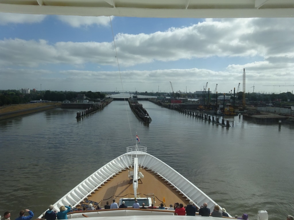
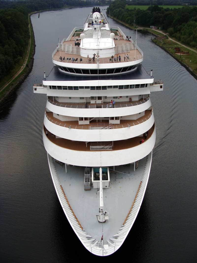
Entering the locks at Brunsbuttel at the Elbe River side. There is a second set of locks to the far right, which is at the moment under re-construction.
There is ample space for the Prinsendam and also larger / read longer and wider ships / to fit in the locks and go through the canal. That is not the problem. The challenge is the height of the ship above the water. There are a number of fixed bridges over the canal and we have to go under them. The Prinsendam is prepared for it as she can lower the top of the radar mast. Some ships also have to lower the funnel (they do that by tipping the top over) but the Prinsendam funnel is low enough. When we book a transit for the canal, one of the things we have to do is to send in a certificate which is approved by Lloyds and which clearly states how high the ship is above water including the draft variations. In the past it has happened a few times that the measurements forwarded to the canal authority where not exactly correct and a bump was the result. Since then a Lloyds Certificate is required.
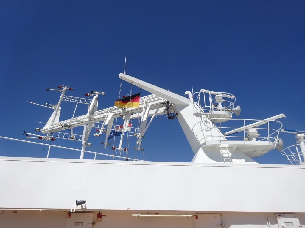
Folding down the top of the Radar Mast to avoid bumping into the bridges.
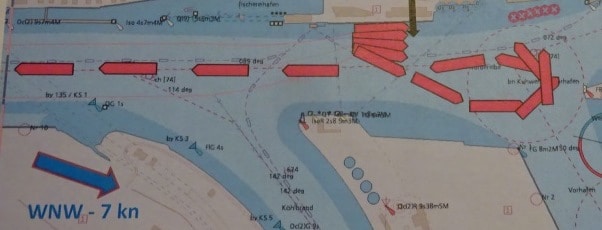
The Kanal has a length of 98 kilometers and the average speed going through is about 10 knots, with stretches where the ship can do 12 and there are some – inhabited areas where the speed has to go down to 7 or 6 knots. Then there are moments that big ships have to pass each other and then one ship will go against pillars at the side of the canal and lean against it. The 2nd part of the canal is the smallest, the part towards the Baltic, and there no traffic can pass each other, so ships wait at moorings until the North bound convoy has passed. In similar style as in the Panama Canal where ships wait in the Gatun Lake. While going through the Canal we have a pilot, who changes half way through the canal, but the pilot also brings helmsmen to steer the ship. They know exactly how to stay in the middle of the canal or to slow or to veer off the center track when there is opposing traffic.
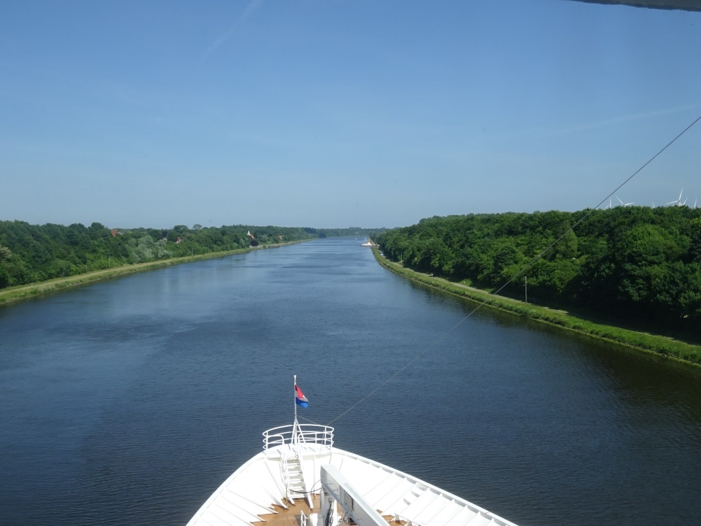
Entering the narrow part of the Canal. There are only a few bridges and the only other way to cross is by small ferries which can be found along the Canal at regular intervals.
By 1830 we were at the end of the Canal at the Holtenau Locks which give access to the Ost See or in English the entrance to the Baltic. This area is called the Kieler “Bucht” or Bight and when we exit the canal it has served the purpose for normal ships of not having to sail around Denmark and for us to have had a very nice scenic day. And we did have a very nice day. With the combined experience of Captain Dag and I we can say that this day was one for the record books. Sunny but not too hot, a gentle breeze but not windy, and a transit all the way on schedule. It is not often that we have all those elements coming together in one day.
This evening we will sail past Kiel and in the lower Baltic and then follow the German coast by going North West towards Tallinn, were we are spend the day, the day after tomorrow.
Expected weather for tomorrow: Sunny, low sixties or around 16.17oC and a gentle breeze. And that gentle breeze should (hopefully) just be enough to keep those low hanging white clouds away.
A view of the Prinsendam from one of the bridges. Taken in 2009 while going through the smallest part of the Canal.

Leave a Reply