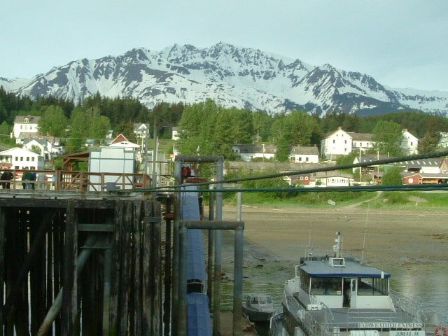
Exactly as planned the cruise ship parade entered Ketchikan and docked at their respective berths. By 07.30 all gangways were in and approx. 8000 eager invaders could descend on the town. About evenly split out between those going on tour first and those going on tour later. A big attraction is the local lumberjack show which highlights how logging was done in the past with a sort of competition element added to it. This show has been around for a while and has so much appeal that Holland America has its own lumberjack on board. I did not get the chance to see him in action but the one we have was a world champion axe thrower sometime in the past and part of his stage show is letting the guests have a go at it as well.
Ketchikan lived up to its expectation of the rainy capital of the world and for most of the day a steady rain and drizzle ensured that the town will keep the record for next year as well. My morning was taken up with organizing the weekly fire drill and as it was being held in port, we opted for putting a public room on fire — simulated — that is. When we drill on sea days we use locations away from the guest areas but with nearly all the guests ashore there is the chance to train dealing with a public room emergency. The drill itself takes about 30 minutes, preparing a lot longer. (The faster the drill goes, the quicker it means that the teams have secured an area and extinguished the fire, or whatever emergency we were simulating) My good friend Murphy has a representative on each Cruise ship in the world and one needs all his experience to be cleverer than he is.
So it starts a few days before by arranging with the Event Manager to have a space available. This time I wanted to use the Cinema/ Wajang Theatre/Culinary Operations Center, our multi purpose entertainment area. It would not do if there was a cooking demonstration going on and suddenly 5 guys with a fire hose were charging in.
With the room secured it was time to become my “nasty self” and start thinking about the scenario and what I can throw at the attack teams and the support behind it. Make the fire location in the furthest corner and we will find out if their hoses are long enough. If not, then do they follow the correct procedure for getting longer ones? To simulate the fire location I borrowed flashings red lights from the stage crew. As it is a cinema you can switch off all the lights. This is different to the rest of the ship where the emergency lights (about every other light) stays on, and it very hard to switch off. In the cinema everything goes out, except the Green EXIT signs near the doors. Installing a smoke machine in combination with all the lights out, and it becomes nice and spooky. I wanted sound effects as well but it did not work out. (See Murphy is here !!!!) Final touch was to put the dummy inside, our in house permanent casualty, in the middle of all the seats so it would be difficult to retrieve. When fire teams enter a large area, they move along the wall/bulkhead in order not to get lost. If there is a casualty in the middle of a large space, then they have to use a special technique to get there without losing the rest of the team in the dark as there is no visibility due to the smoke.
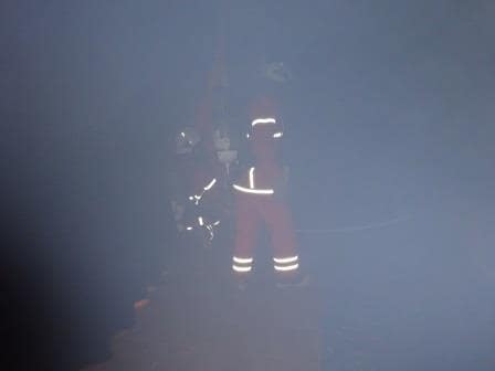
This is what the Fire teams saw inside the cinema. Apart from the smoke; not much
With the venue set up and the scenario in place, there was one last thing to attend to: guests milling around. Although most of them are ashore, there are still some on board and as with any crowd, they always want to be where we do not want them to be during the drill. So the Front Desk had to be advised that I was closing fire screen doors to keep the drill area sealed off. They did not get any complaints so all the precautions must have worked.
The night before I had sent out a scenario and objectives email, giving everybody the chance to prepare and think about the drill, as our drills are always part learning, part exercise. ……………Unless we do an un-expected one.
All in all about 5 hours work, for a drill that lasts 30 minutes. But those 30 minutes are really intense as it has to go fast. We do not have the option as you have ashore to evacuate everybody and to attack from a safe distance. No we are sitting on the fire itself and we have to attack from inside. So speed is of the essence to keep a fire from spreading. And that we achieved again today.
The very final part of the whole sequence almost as important as the drill itself, is the debriefing. Here all the teams explain what they have been doing: Bridge, ECR, ( Engine Control Room) Fire teams, support teams etc. etc. There are so many people involved that only during a debriefing does every participant get the whole picture. That normally takes as long as the drill but it is of vital importance, as lessons learned can be applied to the next drill.
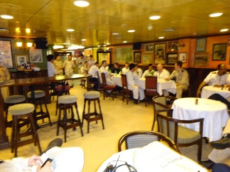
Debriefing in the Officers Mess / Bar which resembles an Irish Pub.
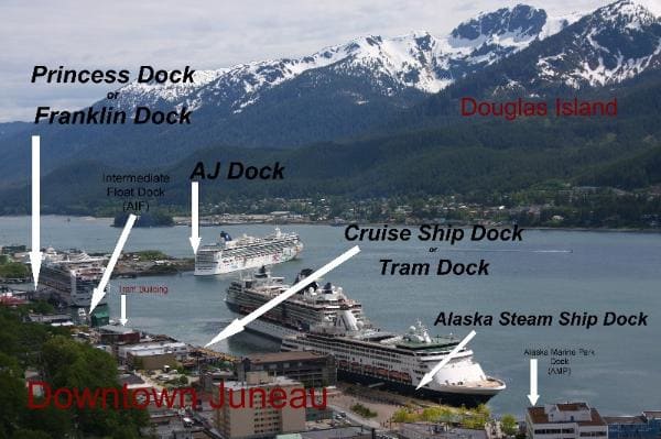
Tomorrow we will be in Juneau. That will be my last day on the Zaandam. In Juneau I will transfer to the Statendam for the next ship visit.