- Captain Albert's Website and Blog -

Ocean Liner History and Stories from the Sea, Past and Present. With an In Depth focus on Holland America Line

Category: excludeRecent (page 15 of 82)

10 April 2018: At Sea.

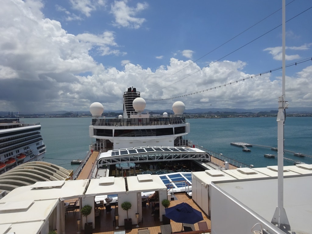
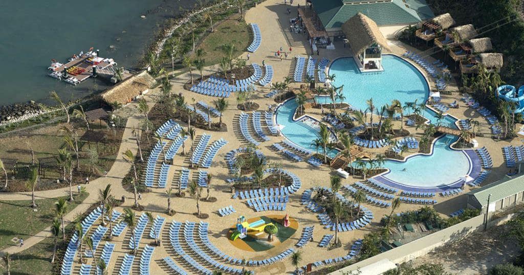
Today we are hurtling with the low flying speed of 16 knots towards the Island of Roatan off the coast of Honduras. Although we are calling at that country, we will not notice much of it, as we are calling at an island with a custom made Resort, built by our parent company Carnival Corporation. Before Mahogany Bay was opened, there was one cruise dock which could take one ship. That dock is still in use when the two berths at Mahogany Bay are full. Quite often we then see a ship belonging to the competition going there. They can also use our berths but only if we are not there.

In the years B.C. (Before Carnival) Holland America used to go there on occasion; mostly during the Christmas cruise when marketing had glued two 7 day cruises together into one 14 day Holiday cruise. I cannot remember what the guests thought about it in those days but we were not impressed. The dock was always occupied by another ship and thus we had to anchor. The East Bay is quite deep and then becomes shallow very quickly and thus we had to drop almost 300 feet of chain before we even touched the bottom. That was not very pleasant when there were squalls coming over and you wanted to raise the anchor quickly. And with the old Nieuw Amsterdam, Noordam and Westerdam you never knew how fast and how much the anchor winch could pull. Tomorrow we dock and now have no more worries.

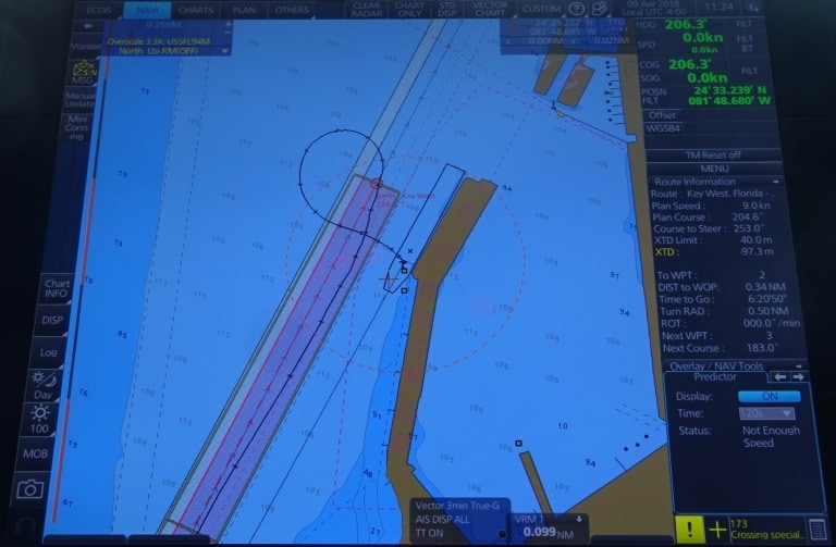
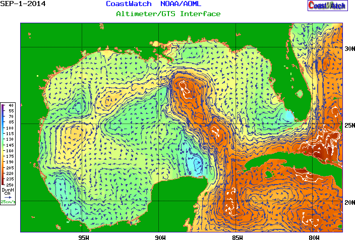
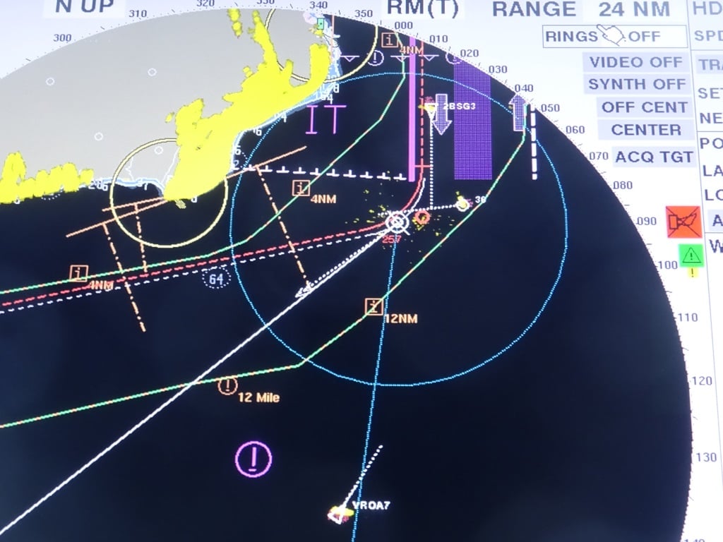
Approaching the VTS, ships highway at sea off the coast of Cabo San Antonio. We are in the top right corner at the end of the white (course) line. There are a few ships around indicated by the yellow dots and the green speed arrows but in general it was a very quiet day today. The green/yellow dot next to us is the Caribbean Princess and on the right hand side of the radar screen you can read her navigation particulars. Most important it says CPA 6.93 miles = Closest Point of Approach.

This morning at 09.30 hrs. we passed the west coast of Cuba, Cabo San Antonio, and then sailed into the Caribbean Sea. The moment we did so, the wind started to breeze up as the Trade Wind is quite strong at the moment due to an extra pressure system laying somewhere in the North Atlantic. But it should calm down again somewhat during the night.

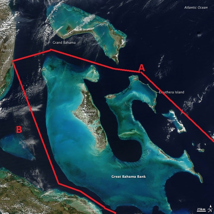
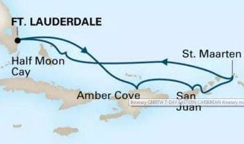
This area of the Caribbean Sea is called the Yucatan Channel as it is located between the Yucatan Peninsula to the West and Cuba to the right. The border between the real Caribbean Sea and the Straits of Florida are a little bit fuzzy as it is all wide open water. For me it roughly starts North of Cozumel and then it stops once past Cabo San Antonio but that is more art than science.  Explorers in the old days, on their slow moving sailing ships, had not much to do so they named everything they could think of. Sometimes after areas at home, sometimes after King/Queen and country and sometimes after themselves.  And thus they were not happy with just naming the whole area Caribbean Sea but gave a different name to the area under Cozumel Island and that has the name of the Gulf of Honduras and stretches from Belize down to the Honduran coast.  That area we entered late this afternoon.

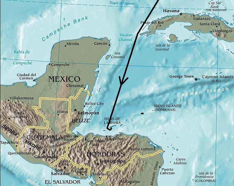
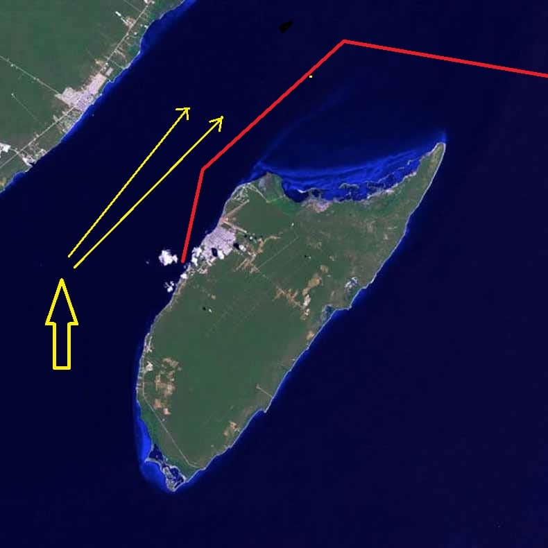
Our course down to Roatan, sailing through the Bay of Honduras.

From Cabo San Antonia it is one straight course down to Roatan. Which is not an island by itself but belongs to a group called Islas de la Bahia or: the Bay Islands. We call it Roatan Island but that is not correct either. Roatan is a town/settlement on the west side of a long and narrow island with the main town of Santa Elena at the East side. The island is called Isla de Utila and is flanked by either side by a very small island. The one on the left is also called Isla de Utila and the one on the right is Isla de Guanaja.


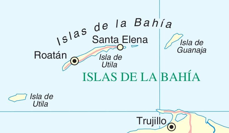
The Islas de La Bahia with Roatan in the middle. (Thank you Wikipedia) Trujillo is an important port on the North Coast of Honduras.

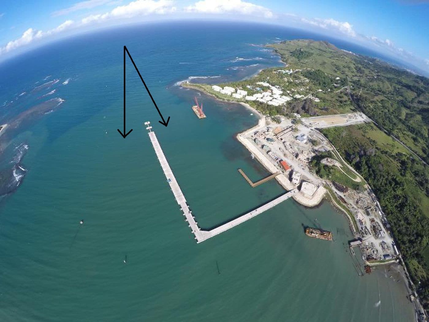
Mahogany Bay is located on the south side of the main island and is in general very well sheltered, except if there are squalls coming through, which can change the predominant Easterly wind to S.E., South or S.W. and then the ships have to be ready with their thrusters so they do not get blown off the dock. We will approach Roatan from the west side and sail between the two Islas de Utila towards the pilot station. We are expected at 07.00 hrs. and as we are supposed to be the only ship, we will dock as deep as possible in the Bay, getting as much shelter as possible from the strong Trade Winds. Weather, overcast skies with a chance of a squall are expected but it will be warm and humid with temperatures up to 27oC / 81oF. I hope the guests will be careful as you can get a sun burn here even if it is overcast.

09 April 2018: Key West, Florida.

Tampa to Key West is a “Pedal to the Metal” run and with going full out the ship can just dock comfortably before 11 am. If you have a fast transit down Tampa Bay then you have a bit of leeway in the schedule but if you have to wait for opposing traffic or you have slow tanker ahead of you, then it is a tight stretch to remain within in the schedule. Luckily Tampa transit was fast last night and the weather good and thus the ms Rotterdam was at the pilot station at the arranged time of 10.00 hrs.

Navy dock mole, swinging on arrival. If you compare the size of the ship with the size of the channel you can see it is not very wide and with a lot of wind there can be problems in the approaches but you cannot go outside the channel as you can do here.

Because everything here is as flat as can be, I think Key West Mountain is 60 feet high at the maximum; we can talk with Key West pilot station while we are still a long distance away. That gives the pilot the sufficient time needed to get ready and we know that he will be out on time as we could give sufficient notice. It also gives the local police or harbor master the chance to carry out their pre arrival security inspections. This includes look for suspicious objects, damage to the pier, flotsam and jetsam, or boating people (canoe’s etc.) hiding under the dock.

A number of years ago when I arrived here with the Statendam we had the VHF on the right channel and we followed a rather bizarre discussion on the VHF. It turned out later that they were doing an exercise and the boat had to find a suspicious package. Because that was not happening, the man shore side was getting a bit restless as we were coming closer and closer:

Shoreside: Have you found anything yet”

Boat: yea we found a broom.

Shoreside: Are you sure it is a broom?

Boat: yea, it has a stick on one side and red hairs on the other side.

Shoreside: Never seen a broom with red hairs.

Boat: that is because it a Cuban broom, they have red hairs, it must have drifted in.

Shoreside: Cuban brooms are not allowed in the USA.

Boat: Shall I tell it to go back or shall I arrest it?

Shoreside: Hold on, let me call the supervisor……………………

Until this day, I have never found out, if this was serious, or a VHF channel 6 staged Abbott and Costello imitation performance. But I have to think about it each time now when the ship calls the pilot and we can see the pilot boat coming out and a second boat going around the dock.

Getting into port in Key West is easy because it is a straight channel with only two course changes. Getting into port can be difficult as the channel is narrow and the wind is nearly always perpendicular over the fairway. To stay exactly in the middle, the have installed leading lights, which makes it easier to see quickly if you are drifting or not. Today we did not have that much wind and we sailed in nicely according to plan.

The leading lights in the pre electronic paper days. At nbr 8 we change course to the next leading lights and then at nbr 12, and then one more time at nbr. 14. all the time there are leading lights to keep us in the middle.

The leading lights for the first course into the channel are just poles standing in the middle of a park and at the beach edge. In the chart to the left, they are located close to nbr. 14.

We were assigned at the Navy Pier. The Carnival Glory was at the B pier and the downtown pier was empty, so no ship would interfere with the sunset over Mallory Square. Today there was hardly a cloud in the sky and thus sunset should be quite sensational tonight. We swung on arrival, courtesy of being nicely on time, and thus we will not bother anybody with sunset while we head for our next port of call; Mahogany Bay in Roatan.


So tomorrow will be a day at sea as Honduras is quite a way down south into the Caribbean.

04 April 2018; San Juan, Puerto Rico.

Today the good weather held and it was a nice and sunny arrival. And it remained sunny until around 5 pm. when dark clouds started to gather above the Tropical Rain Forest on the south side of the Harbor. It was again a quiet day in port with only the Carnival Glory and Silversea Muse to keep us company. The Glory was docked at the east side of Pier 4 and we were at the west side. 14 days ago we had the same situation but then for reasons unknown we were split up and docked at two different docks.

The ms Eurodam docked at Pier 4 together with the Carnival Glory, as seen from the ships tender. The white spot on the hull in the middle of the ship is the tender platform used for the assessments.

My last day here on the Eurodam was taken up with Tender assessments. This is a yearly test for all the deck ratings (Bo ‘sun, Asst. Bo ‘sun, Quartermasters, Able Bodied Sailors, etc.) who hold a tender driver certificate. In the archives of this blog you find some stories from me about giving these training’s if the numbers on board were getting low. Since this year we do not have to do that anymore as the company has now added two real ships tenders to the training center in Manilla where a week long course is given.

So now on the ships we are limiting ourselves to the yearly assessment of the skills. You might say, is this needed, and the answer is yes. Not every ship calls at anchor ports on a regular basis and thus a sailor might not drive a tender for his whole period on board. Coming summer the Eurodam will dock everywhere in Alaska and will only need the ships tenders when it returns to Half Moon Cay and only then when the shore tender capacity is not sufficient. Thus we do an assessment to see if all the basic skills are still there and if they can still dig up all the other knowledge from past learning when the question comes up. …………………………….What do you do when…………….

We like to use ports such as San Juan and Charlotte Amalie for these activities as there is no passing traffic that pulls large wakes. We see that in some other ports where local traffic seems to be totally oblivious of how dangerous it is to have a tender riding up and down along the dock while Grand Mother is trying to embark. Not to mention Mr. Jones who is not willing to hand over the sombrero and camera he is holding in his hand while entering the lurching tender.

For this assessment we rig up the tender platform and the tender driver has to dock portside alongside, starboard side alongside, dock with one engine, dock with one engine on fire etc. At the same time the tender driver should not forget to play the right arrival or departure announcement and also should keep an eye on the Tender helper who has to take care of the guests in the tender while the driver sails the tender. Then they have to be proficient in using Checklists; for preparing the tender, for collisions, for grounding, for a Person over Board and for sinking. If such an emergency occurs they should be able to take all the appropriate actions at once and then verify it with these checklists to see if nothing has been forgotten.

This afternoon we had the extra challenge of a strong wind gusting around the bow of the Eurodam which meant that the tender drivers had to remember: “Use the wind as your friend and not as your enemy) With other words, if you can use the wind to help you dock, do so, and if you can’t then overshoot a little bit and then let the wind help you drift back to the dock. That is quite a challenge for sailors who are often better with their hands than their minds. But as every time happens, the moment you put them in front of a challenge, all the wise training lessons from the past drifts up again to the “operations center” and they know what to do. Today everybody was capable enough to get my seal of approval and they are all good again for a year.

This evening the Eurodam will sail at 8 pm. and then head for St.Maarten where we will arrive around 08.00 hrs. There will be quite a few ships in port so it will be busy in downtown. I will be leaving the ms Eurodam here and fly to Tampa, to pick up the ms Rotterdam on Sunday. So for the coming days there will be no blog as I feel somewhat limited in telling stories about planes and hotel rooms. Although I am scheduled to visit a Chinese Biergarten in Tampa and I have no idea what that is supposed to be.  Sauerkraut with Chopsticks??? That might be a good story for the blog.

A last look at the Eurodam from the Radar mast, while in port today. In the front are the private Cabana’s and above the magrodome of the pool, and the Tamarind Restaurant, which makes the Signature Class (Eurodam / Nieuw Amsterdam) different from the Vista Class. (Zuiderdam etc.)

03 April 2018; Amber Cove, Dominican Republic.

With dark clouds gathering above the hills around Amber Cove it did not look as if it was going to be a good day. This weather was not in the weather forecast for today but in the forecast for the day after tomorrow. However there is always hope that these are only “Caribbean Clouds” as we call them. They gather during the night and often release some rain when the temperature goes down and the outside air reaches its saturation point due to that drop in temperature. Then when the sun rises, the temperature goes up and the rain clouds dissipate and the moisture it contains is just added to the high humidity again. That does not always work, if the local weather is disturbed by a cold front coming down from the North Atlantic, but if the weather is stable then you can more or less count on it.

The dock at Amber Cove which can handle two ships. Here an Aida ship as Aida is also part of Carnival Corp. Note the little bike taxi’s available for those who are not as agile as they used to be.

And today we could count on it. An hour after arrival, the dark clouds had moved away and it turned in to a perfect Caribbean Beach day. Although technically we are not in the Caribbean but in the North Atlantic. I mentioned last week that Amber Cove is an artificial port, constructed with the help of Carnival Corporation, and thus it is used by all the Brands under the carnival umbrella. So you see Carnival ships there, Princess ships, Cunard ships and Holland America by means of the Eurodam and the Koningsdam. Because cruising is becoming more and more popular and there seems to be no end to the demand, the cruise company’s deal with it in two ways. A. bigger ships B. more ports. Building bigger ships is not so difficult as a shipyard will build anything as long as you pay for it. More ports is not so easy as you have to find locations that are sheltered, are deep and safe enough for the ships to get in and out, and fit in the average cruise voyage plans of 7 to 10 days.

Aerial view when construction was not yet completely finished. But it gives a good idea of why it is so popular with families. (Photo Courtesy Carnival Corp)

Thus the companies are looking for options in the 7 day “maximum travel distance”. Somewhere out there must be a Cruise Destination Explorer, who peddles from bay to bay around all the Caribbean Islands and then thinks ”can I park a cruise ship here”. With the very modern ships, that might look like apartment buildings but are very powerful sea ships, they have those options.  If you would look at the cruise ships from the 1980’s, then these ports would be hardly worthwhile to build as quite often the wind would be too strong to let them dock without tugboats. And in these ports there are no tugboats of course. But now the ships have bow thrusters and Azipods which are so strong that they can visit when the wind blows up to 25 to 30 knots or even more. As an example the ships of the Allure of the Seas class, have over 30,000 horse power of bow thruster capacity; that is more power in the bow than our Prinsendam has in its whole engine room.

For those who do not sun bathe, there is also shopping and related options to enjoy.

This means that areas can be developed that would have been a complete no-go in the past. When constructed the understanding is there that once in a while a ship will have to cancel because the weather is simply too inclement. That happened to the Eurodam four weeks ago when heavy storms on the North Atlantic caused mayhem on the US Eastern Seaboard and the swells they generated caused mayhem in the bay of Amber Cove. The bay is sheltered on three sides but not to the North side and that can cause in the winter time the occasional problem. But with spring coming, I think that cancelling Amber Cove will be not happen anymore until December of this year at the earliest, if then, as it all depends on the angle of the Wind in those winter storms.

The approach course is the same as the prevailing storm wind direction in the winter and then sometimes we have to swap Amber Cove for something else. (Photo courtesy Carnival Corp and picture taking during construction)

Today we did not have any care in the world, and the ship was mostly empty for the day, with only those staying behind who had been there and bought the T shirt already. Tonight we will cross the Mona Passage and then make land fall in the early morning. The Approach will start around 08.30 and then we should be parked in the port by 10 am. Weather for the day, same as today 83oF / 28oC but with a good chance of a shower.

02 April 2018; At Sea.

Today we are at sea and cover the distance between Ft. Lauderdale and Amber Cove in the Dominican Republic. As explained last time, we have two ways of getting there, either sailing north of the Grand Bahama Bank or to the south of the Bank. What we do depends on the weather. If the weather looks good then we go north as that is the shortest distance and if the weather is not so good (heavy swells and wind rolling in from the North Atlantic) then we go south. The Southern route protects the ship and the guests on board from the North Atlantic Ocean until about midnight of the sea day. And in that way we do not spoil the first day of the cruise which is one of the only 7 days of this cruise and for quite a few guests the only vacation of the year.

A is the short but exposed route and B is the longer but more sheltered route.

But at the moment the weather is very nice and thus we went around the north, which saves fuel and in the long term also saves on the ticket price, because “the petrol” has to be paid for one way or the other. That money that we save might not be that much but if 14 HAL ships try to do that every day, then it soon mounts up and that works itself through in the prices for the cruises.

The major cost that makes up a cruise ticket price is fuel and labor. Fuel we try to get a cheap as possible by buying in bulk and that saves considerably. Imagine Carnival Corp buying fuel for one ship or for 120 ships, somewhere there will be somebody who will give a good discount to all the 120 ships. The purchase sequence is quite complicated and we do not phone Aruba and say, do you have some cheap fuel left? The fuel they have there is for sale on the international Market and Carnival Corp will buy some for a negotiated or contract price and then a company in Aruba will deliver. Same in Florida, same in Vancouver, same nearly everywhere else. The last time I remember that we dealt with local oil sellers was in St. Petersburg a number of years ago but there things happened in a different way anyway.

A bunker barge pushed by a tug boat. The round contraption on the bow is the oil boom which is laid around the ship and barge to prevent oil to get into the harbor if there was a spill.

Once it comes to loading the fuel, the procedure varies from port to port. Port Everglades has an extensive pipe system running through the port and the oil is pumped directly from a holding tank to the ship. If you are the only ship loading fuel, then they can do this with speeds up to 400 tons per hour. (1 ton is a 1000 cub. Feet) If more ships are hooked up, then speed can go down considerably. Therefore none of the engineers really likes bunkering in Port Everglades on a busy port day. In ports such as Willemstad they also have manifolds at the dock bringing fuel directly from the holding tank. In many other ports, there is a bunker barge coming alongside. Sometimes it is a real barge, put in place with a tugboat. This is standard practice in most American and Canadian ports. But in some other parts of the world, a complete ship, small coaster, comes alongside to deliver the fuel. That gives for the officers on our bridge the strange phenomena to look straight down into the bridge of another ship and see a colleague doing the same work as they are doing.

This is a example of a bunker-boat. A self propelled oil delivery system as seen here in a far eastern port. The ship is the Queen Elizabeth of Cunard which is a near sister to the Vista Class of Holland America and thus also similar to the Eurodam.

The fuel is always ordered by the Chief Engineer and on regular loop cruises as the Eurodam is doing it means we load fuel every 14 days. On longer cruises the Chief Engineer makes a calculation of what he needs and will order for a certain port. Normally that is approved but sometimes he gets the request to load the minimum possible for one port and then a bit more in the next port if there is a lot of difference in the fuel price. If that can be done safely for the stability of the ship (Fuel provides part of the weight in the bottom of the ship so we do not tip over) then that will be done. Therefore the Chief engineer will always have his fuel calculations verified by the 2nd. Officer in charge of stability to see if it is safely possible.

Tomorrow we are at Amber Cove, arriving around 07.00 hrs. at the pilot station and then docked before 08.00 hrs.   The weather calls for another sunny and warm day with 84oF or 29oC. We have this cruise a large number of children on board and I think that they really are going to enjoy the resort.


01 April 2018: Fort Lauderdale, USA.

Today we started a repeat of the cruise from 14 days ago, going Fort Lauderdale – Amber Cove – San Juan – Philipsburg / St.Maarten – Half Moon Cay – Fort Lauderdale.  We are sailing with a full house, including many families as this is the Easter Holiday Cruise. We had Easter chocolate eggs this morning during Lido Breakfast and the Easter Bunny had deposited them at the Salad corner, because as we all know, Chocolate Easter Eggs are calorie free otherwise nobody would eat them.  Happy Easter from the ms Eurodam.

I will not make the full voyage as I have to catch my next ship, the ms Rotterdam, and will therefore fly from St. Maarten to Tampa as the Rotterdam is also a Sunday ship. Trying to make it from ship to ship in one day is too tight when taking into consideration disembarkation, waiting at the airport and possible flight delays. You can drive it in about 4 hrs. but with picking up a car and dropping it off, it is still very tight.

So I will leave the ship earlier as there would be nothing for me to do on the Eurodam after this cruise anyway as the ship will go to wet dock. The ship’s crew is already very busy with planning for that.

The ship will go to Freeport for a 10 day wet dock and after that it will commence the spring Trans canal cruise heading for Alaska. She will then be a Seattle based ship sailing 7 days to Alaska.  A wet dock is a maintenance docking of a ship whereby it is not lifted out of the water……….. , it is not going dry as it is not going into a dry-dock.  In the old days the ships went into dry dock once a year but with better underwater paint and better seals on the propeller shafts or Azipods that is no longer a requirement. Now the ships are going dry every 2.5 years but even this can be extended if Lloyds Register (on behalf of Flag State and the Insurance companies) agrees. This happens sometimes if the cruise schedule of the ship cannot be brought into synch with the regular dry dock schedule and then everything is a little bit extended.

Grand Bahama Shipyard is a big operation and does not only cater for the cruise ships of Carnival Corp.  Here we see from top to bottom, a Crane ship for oil rigs, a super tanker, our ms Maasdam, a small Feeder containership, a regular cargo ship (I think for emergency repairs as the deck cargo is still there), a product tanker and an Apartment of the Seas. (Belonging to RCI, so we also make money from the competition) (Photo Courtesy: I think this photo came via Cruisedailynews)

Grand Bahama Shipyard in Freeport is partly owned by Fincantieri, partly by the Bahama Government and partly owned by Carnival Corp in Miami and thus it makes sense to go there. If you have to pay for a wet or dry dock you might as well pay it to yourself. As all our ships have been built by Fincantieri (except the ms Prinsendam) it is quite handy to have them involved when specialized expertise is needed or Italian spare parts, which otherwise might be hard to get. With Freeport in close proximity to Florida, most of the ships falling under the Carnival Corp. umbrella that are sailing from Florida and scheduled for a dry dock can go there before disappearing to other parts of the world.

A lot of maintenance for a cruise ship can be done while remaining afloat and docked alongside a shipyard pier. It is certainly a lot easier for those on board as there will be no switching over to shore power, no loss of water supplies, steady air-conditioning, etc. etc. The ship has 10 days to accomplish a lot and today we had already service engineers joining us to seize up the scope of the work and to make the initial preparations. Our marshalling area, there where we load the ships supplies, is already starting to fill up with toolboxes, crates, cartons and other pre delivered spare parts. On arrival Fort Lauderdale on the 8th of April a lot more will come on board as we have learned through the years that it is a lot easier to carry the materials on board with us than to start hunting for them in the ship yard.

Captain John Scott.

We also had a change of captain today; Captain Eric Barhorst went on vacation and he was replaced by Captain John Scott who has been on this ship already for quite some time.

Captain Scott is one of the English captains who joined Holland America in the mid 90’s when we had a shortage of Master Licenses in the fleet while we were expanding.

He was the first captain of the ms Noordam IV but transferred not too long ago when we had another round of musical chairs. I have a brief bio on the blog site but I hope to expand that in the future.

The good ship Eurodam pulled out nicely on time as all the guests made it safely on board without a delay. As the weather looks good, we will be sailing north of the Bahama Bank (Through the North West Providence Channel) and then come down to the south by passing the Turks and Caicos Islands why aiming for Amber Cove on the North side of the Dominican Republic.

31 March 2018; Key West, USA.

With very nice weather, for us that means very little wind, we docked in Key West at Pier B. According to plan, the Disney Magic had arrived 45 minutes earlier so the CBP could get a head start there and then come over to us for a full inspection. They will have already done a pre inspection by scrutinizing the Guest List that each ship has to send in before it returns to an USA port. That list is really “scrutinized” and in the past there have been some (un-pleasant) surprises for some guests when upon the end of the cruise there was a welcoming committee waiting. Guests who still had warrants outstanding, had not paid a fine or an important bill, and once somebody who was accused of bigamy. A cruise ship normally has guests on board from all shades of life and thus we also have the good, the bad and the ugly with Clint Eastwood waiting at the gangway sometimes.

Today all was well in the world and two CBP officers processed all the guests on board as quickly as possible. That can take quite some time, not because of the CBP, but because of the getting the guests to the CBP.  We still have guests who do not understand that they have to go through CBP control when returning to their own country or do not understand why it happens here in Key West while the ships disembarkation port is tomorrow. Then we have two more groups; the ones who are not going ashore and therefore do not see any reason to see CBP and those who cannot understand the announcements. Everybody gets a nice letter in the cabin, exactly explaining what to do, why it has to happen, and when to do it, but we are all humans after all. Including myself so I got the question: Why are you the first in line? Well I have a split legal status: I am a crewmember except when I enter the USA, then I am service staff on the Guest List as I travel on a special Visa.  So with these sorts of inspections I try to be first in case the CPB officers want know more. I would not like it to be the last one to go through the line and then hold up the ship.

Mallory Square as it looked to day. By 19.00 hrs. the square will be heaving and full of buskers and artists and then just before sunset they will all line up at the edge to see the sun sink in the sea. (the cable on deck is the ships forward string light, they were changing broken bulbs)

As we were docked at Pier B, we were right on top of downtown, and the very large majority of the guests streamed ashore as fast as CBP could process them. Last time we had to dock at the Navy pier, to stay out of the sunset view from downtown as we were the only ship, but tonight it will not be a problem for anybody. The Disney Magic is at the Navy Pier and that already leaves Mallory Square free for the sunset watchers but with summertime, the Key West sunset is at 19.43 hrs. today, we will be long gone.  Even if we were delayed by stragglers who did not leave Sloppy Joe on time. Did you know there is also a Sloppy Joe in Havana?  Hemingway made Sloppy Joe in Key West famous but I wondered why did I see a second one in Havana, when I was there with the Veendam recently ?  The all-knowing Wikipedia advises there had been one in the ancient days and it was re-opened in 2013 after having been closed for 48 years. And they still had the original furnishings. I wonder if Hemingway had been there as well.

The Official passport of the Conch Republic. They come in different colors and also in a Diplomat Version.

Although we do not have to sail that fast to get back to Port Everglades; we normally do not wait until past the official sailing time before leaving the dock. The advantage of Key West is, if we leave some behind, we can get them by shuttle bus to Fort. Lauderdale and they can pack & pick up their suitcases upon the arrival of the ship. That does not happen very often but about 20 years ago I had the situation where a whole oriental family had missed the ship because of some dispute among the family. 20 minutes are after the official departure time, they were still not there. They were not seen anywhere in the main street, they did not react to the ships whistle and so I left.  They showed up at the pier about 3 hrs. late and having been found totally confused by a local police officer.  Apart from being late, why were they confused? Well a – concerned- local citizen had told them that as they had missed the ship, they now needed a Key West passport to re-enter the States at the border near Miami. And he had sold them for $ 25,– a piece each a Key West –Conch Republic- passport.  So when they made their way to the dock, they showed their new passports to this police officer who then contacted the ships agent who had put them on the Shuttle to Fort Lauderdale.  When they showed up on board, I did not know wether I should have been upset with them or take pity about them.

Tomorrow is the end of the cruise and we will be docked in Port Everglades by 07.00 hrs. We will be part of the Parade again; this time opened up by the Regal Princess, followed by the Celebrity Silhouette, the Eurodam, the Allure of the Seas, the Caribbean Princess and the Zuiderdam.

Weather: Exactly the same as today, another day in Paradise.

30 March 2018; At Sea.

Today is the last sea day of our cruise and it was a glorious day with sunshine galore and just a gentle breeze blowing over the deck. We covered today the distance between Cozumel and Key West. With a nice push in the back from the Gulf Stream we sailed north from the island of Cozumel and then this morning we passed the west point of Cuba and then followed the Gulf Stream towards Key West.  For our whole route we can stay in the Gulf Stream and that gives us a free bonus of distance of 1 to 2 sometimes 3 miles every hour.  Between pilot and pilot we have 30 hrs. of travel and if we gain on average 2 miles an hour then we save 60 hours and that is 3 hrs. sailing at full speed. That is a lot in our business and we get it all for free.

The Gulf Stream as tracked by NOAA. It even flows into the Gulf of Mexico and then returns into the Gulf Stream. (Courtesy NOAA)

Thus the navigation team is totally focused and committed to trying to catch as much of the Gulf Stream as possible.  And here lies the problem as the axis of the Gulf Stream, there where most of the current flow is, moves from one side of the Straits of Florida to the other side and although there are enough theories that abound about the why,  there is still no watertight explanation about why it does so. NOAA is actively studying the Gulf Stream and produces daily charts which are getting more and more accurate but surprises remain. Hence we on board try to substantiate our educated guesses by moving the ship away from the intended cruise course and see what happens. A bit to the north or a bit to the south. And the focus is on trying to find more current but also if we have some current to at least not lose it.  Better one Bird in the hand than 10 in the air as a Dutch saying goes.

A modern bronze sculpture (weight 130 kg) in Lido. Made by the Dutch Artist Eppe de Haan.

Apart from my work on board, my job as Fleet Support Master or Travelling Master has the great advantage that I rotate over the fleet and sail on all the ships. When you are as a regular captain assigned to a ship you tend to stay at least for a few years on that one ship and then you might move. Maybe on own request, maybe because there is a musical chair happening going on and several positions are affected like dominoes in a row. We had that recently when one of the Seabourn Captains passed away while on board and to fill the gap several captains were affected including one promotion, earlier than expected.  But I see all the ships and that is a nice plus for my HAL hobby and so I am busy with documenting all the HAL ships by photographing all the decks and especially all the art work. Until the arrival of the Koningsdam, where most of the art work is modern and music related, all the Holland America ships had a lot of antique art on board. Either related to our history, including the colonies in the East or West Indies, or just beautiful antiques and art just to look at.

An old carving of the Sea God Poseidon. Except it is not old, but certainly traditional,  and is a copy of the original which was standing on board the Noordam III and that was an old carving.

But also here there is a pattern. Where the N-ships and the S Class were completely full of only old stuff, by the time the Eurodam came into being it had become a sort of a mix where old and new were on display in perfect harmony. In one corner an antique in another corner something new. Or something that hinged between both worlds. For this blog, I have selected three photos which show exactly that. The fact that the guests do enjoy what we display on board is visible by the cooperation Holland America Line has arranged with the Dutch Rijksmuseum and what has resulted in the lower Atrium of the Westerdam now being a learning center for the art in the real Rijksmuseum. Although I am not an art expert, I can only discern between what I like: nice, and what I do not like: not nice but I find it fascinating what we have in different art variations all over the fleet.

And this is something totally different, the Dutch artist Rodolfo Sanz was asked to create something that related to the cooking classes in the Queens Lounge next door. For which we  have a complete kitchen on the stage.  So he put an apple on a dining table that you can eat without cooking. (Maybe in case the cooking class failed ???)

We were supposed to be docked by 08.00 hrs. tomorrow morning in Key West but for operational reasons we will now arrive at 08.30 and to make it up for the guests we will also stay half hour longer. Reason for this is there are two ships coming in (us and the Disney Magic) who both need to go through a full CPB inspection as they are both coming from foreign ports, and with a finite number of CBP officers available, we have to share. Thus with staggering it a little bit, the CBP can clear both ships in the most economical way possible. We are scheduled to dock at Pier B, which is in downtown, only one block away from Mallory Square. For the weather it is going to be a very warm day again. 27 oC / 80oF with light winds.

29 March 2018; Cozumel; Mexico.

The distance from Grand Cayman to Cozumel is too long to make it for a 08.00 arrival but if you can still give the guests a full day in port by staying later than it does not matter that much if you arrive late morning. And that is what our schedule called for; docking by 11 am. and sailing by 11 pm. Tomorrow is a day at sea and that gives us enough time to make it to Key West our last port of call. Everybody talks about Cozumel and that is the name of the island. We are really calling at the port of San Miguel as that is where the cruise ship berths are located. It is also the main hot spot of the island.

The one strange thing with Cozumel is, at least when coming from the East from Grand Cayman, that you are already almost there and then you still have two hours to go. Courtesy of the fact that Cozumel town is located on the west side of the island and we were approaching from the East side. Because the island is almost flat, the authorities in downtown can see the ships coming from a long distance away and start calling as soon as the sun is above the horizon. Also in our case, shortly after 07.00 hrs. shortly after sunrise, Cozumel port control came on the VHF asking for our best ETA to the pilot station and we were still 3.5. hrs. away. Not as the crow flies but including sailing around Punta Molas, the north point of Cozumel Island.

Air photo Cozumel. I googled this one from the internet, and courtesy and apologies to those who created it as I could not trace the owner.

Thus we also got confirmation that the original schedule, as published on the Cozumel website was not what the authorities had in mind. The downtown Lagosta Pier was taken up by the two RCI ships and Carnival and Holland America were on the twin piers of Puerta Maya further south. My logic is that they put the two ships which brought in the most guests together, and they were given the benefit of having the shortest distance to town. And thus we docked at the outer dock of the twin Puerta Maya Pier, which is next door to the TMM or International Pier which was the first pier constructed in Cozumel. It was originally a cargo pier with a Ro Ro ramp for ships owned or operated by the Mexican Company T.M.M (Transport Maritime Mexico) There is another ferry pier, very close to the Lagosta Pier in downtown but that is mainly in use by ferries sailing to Playa del Carmen on the main land. Very much in use as people can take a tour to the Ruins at Tulum by going across to the main land and even onwards to Chichen Itza but apart from the ferry that tour includes sitting in the bus for more than an hour from Playa del Carmen.

The beginning of the Gulf Stream. Once the current starts to pass the island, it follows the coast line. But how it does that varies from day to day, depending on the amount of water that is being pushed through and the wind at the time.

The challenge with docking at any of the piers in Cozumel is the current. The beginning of the Gulf Stream comes charging through the opening between the island and the main land with a velocity of up to four knots. The axis of the current can be in the middle, or a bit to the west or a bit to the east all depending on how it bends around the islands coast line. And only when the ship is in line with the pier, the current is not an influence anymore. Thus the pilot boat keeps an eye all day on where the current is and how much velocity it has and then the pilot can advise the Captain about the best approach.

This is the track line of the ship during the final approach. You can see that at the last moment it went a bit to the port, to compensate for the push back of the current while slowly drifting towards the dock. There is no room to overshoot so it has to work out just right.

If the current is very close to the dock it can be an eerie experience as you are set very fast towards the island, sometimes the current runs faster than your own approach speed and the moment you really start to get nervous about becoming a hotel on Cozumel beach, the current suddenly falls away. For this reason the ships are normally docked nose in so you can steer against the current. Ships do also dock nose out but mostly when the current is weak or a bit away from the docking area and the ship can be kept easily under control while swinging. The current curved a bit today so the ships at the Lagosta Pier could dock nose out and those at the International Pier and the Puerta Maya pier docked nose in.

If you can dock nose out, that is always an advantage, because whatever happens to wind and current during the day, the escape plan is simple: full ahead and get out of there.

We will be getting “out of there” sometime after 22.30 hrs. tonight, as soon as all our guests are back. We have quite a lively bunch on board this cruise so we might have to wait for some stragglers. But the authorities are used to that and they have quite a good system going of getting everybody back on time, and what is more, to the right ship.

For the next 24 hrs. we will sail through the Yucatan Channel, located between the Mexican/Yucatan Peninsula and the West point of Cuba and then into the Straits of Florida heading for Key West. We will have the Gulf Stream all the way with us, giving us a nice push in the back. That saves fuel and thus we will have a happy Chief Engineer.

28 March 2018; Georgetown, Grand Cayman.

To continue where I left off yesterday, the good ship Eurodam sailed south through the Windward Passage in the early morning hours. Then we made a sharp turn to starboard and sailed around the South East point of Cuba heading into the Caribbean. As you can see from the Radar/Electronic chart image we stay as close as possible to the coast to find the most optimum – shortest – course & distance legally possible. When you do not call at a country then you should stay at least 3 Nautical Miles off  the coast when safely feasible. (In areas such as Dover strait and Singapore Strait that does not work of course)

Sailing around the East Point of Cuba. As it was clear weather due to the cold front, Cuba could be seen very well.

For that reason the Vessel Traffic Separation Scheme (VTSS) off Cabo Maisi stays four miles off shore. We always try to do the same 3 miles + 1 to have room to change course to have no confusion. The 4 mile boundary is the green line on the screen. The arrow down on the top right hand side indicates the direction of sailing in the VTSS and right at the arrow is the echo of another ship which is doing what we just have finished doing, staying nicely on the ships highway.  It is not compulsory to use a VTSS, you can sail around it if you want, but if you are in it, then you have to abide by the rules which govern these VTSS’s. Our ship is on the picture still in the process of going around the corner and will end up on the Red dotted line again, as soon as the turn has been completed. In a turn it is nearly impossible to stay exactly on it, because the moment you change course the wind starts blowing under another angle and it will push you a little but off the planned route. On the bottom of the screen you can see a ship going the other way and that ship will follow the blue arrow UP, to sail north through the Windward Passage.

For most of the day, yesterday, we could see the coast of Cuba on our starboard side as we only slowly angled away from it. Slowly as Grand Cayman is not that far to the south of Cuba. The course led the ship to the S.E corner of Grand Cayman and then this morning we sailed south of the island to make our approach to the anchorage. Yesterday we were a bit concerned about the strong winds forecasted to be blowing, courtesy of yet another frontal system, and yes it did blow considerably yesterday and this morning. But when we arrived, the Norwegian Epic and the Carnival Paradise were already in position, so we knew we could make the call. As those two ships use shore tenders, they went to a pier to the west of downtown and our guests had the downtown pier to themselves.

Anchorage nbr 4. Laying with the bow behind the anchor on the reef and the stern in deep water. The yellow strip near the top is the Carnival Paradise which is at anchorage nbr 3. The little yellow blobs between the ship and the shore on the white heading line are the ships tenders.

There are four anchorages south of the port and today there were three in use, 2,3 and 4 while nbr. 1 furthest to the west remained empty. There is talk about building a cruise ship pier with two berths, but it has been in the political planning stage for about 15 years. There are different factions on the island who all have their own views and as these factions seem to be of the same size not much is happening. The area is quite limited where a dock could be built and thus everything has it pro’s and con’s and there is not much more space for more than two berths as otherwise the coral reef gets damaged. And if you put two berths in, then there will still be 3 or 4 ships that will have to anchor or float and those guests would be complaining…………. So maybe this political status quo is not such a bad thing.

We sail from here to Cozumel, where we will arrive tomorrow morning around 11 am. As we have 2 other ships in port tomorrow the total count will be six ships which mean that all the docks will be full. Carnival with the Glory, Miracle and the Paradise, RCI with the Brilliance and the Freedom and Holland America with the Eurodam. Long time ago, when I was a very junior officer on the Nieuw Amsterdam (III) our crew was asked to help open the new location of Carlos & Charlies in Cozumel. According to the captain at the time, we also closed C&C that night or better said early in the morning. We had an overnight stay as we had some sort of Tax Incentive Charter with Doctors.  The first part I remember, the 2nd part, closing the pub, I don’t, so it cannot be true. But with six big ships in port, I am not going ashore to see if C&C is still there.

If I am not mistaken the Lagosta pier is the downtown one and if we get that one, then that would be nice for the guests. Short walk and no doubt in the late afternoon we will be able to hear C&C’s.  It is also going to be a very warm day, 29oC / 84oF, with a gentle to moderate breeze from the South East. ………… and if so then that will make docking a lot easier.

Older posts Newer posts