Today we are hurtling with the low flying speed of 16 knots towards the Island of Roatan off the coast of Honduras. Although we are calling at that country, we will not notice much of it, as we are calling at an island with a custom made Resort, built by our parent company Carnival Corporation. Before Mahogany Bay was opened, there was one cruise dock which could take one ship. That dock is still in use when the two berths at Mahogany Bay are full. Quite often we then see a ship belonging to the competition going there. They can also use our berths but only if we are not there.
In the years B.C. (Before Carnival) Holland America used to go there on occasion; mostly during the Christmas cruise when marketing had glued two 7 day cruises together into one 14 day Holiday cruise. I cannot remember what the guests thought about it in those days but we were not impressed. The dock was always occupied by another ship and thus we had to anchor. The East Bay is quite deep and then becomes shallow very quickly and thus we had to drop almost 300 feet of chain before we even touched the bottom. That was not very pleasant when there were squalls coming over and you wanted to raise the anchor quickly. And with the old Nieuw Amsterdam, Noordam and Westerdam you never knew how fast and how much the anchor winch could pull. Tomorrow we dock and now have no more worries.

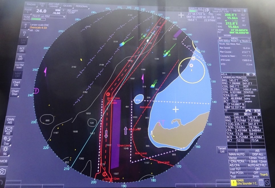
Approaching the VTS, ships highway at sea off the coast of Cabo San Antonio. We are in the top right corner at the end of the white (course) line. There are a few ships around indicated by the yellow dots and the green speed arrows but in general it was a very quiet day today. The green/yellow dot next to us is the Caribbean Princess and on the right hand side of the radar screen you can read her navigation particulars. Most important it says CPA 6.93 miles = Closest Point of Approach.
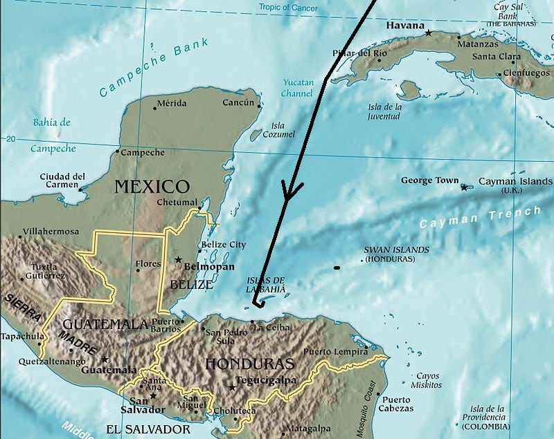
This morning at 09.30 hrs. we passed the west coast of Cuba, Cabo San Antonio, and then sailed into the Caribbean Sea. The moment we did so, the wind started to breeze up as the Trade Wind is quite strong at the moment due to an extra pressure system laying somewhere in the North Atlantic. But it should calm down again somewhat during the night.
This area of the Caribbean Sea is called the Yucatan Channel as it is located between the Yucatan Peninsula to the West and Cuba to the right. The border between the real Caribbean Sea and the Straits of Florida are a little bit fuzzy as it is all wide open water. For me it roughly starts North of Cozumel and then it stops once past Cabo San Antonio but that is more art than science. Explorers in the old days, on their slow moving sailing ships, had not much to do so they named everything they could think of. Sometimes after areas at home, sometimes after King/Queen and country and sometimes after themselves. And thus they were not happy with just naming the whole area Caribbean Sea but gave a different name to the area under Cozumel Island and that has the name of the Gulf of Honduras and stretches from Belize down to the Honduran coast. That area we entered late this afternoon.
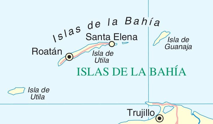
From Cabo San Antonia it is one straight course down to Roatan. Which is not an island by itself but belongs to a group called Islas de la Bahia or: the Bay Islands. We call it Roatan Island but that is not correct either. Roatan is a town/settlement on the west side of a long and narrow island with the main town of Santa Elena at the East side. The island is called Isla de Utila and is flanked by either side by a very small island. The one on the left is also called Isla de Utila and the one on the right is Isla de Guanaja.

The Islas de La Bahia with Roatan in the middle. (Thank you Wikipedia) Trujillo is an important port on the North Coast of Honduras.
Mahogany Bay is located on the south side of the main island and is in general very well sheltered, except if there are squalls coming through, which can change the predominant Easterly wind to S.E., South or S.W. and then the ships have to be ready with their thrusters so they do not get blown off the dock. We will approach Roatan from the west side and sail between the two Islas de Utila towards the pilot station. We are expected at 07.00 hrs. and as we are supposed to be the only ship, we will dock as deep as possible in the Bay, getting as much shelter as possible from the strong Trade Winds. Weather, overcast skies with a chance of a squall are expected but it will be warm and humid with temperatures up to 27oC / 81oF. I hope the guests will be careful as you can get a sun burn here even if it is overcast.


April 11, 2018 at 3:14 pm
Oops! Looks like MSC Armonia took out one of the docks!