By 0700 hours we arrived at the anchorage of Georgetown Grand Cayman with good weather and what would turn out to be a glorious day. The two other cruise ships were arriving at the same time each going to their designated anchorage. Sort of, as the Aida Diva decided to stay on the engines. We got somehow the impression that the captain there was on his first visit to Grand Cayman and had never experienced anchoring on the ledge and then letting the wind keep you off the island. So they hovered close by. No problem for us, as long as each ship stays at their own anchorage area as it is all quite tight here. My old school buddy from 1976-1981 thinks that I am / we are completely nuts to do this sort of things as, according to him, nobody in his right mind would rely on the wind not to run aground. I think from my side that he is completely nuts by sailing on a container ship with only 20000 boxes to talk to, but sailing box-boats is also a special skill, so each to its own.
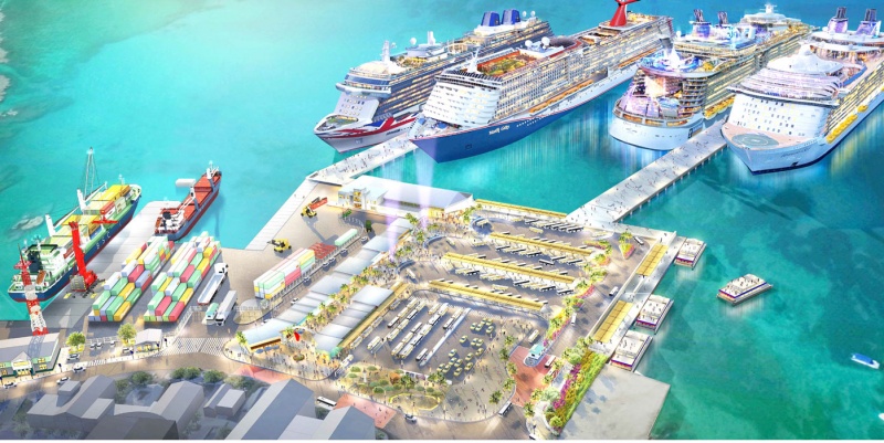
Half of Grand Cayman dreams about cruise ship docks and the other half thinks it is a nightmare and thus the approval process does not go very quickly. This is one of the proposals. But it will mean digging through the under water sediment and that is costly.
So what we are doing to be designated of being absolutely nuts according to the cargo world. It is a bit unusual but when professionally done it is completely safe and works very well. Grand Cayman is a sort of (volcanic) mountain which rises out of the depths of the Caribbean Sea to about 3 meters above water. (They have one high mountain and that is the local garbage dumps which towers above the whole town) Thus there is only a small area of shallow sea/land which we can use for anchoring. Not enough for a ship to swing around but with lots of space to enjoy. Georgetown has a small dock, which is used by very small cruise ships and small freighters that bring in the supplies for the islands. Everything else has to anchor. Since about 20 years there are/have been various plans to build a cruise ship dock for two ships, either by a pier or by mooring buoys, but it is still being discussed. And until that time we anchor.
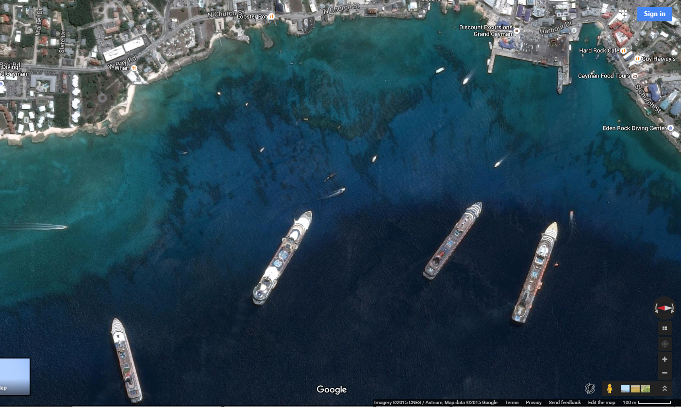
Satellite photo by Google. From left to right, anchorage 1,2,3 and 4. The Veendam was at anchorage 4 which is the closest to downtown. The bows of the ship have about 30 feet of water under the keel, and the stern about a 1000 ft. The green in the photo indicates depths of 20 feet or less and thus forms a no go zone, unless you want to become a permanent hotel here.
There is a stretch of a half a mile wide where 4 anchorages have been created and the cruise ships drop anchor on that stretch which in a straight line is about a 1000 feet from the shore line. A 1000 feet where the average depth is less than 30 feet. So what do we do? We approach on a right angle to the wind to the assigned anchorage. At the assigned spot the pilot boat is sitting on top of the location and we bring the anchor right above the boat and then stop. Now the pilot boat moves away and we let go the anchor. Then we move the bow sideways and pay out the anchor chain sideways over the ledge. Normally about 5 lengths (which is 450 feet of chain and the anchor) into the water. That is enough for the average wind that blows. Which is the Trade wind with a normal velocity of about a wind force 4. The pilot boat now checks if the anchor has dug in. This means that you have the flukes of the anchor grabbing themselves into the sandy bottom of the ledge? When so, the ship is safe at anchor. The wind will now push the ship away from the shallows and hold it in deep water as the Trade Wind seldom changes direction. The end result is that the bow floats above about 10 feet of water and the stern over 1000+ feet of water as Grand Cayman has this very steep rise.
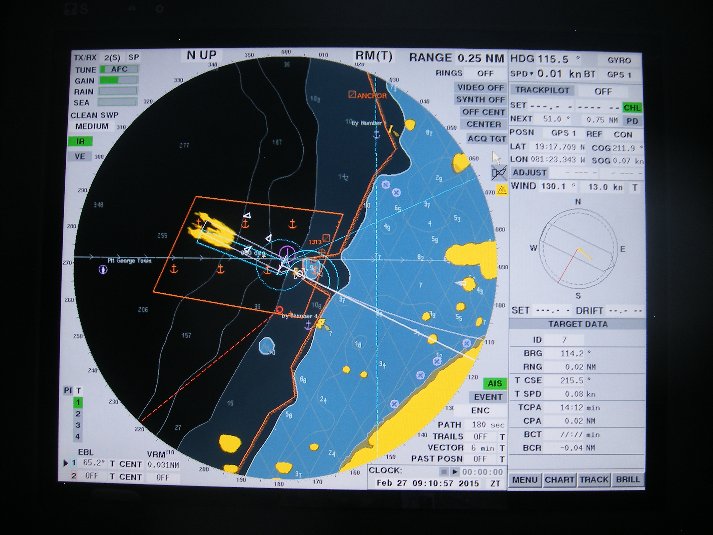
The view from the Radar. The first lighter blue is the 10 meter line the second very light blue area is the 5 meter line. So the ship anchors right on the edge. Around the ships diagram is a brown box. This is our “safety box” as long as the ship swings inside this box it is safe.
If the wind changes a little bit in direction then we can use the stern thruster to keep the nose exactly in the wind, or a little bit off the wind, so we create a good lee side for the tender service. Since some time all ships now use shore tenders which is a relief to all of us. In the past the large ships had shore tenders but the smaller ships ran their own. This resulted on occasion in stressful situations in the downtown harbor as too many boats, shore side boats, tour boats, ships tenders, on the same location can be complicated. Now we have these large shore tenders and they get the ship empty much faster than we can do with our own boats. And those tour boats run from all the ships on a continuous shuttle bringing ashore around 6900 guests and a potential 2500 crew, but most crew do not go ashore here as —how many tax free watches can you buy—
Tomorrow we are in Ocho Rios Jamaica, which is one of the three cruise ports along the North Coast. The other two are Montego Bay and Portsmouth. We will be docked before 0800 hrs. in the morning. As far as I understand we are the only ship in port and will thus have all the port facilities to ourselves.
Weather: little change, with same temperatures as today, but as Jamaica is blessed with mountains and a tropical forest there is always the chance of a shower in the early afternoon.

February 16, 2020 at 4:05 pm
Thanks for the tutorial about the anchorages in GC. I’ve been there many times and wondered what the organizational structure was for 4 large ships.
Thanks again for your always interesting blog.
February 17, 2020 at 1:35 am
Years ago when in Grand Cayman a Holland America ship had lost an anchor and they officers and divers spent half a day recovering the anchor. I can’t remember which ship it was.
February 17, 2020 at 5:27 pm
thank you for reading my blog.
that was the ms Noordam (number iii) they found the anchor back and next voyage they picked it up again.
Best regards
Capt. Albert
February 17, 2020 at 5:06 am
Born there by accident. Left when I was 4months old. Never been back. My sons father teases me when he shows our son where I was born. He says “mommy island is a dot.” Lol! So thanks for the beautiful dicription!