Today Holland America is 148 years young and although 2020 was the most challenging year in its history as far as sailing goes, we will weather this storm and we will continue. Our history has taught us many valuable lessons and gives ample proof we the company is able to weather any storm. Whether it was War, Depression, the onset of the Airplane, or the Mass market cruisers, the company has always navigated safely through every challenge. So I am confident that we will sail through the Covid Storm as well.
In November this year I will be sailing for Holland America for 40 years in those years I have seen how strong this company is in dealing with challenging great and small.
So Happy Birth Day Holland America. Two years to go to the big 150
As a small tribute I have created a company time line from the beginning to the current day.
Please find below the highlights of our History, year by year, condensed to two sentences. Every year has several highlights and what are considered the most important greatly depends on an historians personal insights. These are mine. I have tried to find an illustration in my collection which relates to the year concerned,
For more information, under the drop down box of HAL history on this website, I have also brought the company history up-to-date with more information and photos.
Enjoy
Capt. Albert
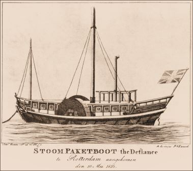
The Defiance credited with being the first steam driven boat to enter Rotterdam
1816 The first Steamboat visits Rotterdam and the public and business community gets the first glimpse of what can be done without sails.
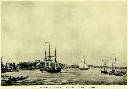
The caption reads view on the Maas at Rotterdam with Steam boat in 1825.
1825 The first river boats with (auxiliary) stream propulsion arrive on the Dutch inland waterways and thoughts in Rotterdam are going towards using steam for deep sea.
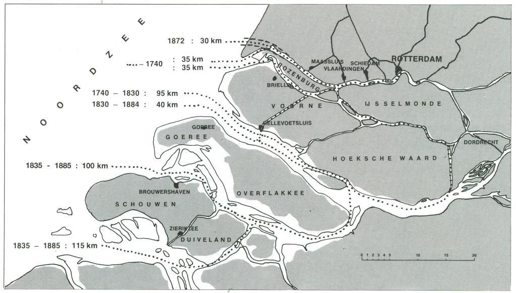
This was what all the fuss was about. Before 1872 it was a long way around the islands to get to Rotterdam with a large and deep drafted ship.
1863 The Dutch Government agrees to create a “New Waterway”, capable of accommodating deep drafted Steamships, which will link the port of Rotterdam with the North Sea.
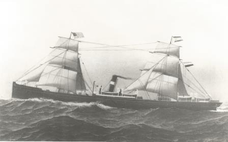
Our first ship the ss Rotterdam (I) depicted on a painting by C.A de Vries.
1871 On February 08, the forebear of the Holland America line is founded; by means of the private company C.V Plate, Reuchlin & Co. and two new steamships are ordered in Scotland.
The sister ship ms Maas. named after the river which gave Rotterdam access to the sea. she was later renamed to Maasdam (I) to bring all the ship names in line with the DAM naming policy.
1872 The Nieuwe Waterweg .e.g. New Water Way is opened. On October 15, the first ship of the new company the ss Rotterdam (I) departs for New York.
Funnel Markings and Flag. Green-White-Green where the colours of the city of Rotterdam
1873 On April 18, the private company goes public to obtain funds for more ships and the Nederlandsch Amerikaansche Stoomvaart Maatschappij or NASM sees the light of day. We consider this the official birthday of Holland America Line.
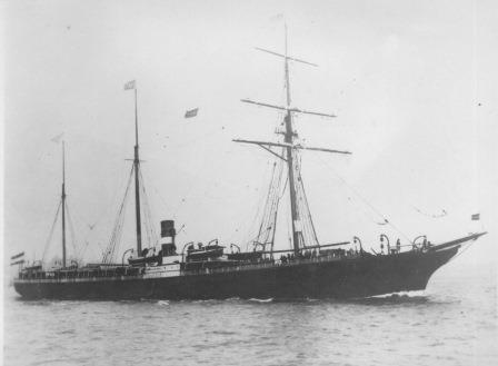
The P. Caland. The 2nd newbuilt of the company after it went public. Seen here in the local drydock.
1874 Two new ships are added to the Fleet, the s.s. W.A Scholten and the s.s. P. Caland. With four ships a regular steamship service to New York can now be maintained.
And here a sea-view of the same P. Caland at New York. the ship was named after the designer of the “Nieuwe Waterweg” which Rotterdam access to the North Sea.
1875 The “Nieuwe Waterweg” starts to silt up and the ships have to take a circumstantial inland water route to reach Rotterdam or discharge cargo to reduce the draft. All costing time and money.
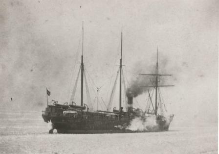
The ss W.A Scholten sister to the P. Caland and named after a major investor in the company. Seen here ploughing through the winter ice in New york.
1876 The new company is in crisis as there is an economic slump in the USA and no investments can be made as there is not much money coming in.
The ss Schiedam (I) shortly after she came into service.
1877 Trade picks up and a fifth ship, the ss Schiedam (I), is added to the fleet. This is an existing ship which is taken over from English Company and could thus be directly slotted into the fleet.
In the beginning emigrants stayed in local hotel which were often not that great. In 1901 the company opened its own Hotel on the company pier. It came complete with a chapel, a Cafe and medical facilities.
1878 Holland America at this time was primarily an emigrant carrier and in this year it started to work together with the local authorities to ensure good local hotel facilities for the waiting emigrants.
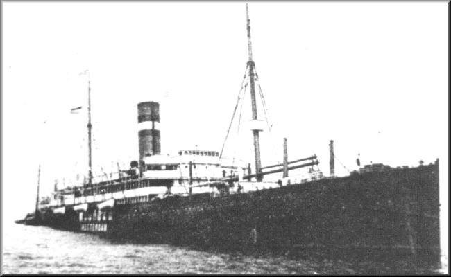
The ss Amsterdam I. The painter who created this took some liberty with reality as the wind is pushing the sails one way and the smoke the other way.
1879 Profits are up and the company orders a new ship. The ss Amsterdam (I) would arrive in March 1880. Also this year dividend could be paid again to the shareholders.
The Holland Amerika Lijn docks before 1900.
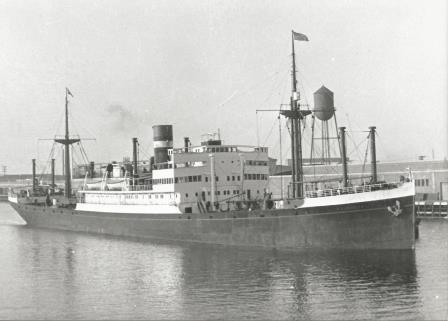
1880 A sister ship to the Amsterdam (I) was ordered and arrived in 1881, called the Edam (I) The ships now had a permanent dock location in Rotterdam where the company would stay until 1891.
The docks at Hoboken. this engraving is from around 1890,
1881 Also on the American side a permanent pier was leased. The company settled down at the Hoboken side of the river. Here the leases were cheaper and the docks were also closer to the railroad station.
The companies docks in Amsterdam.
1882 Competition from a company in Amsterdam had to be warded off and for the next 10 years Holland America also sailed from this port. Using charter ships in the beginning and own tonnage later.
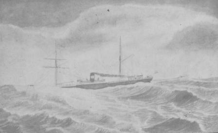
The ss Edam (I) of 1881 was the first of 4 ships bearing this name. this is a rather scarce postcard showing the ship in bad weather. And not un-realistic as the ships were small and the waves were big.
1883 The ss Maas, the 2nd ship of the company went for a refit and the company grabbed the opportunity to rename her in Maasdam (I) establishing the naming pattern which has lasted to the current day.
A very scarce photo is showing a deck scene on board the ss Edam (II). The sign on the railing is there to advise the emigrants to stay off the First Class deck area.
1884 The ss Amsterdam (I) was lost due to a fire caused by an exploding petrol lamp and the ship was not directly replaced as trade was not as brisk as was hoped for.
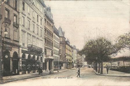
To attract passengers, first class and emigrants alike, the company had an extensive network of agents all over Europe and the US. This, to the left, is the office in Geneva around 1900.
1885 By now a trade war had broken out on the North Atlantic. More ships meant more berths to fill and thus the emigrant ticket prices went down. It would not be until 1892 that a solution was derived at.
The Werkendam. One of a series of new ships bought. Marketing in later years did not like the name very much (hard to pronounce for non -Dutch) and thus it was not repeated in naming routine.
1886 Trade started to pick up again and in a few years’ time seven more ships were added to the fleet. Rotterdam (II), Amsterdam (II), Maasdam (II), Obdam, Werkendam, Veendam (I), Spaarndam (I).
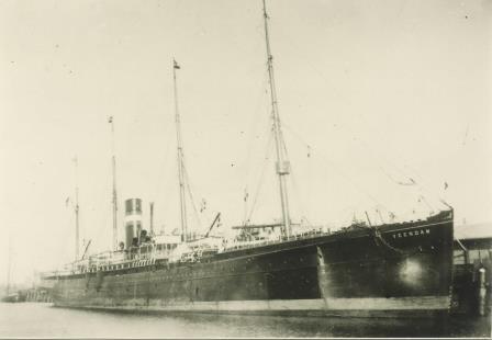
The Veendam (I) seen here docked in an unknown port but most likely Rotterdam.
1887 Another ship was lost, the W.A Scholten from 1874, which sank after a collision. The man after which the ship was named came from the town of Veendam and hence a new Veendam (I) was added.
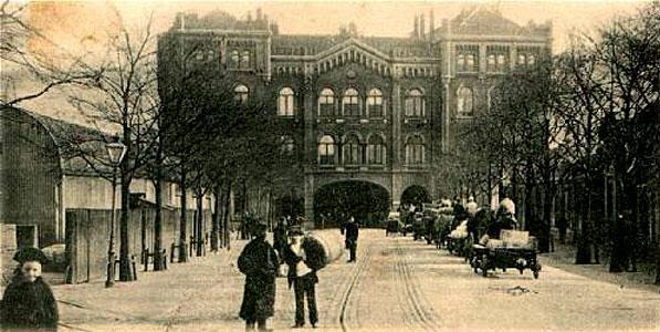
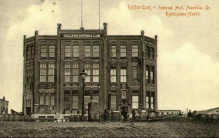
Poort means Gate and hence it is easy to see why the building was called the “Gate-Building” Holland America had its offices on the second floor.
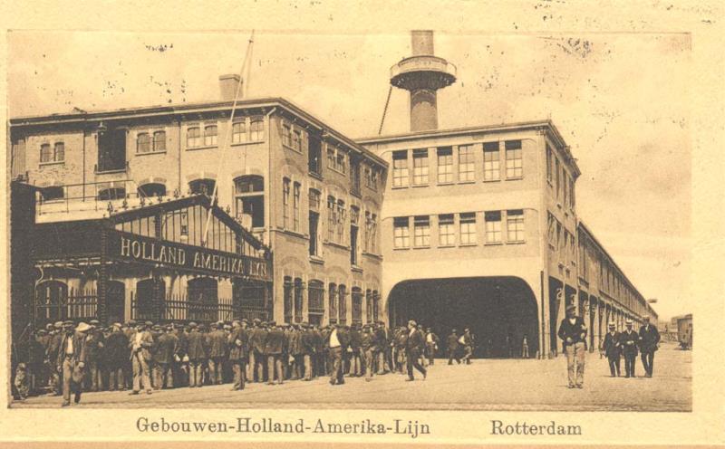
1888 A new headquarters was established at “Het Poort Gebouw” in Rotterdam. Easily recognizable as the entrance road into the dock area went under the office areas. The company would stay here until 1891.
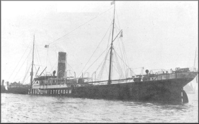
The ss Zaandam (I)Painted by Antonio Jacobson of New York who had a preference for wild seas if given a free hand in the composition.
1889 The company decided to diversify and opened a service to Argentina with the Zaandam (I) taking the first sailing to Buenos Aires in December.
The ss Didam of 1891. The company had the ships for the Argentina service especially built as they needed a much larger coal storage / bunker space due to the long distance to Buenos Aires.
1890 The trade to Argentina look promising and two new ships were ordered for this route. The Didam and the Dubbeldam. However a revolution broke out and the venture came to an untimely end.
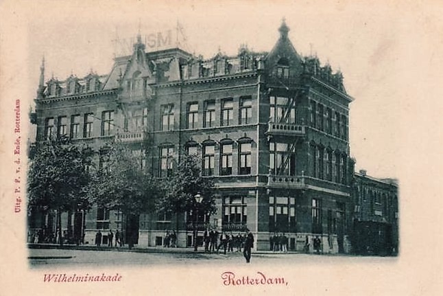
The New head office under construction. It is still exists and is now a very popular hotel and /restaurant,
1891 The Head Office moved to the Wilhelminakade in the center of the port and here it would keep it main office until the passenger side was moved to New York in 1971.
A well-known photo of this very important agreement. All the representatives of the participating companies are present here.
1892 Very important for the survival of most of the North Atlantic steamship company’s was the creation of the North Atlantic Steam Association which from now on regulated the prices for emigrant crossings.

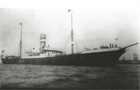
The Holland America Tender “Chicago” embarking emigrants to take to the ship at anchor outside the port.
1893 The World Fair took place in Paris and the HAL ships started to call at the French Port of Boulogne Sur Mer. BSM would remain the regular French port of call for the company until the 2nd world war.
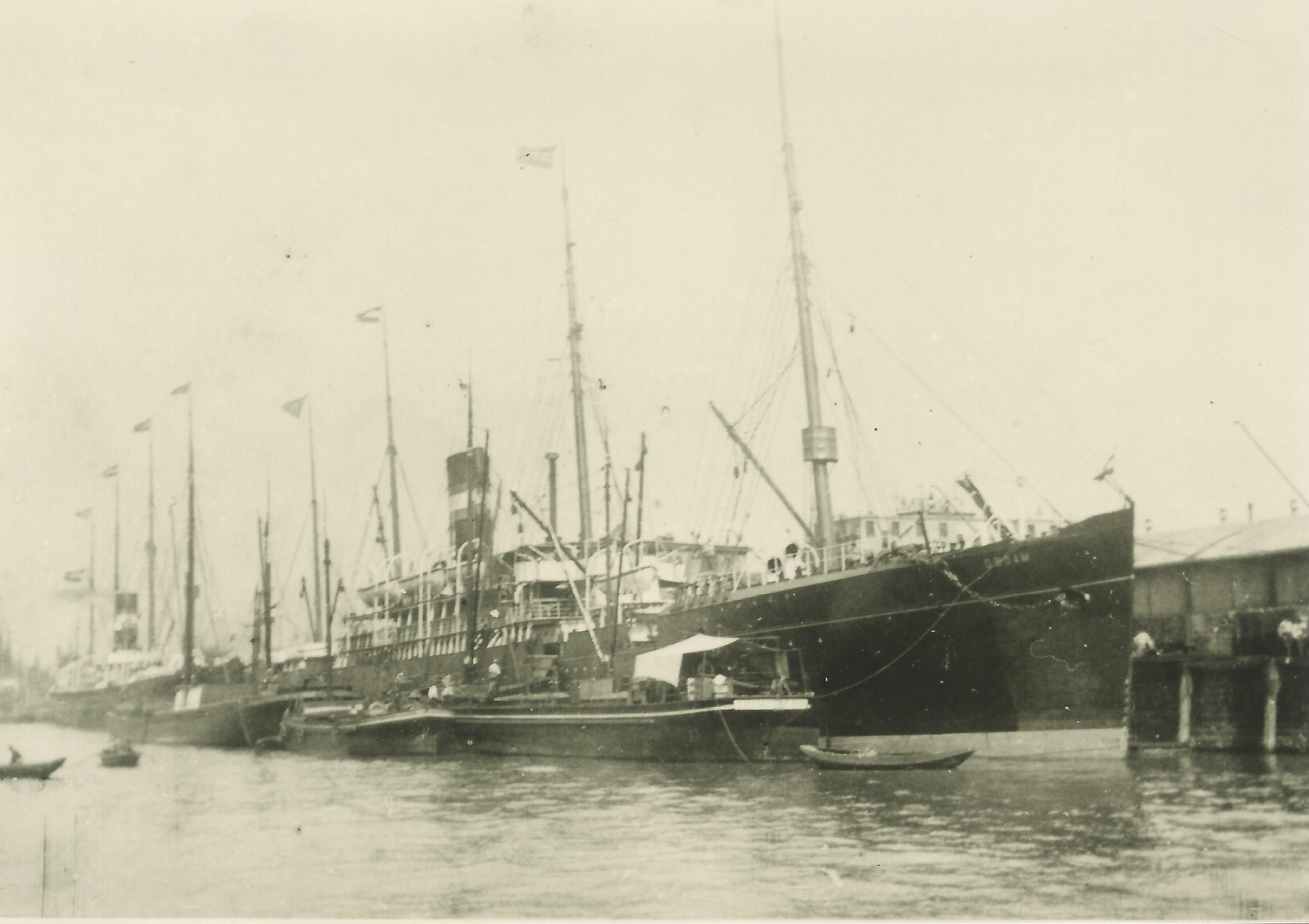
The docks at Hoboken sometime after 1900. Alongside the ss Potsdam recognizable due to the very tall funnel.
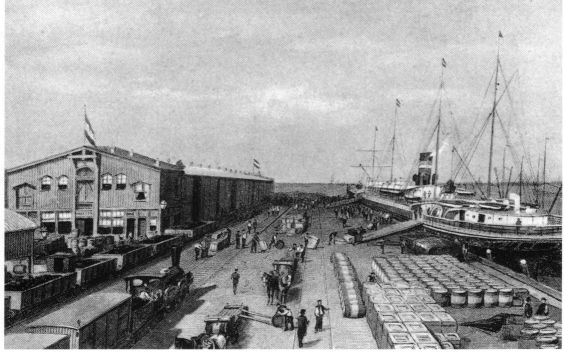
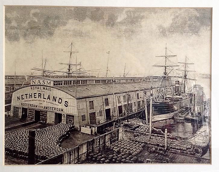
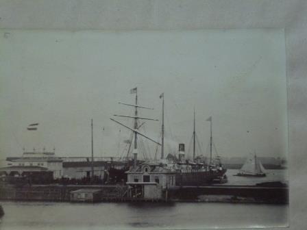
1894 At Hoboken a 2nd pier was leased from the port Authority at 7th. Street and here the company would keep its terminal until 1964 when it fully moved to the Manhattan side of the Hudson River.
The Rotterdam (II) at anchor near Copenhagen. Apart from going through the Canal a visit to this city was also part of the “Excursion”.
1895 The ss Rotterdam (II) made the first cruise for Holland America with an “excursion” to the Kieler Kanal. The success would help to decide the entry into cruising a number of years later.
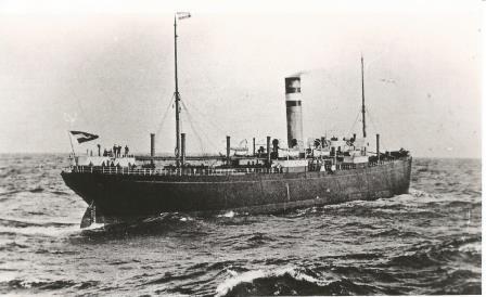
The ss Obdam, seen here loading in Rotterdam, did not sail long for the company but was sold in 1898 to the USA and played a signifciant role in the Spanish- American war.
1896 The Directors of the NASM finally accepted the fact that everybody called the company Holland America Line and not by its very long founding name. Both titles were now to be used.
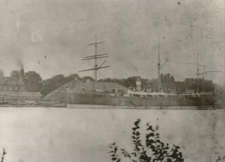
The ss Rotterdam III is the least known of all the “Rotterdams” which sailed for the HAL. Most likely as she was overshadowed by her namesake of 1908.
1897 The ss Rotterdam (III) entered service and she was the first twin screw vessel for the company. This ship was still built in Great Britain as the Dutch yards could not yet deliver ships of this size.
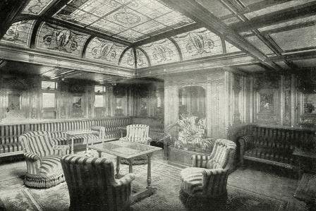
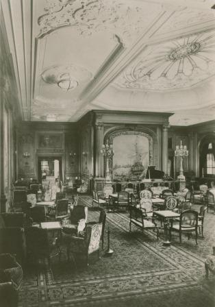
This is the “Ladies Salon” also called the “Drawing Room” or the “Parlor” depending of the preference of the newspaper men.
1898 A near sister if the Rotterdam (III), the Statendam (I) entered service and she has been credited with being the first ship where the management took a great interest in the interior lay out of the vessel.
The ss Amsteldijk (I) one of the first cargo-only ships of the company. Apart from cargo she could also carry 350 head of cattle and had accommodation for 48 officers and crew and 18 Cattle Hands.
1899 A new route was opened to Newport News for cargo ships and this was so successful that 3 new cargo-only ships were ordered. These all received names with Dijk endings such as ss Amsteldijk (I).
The first in the series of new passenger ships was the ss Potsdam of 1900.
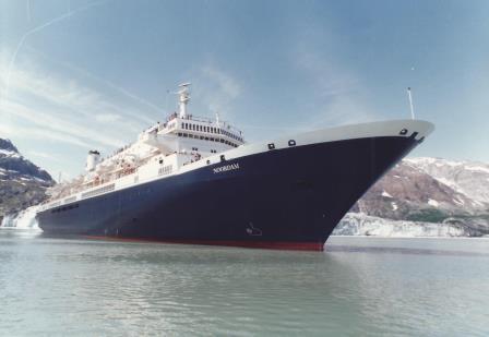
1900 The ships with a DAM name ending were now designated as Passenger ships and three new ones were brought into service. The ss Potsdam (1900), ss Noordam (I) (1901) and the ss Rijndam (I) (1902)
The ss Noordam (I) which entered service in 1901 as was an identical sister to the Rijndam (I) of 1902
1901 The Banker and Rail Road magnate J.P Morgan obtained control of a large number of HAL shares and also those of some other companies. Idea was to create a “railroad at sea” without competition.
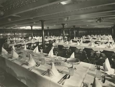
The First Class Dining room. There is a small sky light for natural light in in centre. with the later ships this would grow out to a two story affair.
1902 More than 51% of the shares came under his control and timetables were brought in line with the sailings of the other companies. It was not until well into WWI before HAL was independent again.
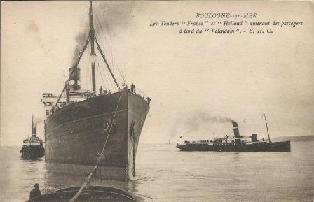
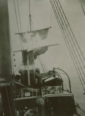
This shows the Tenders Holland an France attending the ss Volendam (I) from 1922. The ships would often stop not longer than 30 minutes to an hour to do the transfers.
1903 The company established a French Subsidiary in Boulogne Sur Mer, called the Compagnie Franco Hollando Americaine, needed to operate its tenders as the ships stayed at anchor at this port.
The original Wireless Transmitting “Marconi” Radio Station on the ss Noordam (I)
1904 Telegraphy arrived on the ships and the ss Noordam (I) was the first to receive such an installation. Not operated by the company’s officers but by the Marconi Company who controlled the trade.
The Nieuw Amsterdam (I) on the slipway of Harland and Wolff in Belfast.
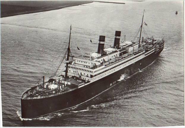
1905 With the Ticket prices regulated competition had become fair again and the company had ordered two new and very big ships the Nieuw Amsterdam (I) and the Rotterdam (IV).
The Nieuw Amstedam (I) of 1906 seen here at full speed.
1906 The Nieuw Amsterdam (I) arrived this year and with a tonnage of 16967 Grt. It was one of the 10 largest ships in the world for that year. It could carry 2350 emigrants but also 440 First Class and 246 second class pax.
The Japanese Tea room on board the Nieuw Amsterdam (I) A large skylight provided natural light which was considered a luxury item for a ship.
1907 The service to Newport News was expanded with regular calls at other ports and would remain part of the Holland America route system to well into the late 1960’s.
The ss Rotterdam (IV) seen here on the Nieuw Waterweg heading for open sea.
1908 The Rotterdam (IV) was 30% larger than the Nieuw Amsterdam but its emigrant accommodation was smaller as the company was now offering more elbow room for even its cheapest fare guests.
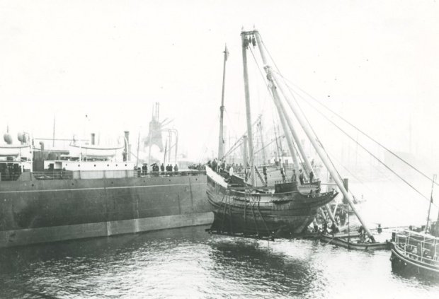
The company donated a replica of the original Haelve Maen which Henry Hudson used to sail up to what is now Manhattan. The model can be seen loaded her on board the cargo ship ss Soestdijk (I) for transport to New York.
1909 The British Neptune Line to Newport News was taken over and with it came six cargo ships, greatly expanding the fleet. In New York Holland America took part in the Hudson – Festivities.
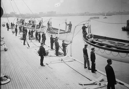
Not many photos exist of the safety drills in the old days. But here is one of a boat drill held on the Statendam (I) Pre-Titanic so no lifejackets, no railings and no safety lines.
1910 The Statendam (I) made a cruise to the Holy Land in March and its success made sure that the ss Rotterdam (IV) would eventually be used for similar voyages.
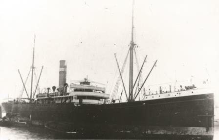
The ss Zijldijk of 1909 still had a bowsprit and a figure head as a throwback to the old sailing days. She called on her voyages at the port of Savanah.
1911 Another service, started in 1910, became a permanent feature with cargo ships sailing from Rotterdam to Savannah. This route was called the “Burg Lijn” and was carried out for a Dutch brokerage company.
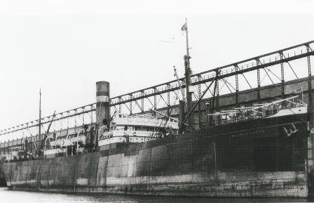
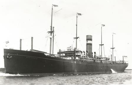
The ss Maartendijk of 1909, built for the service to North East America was moved to the new Gulf service in 1913
1912 A new cargo service to Cuba, Mexico and New Orleans was opened. This was such a success that after WWI a series of 4 passenger cargo ships was built especially for this route.
The ss Westerdijk of 1913 filled the gap when the ss Maartendijk was moved tot the new route.
1913 To have sufficient capacity for all these new routes, new cargo ships were taken into service. The Oosterdijk, Westerdijk and Zuiderdijk, all named after the main points of a compass.
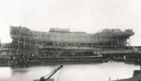
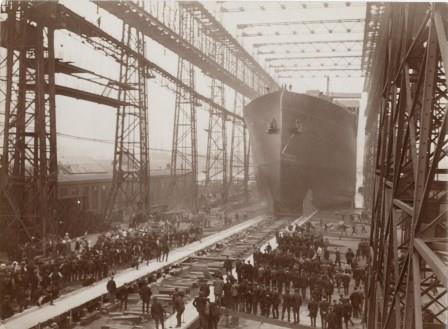
The ss Statendam (II) seen here launched on 06 July 1914. She was supposed to be about 30% bigger again as the ss Rotterdam (IV) from 1908.
1914 On the 6th. of July, the Statendam (II) was launched with the intention to have her enter service in 1915. War interfered and she was torpedoed in 1917 as the troopship Justicia sailing for the British.
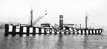
To avoid being torpedoed several ideas were tried. Being neutral required the name of the ship on the side and then “dazzle Paint” was applied to make it as difficult as possible for an U boat commander to see the ship. This is the Sommelsdijk (II) of 1912.
1915 The Netherlands was neutral during WWI and most ships continued sailing but under very difficult circumstances. 3 ships hit a mine and all ships were subject to strict inspections by the allied forces.
For neutral ships the biggest danger was mines. Here the ss Noordam (I) is seen sinking after mine hit the stern of the ship. Luckily she could be saved.
1916 The U-boat danger was now so grave that the ss Rotterdam (IV) was laid up but the profits made with the other ships were so high that the 1915 dividend was set at 50% over each share.
The ss Zaandijk (I)ran on a mine in 1916. as seen above, but cold be repaired. The next year she was not so lucky.
1917 Two cargo ships, the Noorderdijk (I) and Zaandijk (I) were torpedoed on the same day and sunk. The Noordam (I) ran on a mine for the 2nd time. But profits continued to be good and the company managed to buy back all foreign held shares. Making it a fully independent company again.
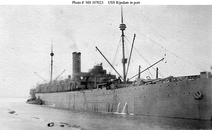
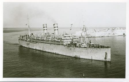
The USS Rijndam (I), seen here at St.Nazaire France, ferried US troops to Flanders Fields and later back again. (Photo courtesy: US Congress)
1918 All the HAL ships that were laid up in USA ports had been seized in 1917 and forced into service for the US Government. The Oosterdijk sank after a collision and the ss Rijndam (I) became a US troopship.
The ss Zaandijk (II) was taken over from the Germans as compensation for the sinking of the Zaandijk (I). She was originally the ss Silesia of HAPAG.
1919 With the war over reconstruction could begin. Cargo ships from Germany were taken over, two replacement passengerships were ordered for the sunk ss Justicia and 60,000 tons of steel was received as compensation.
The ss Waaldijk which had joined the fleet in 1914 seen here in VNS charter. The only change to sail for the VNS was, to paint over the hal colours on the funnel to one red band.
1920 Holland America participated in a joint venture with other Dutch companies called the VNS or United Shipping for services to the Far East and Africa. Each company participated with entering own ships.
In 1919 the company had bought an American ferry, the SS Madison and used here as the ss Warszawa to feeder emigrants from Dantzig and Libau in the Baltic to Rotterdam. She was sold back to her original owners in 1926.
1921 Plans to return to the pre-war emigrant trade were dashed when US congress approved a Quota Act to reduce the number of emigrants entering the USA. Basically now only 10% of the postwar emigrant numbers were allowed to be landed by each company. Other sources of income had to be found.
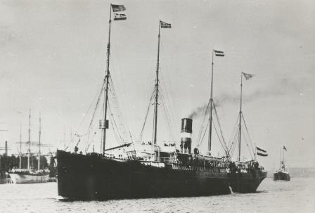
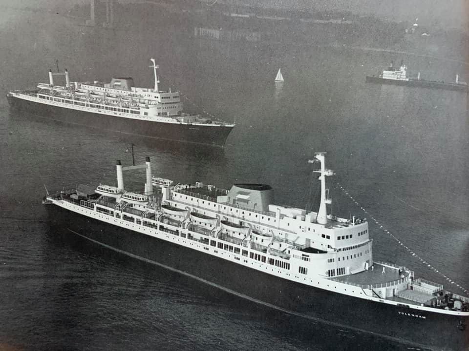
The ss Volendam (I) of 1922 Seen here manoeuvring off Hoboken in New York
1922 Two medium seized passenger ships entered service, the Veendam (II) and Volendam (I) their immigrant capacity reduced from 1200 Third class to 484 Tourist Class.
The ss Bilderdyk (I) of 1923. the others in the class were the Binnendyk, Blijdendyk, Breedyk, Burgerdyk, Beemsterdyk, Boschdyk and Blommersdyk.
1923 With the 60,000 tons steel a series o f cargo ships were built called the B class. Construction of a new Statendam (III) started in 1920 was halted. Holland America changed the spelling of the ships names from IJ to Y. So a Dutch Dijk became an American Dyk.
The Statendam (III) launched on 11 September 1924
1924 The hull of the Statendam (III) was launched without ceremony and promptly laid up with all work suspended due to lack of money.
The ss Rotterdam (IV) seen here at Cannes during one of her 1920’s cruises.
1925 The Rotterdam (IV) had resumed the pre-war Holy Land cruises from New York and would from now on make each year such a cruise during the North Atlantic Off-season of January, February and March.
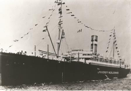
The ss Rijndam (I) sailing as a floating University.
1926 A more un-usual cruise was made this year, the Ryndam (I) went for a seven month around the World cruise as a floating University. The 506 students on board visited the countries they studied about on board, saw the sights, and also met Mussolini and the King of Siam.
The unfinished hull of the ss Statendam (III) being towed to Rotterdam by three Dutch Tugs.
1927 The hull of the laid up Statendam (II) was towed to Holland for completion and would enter service in 1929. Finally there was money to complete the ship which was quite similar to the ill fated Statendam (II)
The ms Delftdyk was especially built for the North Pacific service. After the war she hit a min and was completely rebuilt and given a new name: ms Dongedyk.
1928 Two new motor ships (Delftdyk/Damsterdyk) had been ordered for the North Pacific service to Vancouver in 1927 and would come into service in 1929 and 1930. Each could carry 50 passengers.
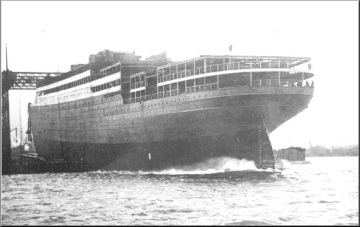
The ss Statendam (III) when finished, she was the only 3 funnelled ship ever to be in operation for Holland America.
1929 There was the Wall Street Crash and the maiden voyage of the ss Statendam (III). The company now had 3 large passenger ships in service but at the same time revenue plummeted.
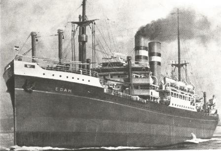
The ss Edam (IV) was the lead ship of a class of four passenger cargo ships built for the Rotterdam, Iberia, Cuba and Gulf Service in 1921. They could carry 14 First Class, 174 Second Class and 802 Third Class.
1930 Most of the Cargo ships were laid up and carrying passengers to Cuba and the Gulf of Mexico was completely stopped and the route only continued as a cargo service.
The entrance to the Company docks. Laborers waiting to go to work.
1931 Cost savings had to be made and Sea and Shore side personnel were laid off. Contributions to the pension fund were reduced and some permanent labour contracts were changed to “by the day”.
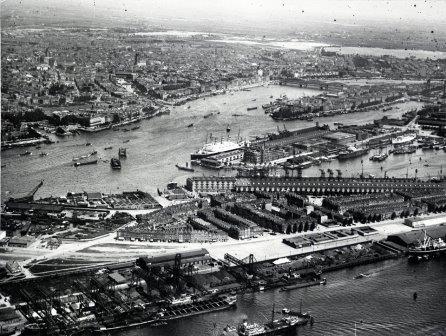
Aerial view of the port of Rotterdam. the whole center area was part of the Holland Amerika Lijn. The ss Statendam (III) ca be seen alongside the passenger terminal
1932 Ticket prices were reduced by up to 40%. Laid up cargo ships were sold off or scrapped. The Nieuw Amsterdam (I) was sold for scrap in 1931 and no feasible plans could be considered for a replacement.
The passenger ships made as many cruises as possible to compensate for the down turn in Trans Atlantic business. The Rotterdam (IV) was even painted white for a short while but that was not a great success.
1933 The shareholders became so worried about their investments that a special “strong man” from outside the company was appointed to restructure the company at save it for the future.
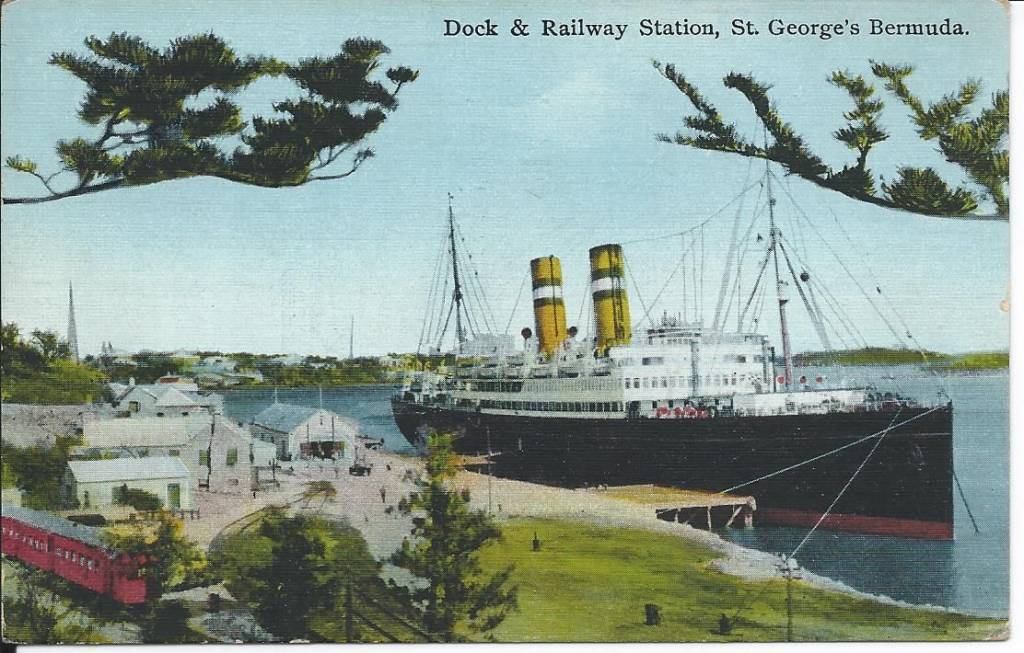
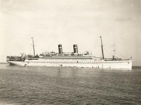
The ss Veendam (II) seen here docked at St. Georges, Bermuda during one of her cruises from New York.
1934 The new company structure was successful and as world trade slowly improved plans were drawn up to build a running mate for the Statendam (III) which eventually entered service in 1938
The ms Noordam (II) was the first of a series of four passenger cargo ships with the first one arriving in 1938.
1935 The company made a profit again and decided to design 4 passenger cargo ships for the direct intermediate service to New York with a one class accommodation of 125 passengers.
First Class Lounge on the Statendam (III). The carpet could be rolled away and then a large dancefloor was exposed.
1936 A sign of things to come was when the Statendam (III) carried an airplane to the Netherlands for the Royal Dutch Airlines. It were the airplanes which eventually brought the regular passenger liner service to an end.
The Sloterdyk (II) and her sister Sommelsdyk (III) came into service just before the war started. Although being cargo ships there was space for 12 passengers,
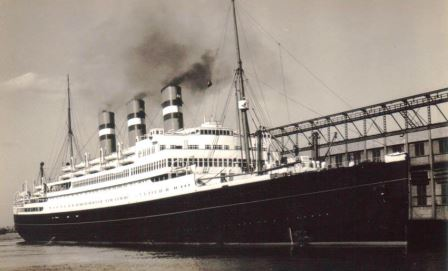
1937 On the 10th of April Queen Wilhelmina launched the new flagship of the company the Nieuw Amsterdam (II) and two new cargo ships were ordered, the Sloterdyk (II) and Sommelsdyk (III).
The Nieuw Amsterdam (II) this photo was taken on the departure for her maiden voyage to New York.
1938 The first of the four passenger cargo ships the Noordam (II) came into service in April followed by Nieuw Amsterdam (II) in May. With a size of £36,287 gt. She could carry 1200+ passengers in 3 classes.
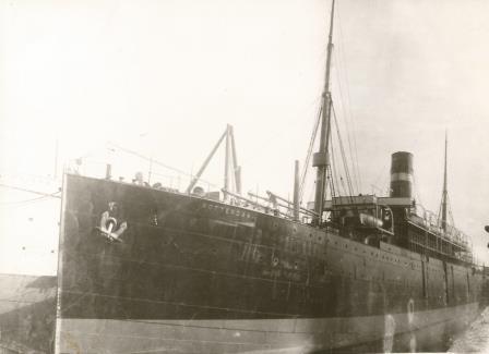
The ss Westernland in HAL colours. She was eventually sold to the British Admirality to be turned into a Navy support ship.
1939 The Red Star Line was bought. Owned by the Jewish Mr. Bernstein who could no longer operate the company due being under arrest in Germany. Two ships the ss Pennland and the ss Westernland were taken over.
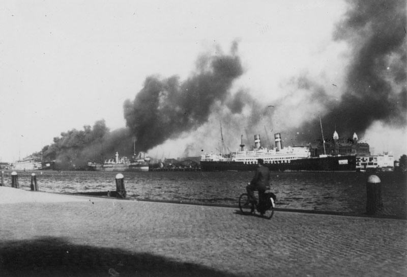
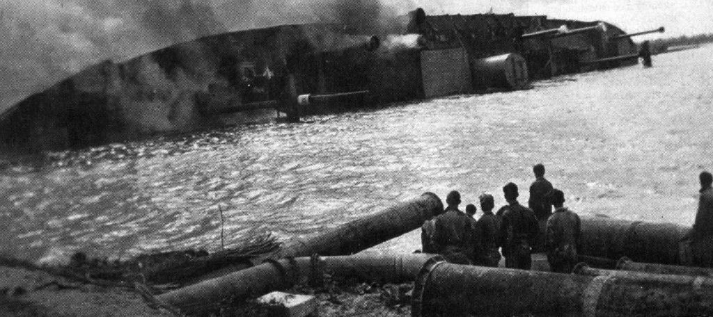
The HAL ships came in the cross fire when German Paratroopers came up against the Dutch Royal Marines. To the left the ss Statendam (III) can be seen on fire. Behind the man on the bike is the ss Veendam (II) which spent the war in German hands.
1940 On 10 May 1940 Nazi Germany invaded the Netherlands. Luckily most of the fleet was outside the home port and joined the Allied war effort. The Statendam (III) caught fire and burnt out. As resistance was fierce, the City of Rotterdam was bombed causing the Dutch to surrender.
The ss Pennland on fire off the coast of Greece. (Photo courtesy Capt. A.M van Gemert from whose lifeboat this photo was taken)
1941 The cargo ship ss Beemsterdyk was torpedoed and the ss Pennland sank after air attacks off Greece. Shortly after the ss Maasdam (II) was also torpedoed and sank while in convoy when a nearby ship exploded.
The ss Breedijk in war ship grey colours. She was torpedoed on 14 September 1942 South of Las Palmas. The Captain and one Steward died in the tragedy.
1942 Apart from the cargo ship ss Breedyk also the ppassenger cargo liner ss Zaandam (II) was torpedoed and suffered 127 casualties including two Holland America Line captains.
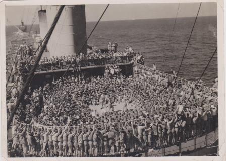
Full house on the Nieuw Amsterdam during troop transport in the tropics. Apart from boxing contests there was often a complete entertainment group on board including well known stars from Stage and Screen.
1943 The passenger ships were all converted to troopships. The ms Noordam (II) designed for 125 passengers could now carry 2300 troops and the ss Nieuw Amsterdam (II) just short of 9000.
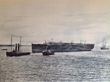
The ms Zuiderdam (I) sister to the ms Noordam (II) and ms Zaandam (II) was sunk in the “Nieuwe Waterweg” and burnt out. the hull was deemed beyond salvage and scrapped after the war.
1944 At home two cargo passenger ships, Westerdam (I) and Zuiderdam (I) had been under construction when the war started and were now used as blockade ships to keep the expected invasion out the ports.
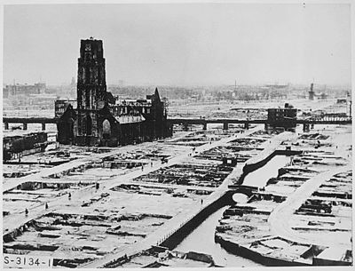
This was what was left of downtown Rotterdam after the bombardment of 1940. The situation at the company docks was not much different with only the main office building still standing.
1945 After the liberation on the 10 th. of May 1945 the rebuiling started at once. Holland America had lost 50% of its fleet, 265 employees had lost their lives and nearly all the Rotterdam property was damaged beyond repair and needed to be rebuilt from scratch.
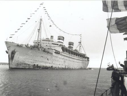
The ss Nieuw Amsterdam (II) coming home in 1946. When the war ended she still sailed a full year as a troopship for bringing the troops home.
1946 The Nieuw Amsterdam (II) arrived home on 10 April 1946 with a war record of having steamed 530,452 miles and carried 378,361 troops. A record only broken by the Cunard Queens who were double the size.
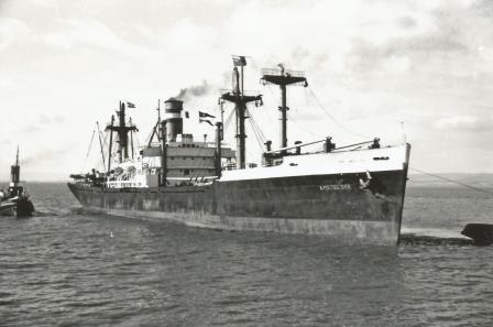
The Amsteldyk (II) was the first of 10 Victory cargo ships acquired by the HAL.
1947 Part of the rebuilt program was the acquisition of 10 Victory cargo ships who were called the A class. The Veendam (II) which had spent the war in Germany returned to service as well as the Nieuw Amsterdam (II).
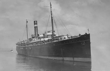
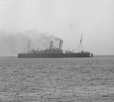
The ss Volendam (I) seen here entering the Grand Harbour in Valetta Malta had served the whole war as a troopship. Together with her sister Veendam (II) they were refitted for post war duty but were by then old and tired ships.
1948 In three years’ time 19 ships were added to the fleet and 5 passenger ships were in operation. Plans were drawn up for new ships for the West Coast service and to replace the Veendam (II) and Volendam (I)
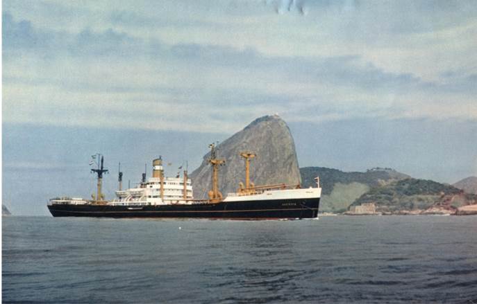
The ss Aalsdyk sailing by Sugar Loaf mountain near Rio de Janeiro
1949 A new service was opened to South America and the company became an important carrier of goods for the Marshall Plan, the support program the USA had set up to get Europe back on its feet again.
The ms Damsterdyk from 1930 re-emerged after the war as the ms Dalerdyk after a complete refurbishment.
1950 Two pre-war ships employed on the North Pacific service were completely refurbished and renamed. This service ran from Hamburg via Rotterdam, Panama Canal along the whole Pacific Coast of North America to Vancouver.
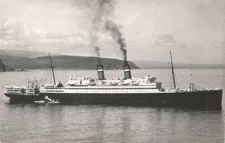
The ss Ryndam (II) of 1951 had for those days, the very unusual concept of only a small First Class area just under the funnel and the rest of the ship assigned as Tourist Class.
1951 The ss Ryndam (II) was commissioned followed by a sister ship the ss Maasdam (IV) and they took over from the aging V ships. Because the original hull design had been meant for a cargo ship they were known to be very ” lively”.
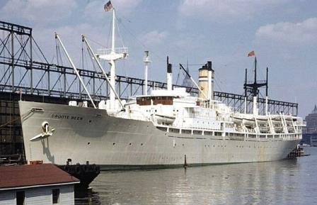
The ss Groote Beer was originally built as a Victory ship with troop capacity. Obtained by the Dutch Government, first for troopship duty and then for emigrant voyages. Those to North America were under management of the HAL.
1952 For the booming emigrant trade the HAL took over the troopship Groote Beer from the Dutch Government and used her for emigrant services to the USA and Canada and student trips to Europe.
The Ryndam (II) and Maasdam (III) both docked at Hoboken Piers. For a while they were marked as “The Thrifty Liners” as a Tourist Class ticket was really good value for money.
1953 Business was going well and thoughts went towards an intermediate liner which could also be used for cruises and a running mate for the Nieuw Amsterdam (II) which would become the Rotterdam (V).
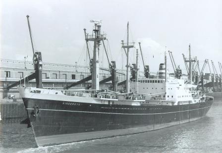
The K -class, with the ms Kinderdyk seen here as the first of the series. These ships just fitted in the new St. Lawrence Locks.
1954 The company expanded once again their cargo network with opening a new route to the Great Lakes when access locks to the St. Lawrence River were enlarged. The K-class ships were built.
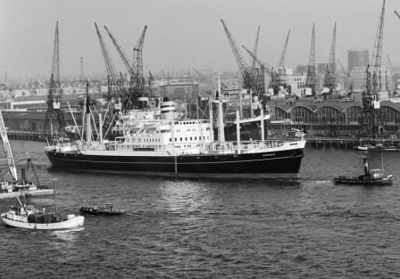
Apart from ordering ships for the St. Lawrence locks, also new builds were commissioned for the North Pacific service. Here we see the ss Diemerdyk leaving Rotterdam.
1955 The name ss Statendam (IV) was announced for the intermediate Liner which was to enter service in 1957 and the order for the Rotterdam (V) was given to the Rotterdam Dry-dock Company in Rotterdam.
The ss Statendam (IV). The first class accommodation of 89 passengers was located on the decks right behind the funnel. The 857 in Tourist class had the run of the rest of the ship.
1956 The clasas concept of the Ryndam (II) had proven very successful and thus the Statendam (IV) also was designed with a small First Class and a large Tourist Class capacity making it easy for one class cruising.
The ss Dinteldyk (II) Although being a cargo ship with a large passenger accommodation she was given the grey color passenger hull as she was considered the flagship of the west-coast fleet.
1957 The ss Statendam (IV) came into service on the North Atlantic route and would make in 1958 the First World cruise for the company with normal guests on board.
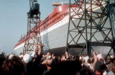
The ss Rotterdam (V) being launched. It was estimated that approx. 100,000 people from City of Rotterdam attended the launch.
1958 The Statendam (IV) made the first world cruise for regular passengers and the ss Rotterdam (V) was launched on the 13th. of September by her Majesty Queen Juliana of the Netherlands.
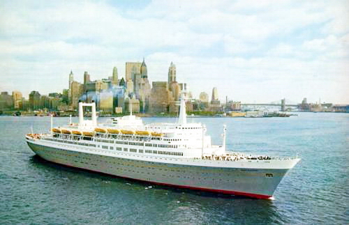
Most traditional liners had the accommodation laid out vertically. The Rotterdam (V) had all the public rooms horizontally. First Class on Upper Promenade Deck and Tourist class on Promenade deck. Open the connecting doors and two full decks were easy accessible to all during One Class cruises.
1959 In 1958 the airplane had carried as many travellers as all the ships on the North Atlantic route together and thus cruising became more and more important. Hence the new Flagship was optimized in layout for one class cruising during the North Atlantic off-season.
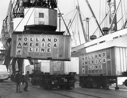
The arrival of the container caused a major disruption in the port and ships operations and also in labour relations.
1960 The step by step arrival of the container in the cargo business meant that conventional cargo ships became less and less effective. Competitors from the past now joined up to form joint ventures to reduce the costs.
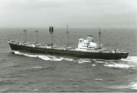
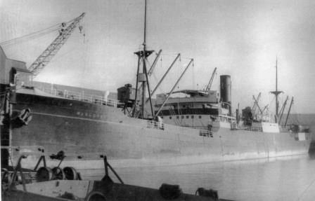
The ms Gaasterdyk (II) The lead ship of the G- class especially meant for for the Gulf service. Although they were also seen on all the other routes of the company.
1961 New cargo ships, called the G-class were introduced especially for the Gulf of Mexico service and the older A class cargos ships were sold off one after the other and were all gone by 1969.
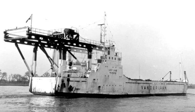
The ms Lady Jane ,of Vander Laan Shipping, was one of the first ships designed to carry ultra heavy cargos and where in high demand for transit with oil exploration related cargos. HAL had taken a share in this “heavy Lift” company.
1962 With both the North Atlantic and the cargo business facing an uncertain future, the company decided to diversify with investments outside its core business. Acquisitions were made in hotels, an airline, travel agencies, a dredging company etc. etc.
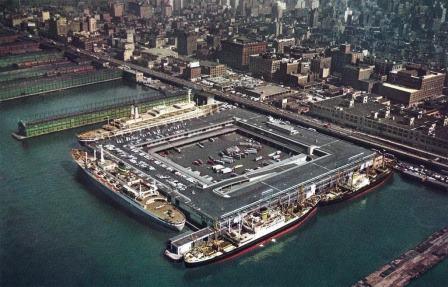
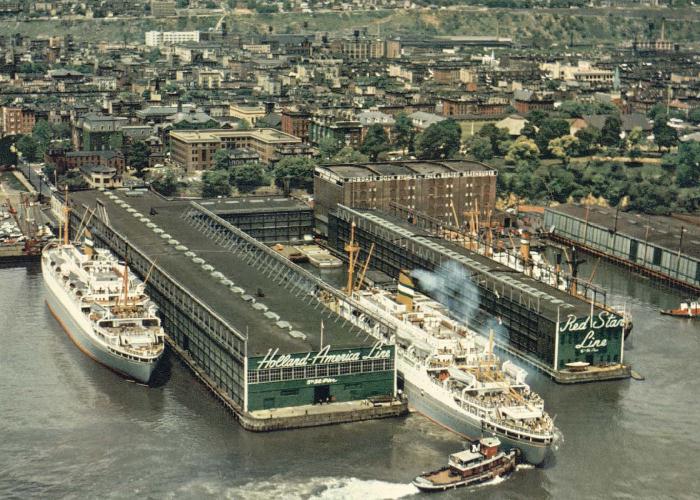
Pier 40 was the best pier there was for processing cargo and passengers when opened in 1962 . From left to right: The ss Rotterdam (V), the ss Statendam (IV), either the Noordam (II) or the Westerdam (I) and a K class freighter.
1963 Between the end of 1962 and mid 1964 Holland America moved its operation from the Hoboken side of the Hudson to downtown Manhattan where it had taken a lease on the brand new Pier 40.
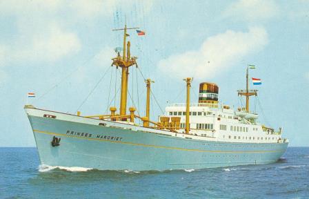
The ms Prinses Margriet was taken over from another company and as she carried the name of the “God child” of the Dutch Merchant Marine (2nd daughter of the Queen) she was not renamed to a DAM name.
1964 A small passenger- cargo ship the Prinses Margriet which had been in charter for a while was taken over and used for North Atlantic crossings and well attended “cargo cruises” from New York to the Caribbean.
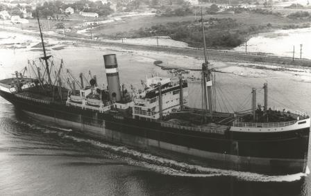
The ms Moerdyk (II) This ship was already container friendly with having space for them around the cargo hatches but it was not enough to keep the real container ships from taking over.
1965 The last conventional cargo ship the ms Moerdyk (II) came into service. The next step would be to invest in container ships and the company participated in the Atlantic Container Line.
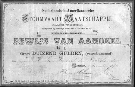
The first ever Share of the company. bought by His Royal highness Prins Hendrik of the Netherlands and sponsor of the company in 1873.
1966 When the company was founded in 1873 it had been scheduled for a lifespan of 100 years. To avoid the company from being abolished in 1973 a new charter was adopted for an open ended future.
The first containership the ms Atlantic Star. She carried containers in front of the bridge and rolling stock (cars and anything else on wheels) in a large space under the accommodation with a ramp at the stern.
1967 The English company Cunard joined the ACL combine and each company would now participate with two ships. One slow, one fast. Holland America brought in the Atlantic Star and the fast Atlantic Crown.
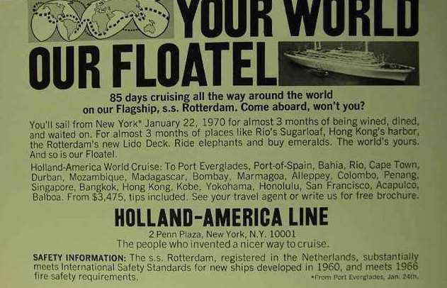
The ships became Hotels and somebody in marketing came up with the idea of “Floatels”.
1968 The North Atlantic service was coming to an end and the operating structure on board the passenger ships was changed to a Hotel setup with an integrated service led by a Hotel manager.
The last of her kind with HAL. The Victory cargo ship ss Andyk (II) was phased out in 1969.
1969 The shore side operating structure was also re-organized with more clearly defined departments and overlaps were removed. The last ship of the A class the ss Andyk (II) was sold.
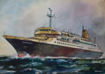
The first artist impression of the Prinsendam (I) Here Holland America would test its idea’s about the future of cruising.
1970 An order was placed for two small cruise ships as the company wanted to experiment with an own design for the future cruise fleet. In the end only one was built. As the Dutch Tax system became so progressive the HAL introduced Indonesian crewmembers on the ships.
The ss Statendam (IV) seen here sporting the new blue hull and the orange funnel with the wave logo.
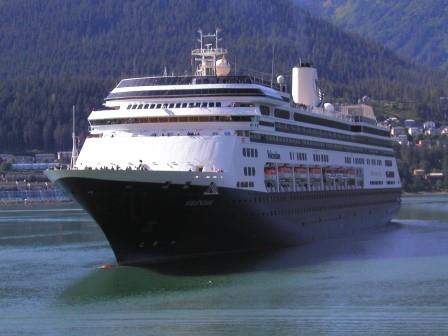
1971 A 70% share was taken in the Westours Tour Organization of Seattle which gave Holland America access to Alaska. The cruise ships were refurbished and a new “Wave” logo and hull color appeared.
The ms Bilderdyk (II) A large crane moved over the whole length of the ship cargo bays. The barges were lowered into the water at the stern of the ship.
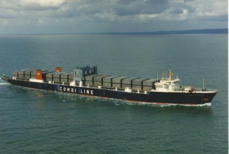
1972 The company had also just introduced the ms Bilderdyk (II) a LASH (Lighter Aboard SHip) barge carrier for the Gulf service. 83 barges could be left behind for loading and un-loading while the ship continued its voyage.
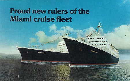
The ss Veendam (III) and Volendam (II). Very steady, deep drafted and spacious ships. But they used a lot of oil and thus their profitability after the Oil-crisis was somewhat limited.
1973 Now 100 years young and the company brought into service two ex-American passenger ships under the names of Volendam (II) and Veendam (III). But due to the oil crises they had to be laid up again.
The ms Prinsendam (I). A sistership was never built but her design was the basis for the new N-class
1974 The 8900 ton Prinsendam (I) arrived carrying 374 guests was sent to Alaska and Indonesia for summer and winter cruises. It was also decided to sell off the complete cargo division as per 01 January 1975.
The Monarch Sun and Monarch Star. Operationally it did not really work out with this daughter company and hence the company lasted only a few years.
1975 The Veendam and Volendam came back into service but for a Subsidiary called Monarch Cruises with trips to the Caribbean from Miami. The Lease of Pier 40 in New York was sold and the offices moved to Two Penn Plaza.
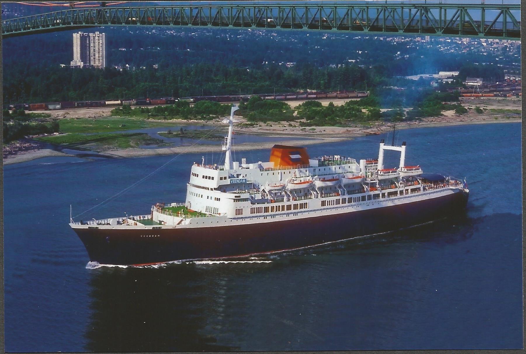
the counter the larger P&O ships, the Monarch Star was send to Alaska. And when the ships came back under the HAL flag, the ss Veendam (II) continued to do so. Here the ship is sailing under the Lions Gate bridge from Vancouver to Alaska.
1976 Although Holland America had pulled out of Europe with its ships and marketing, the company bought a British travel Agency chain as it was noted that many British Guests took P&O ships to the USA and Alaska.
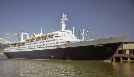
The ss Rotterdam (V) in the mean time made cruises to the Bahamas and Bermuda until also she was sent to Alaska.
1977 In 1973/74 the registration of the cruise ships had been moved from Rotterdam the Netherlands to Willemstad, Curacao. In this year the financial seat of HAL was moved here was well.
The Fairweather I was used as a dayboat between Juneau and Skagway sailing up and down the scenic Lynn Canal.
1978 Monarch Cruises had been absorbed into a new company Holland America Tours. Investments were made in the Alaska infrastructure with buying more hotels, a day boat for the Lynn Canal and more coaches.
1979 As part of the Coach expansion The “Gray line of Seattle” franchise was bought. The buses were used to bring guests from Seattle airport to the ships in Vancouver and for sightseeing tours.
The N-ships were an enlarged version of the 1973 Prinsendam (I) with some features taken over from the V ships such as the Crowsnest.
1980 Experience with the Prinsendam (I) had learned how much more economical a purposely designed ship was compared to the older tonnage such as the Statendam (IV). Two enlarged Prinsendam versions were ordered in France.
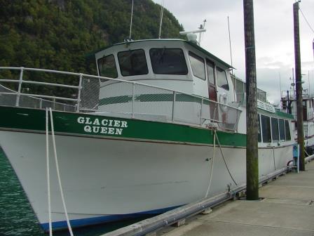
The Glacier Queen I was used for day trips at various locations in Alaska.
1981 The Prinsendam (I) would never see her larger sister as she sank in autumn 1980 in the Gulf of Alaska due to an engine room fire; luckily without any casualties. A sightseeing company in the Prince William Sound was bought to provide glacier tours in College Fjord.
The Fairbanks Hotel in Alaska. Holland America -Westours operated a large number of these Hotels under the Westmark name.
1982 More investments took place in Alaska and by now Westours / HAL controlled 65% of the Alaska Tour trade. The Statendam (IV) was sold to French Operators.
The Nieuw Amsterdam (III) of 1983 and one of the most fuel economic cruise ships out there. She could almost carry double of the V-ships capacity for a 3rd of the fuel consumption.
1983 The operating costs of the older ships had weighed heavily the balance sheet and this year was a crucial year in turning the company around by moving away from the old ways of operating and cost control. The first new build the Nieuw Amsterdam (III) entered service.
The ms Noordam (III) Once completed she was immediately sent to Alaska for the summer season. Seen here in Glacier Bay.
1984 The 2nd new build the Noordam (III) entered service in April. The V ships were sold off but the Rotterdam (V) stayed as she could still very well cope with the changes in the Cruise Industry.
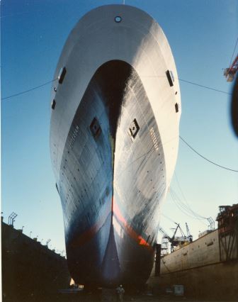
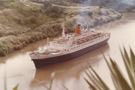
The mighty bow if the ss Rotterdam (V). Seen here during her 1985 dry dock.
1985 Apart from the yearly world cruise of the Rotterdam (V) all three ships were now employed on short but very profitable cruises to Alaska, Mexico and the Caribbean.
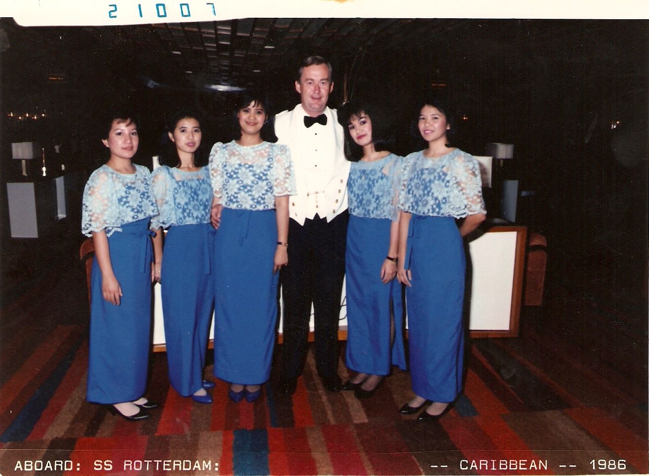
The first group of Philippina Bar stewardesses on board the ss Rotterdam V. Some of the Ladies served more than 30 years with the company, In the middle Chief Officer (later Captain) Leo van Lanschot Hubrecht.
1986 The company started to employ Ladies from the Philippines in the Front Office and in the Bars.
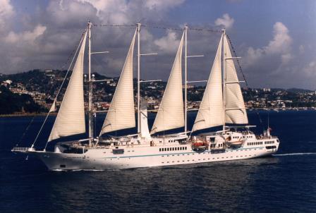
The motor sailing yacht Windstar. If the wind was blowing the wrong way, then the engine ensured that the next port was still reached on time.
1987 The Rotterdam (V) made her last world cruise as the revenue on the shorter cruise was much higher. A 50% share in Windstar Sail Cruises was taken and the company bought outright in 1988
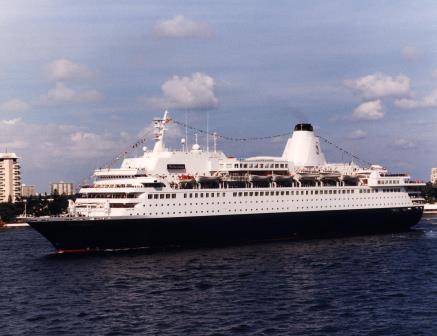
The ms Westerdam (II) ex ms Homeric. In the winter of 1989/90 she was stretched by an 100 feet to increase capacity.
1988 The next acquisition was buying the Home Line ships, Atlantic and Homeric. The Atlantic was chartered out and then sold off but the Homeric became the Westerdam (II) and was with 42000 tons the largest ship ever to sail under the Holland America Line flag.
Carnival Corporation owned Carnival Cruise Lines but was not just a cruise company. It was a much larger organisation which even owned an own Air Line.
1989 On 15 January Holland America became un-expectedly an independent subsidiary of the Carnival Corporation of Miami. They operated Carnival Cruise Lines but now wanted access to the premium market.
The Cape Fox Hotel, high up the hill, was operated by WestMark hotels and could be reached by road but also by Funicular.
1990 Money was made available to order 3 new ships called the S-class in Italy. Each to be in the region of 55,000 tons with 1266 lower beds. A new hotel was built overlooking Ketchikan in a joint venture with the local Indian tribe.
These coaches were called “Bendy Busses” on they ships and had a bar in the back part of the carriage.
1991 17 more coaches were added to the Alaska coach fleet and they were quite special as they had a small kitchen/bar with stewardess on board at the end of the cabin.
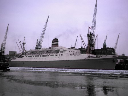
The ms Statendam (V) arriving in Amsterdam in 1993. Almost double the size but with the same umber of guests as the N-ships, the S -class was a great improvement.
1992 The company now geared up for a major tour de force, doubling the fleet by adding a new ship every year for the next 3 years and needing to train up about 3000 new crewmembers.
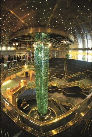
The S-class ships came with the first real atriums on the HAL ships. Located in the center of the ship. This is the “Jacobs” ladder on the ms Maasdam (V) made of Murano glass.
1993 The first new built ms Statendam (V) was delayed entering service by 6 weeks but made a big impact as, although carrying more guests, her space ratio compared to the N ships was 43.8 against 27.9. The Maasdam (V) followed in October.
The ms Ryndam (III) Seen here sailing to Alaska with a Vancouver departure.
1994 The ms Statendam (V) was send on a world cruise but it was decided to move the cruise back to the Rotterdam which had done made the 1993 World Cruise. With all the extra capacity available the company started to sail in European waters in the summer as well and not just to Alaska.
The ms Veendam (III) seen here on a windless day off the port of Haines in Alaska.
1995 With the arrival of the Ryndam (III) the fleet was complete but a fourth sister the Veendam (IV) had been ordered for 1996. HAL ships were now sailing to all corners of the world.
The new Fastdam as per artist impression painting by Marine Artist Captain Stephen Card.
1996 Project “Fastdam” was embarked upon. A ship which could take over the role of the Rotterdam (V) and with a 25 knot speed visit more ports on longer (world cruises) in a same time period.
An artificial harbour was dug on the west (=lee) side of the island where the ships tender could dock.
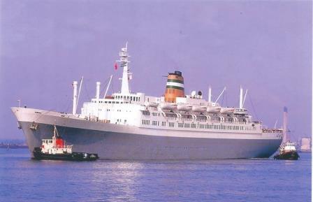
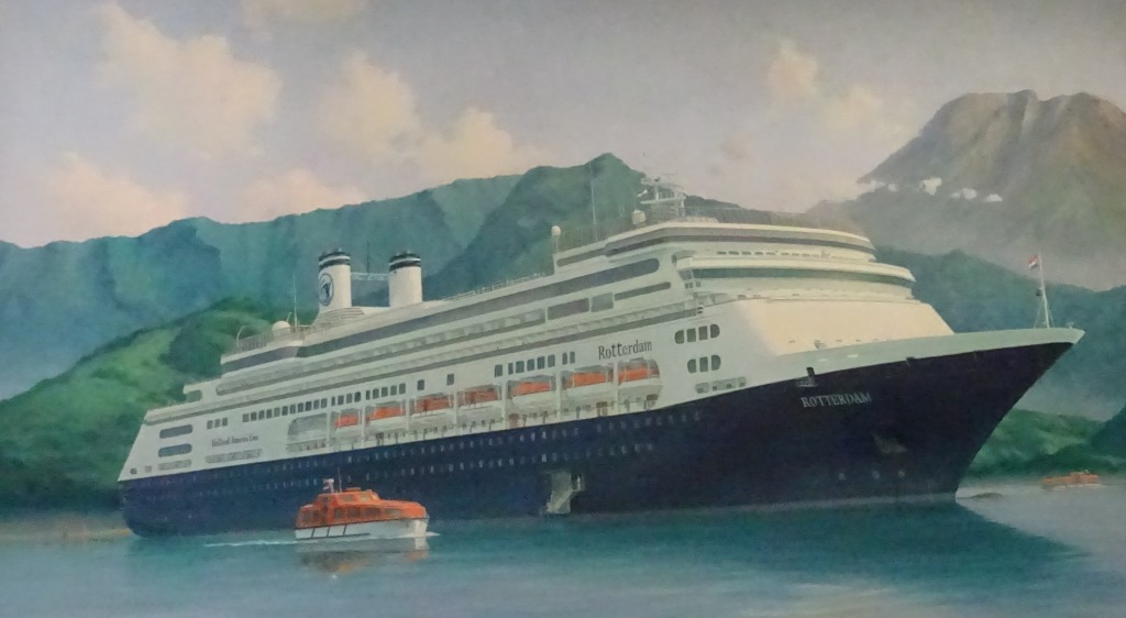
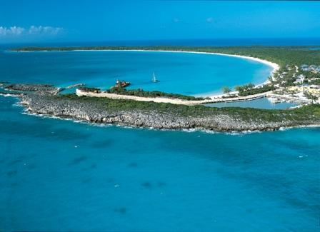
1997 The company leased 15000 acres of Little San Salvador Island in the Bahamas as a resort and renamed it Half Moon Cay. The Rotterdam (V) left Holland America on September 30th. but a new Rotterdam (VI) filled the void.
Apart from the close sister to the Rotterdam (VI) also two more ships in the class were ordered, the Volendam (III) and the Zaandam (III). These last two only had one funnel and a slightly larger guest capacity.
1998 Now 125 years young the company was thriving as never before. In this year 120 departures to Alaska were offered and a sister ship for the Rotterdam (VI) was ordered.
The Vista class was an evolution of the Signature Class with now the focus on optimizing the number of balcony cabins.
1999 Competition was fierce in Alaska with Princess Cruises bringing in larger and larger ships. The answer was the Vista class; a series of four ships with 1900 guests but with the same space ratio as the S class.
The ms Amsterdam (III) was a near sister of the Rotterdam (VII) only the tone of her interiors was different and the Azi-pod propulsion.
2000 The Volendam (III) had entered service in 1999 and was followed by her sister the Zaandam (III) in this year. Also the Amsterdam (III) was commissioned, completing the R Class of four ships.
The ms Volendam (III) seen here approaching the dock in Juneau.
2001 The Nieuw Amsterdam (II) had been sold to United States Lines in 2000 and renamed in Patriot only to return after USL went bankrupt. The ship was eventually sold on and chartered by TUI for many years.
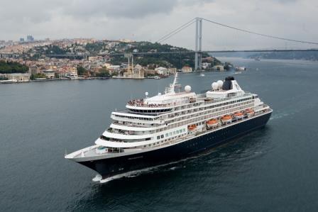
The Prinsendam (II) sailing through the Bosporus. During her far flung voyages, calling at Istanbul was a regular part of her routine.
2002 The Prinsendam (II) arrived. Transferred by Carnival Corporation from Seabourn / Cunard to HAL who needed a smaller ship for longer cruises which also able to go into smaller ports.
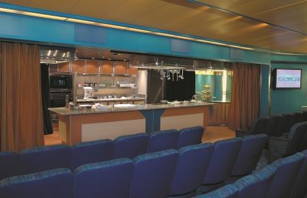
The ms Ryndam (III) was the first ship to be part of the SOE program and in the Movie theatre a kitchen was installed , called the Culinary Arts Center, where the Exe. Chef or Guest Chefs would give cooking demonstrations.
2003 The Signature of Excellence program started. This was an investment program to bring all the existing ship up to the highest standards by investing in remakes of public areas, new soft goods in then cabins and back of the house upgrades.
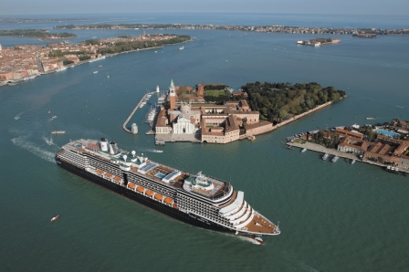
The Westerdam (III) sailing through Venice after delivery from the shipyard.
2004 In 2002 the first Vista class ship had entered service; the Zuiderdam (II), followed by the Oosterdam in 2003 and now the Westerdam (III) in 2004. Eventually the Noordam (IV) followed in 2006.
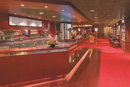
Another introduction which was part of the SOE was the Explorations Cafe. Library, Reading room, Puzzle corner and Coffee Bar are combined into one Multi Purpose space.
2005 While the SOE program continued, more new ships were considered and an upgraded version of the Vista class, the Signature class was decided upon. One to enter service in 2008 and one in 2010
See here at San Diego a shore side installation provides electric power to the ship. ALL the engines could be switched off while in port.
2006 One of the “back of the House” upgrades was the introduction of “Hoteling”. When a ship was in port it could now be connected to the shore side power grid and for the duration its own engines were not needed. All ships from the Amsterdam (III) onwards were upgraded in this way.
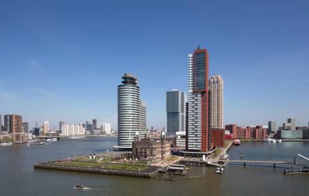
When the company gave up the Wilhelminakade, the “Dutch Offices” left the City for awhile. When they returned the old Main office was a Hotel but space was found in the brown sky scraper to the right. Behind the rounded building (Harbour masters office) to the left is the Passenger Terminal from the old days but still in use.
2007 Windstar became less and less compatible with the core operation of the company and was sold off. Investments were made in the offices both in Rotterdam and Seattle.
The ms Eurodam first of the Signature Class sailing into Rotterdam.
2008 The ms Eurodam was dedicated in Rotterdam by HM Queen Beatrix of the Netherlands. The ship had an additional Far East themed restaurant on board and with it came the first female Indonesian employees.
The “Mix” was a cluster of three bars (Champagne, Sports and Cocktail) located opposite the shops on board which also doubled up as the Late Night Piano Bar. This is the layout on the ms Veendam (IV)
2009 As part of the SOE the “Mix” was introduced on the ships, a central public area with bars and entertainment. Computer classes were given and the facilities on Half Moon Cay were expanded.
Seen here at Warnemunde Germany, the new cabins at the stern of the ms Prinsendam (II) are clearly visible. Apart from more guests it also gave the company the change to increase and modify the swimming pool layout, which had been a challenge until that time.
2010 The capacity of the ms Prinsendam (II) was increased with 22 cabins at the aft part of the ship and the Nieuw Amsterdam (IV) the 2nd ship of the Signature class entered service.
The Seabourn ships, apart from being smaller then the HAL ships, also had facilities which were not possible on larger ships such a a water sports Marina in the stern.
2011 Seabourn Cruises became a daughter company of Holland America and this resulted in cost reductions as the operations departments could merge or work closer together.
The Rotterdam (VI) had been especially designed for longer cruises with a higher cruising speed in mind and thus winter cruises from the port of Rotterdam were no problem as the ship simply raced from the wintery weather into the sun and the tropics
2012 The number of cruises starting in Europe had been expanding through the years and this year the Rotterdam (VI) sailed all year around from the port of Rotterdam on long and short cruises.
These various companies were brought together under one umbrella as their operating styles were not dis-similar although the Brands were.
2013 The HAL Group was created within Carnival Corporation consisting out of Holland America, Seabourn, Princess, P&O Australia and the Alaskan Land Operations. A new ship was ordered in Italy.
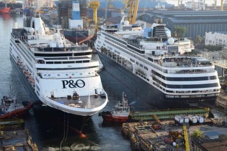
The ms Ryndam (III) and ms Statendam (V) at Keppel Shipyard in Singapore, for transformation into the Pacific Eden and the Pacific Aria for P&O Australia.
2014 Statendam (V) and Ryndam (III) were transferred to P&O Australia to make room for the new class of ships, The Pinnacle Class of which a 2nd one was ordered this year.
The other two sisters ms Maasdam (V) and ms Veendam (IV) remained with the fleet. the Veendam’s capacity was enlarged by adding balcony cabins to the stern.
2015 Re-alignment in the HAL Group continued with the creation of two branches. Brands (Marketing and Sales and related ) and Marine Services (Support, HR, IT, Nautical, Technical and related)
The ms Koningsdam. The first ship of the Pinnacle Class , seen here at full speed in the Norwegian Fjords,
2016 The first ship of the Pinnacle Class arrived, the ms Koningsdam. With a size of 99,500 tons she could carry 2500 guests. The main theme on board was music with musical art and multiple musical venues.
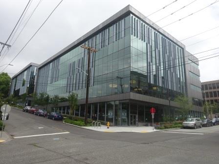
The new Office of the company located on 3rd Avenue, in Seattle, just one block away from the old one.
2017 Holland America built a new Head Office in Seattle, one block away from the old one, but now solely occupied by the HAL Group. A 3rd Pinnacle Class ship was ordered with a delivery date of spring 2021.
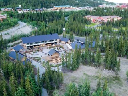
McKinley Chalet Park and resort in Denali Park Alaska. Chalets, Hotel rooms, Restaurants, a Saloon and an Outdoor Auditorium. coaches would stop her for overnight while on their tours through theAlaskan interior.
2018 The company continued to invest in Alaska by expanding its McKinley Chalet Resort hotel in Denali Park with and extra hotel wing having 99 rooms. The Nieuw Statendam (VI) entered service in December.

One of the outstanding features of the Music Walk on the Pinnacle Class ships is “The World Stage” with its 270o LED screen so everybody in the audience can have a perfect view.
2019 In June 2019 the ms Prinsendam (II) left the company and was sold to a German Operator. On 21 November 2019 the keel of the 3rd Pinnacle Class ship the ms Ryndam (IV) was laid.
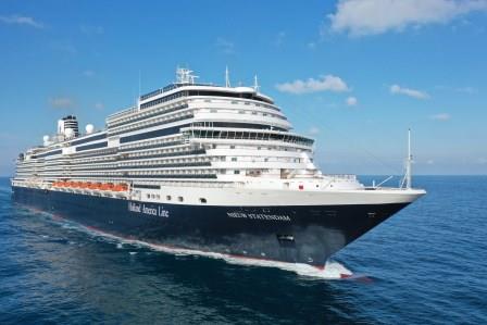
The ms Nieuw Statendam (V). Sistership to the Koningsdam and the Ryndam / Rotterdam.
2020 On 14 March 2020 the company ordered a stop to all cruise operations due to the Covid-19 pandemic and all ships were ordered to disembark their guests. The ships went into Warm Lay-up. 4 ships were sold to other operators. On 20 July it was announced that the ms Ryndam (IV) would enter service as the ms Rotterdam (VII)
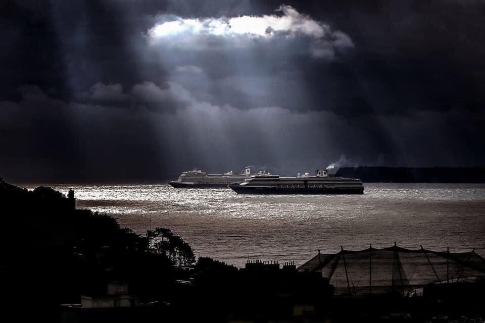
The Nieuw Statendam (VI) and Westerdam (III) in lay up at the anchorage at Tor Bay near Torquay England. October 2020. (Photo courtesy: Mr. Ian Williams www.iwpix.com)
2021 The ships continued in lay-up waiting for the Pandemic to be brought under control with the vaccination programs and various countries opening their ports again.
Published 18 April 2021
Last Update 28 April 2021