After a glorious day the good ship Koningsdam set sail for Amsterdam early last evening. In Amsterdam this cruise will end and we will turn around for the next one. Stavanger had provided us with a cloudless day and made Norway look at its best. (And there are not that many days when Norway looks at it best, as it can rain here profusely) Because of this extensive high pressure system that is lying over the area, we had a nice day to day as well and we will also have a nice day tomorrow.
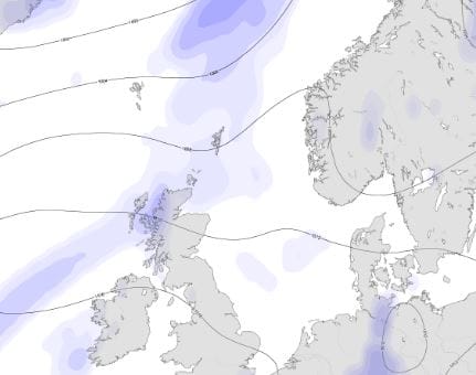
The isobars are very far apart. So hardly any wind and no wind means no rain clouds coming in from the Atlantic. (Both diagrams are courtesy of a weather site called Seaweed)
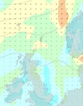
The wind picture today. Just a gentle breeze on the North Sea and even less around England.
Not everybody is happy about this very good weather. At home in England they have imposed the first hose pipe ban. This means that individual households are not allowed to water the garden or wash their car. Quite an achievement for a country that is known throughout the world for the amount of rain it gets. But it indicates how little rain has fallen recently in the area. The Netherlands are coming closer to this situation as well, although there is plenty water around, it is not evenly distributed. The greater part of the west might be below sea level, the east is well above and thus water shortage might become as issue here as well. The west is also dealing with a very peculiar issue and that is that the dykes are drying out. The dykes are there to keep the water away from the low lying land and that that do very well. But the parts that are above water are now drying out and the strong clay of which most of them have been made is starting to pulverize. Thus there are now boats sailing around the canals and water ways which pump water up and spray it Fire brigade style over the surface of each dyke.
None of these problems here on board. The North Sea is only there to float in and we make all our own water on board, also courtesy of the North Sea. We do try to load water in port if it is cheaper than producing it on board; but often we can make a lot of water by using the hot exhaust gases from the engines before they are released into the outside air. For that purpose we have Exhaust Gas boilers fitted in the funnel and that water does not cost us anything to make as the engines have to run anyway.
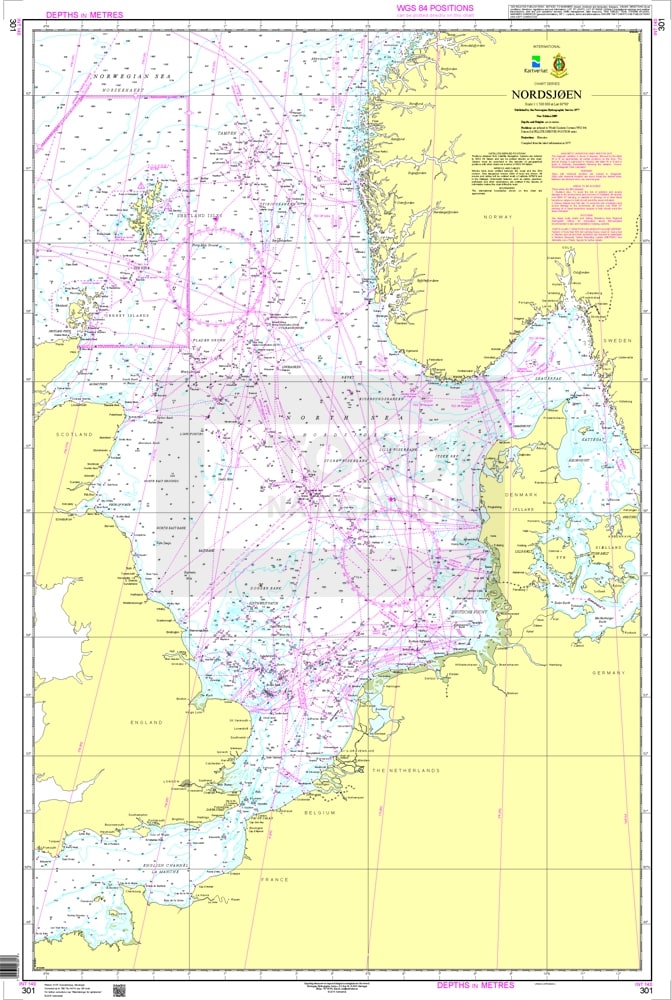
British Admiralty chart 301, re-issued by the Norwegian cartography services.The North Sea. Everything that is purple is either indicating a boundary, an under water cable or a Highway at Sea.
Sailing in the North Sea is nowadays a major headache and the place is getting so full and (over?) regulated. Thus we are following the vessel traffic separation schemes and being southbound we are basically right in the middle of the North Sea. In the good old days we could have hugged the Dutch Coast while coming down and save a few miles here and there. But there were so many ships doing that, that several bumped into each other and now the routes are (compulsory) spread out. Even if we wanted to deviate it would be hard as to starboard we have oil rigs and to port we have wind farm parks. Thus we have to find our way in between them and that has been made easier with the Vessel Traffic Routes.
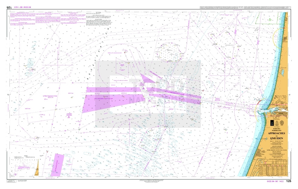
British Admiralty chart 125. Approaches to Ijmuiden. The Koningsdam will join the VTS where the triangle is located above the other purple blocks. It will merge here with East /West traffic coming / going to England and/or to Dover Strait. The pilot will join where the purple blocks of separation zones stop.
Early tomorrow morning we will make a 90o turn in the middle of the North Sea, a turn to port or to the East and then follow the approach channels to Ijmuiden pilot station. That will be around 02.00 in the morning and the pilot will board 45 minutes later. From there is about 4 hours to the cruise terminal in downtown. The Koningsdam will take 4 hours as it will swing on arrival so we can dock nose out. Because of the size of the ship, we go a little bit into the port than shorter ships as we go to the main turning basin. More about that tomorrow.
If we did not have a these regulations in the North Sea, our time at sea could be about 5 to 6 hours less but with the increased chance of hitting somebody who decided to do the same thing.
Weather for tomorrow; Partly Cloudy skies with temperatures around 26o C / 78oF with a gentle breeze.

July 26, 2018 at 5:07 pm
Captain, another problem we have is the pressure and influence of the salt sea water. Less sweet water is coming from the rivers, so they activated a special waterplan to regulate the sweet water in the direction of the West.
But we also need lots of rain, because the water plan won’t last for ever.