Today was the absolute highlight of the cruise. This cruise is called the “Top of the World” cruise and thus the idea is to go to the top of the world. At least as close as possible. By the time you come to the drift ice it is time to stop as we are not an ice breaker. In the last 14 days I had kept a close eye on the ice border North of Svalbard. In May they had a warm month in this area and that caused the ice rim to retreat. The worry was how far as I had only so many hours in the schedule to sail North and go looking for the ice without endangering the next port of call Ny-Alesund, which I knew was also going to be a highlight. You do not visit the middle of nowhere everyday, thus we had to go. The ice charts kept however indicating that the ice hovered between 150 and a 100 miles North of Spitsbergen, with the Fast ice about 200 miles away. That meant that I would be able to find it within the schedule as with full speed I would be able to cover 300 miles extra, as long as I would make enough time available to do so. Meaning we had to go to Magdalena Bay very early in the morning.
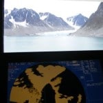
 Action shot on the bridge. showing the face of the Glacier through the window and on the radar.
Thus your,s truly was on the bridge by 5 am to start the approach to Magdalena bay by 0600. As there is a glacier at the end, you never know how much ice there will be in the bay, so I had planned the whole thing for 5 knots or less. Less ice giving more time at the Glacier face, more ice, still having time to sail in, and sail out slowly while dodging the ice cubes Maximum available time to spend: from 0600 to 1000 if needed. Compared with last year there was very little ice, so I moved to the bay at 8 knots and was parked at the glacier face at 07.00. What better way to wake up than seeing this majestic fjord towering up all around you? Frank our travel guru started his glacier talk at 07.15 while I did a full spin (called the Balcony maneuver) around so that everybody wherever standing or sitting could have a good view of the whole fjord. By 8 am the interest on deck started to wane and thus we slowly sailed out to open sea again. Bonus part of the view was a little Polish base camp on the North shore. Science in progress.
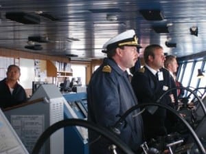
 Worried faces on the bridge looking at the dense green/blue ice in front of us. Not good to point the bow in. On the photo: Quartermaster Salim behind the wheel, 2nd officer Simon Allcock, Chief Officer Ane Smit, Yours truly.
Thus we headed north to look for the North Pole ice. Expecting to find anytime between noon and 1600 hrs, depending how reliable the ice chart information was. I myself was gambling at around 13.30 based on the pattern of the last two weeks. By 12:15 I could announce the ice as I saw the ice glare (sun reflecting off the ice) at the horizon. That meant slowing down as it is impossible to judge the distance to a low rim of ice floating on the sea. However, shortly after we saw a big piece of glacier ice that was caught in the sheet ice and that did give an echo on the radar and an indication of how far I was still away. I think that ice came from the Greenland shore and was pushed North by the wind into the Pole ice. We had had Southerly wind for the last 24 hours and thus the ice rim was much denser than expected and that meant I could not put the ships nose into the ice. Sheet ice especially the stacked version can be razor sharp and dangerous even for an ice strengthened bow as the Prinsendam.
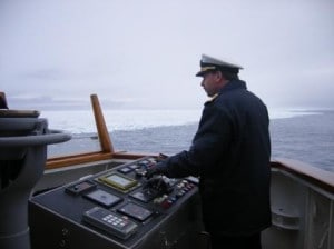
 As close as we could get……..
So this year we had to stay a few 100 feet away from the rim but it was still impressive enough. At 12:52 I could sound the horn and the Cruise Director proudly announced that we had broken last year’s record by 10 miles. The water temperature was exactly 0oC/ 33oF and the air 7oC/42oF. So it was nippy to say the least. The good thing was that the Southerly wind made it less cold (relatively speaking) for the guests on deck, but made my life difficult as it wanted to push the ship sideways towards the ice every time it curled around the funnel. Along the ice rim, there is also a sort of current, so in the end, the ship almost travelled a mile sideways to starboard while going slowly astern to stay out of the ice. A drift hardly visible with the naked eye, due to the enormous size of the ice field, so I needed the readouts of the GPS to tell me where the ship was exactly going.
By 13:30 we turned away and sailed slowly to open sea. I had found the ice well within my maximum allowable time and thus we could sail slowly towards our next highlight: Ny-Alesund. That is a nature reserve and not a town as such. It is a settlement, with its roots in the mining industry and now solely in use as a scientific centre. That means that they have strict rules for guests coming ashore, where they can go and what they can do. So I had a letter send to each guest and to each crew member advising what was expected and I made an appearance in the Show room at Sea before each show, to preach the gospel. A Glacier Bay Ranger would have been proud of me.
So tomorrow we are in Ny Alesund. The weather looks good; the only thing that worries me is the direction of the wind. If it blows from the wrong direction then I cannot anchor as it will set the ship towards the rocks when on a stretched chain. Anchoring further out does not work either as the fjord goes deep very quickly. So I might have to stay on the engines and maneuver all day.
All photos by roving reporter Lesley Schoonderbeek

August 8, 2010 at 8:57 pm
It´s been a great experience being on the ship last year when she went into the ice and seeing a seal saying farewell to us when we left the ice cap.
August 9, 2010 at 4:21 pm
I have been enjoying your blog for the last couple of years, it gives me the feeling of being “at sea” when I am between cruises. I am particularly intrigued by this cruise since it is an area I have not sailed in my 40 cruises to date. What were the coordinates at your closest point to the polar ice?
August 9, 2010 at 8:11 pm
Good morning,
the coordinates for this year: 08o31’1023 North and 010o 23′.1856 East.
Best regards
Captain Albert
August 9, 2010 at 8:32 pm
Last year´s coordinates:
N 80°20.8653 and E 10″28.6479
579 NM from the North Pole
As Capt. Albert said, this time they have been 10 NM further to the pole although he sailed into the ice last year.
August 16, 2010 at 12:06 am
Dear Captain,
Thank you so very much for this cruise! I was aboard and had a wonderful time! Especially this trip to the Polar Ice Cap! Again, thank you for taking care of us and the lovely a Elegant Explorer, the ms Prinsendam.