- Captain Albert's Website and Blog -

Ocean Liner History and Stories from the Sea, Past and Present. With an In Depth focus on Holland America Line

Month: July 2017 (page 2 of 2)

12 July 2017; Juneau, Alaska.

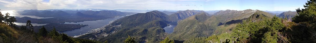
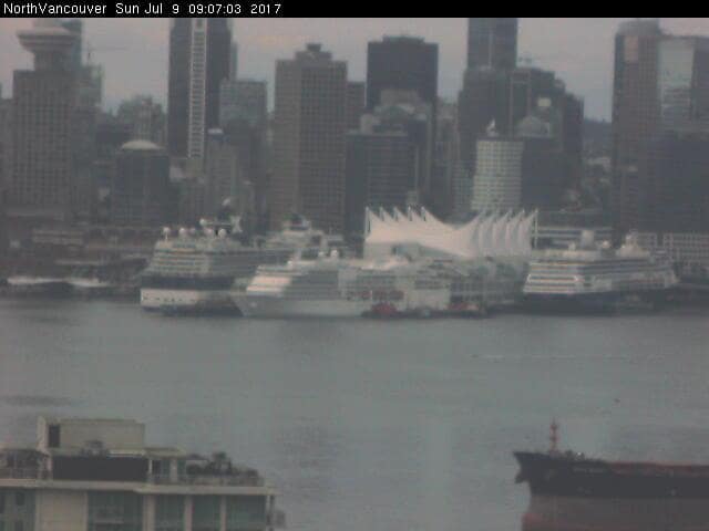
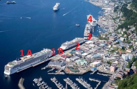
Today we had a HAL group day. As mentioned before since about three years we have a sub group under the Carnival umbrella, called the HAL Group. This group consists of Holland America, Princess and Seabourn. Today the port was filled up with the fleet and only one other vessel in port, the Seven Seas Navigator which was at anchor. The Zaandam was nicely sitting at the best dock in the port the Cruise Terminal, and around her we had three Princess ships, the Emerald Princess, The Grand Princess and the Star Princess.  Altogether good for bringing ashore well of 11000 guests and not counting the crew. The T shirt sellers must have made a fortune.

If all the cruise ships come in at the same time, then there is a pecking order depending for which berth the ship is scheduled and which way it will go alongside. Shooting nose in takes a lot less time than swinging around and then docking. The Cruise Lines Agency of Alaska makes the schedules as it represents all the company’s in Alaska. There was never any need for other agents to try to get a piece of the cake as this works extremely well, ever since we started cruising here. Today the whole setup was a lot easier as all the ships arrived at totally different times. Star Princess at 06.30, Grand Princess at 07.00, Zaandam at 10.00 hrs. Seven Seas Navigator at 11.00 hrs. and the Emerald Princess at 13.30 hrs. So no traffic jams and nobody had to wait for anybody else.

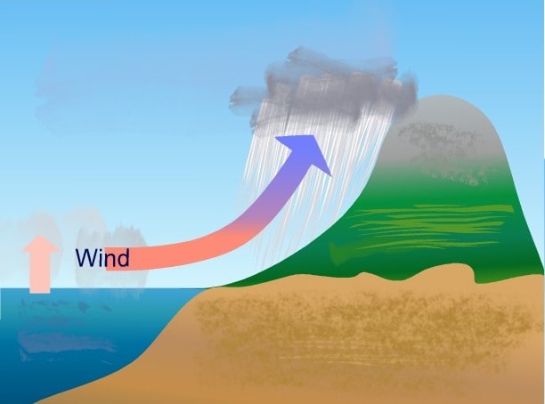
As mentioned yesterday Juneau was going to have rain as well but it turned out nothing more than a sprinkle. Main reason, the wind remained from the same direction and then Juneau is sheltered from these westerly winds and rains by Mount Juneau and Mount Roberts. They catch a lot of the rain which is handy for the Residents as that rain goes into a big lake which provides the town with all the fresh water. So much fresh water, that the cruise ships can take their fill as well, and we do. Alaskan water is of such good quality that it is on par with what we produce ourselves on board, which is pure water made from seawater.  Sometimes it is almost a pity that we then have to chlorinate the water to ensure that it is clean. But the chlorination rules are there for a good reason.  Not every port in the world produces water up to Alaskan standards and you cannot expect legislation to start differentiating between all those ports.  So we get water from  Alaska where possible and then we chlorinate.  Roughly each ship loads about 500 tons of fresh water during the day, so with four ships that is at least 2000 tons. But such is the rain fall at mountain level that there is seldom an issue of not having enough water. Unless we have a long and dry summer and that is currently not the case.

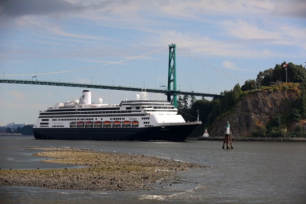
Juneau is a sheltered port unless there is a strong South Easterly wind blowing and thus an opportune port for drills. And through the course of the day we saw lifeboats going up and down everywhere; fire alarms were sounded and tenders being lowered for extra exercise. Including yours truly who currently has another group of eager young sailors who want to be immersed in the finer points of tender navigating. Tender Operators have to be licensed to run a tender with guests in them and we can do that licensing (read training and exam) ourselves as long as our training courses comply with Flag State standards. With more ships coming there is the constant need to train more crew. Holland America has now decided that this flow is continuous that it should be done shore side. Thus the company has bought two tenders (a new one can cost close to $ 500,000, as they are also lifeboats) and they will be stationed at our school in Manilla. Here a lot of certification work already takes place before the crew goes to sea and Tender courses will now be part of it.

We will stay in Juneau mid evening and sail around the mountains to the other side to get to Skagway. That will be an early arrival as the Zaandam will lead the parade of four ships coming in which will mean all the docks will be full.

Weather forecast: overcast with a chance of showers around noon time and little change in the temperatures. 56oF / 13oC.

For those of you who want to check the ports for yourself, the whole cruise ship schedule is on line:

http://claalaska.com/?page_id=1250

11 July 2017; Ketchikan, Alaska.

It rains on average 332 days of the year in Ketchikan. And today we had one of those 332 days. In 1949 it recorded its wettest year with 203 inches of rain, which for metric people translates into just over 5 meters. So you had a watertight fence around your garden, it would have turned into a 5 meter deep pool or drinking water basin.

Luckily today’s variation was not a downpour but a constant drizzle with different variations in the size of the droplets. Still it is not what most would think that a holiday should look like, especially as you seldom see rainy pictures in cruise brochures. But it does give another impression of The Great Land. Due to its size is varies enormously in weather patterns. Especially in the summer.  Then the inland can be baking hot while the South East and South West coastal areas, also called the panhandle, remain quite moist and often continue to be so in the winter as well.

What causes all this rain? The North Pacific Ocean In the same way as the North Atlantic Ocean delivers lots of rain to Ireland. Rain clouds form above an open ocean and are then carried towards land by the prevailing winds. Those prevailing winds keep a constant circulation going around the world, often boosted by the Jet Stream located on a higher level. As a result we have all these winds with specific names such as the Trade Winds. In the hurricane season that wind helps to bring the hurricanes towards the East side of the USA instead of down to South America.

For Ketchikan the bump to the right would be called Deear Mountain.

Here in Alaska we have the regular sea winds blowing which come in from the West. They carry all that rain with it in the air as vapor. When it hits land it get warmed up or cooled down depending on the surface temperature of the land. If it is very cold, you invariably get snow. Ketchikan has something else. Mountains. It is very close to the  open Ocean and the rain clouds can drift in unhindered from the Cape Decision area (see my blog of a few days ago) over relatively low land until it comes to the Ketchikan area.  Ketchikan is open to the west but sheltered to the East by a mountain range dominated by Deer Mountain. Thus if a rain cloud has drifted towards Ketchikan it will bump into this mountain range. It is pushed up along the slope into the higher air, where the temperature is a little bit lower and condensation starts. And we call that rain when it falls down on our head.

Because the sea air is relatively warm, the winters in Ketchikan are not as harsh as elsewhere in Alaska. Although it gets cold, the warmer rain balances things out a little bit. What can make the winter in Ketchikan very un-attractive, although its 9000 inhabitants do not seem to mind very much, is the wind that comes with the rain in the winter. These are the autumn and winter storms which can whistle in unrestricted from the Gulf of Alaska. Ketchikan has the phenomena called Horizontal Rain. It rains but the raging storm wind blows the wind horizontally along for a large distance before it finally hits the surface. I have seen it once when it started; my face got wet and the pavement stayed initially dry. A very strange experience.

Panoramic view of Ketchikan and Tongass Narrows from Deer Mountain. (Diagram above and this photo both courtesy of Wikipedia)

Those autumn storms are the reason that the Alaska cruise ship season ends somewhere around October first. Sometimes ships stay a little bit longer but that can be a gamble. I have experienced the most beautiful Indian Summers but also cruises where I had to cancel 2 out of the 3 ports because I did not dare to sail with the ship through Gastineau Channel (for Juneau) or Tongass Narrows (for Ketchikan) as there was a 50 to 60 knot wind gusting through both Fjords.

Today there was a little bit of a breeze from the South East which might have helped to keep the rain down to a drizzle but it was a real Ketchikan day none the less. The only person who was sort of happy of about it was the Captain as he had all his guests back on board on time. We need a prompt departure from here as Ketchikan to Juneau is a tight schedule and lots of fishing boats are expected on the way, as the fishing season has opened.

Tomorrow we are in Juneau: And here less rain is expected instead of 90% it is now down to 50%. Temperatures will remain low, in the low fifties or around 12oC.

10 July 2017; The B.C. Inside Passage.

With the Seymour Narrows transit being around 1 am. in the morning, it unfortunately means that the majority of the voyage through the Inside Passage is during the darker hours. At least the part where it is narrower. By the time most of our guests awaken we have just passed Pine Island and enter Queen Charlotte Sound. Although it is inland waters, the Sound is more than 25 miles wide at places, and when there you can just see the Canadian Mainland to the East and the Queen Charlotte Islands to the West. In summer time it is nice sailing and often a lot of wild life to be seen as long as you take the time to look for it. In the winter time is this is a very nasty place. You might think as it is enclosed at all sides, it would not be as bad as the North Pacific Ocean itself but in some aspects it can be worse.  Much worse.

The Sound is practically North to South orientated and then continues up north into Hecate Strait which ends up in Dixon Entrance. This separation zone between Canada and the USA runs East to West. So all the bad weather from the North Pacific can roll straight in. If the bad weather is coming from the South then it blows directly into the Sound and up to Hecate Strait. So whatever the bad weather is, it can find a nice place in Queen Charlotte Sound to play around in. Even if the bad weather comes from the East, from the Mainland, then the surface area is big enough for an Easterly wind to whip up the waves and those waves have nowhere to go as to the West there are the islands. Roller Coaster Times.

Over view of the Queen Charlotte Sound. (Courtesy of Wikipedia) In the old days we could slip inside just North of Cape Caution, now it is just passed Day Point for most ships.

The other challenge with this area is, is that the Sound is not very deep and the open area open enough to have the wind whip up sufficient high waves. When waves are created by the wind, they have to carry the wind energy somewhere in one way or the other. In the ocean that results in long and high waves of great length. They can be nasty but normally the ship can ride them by adjusting speed and going into a sort of surfing mode. Our Prinsendam is a ship which has a perfect length for that and is therefore a very good sea ship and is much less affected by bad weather than other- larger- vessels.

On shallow water things change. The waves have nowhere to put the energy as no long rolling waves can be created. A wave has a part that goes up and a part that goes down. On shallow water the wave cannot go down, only up. This results in shorter and sharper waves which are very difficult to ride. The ship almost at once starts pitching (slamming of the bow on the waves) and it becomes very uncomfortable for those on board and it can become very dangerous for the ship itself. Many a captain who decided to go in the open during the winter time was caught by an un-expected storm and lost his ship. Either the ship took on too much water or the wooden hull cracked due to slamming onto the waves.

So in the winter the only option is, to stay all the way inside. That is possible but it size dependent. The regular steamer route which we follow takes us part outside and part inside. Depending on the time available a few variations are possible. To stay completely inside is depending on the size as there are a few locations where the turns are very tight and you cannot see what is coming from the other side.  Well known for this are Hiekish Narrows and Boat-bluff. When we still had our previous Prinsendam (1973 / 9000 tons) it was possible to stay “behind the mountains” all the way. Later with our Statendam IV of 25000 tons, we had to forego one area and with the arrival of the Rotterdam V of 38.000 tons we had to forego another route. Now the ships are all 55000 tons and over and although the ships offer a lot more inside the ship, we are a bit limited for where we can go to show things outside the ship.

Still, there is lot’s to see. I was cooped up inside the ship all day for trainings and inspections but the one moment I stepped outside I saw both a Minke Whale and a group of small porpoises quite nearby.

Tomorrow we are in Ketchikan and it looks like a real Ketchikan day. 11oC / 51oF. and 90% chance of rain and drizzle, plus a cold wind blowing. But the wind is supposed to be from the S.E so maybe the mountains will provide some shelter. There will be three ships inn port but we will have the best dock with the shortest walking distance into town. (Basically ——- Cross the road and you are there)

09 July 2017; Vancouver, Canada.

The Strait of Georgia or Georgia Strait runs from Cape Mudge all the way to the Lions Gate Bridge.

After the whole parade had made it through the Narrows everybody swerved out into the wide open spaces of Georgia Strait. Because the ships have not all the same engine configurations, they do not all run the same speed at the same time. Some go a bit faster first and then stop one or more engines to adjust for the final ETA; some go slower first and then speed up using their most ideal engine configuration. During the night the ships were all over the place but when coming closer to the Lions Gate Bridge they all started to line up again.

The picking order then depends on the dock that a ship has been assigned. We are all aiming for the same time alongside, one minute passed 07.00 hrs. and thus we all want to pass under the bridge at the same time. Obviously that does not work and thus the arrangement is that the ship that has to go the furthest into the port goes first. And that is the ship or ships that have been assigned to Ballantyne Pier, about halfway up the harbor. The next ship is the ship assigned to Canada Place East as it has to make a wider/ longer turn to line up for the hole between the container terminal and Canada Place. Lastly the ships follow that are assigned to Canada place West, facing Stanley Park.

All happily docked at Canada Place. From Right to left, Zaandam, Seven Seas Explorer, Celebrity Infinity. Photo courtesy, Lesley Schoonderbeek who somehow found out there is a webcam at the Vancouver Northside of the harbor, overlooking Canada Place.

The reason we all want to dock at 07.01 hrs. is because of labor costs. If we put a line ashore before 07.00 hrs. then there is a lot of extra cost involved to pay the longshoremen. So we come alongside, look at the time on the GPS and at 1 minute past seven the first messenger line goes ashore for the first rope. There is only one exception to the rule and that is when you come from deep sea or go to deep-sea. Then the lines are handled by dedicated linesmen, who work all over the port, and they get paid for 4 hour intervals and so it does not matter.  When you are coastal; which includes coming from Alaska, you can use the longshoremen who attend to the ship during the day, as you are using regular Canadian labor.  For departure there are similar rules, so we always try to be off the dock on time as well.

Today was a busy day in the port as we had the Seven Seas Navigator, The Celebrity Explorer and the Zaandam all at Canada Place and The World at Ballantyne. The World is more of a country club than a real cruise ship as the cabins are owned by the people inside them and all those owners together decide where the ship is going for its cruises. Which means that sometime last year or earlier, there must have been a vote that decided on a visit to Alaska. Because of this voting system, the ship quite often pops up in places where the Jet Set is gathering and she has been seen at the GP of Monte Carlo, the Americas Cup race, the Bi-annale of Venice, etc. etc. I do not know if it is good value for money as the maintenance charge is quite high but at least you do not have to pack and unpack all the time, because the cabin is only used by your good self and thus everything can stay in the closets.

Holland America ships most often docks at Canada Place West, or North, which is the end of the West side after the bend in the pier. It is also the best spot as far as the Navigators are concerned as on a Sunday, the boulevard is always full of people. The East does not have much of a boulevard or esplanade as has the utility doors and service openings for the Pan Pacific Hotel on top of Canada place.  Normally it is the men who are on the bridge ogling the ladies through the binoculars but today our Lady navigators joined in as there was some sort of Body Building competition going on and a whole parade of very muscular men came by under the portside bridge wing. However the consensus that brain over brawn was a lot more important.

The sister of the Zaandam, the Volendam sailing under the Lions Gate. The Volendam is calling at Canada Place tomorrow.

Tonight the slack tide at Seymour Narrows is at 01.28 in the morning and the current drops under 4 knots at 00.28. in the morning. Thus we will aim for that accordingly and then see how the traffic lines up for the hole to decide the exact time of transit.

Weather for tomorrow: rain in the early morning and a windy and chilly day later.

08 July 2017; Inside Passage, British Columbia, Canada.

Once you leave Ketchikan, the voyage to Vancouver is dictated by just one thing: the slack tide at Seymour Narrows. And as the time of slack tide (the moment the current goes from Ebbing to Flooding or vice versa) changes every day, the planning for this section of the cruise has to be reviewed for every passage.  As the tides go up and down (and in and out) on a six hour cycle, the slack tide at the Narrows is moving to and from within a six hour cycle as well.  On average that boundary is somewhere between 8 pm in the evening and 2 pm. in the morning. There are 3 more slack tides in the day but the evening one is the important one for us.  Important because of the time needed to get from Seymour Narrows to Vancouver and after departure back again. At the minimum you need 5 hrs. as the distance between Vancouver / Lions gate Bridge and Cape Mudge (there where the approach to the Narrows start) is 96 miles and the normal top speed of a cruise ship is around 20 knots.

For today there was a slack tide at 18.29 hrs. when the flood went to ebbing and at 00.41 hrs. on Sunday morning when ebbing went to flood.

In this diagram each horizontal line indicates 2 knots of current. Thus the current on Saturday at 2.52 PM PDT came to 12 knots.

So the captain has to make a decision, which tide to take. 18.29 hrs. is very early and you have to race down the coast to get there on time and even then it is doubtful if you make it. So it makes sense to focus on 00.41 hrs.  This does not mean that you have to go through there at that time.  Normally the pilots are quite comfortable with anything under 4 knots.

Overview of the Seymour Narrows area. For us the approach starts near Brown Bay; then there is no place else to go anymore and it ends at Cape Mudge where we are back in open waters.

Thus the navigator sorts outs the times that work best for the schedule and then the captain decides on the window of opportunity. If you look at the diagram you can see that slack tide is at 12.41 am on Sunday 9th of July between there is a curve in the tide.  Each line gives two knots of current speed and thus the first moment for the ship to go through would be 23.45 hrs. Saturday evening.  So the captain sets his initial sights on this time. When the pilot’s board, there will be a Master Pilot discussion and a decision is made if this time is the best. Taking into consideration, the local knowledge of the pilots, the latest navigation information, expected traffic at the Narrows and along the road and anything else which might cause delays. Once a time has been decided upon the speed for that time is set and the route decided. Maybe there is time for some sightseeing but maybe the ship has to take the shortest route just to get there on time.

During the approach to the Narrows, the pilots receive constant updates in regards to traffic near the Narrows from a VTS system that we have here in the British Inside Passage. Also by now they will have heard from their colleagues what the other cruise ships want (normally we all want the same) and have thrashed out a schedule among themselves of who should go first through the hole as there is only room for one ship at the time. For “who goes first” that has mainly to do with who needs to arrive in Vancouver first and that is normally the ship that is assigned to Ballantyne Pier which is the 2nd cruise terminal in the port after Canada Place.

Once this is all sorted out, the cruise ships line up behind each other, normally 5 to 10 minutes apart, and they speed up and slow down then depending on any issues the first ship has with tug and tows or fishing boats which are also in the transit.

With a passage time of 23.45 hrs. the ship will then be in open waters again, passed Cape Mudge at 00.30 and that gives it then 6 hrs. to cover 96 miles to be under the Lions Gate bridge at 06.30 for a 07.00 hrs. docking.  More about that tomorrow. We are looking at a sunny day in Vancouver with temperatures of 77oF and 22 oC.  That is about perfect for a Vancouver Sunday.

Note: both diagrams are courtesy of a tides website called: tides.mobilegeographics.com/locations/5757.html

07 July 2017; Ketchikan, Alaska.

Nicely on time we arrived in Ketchikan and of course that is something everybody expects. However as we sail the Inside Passage of Alaska it is not so straight forward. Between Juneau and Ketchikan we have a couple of bottle necks where the ship might have to slow down for a prolonged amount of time and then suddenly you arrive half hour our late, instead of being a little bit early.

There are three areas where there is a bigger chance of this to happen. Cape Decision, Point Baker and Snow Passage. At these three locations there is less room for a transit at full speed because there might be opposing traffic, or fishermen or wildlife (whales). Then you will have to slow down, or even stop.

Sumner Strait. Starts at Cape Decision Passage (A), then turns at Point Baker and becomes very narrow at Bushy Island Light / Snow Passage.

Cape Decision can be a challenge because you make an almost 180o turn around the Cape. The ship is coming south along the coast and then goes back up north again. Opposite traffic can do the same thing and everybody is trying to stay as close as safely possible to the cape to travel as few miles as possible. There is no vessel traffic separation here and thus the ships curve around the Cape as close as possible. At least as close as safe navigation allows.  Ships and boats that go into the Pacific from here will have already set a course for their next destination and might thus be on a track of where an inbound would like to be. An inbound ship will try to stay more to the south of the Cape to avoid opposing traffic coming out which will hug the Cape. But ships going south into the Pacific might decide to go wide as well and thus meet the incoming ship.  Thus opposing ships might be all over the place in the entrance and if so, it means slowing down and time delay.

Once inside the ship sails north through Sumner Strait and then has to make a 90o turn to the East at Baker Point. That 90 degree turn is not a problem, the fact that it is a fishing location can be. In the old days of the 1980’s we always had challenges here.  Fishermen just ran their nets all over the place and we counted ourselves lucky that we did not tear up more nets than we did. But the indiscriminate fishing depleted the stocks and regulation was introduced and now, while the fish stocks are coming back, things are regulated a bit better. There are now specified fishing openings in various areas and the fishermen also learned that if they are sitting in the steamer track with their net, there is no insurance company that will buy them a new one. Still when the fishing fleet is there we slow down and sail by at a no –wake speed. Good for everybody but it costs time.

NOAA Chart 17383 covering Snow Passage between Sumner Strait and Clarence Strait. You can also go north of Zarembo Island but it takes a lot more time.

The last bottle neck before Ketchikan is going through Snow Passage at the south side of Zarembo Island. Looking at the chart it does not look very difficult but the challenge is the current, which can run up to 4 knots, and pushes you off your regular track line. We normally slow down here to about 14 knots, to have more time to adjust for the way the current sets, and also to have more time to curve around the buoy while being pushed over by the current. Because there is current, there is food and thus Whales like to hang out here and they go fishing in the middle of our intended track line. A 2nd reason to slow down. Give them time to recognize us and move out of the way.  Then there are the fishing boats and the Tug and Tows.  The tugboats normally join in and give a timely warning on the VHF that they are in the vicinity and are going to make a transit. Then the pilot on board will make arrangements which ensure that we do not meet in the middle.

Fishing boats are a different matter, there is not much fishing here, too much current, but they transit the area. They do not always adhere to the VHF protocols or hear the announcements (we see many a fisherman happily sailing by with headphones on for music) and they will go through the passage right in the middle where they know the water is the deepest.  We plot them on the Radar and then we slow down even more.

These happenings are the main reason when you suddenly realize your ship did not arrive on time in Ketchikan or in Juneau if it was making a transit between these two ports. Today all was well in the world and the Zaandam arrived very timely at berth 1B and docked behind the Oosterdam, which makes a morning call here, before returning to Seattle. We even had a bit of sunshine on arrival and for Ketchikan standards that is something to cherish.

06 July 2017: Juneau, Alaska.

There are several hotels in Juneau but Holland America prefers to use the Baranof in the Main Street as it is a Westmark hotel which is part of the company. It makes sense that if you have to spend money on travel for your employees then you might as well put it back in your own pocket. It is a pity that Holland America has no air transport capability otherwise travel would be a sort of enclosed circulation of all its own funds.  But we do not have that and thus I was flown by Alaskan Air from Seattle back to the Great Land. The Baranof has been in operation since 1939 and has become a sort of landmark of Juneau, together with the Alaska hotel (much older) and the Red dog Saloon.  Juneau had two days of no-rain in a row and that gave me the chance to walk to the ship pulling my suitcase. I somehow find it a bit over the top to get a cab to travel the distance of three blocks from the Hotel to the docks.

When ships are on a 14 day cycle opposite it each other and the other ships are on a seven day cycle you get some strange situations; as if nothing has changed. I had been with the Noordam in Juneau and docked next to the Celebrity Infinity. Today I approached the dock and I see the Zaandam docked next to the Celebrity Infinity. The Zaandam with its one funnel looks of course different than the Noordam but that made the only difference. For reasons totally unknown to me, we have an R class ship, the Zaandam sailing opposite a Vista Class ship, the Noordam. You would think that with the Seward run it would have been easier to have two of the same class to run the Seward cruises as the interior would simply deal with the same size guest flows in the interior. But it must work for marketing as the ships are full and the guests are happy.

The Zaandam as seen at anchor at Cabo San Lucas in 2014. Note the single large funnel.

The Zaandam was the last of the R class. It followed the Rotterdam, Volendam and the Amsterdam. They are all considered sister ships but in reality the Rotterdam and Amsterdam are sisters and the Volendam and Zaandam are sisters. From the outside you can see the difference easily as both the Rotterdam and the Amsterdam have two funnels side by side. Not that this was necessary, one funnel for those ships would have sufficed as well but the company decided that the Rotterdam VI was going to have a reminder from the Grand Dame of the Seas, the Rotterdam V. And this was done by copying the twin smoke stacks of the Rotterdam V. The Rotterdam VI took over the (world) cruises of the Rotterdam V and the Amsterdam (III) was also planned for long cruises. Hence it has the same funnel configuration. The Zaandam and Volendam which have a slightly larger guest capacity were designed for the shorter cruises. With the idea of 3 week period or less firmly in mind. And that is still more or less true with the Amsterdam and Rotterdam doing the long voyages and the other two around 14 days or so, not counting repositioning cruises.

The ms Rotterdam VI, flagship of the company. The twin funnel gives the ship a totally different aspect.

Keeping completely in tune with this, the Zaandam is now on 14 day up and down Alaska cruises before it sails south again to start her winter program around the southern part of South America. Captain in command is Chris Norman who joined Holland America half way through his career as in an earlier life he was a fisherman. Recently he was on loan to P&O Australia when we handed over the Statendam and the Ryndam. As those ships are now completely integrated in that fleet most of the Hal Officers involved in the transfer are now coming back to the mother company and are being re-assigned in the fleet.

The Zaandam sailed at the regular southbound time departure of 18.00 hrs. and will then aim for 10.00 hrs. first line tomorrow morning in Ketchikan. Official arrival time is 11.00 hrs. but the captains like to be here a bit earlier, if the weather and safe navigation allows this, as it is a short stop and it takes the pressure a little bit off the initial rush ashore. Ketchikan promises a chilly but sunny day and that is GOOD weather for Ketchikan.


05 July 2017; Enroute to Zaandam.

For all American readers, happy 4th. of July. I hope you had a great day as I had while in Seattle. Historically speaking I always feel a sort of Dutch – American connection during this day as the Netherlands were the first country in the world to recognize the independence of the new USA. It did so by raising the flag when an American warship came to the island of St. Bartholomew in the Caribbean shortly after the declaration. During the day I had a walk around the Space Needle area which is a congregation place for outdoor activities with buskers and huskers. One fixed group are Peruvians, I can see their Inca descendants, who for several years already have a fixed location opposite the entrance to the Space Needle.  In the evening  I went to see the Fireworks of Seattle over Lake Union and to my great happiness there was an outlet where they sold Summer Ale made by the locate Fremont brewery. There is nothing better than watching culture with a pint in your hand. Seattle had perfect weather for a 4th. of July celebration which to the utter amazement of the locals has now been the case for three years in a row.  No rain but sunshine………………………..

Our new Seattle Head Office. The main entrance is behind the silver car halfway up the hill.

The day before I reported to my head office as I had to renew my security card, had a meeting with the Sr. Director of Marine/Nautical Operations and took the chance to see our new office building. Holland America moved buildings in January 2017. The new building is one block higher up the road and now has great views of the Pudget Sound when you are in the Restaurant on the top floor. 300 Elliott Avenue West is now empty for a larger part and there is work going on inside to make it ready for new tenants. Holland America had in the end three offices in Seattle but now everything is back under one roof.

Looking Down in the Atrium from Deck 3. To the left the :”bridge” to the North section of the building.

Our new office which is called 3rd on 3rd, as it is located on 3rd. Avenue is not owned by HAL but there is a very long lease. Long enough to make it possible for HAL to be part of the design team. As a result the architect has tried to give the interior a nautical flavor. There is an Atrium with bridges on each level to connect the North and South Pier of the building and in various areas lights and other fixtures look like portholes. The floors are called decks and named after continents.   The whole complex is a big improvement on the gloomy aspect of the old building. My only observation would be that for my taste it does not look “shippy” enough. Too many bare walls but maybe that will change with the years. There are ships models on every level and to my delight also one or two old ones. There is a model of the Haelve Maen, the sailing ship which until recently graced our Ships logo and a model of the Homeric before it became the ms Westerdam. And of course all the blue hull models of our current fleet.

I sent the Rotterdam V Bell to Seattle in 1997 where it found a place in the entrance of the old building. Now it is standing here in the new buildings lobby,

The designer choose for an open office plan, which means everybody has a work station and not an enclosed office anymore. The old building had a large number of”Aquariums” as I called them arranged around central areas with office cubicles. Now Sr. staff and Jr. Staff have work stations in the same area and in the central nave there are meeting rooms (named after ports of call), telephone rooms and sitting area’s to meet people.  As a shipping office runs on coffee, on each level there is a coffee station with a sitting area next to the central staircase. I think that is the most successful part of the design as it gives the option to do some informal business without having to hang around the coffee machine or sit in a stuffy meeting room.

The building is occupied by Holland America Line, Seabourn and a section of Princess Cruises. The latter’s main office is in Santa Clarita but as we share the overland tour business with Princess and all three are now part of the HAG (Holland America Group) Princess also has a presence here which is mainly noticed by white hulled ships models in the waiting area’s around the Atrium.  For the rest you do cannot see it as the computer work stations look exactly the same.

What has not been moved yet is the old Veendam anchor which is still standing outside the old office. Nobody could tell me if there were any immediate plans for it to be moved closer to the new building. There is a little of space outside the main entrance to the new office so it would be possible. We just have to wait and see. It is not easy to walk away with 12000 pounds of steel so I assume the owners of the old office building will not be in a hurry to have I removed.

The builders model of the ms Westerdam which came to Holland America when it took over Home Lines in 1988.

Tomorrow I will join the Zaandam in Juneau and then we will return to the Alaska Cruise schedule of calling at Seward. The Zaandam sails the opposite way of the Noordam and they will pass each other tomorrow evening when the Zaandam comes down from Haines and the Noordam goes up to Skagway.

The oldest piece of history in the office. A Jacobson painting of the ms Maasdam II of 1889. It hangs outside the Board room. Around that time the locals in New York had the tendency to call a line serving New York after it’s home country. So there was the French Line but Holland America was often called the Netherlands Line and even promoted itself as such.

01 July 2017 in between ships.

Due to the time difference I currently post my blog the day after the date. That results today in a conflict of interests as I am leaving the Noordam and  transferring to the Zaandam, via a short visit to our NEW head office in Seattle.

So I will try to catch up tomorrow as I am flying today.

Thus today there will be no blog but hopefully there will be one tomorrow with some photos of our new head quarters.

Best regards

Capt. Albert


30 June 2017; Ketchikan, Alaska.

As mentioned yesterday the ms Noordam was on a tight schedule to get to Ketchikan on time and thus we raced through the night from Juneau, via Cape Spencer and Snow Passage to Ketchikan. As there was no traffic to hold us up, the ship docked nicely on time at Berth 4 in Ketchikan. Berth 4 is the farthest to the north and also the farthest away from down town. (Although is there is shopping board walk to guide you there) We have been assigned to this dock because we were the last one coming in. On berth 1 we had the Oosterdam which arrived early and left at 13.00 hrs. Her spot was then immediately taken by the Celebrity Infinity. On berth 2, facing north was the Seven Seas Mariner, and on berth 3 was the Norwegian Pearl who had left Juneau earlier than us and thus could dock earlier as well. Four ships, four docks and the port was full again. That leaves one anchorage space in the middle of the harbor but it is normally only used on congested days. I think they have the first one on July 3 when then Grand Princess has to anchor during a full day call.

Tongass Narrows as seen from the south out of an airplane. (Courtesy: thank you to the unknown maker)

Ketchikan is partly sheltered by Tongass Narrows and to get there you have to sail through it completely during the journey either Northbound or Southbound. As there are houses and docks on either side of the Narrows there are speed restrictions. So we have a whole protocol to abide by. The pilot is the person ensuring that we do abide as it is his license on the line as being the Government Representative on board. Only if the captain would ignore the pilot’s advice in regards to the regulations, then the ship would be held responsible. The whole of the South East Alaska ports are covered by a rule book. The S.E Alaska Waterway Guide.  All who are involved in navigating have to know its contents and if something changes, we will hear about it via the pilots, the ships agent and the Notices to Mariners; although the latter can be quite delayed in coming to us as it has to go through governmental pipe lines.

The Nautical Chart of the Tongass Narrows. (Courtesy Noaa 174286)

The north point of Tongass Narrows is defined by Guard Island (A), a clever name as indeed the lighthouse on top of it guards the entrance. At this point the ship will slow down its speed to full maneuverable. This means the engines come down from a most economical sea setting to where we can pull the handles without causing any issues with the propulsion. (The ships engines are always ready to slow down but a gentle way is preferred when high temperatures are involved) Then it is about two miles until we come to Rosa Reef (B) which is a small reef sticking out from the southern shore. There we have to be down to 16 knots. The next location is Ship Island (C) where we have to be down to 10 knots. This speed is universally considered a no-wake-speed and that will protect the boats and floats along the sides of the Narrows which are now becoming more and narrower here.

Next step is when we pass Tongass Dry-dock (D) opposite the airport. Due to the floating dry dock, the Narrows are now really narrow and thus we have to be down to 7 knots. Here is also a small ferry crossing for people to go from Ketchikan to the Airport and vice versa.  The seven knots speed limit is in force for the whole port area and thus we can adjust the speed for the rest of the distance to the dock to our own liking. Normally we approach the dock (E) with a speed of about 3 knots and then let the Azipods trail astern to come to a standstill in the right position.  That right position is where the gangways will be located and as dock 4 has a floating pontoon to accommodate a tide-less gangway, that is where we have to aim for.

Downtown Ketchikan, with cruise ships in port on a congested port day as also the anchorage is occupied.

Ketchikan did let us know a few times during the day that it is the Rainy Capital of the World but there was no wind, so it was not that chilly when being ashore.

We will sail after 18.30 hrs. to get back to Canada ad after an hour forward to get back into the Canadian Time zone we will sail the Inside Passage from around noon time onwards. It is expected to remain a bit rainy.


Newer posts